
 Featured Collection
Crescent City Connections
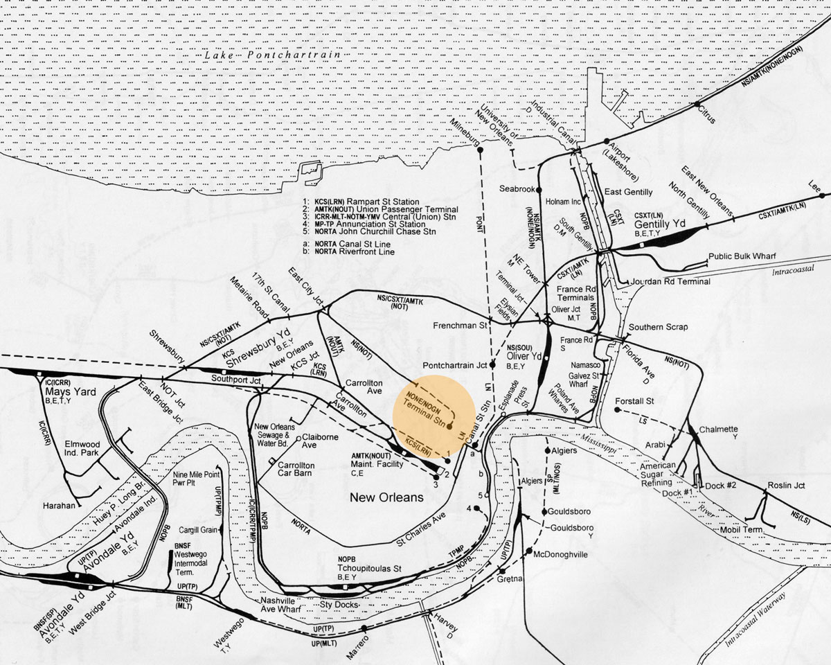
Trains and Trolleys in New Orleans
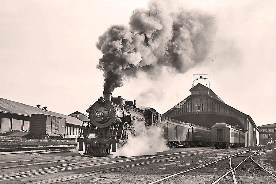
The Big Easy: at the height of American passenger rail, the terminus at the Gulf of Mexico for seven major movers using five terminal stations. The city organized its own public belt switching operation to shuffle all the freight coming into its ports from around the hemisphere. And of course those streetcars: the world's oldest continually operating public street railway. Those cars roll on, expanded, and so do five Class One railroads, plus four Amtrak routes. Crescent City connections abound.


 Lorem ipsum dolor sit amet, consectetur adipisicing elit, sed do eiusmod tempor incididunt ut labore et dolore magna aliqua. Ut enim ad minim veniam, quis nostrud exercitation ullamco laboris nisi ut aliquip ex ea commodo consequat. Duis aute irure dolor in reprehenderit in voluptate velit esse cillum dolore eu fugiat nulla pariatur. Excepteur sint occaecat cupidatat non proident, sunt in culpa qui officia deserunt mollit anim id est laborum.
Sed ut perspiciatis unde omnis iste natus error sit voluptatem accusantium doloremque laudantium, totam rem aperiam, eaque ipsa quae ab illo inventore veritatis et quasi architecto beatae vitae dicta sunt explicabo. Nemo enim ipsam voluptatem quia voluptas sit aspernatur aut odit aut fugit, sed quia consequuntur magni dolores eos qui ratione voluptatem sequi nesciunt. Neque porro quisquam est, qui dolorem ipsum quia dolor sit amet, consectetur, adipisci velit, sed quia non numquam eius modi tempora incidunt ut labore et dolore magnam aliquam quaerat voluptatem. Ut enim ad minima veniam, quis nostrum exercitationem ullam corporis suscipit laboriosam, nisi ut aliquid ex ea commodi consequatur? Quis autem vel eum iure reprehenderit qui in ea voluptate velit esse quam nihil molestiae consequatur, vel illum qui dolorem eum fugiat quo voluptas nulla pariatur?
Lorem ipsum dolor sit amet, consectetur adipisicing elit, sed do eiusmod tempor incididunt ut labore et dolore magna aliqua. Ut enim ad minim veniam, quis nostrud exercitation ullamco laboris nisi ut aliquip ex ea commodo consequat. Duis aute irure dolor in reprehenderit in voluptate velit esse cillum dolore eu fugiat nulla pariatur. Excepteur sint occaecat cupidatat non proident, sunt in culpa qui officia deserunt mollit anim id est laborum.
Sed ut perspiciatis unde omnis iste natus error sit voluptatem accusantium doloremque laudantium, totam rem aperiam, eaque ipsa quae ab illo inventore veritatis et quasi architecto beatae vitae dicta sunt explicabo. Nemo enim ipsam voluptatem quia voluptas sit aspernatur aut odit aut fugit, sed quia consequuntur magni dolores eos qui ratione voluptatem sequi nesciunt. Neque porro quisquam est, qui dolorem ipsum quia dolor sit amet, consectetur, adipisci velit, sed quia non numquam eius modi tempora incidunt ut labore et dolore magnam aliquam quaerat voluptatem. Ut enim ad minima veniam, quis nostrum exercitationem ullam corporis suscipit laboriosam, nisi ut aliquid ex ea commodi consequatur? Quis autem vel eum iure reprehenderit qui in ea voluptate velit esse quam nihil molestiae consequatur, vel illum qui dolorem eum fugiat quo voluptas nulla pariatur?

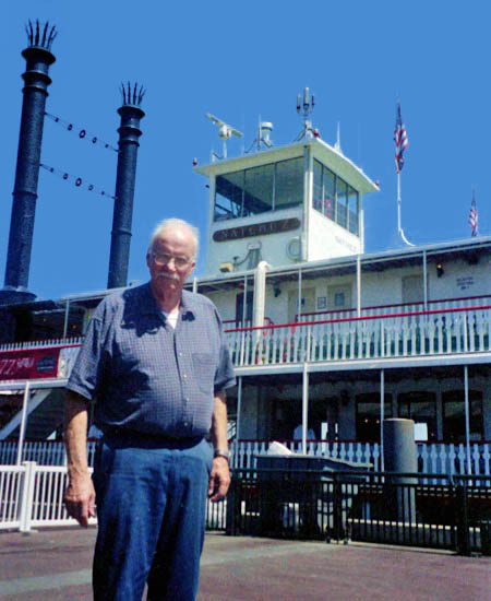
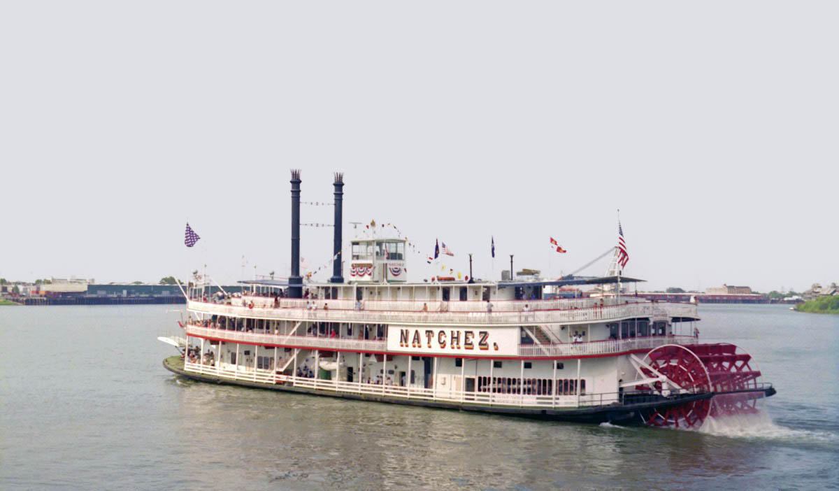
New Orleans, La / May 2000 / JCH
details

Feb 2024 / RWH

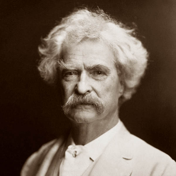
 It has been said that a Scotchman has not seen the world until he has seen Edinburgh; and I think that I may say that an American has not seen the United States until he has seen Mardi-Gras in New Orleans. But the people cannot have wells, and so they take rain-water. Neither can they conveniently have cellars or graves, the town being built upon "made ground"; so they do without both, and few of the living complain, and none of the others.
Mark Twain, 1859
New Orleans, La / Sep 2003 / JCH
HawkinsRails thanks our longtime friends Gordon Payne and Michael Palmieri for sharing their New Orleans railfan photography collections with us for this and other NOLA pages

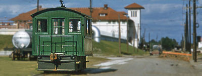
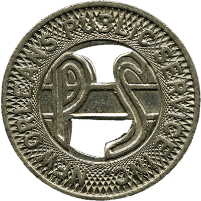
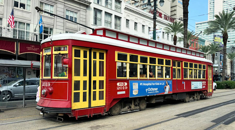
New Orleans Streetcars
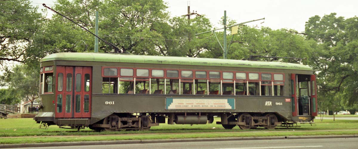
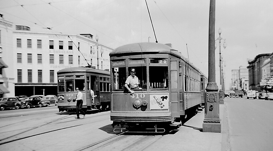
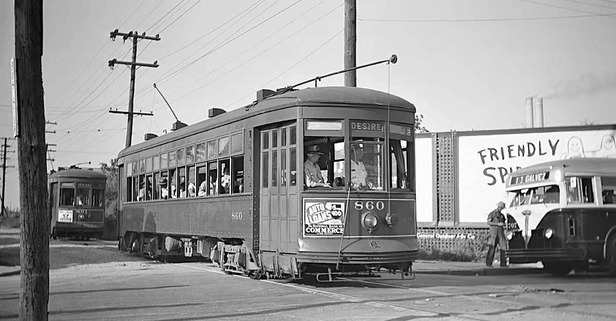
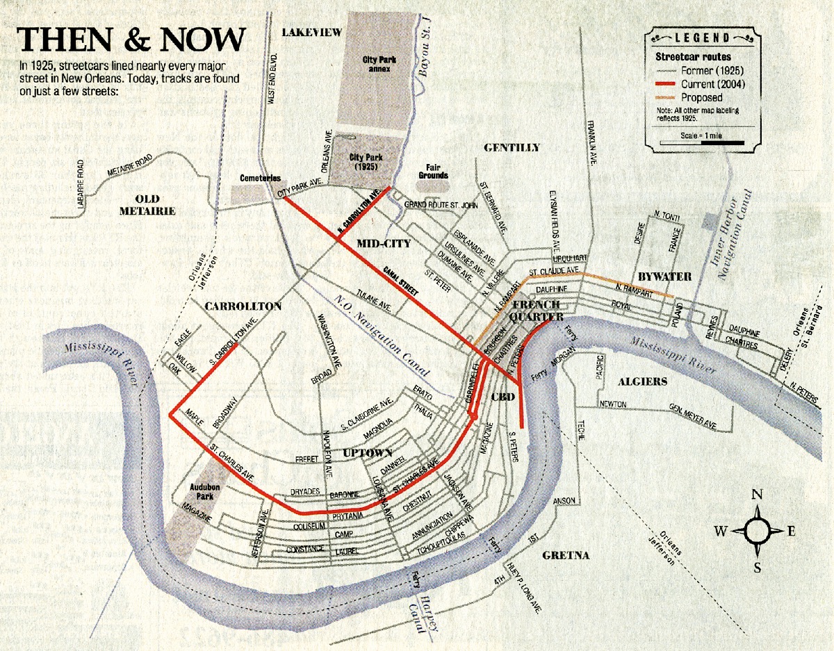
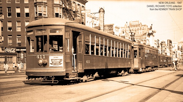
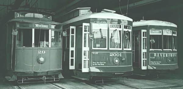
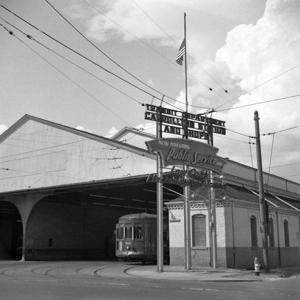
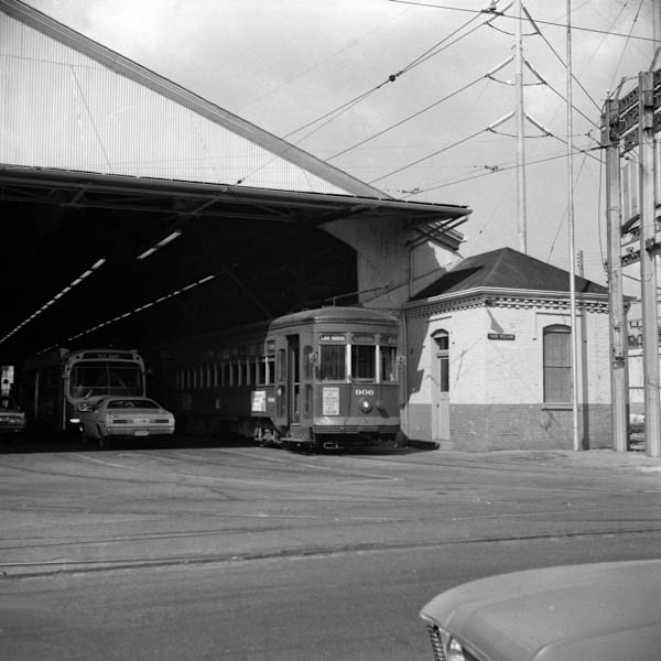
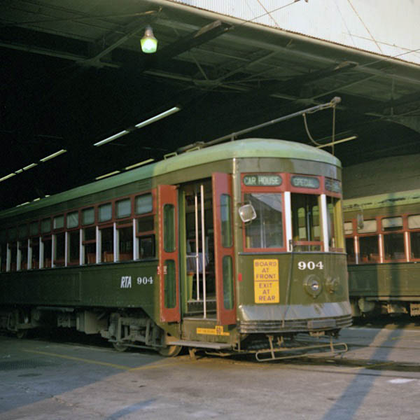
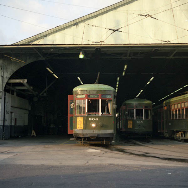
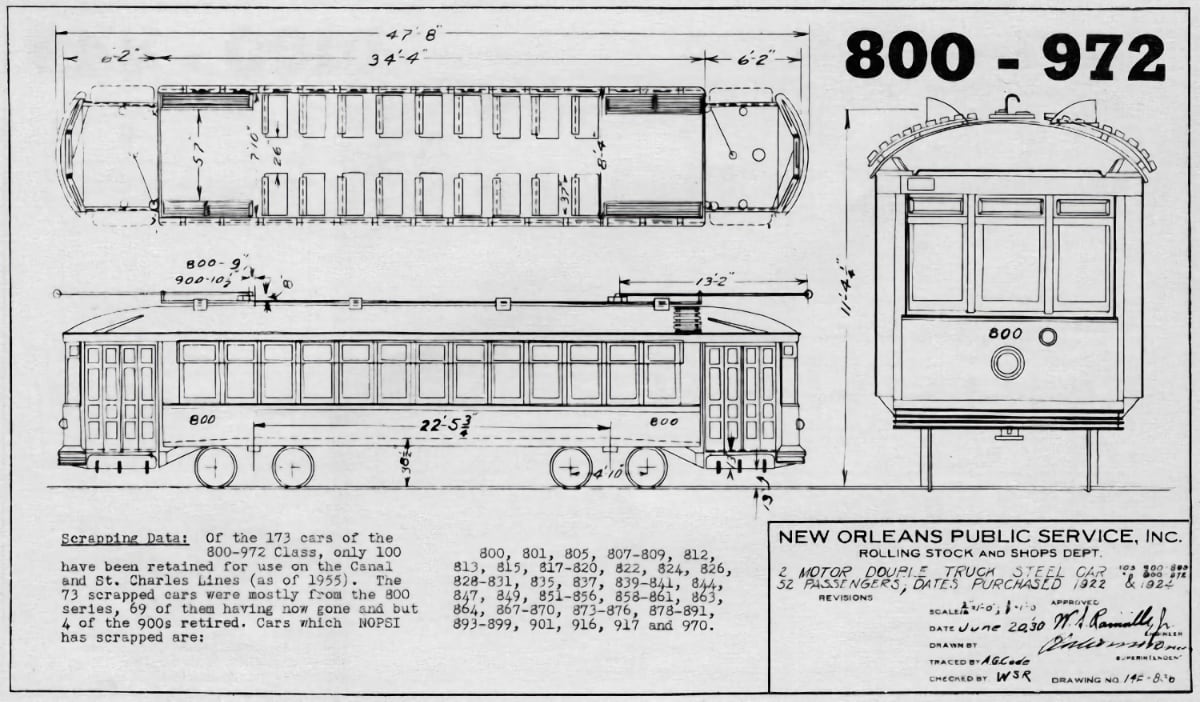
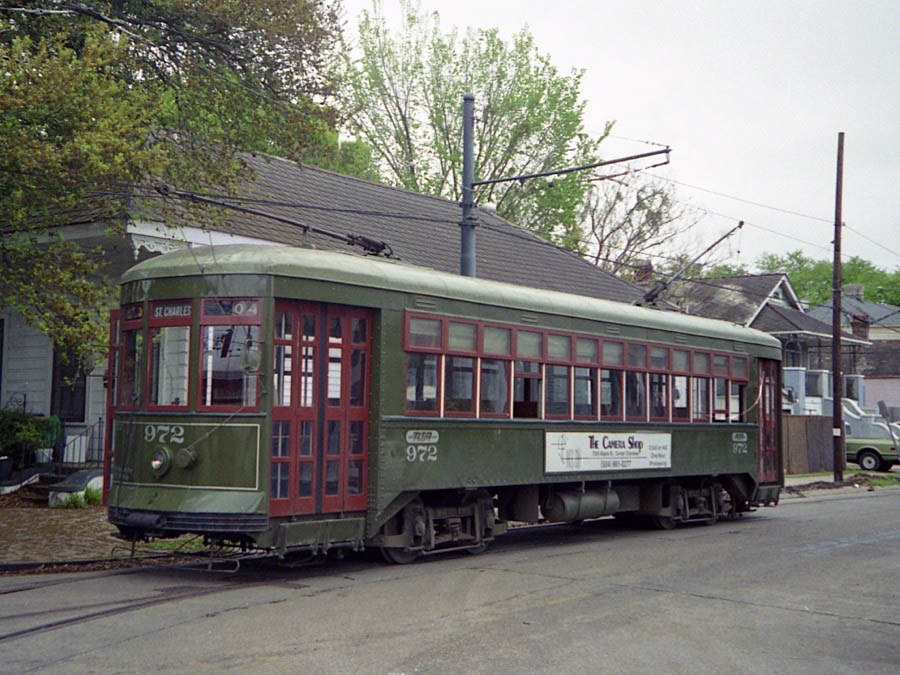
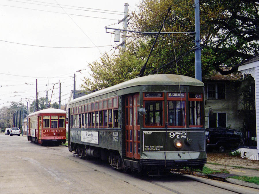
 Streetcars of one type or another have been a central element of public transportation in New Orleans since before the Civil War. After electrification, an assortment of companies in the early 20th century operated numerous lines that covered the city and its East Bank suburbs. In 1922, these operators were consolidated into NOPSI: New Orleans Public Service Inc., which operated the system for decades. After World War II, all but four lines were converted to fuel or electric buses. In the early 1980s, the Regional Transit Authority (RTA) was formed; under its stewardship, streetcar service has expanded back to five routes representing 16 miles of rail. The longest route, the historic St. Charles line, remains the oldest continuously operated public streetcar line in the world.

collection
New Orleans, La / Jun 1947 / Michael Palmieri collection
collection
New Orleans, La / May 1948 / Michael Palmieri collection
collection
Michael Palmieri collection and JCH

RWH
New Orleans, La / 1972 and 1988 / JCH
collection
New Orleans, La / Mar 2002 / JCH
collection
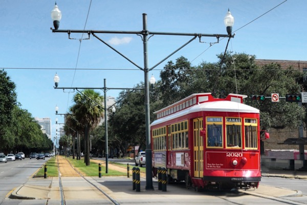 There are currently five operating streetcar lines in New Orleans: The St. Charles Avenue Line, the Riverfront Line, the Canal Street Line (which has two branches), and the Rampart-Loyola Line. The St. Charles Avenue Line is the only line that has operated continuously throughout New Orleans' streetcar history (though service was interrupted after Hurricane Katrina in August 2005 and resumed only in part in December 2006, as noted below). All other lines were replaced by bus service in the period from the late 1940s to the early 1960s. Preservationists were unable to save the streetcars on Canal Street, but were able to convince the city government to protect the St. Charles Avenue Line by granting it historic landmark status. In the later 20th century, trends began to favor rail transit again. A short Riverfront Line started service in 1988, and service returned to Canal Street in 2004, 40 years after it had been shut down.
Aug 2014 / RWH
New Orleans, La / Aug 2014 / RWH

See our complete New Orleans Streetcar featured scrapbook in Streetcars
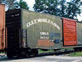
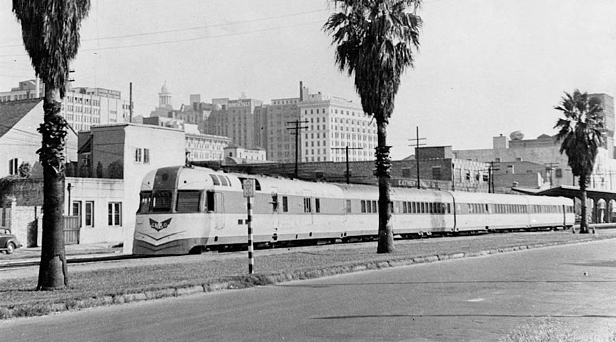
Gulf Mobile & Northern
![]()
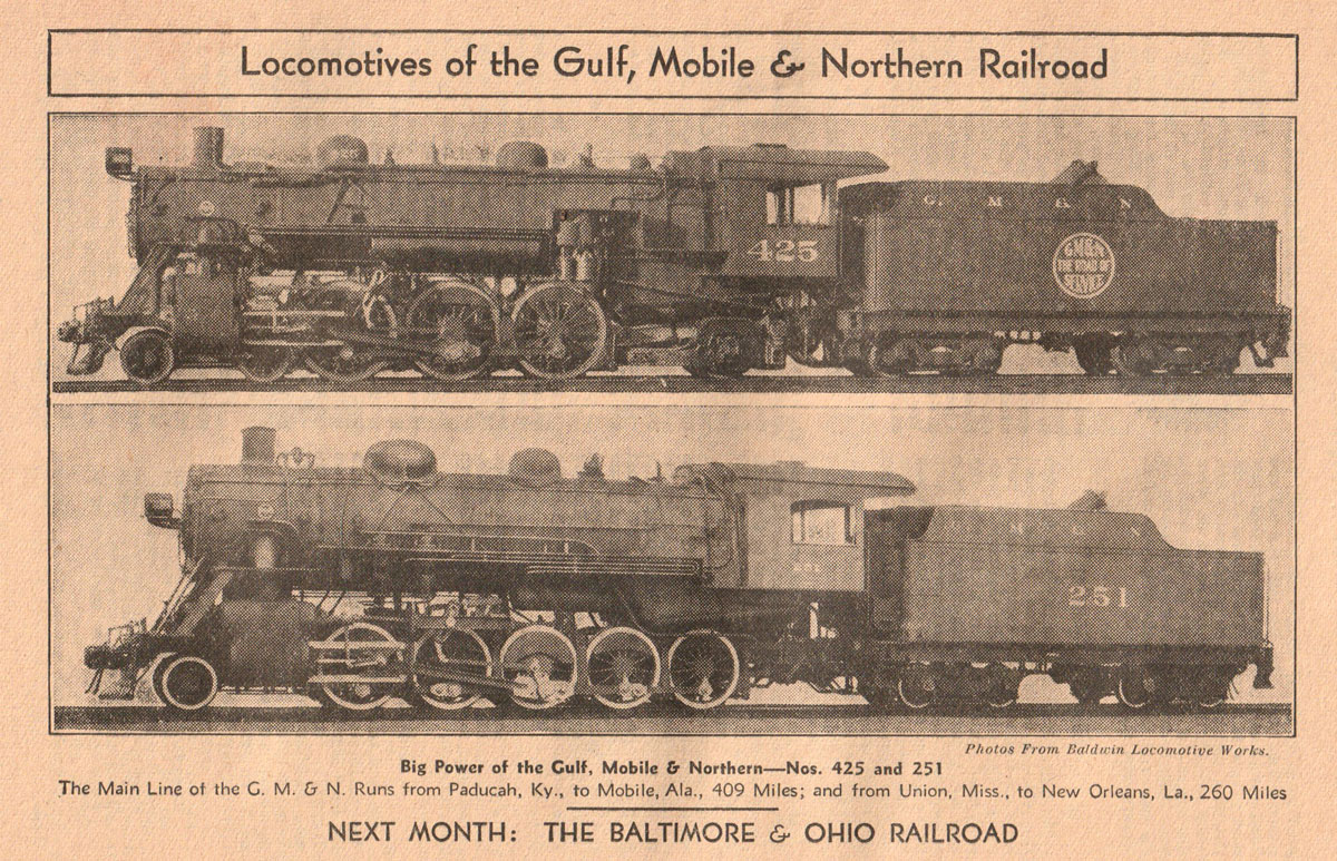
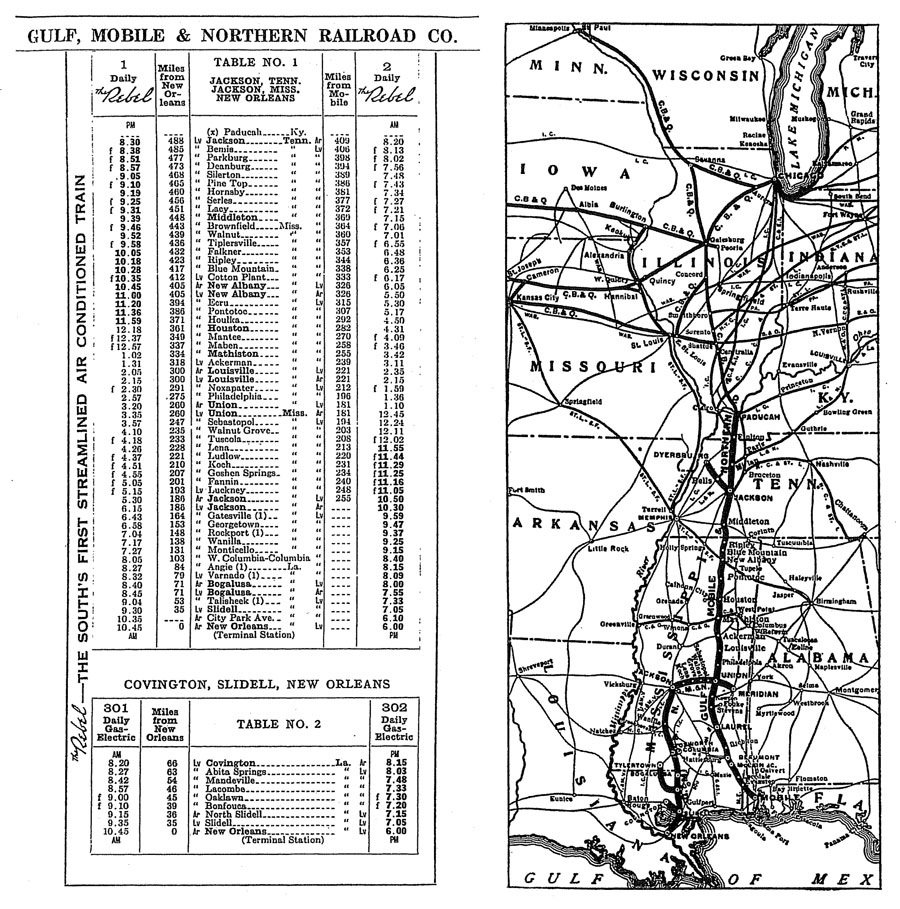
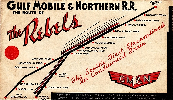
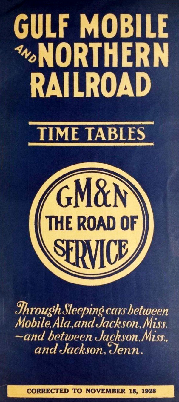
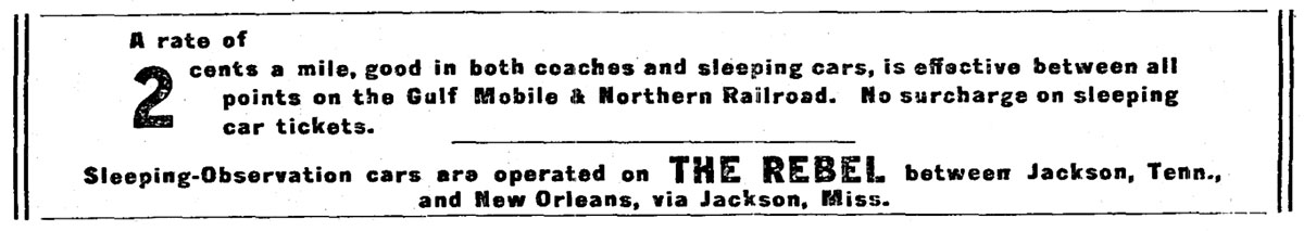
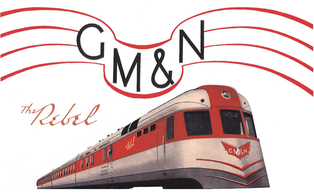
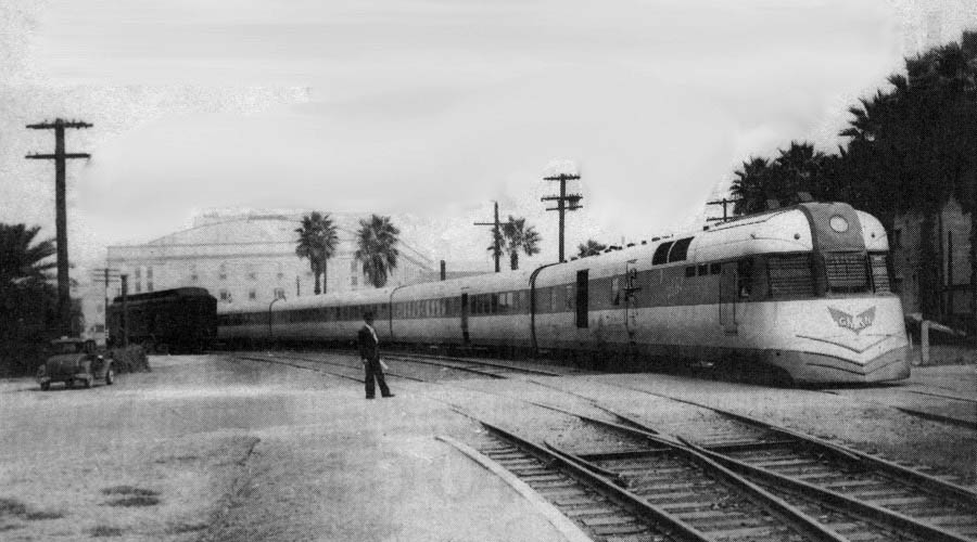
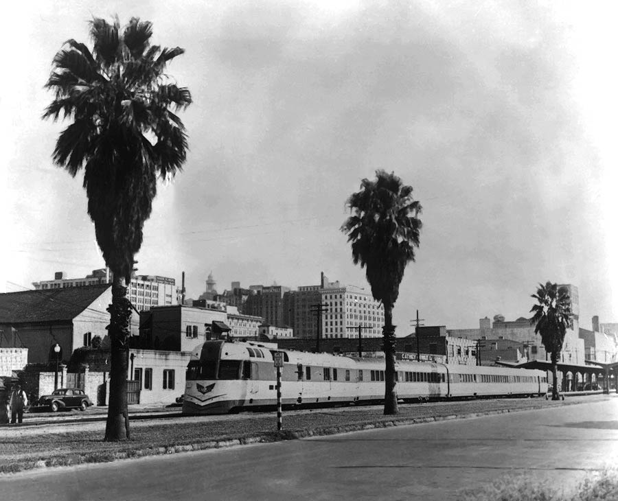
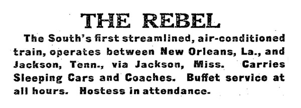
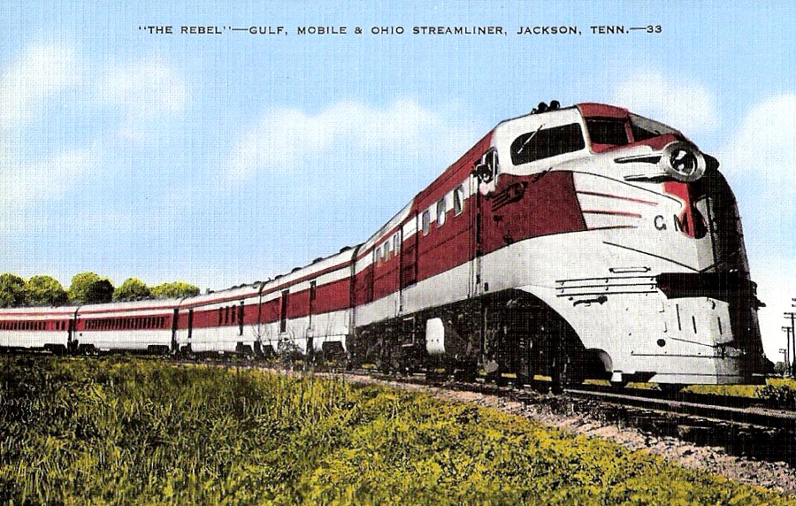
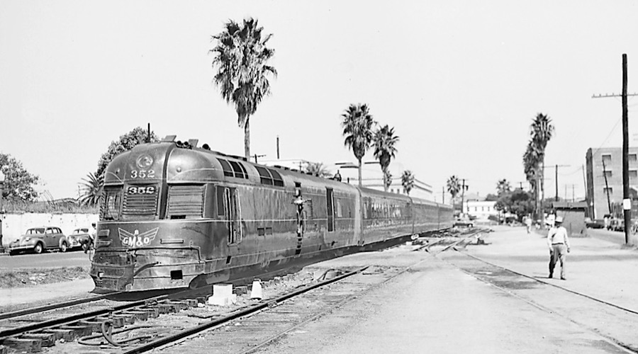
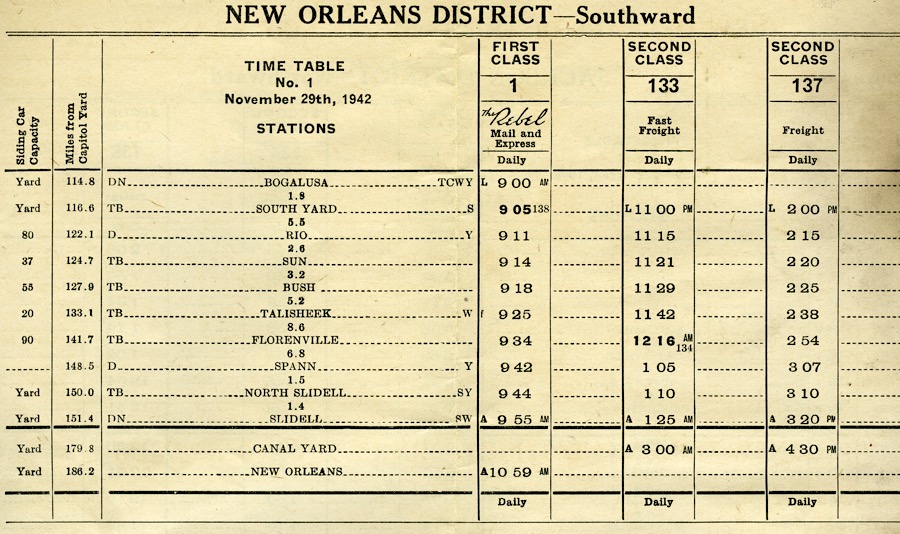
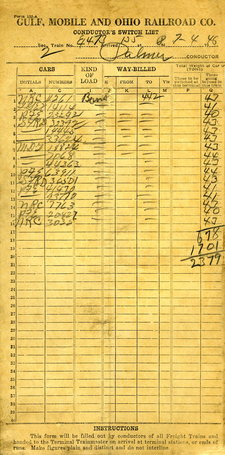
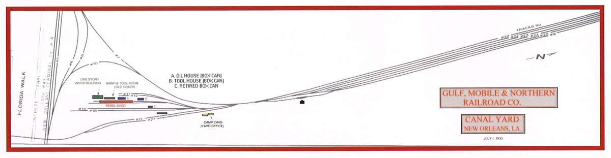
 The Gulf, Mobile & Northern Railroad was formed in 1917 through the reorganization of the New Orleans, Mobile & Chicago Railroad. The backbone of the GM&N was a north-south mainline from Jackson, Tennessee to Mobile, Alabama. In order to leverage traffic agreements with northern railroads, the expanding GM&N took control of the New Orleans Great Northern Railroad in 1929. This lease brought access to New Orleans, via trackage rights at Slidell over the Southern Railway. Once in the city via the Southern, the GM&N had a small freight yard of its own in east New Orleans. Passenger trains used Southern's terminal station on Canal Street. The Gulf, Mobile & Northern was notable for operating an unusual streamlined passenger trainset known The Rebel which operated from Jackson to Mobile, with a section that extended to New Orleans. On September 13, 1940, the GM&N merged with previous north-south neighbor the Mobile & Ohio to form the Gulf, Mobile & Ohio Railroad.
from Railroad Stories magazine (May 1932) / collection

1938 timetable / collection

collection

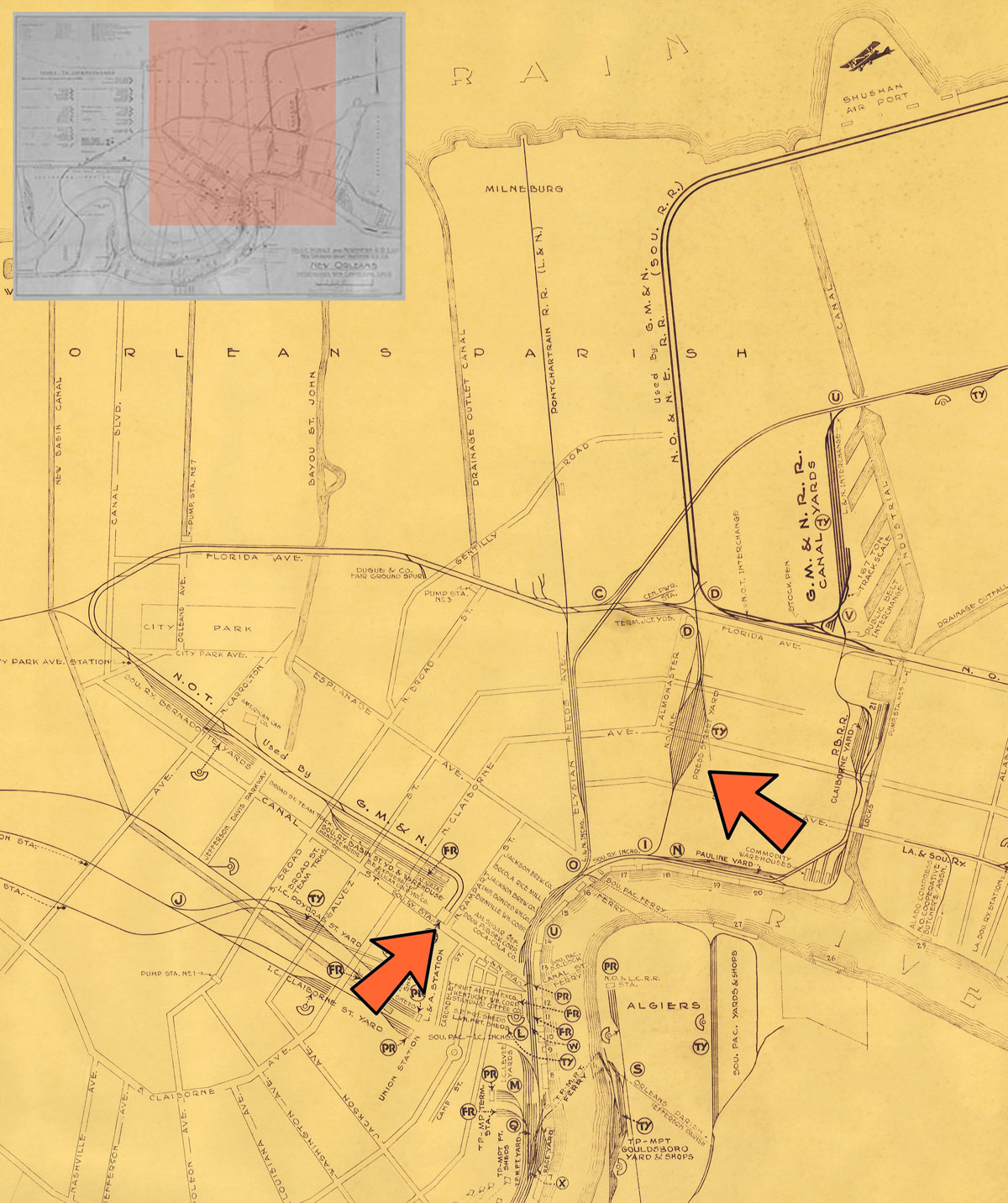
GM&N map detail / adapted RWH
1937 Official Guide ad / collection
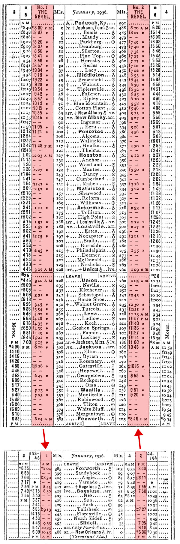
1936 timetable / collection
collection
New Orleans, La / collection
New Orleans, La / collection
collection
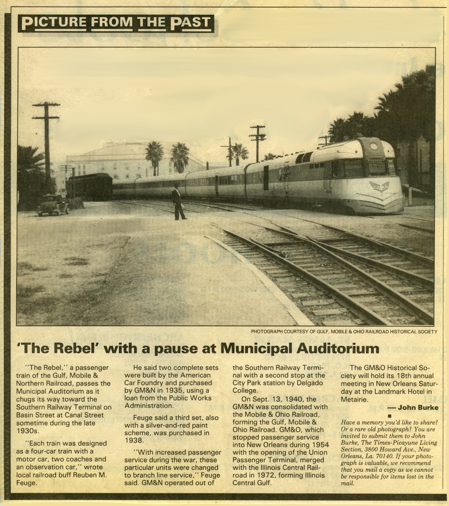
from New Orleans Times-Picayune newspaper (Oct 1990) / collection


See our complete Gulf, Mobile & Northern Fallen Flag scrapbook in Mainlines
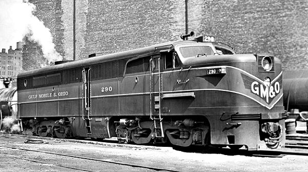
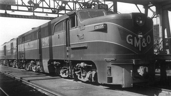
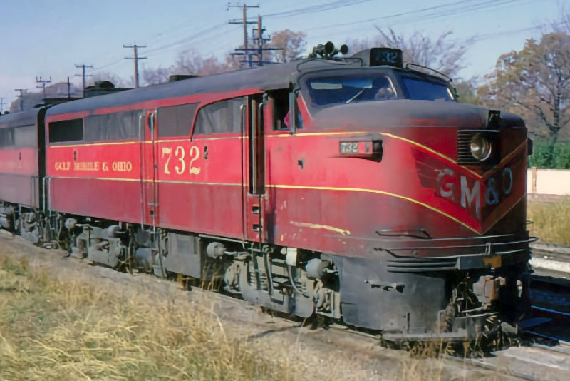
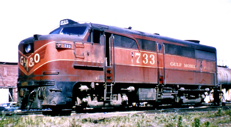
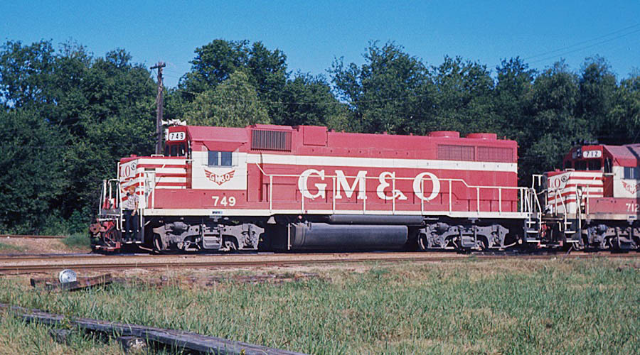
Gulf Mobile & Ohio
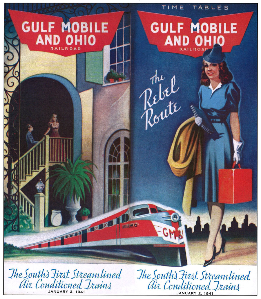
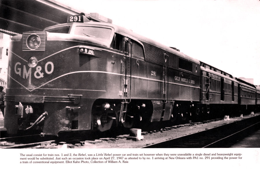
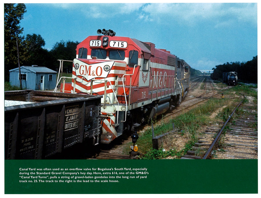
 Created in 1940, the Gulf, Mobile & Ohio Railroad came into being as the merger of two parallel regionals running south to north: newcomer Gulf, Mobile & Northern and the bankrupt veteran Mobile & Ohio. Both predecessor roads served the Gulf Coast ports — Mobile and New Orleans — and both laid rails northward to inland city markets in Tennessee, Kentucky, and Missouri. The new GM&O continued its predecessor GM&N's practice of entering New Orleans on Southern Railway rails. South Yard in Bogalusa, Louisiana, was the GM&O's major staging yard for interchange traffic to the city, but the its mainline ended at Slidell. From there, the Rebel Route crossed Lake Pontchartrain on Southern's bridge and used its mainline to within a mile of Southern's major yard, turning east to the former Gulf Mobile & Northern Canal Yard. GM&O passenger trains likewise used Southern's Terminal Station on Canal Street, but when New Orleans Union Passenger Terminal was construction and Southern's Terminal was closed, the GM&O gave up on passenger service into the Big Easy. The Rebel Route had a freight presence in the city until its merger with rival Illinois Central, forming the Illinois Central Gulf, after which the connection at Slidell as a way to the city became redundant.
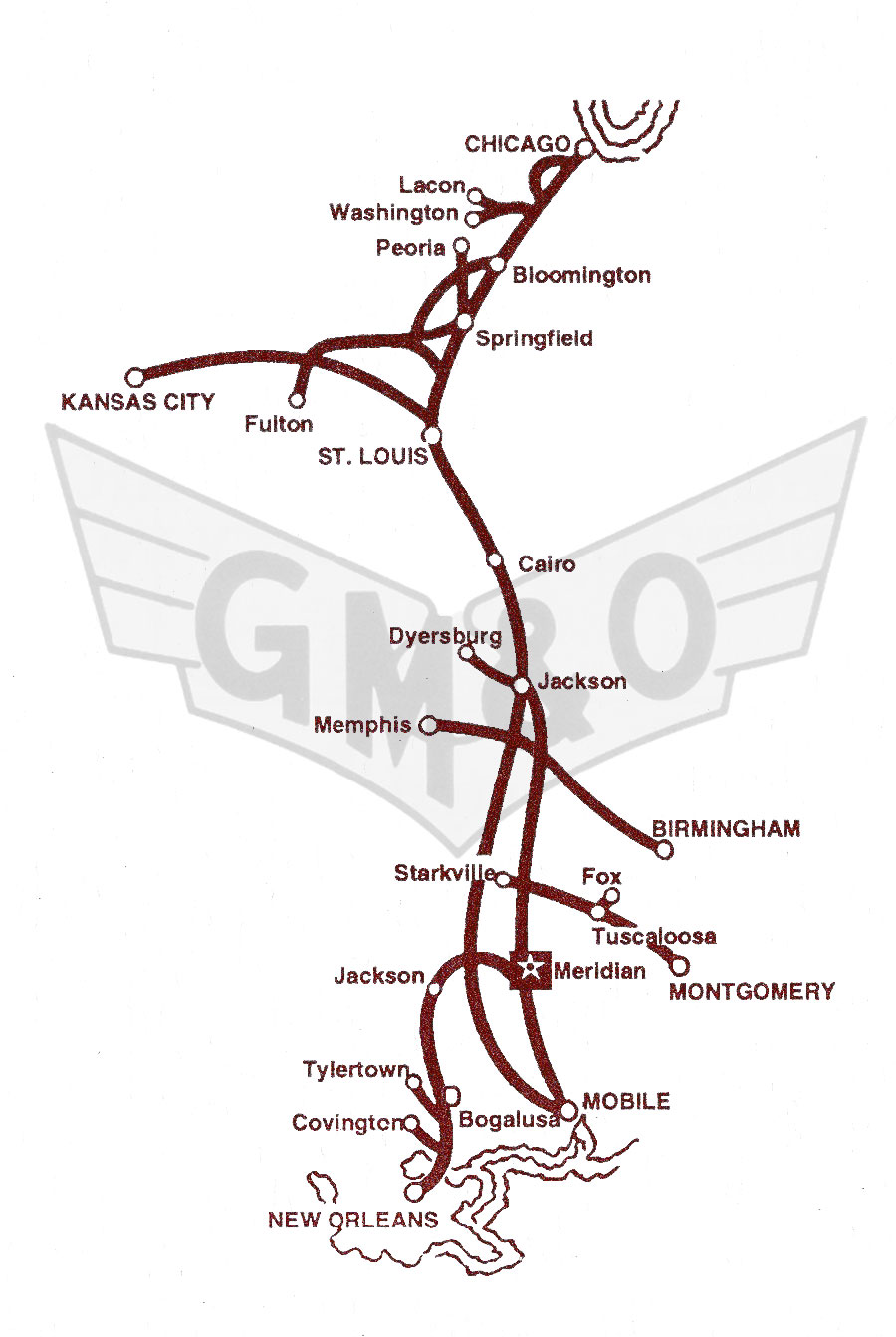
GM&O system map / adapted RWH
collection
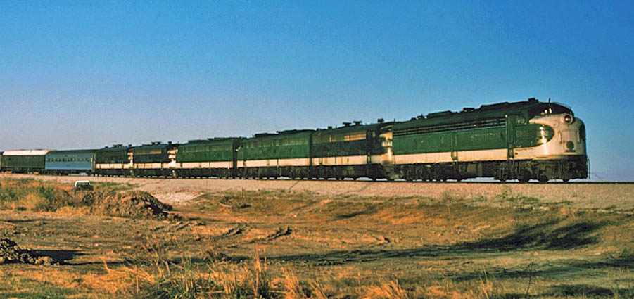
New Orleans, La / Jan 1945 and Oct 1950 / Michael Palmieri collection
1941 timetable / collection
1942 timetable / collection


collection
collection
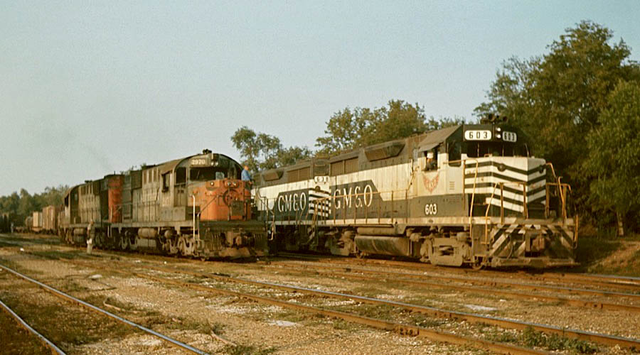
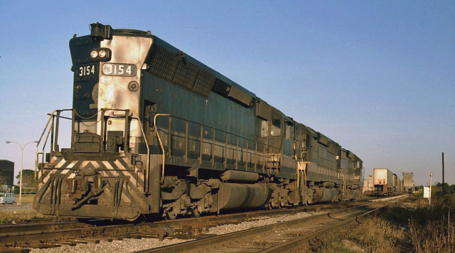
New Orleans, La / Oct 1971 and Feb 1972 / Michael Palmieri collection
from Gulf Mobile & Ohio Historical Society magazine / collection
collection
from Gulf Mobile & Ohio Historical Society magazine / collection
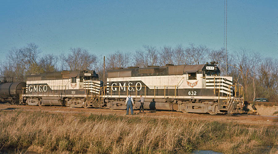
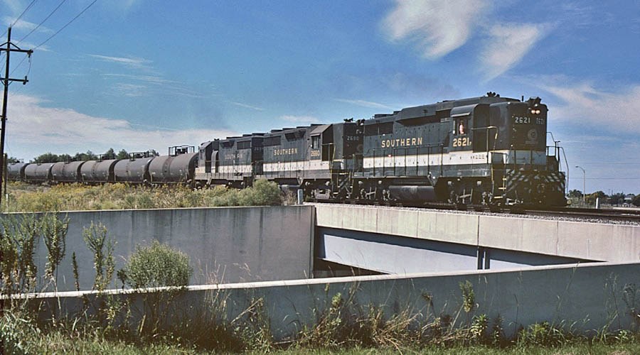
New Orleans, La / Aug 1972 / Michael Palmieri collection
See our complete Gulf Mobile & Ohio Fallen Flag scrapbook in Mainlines
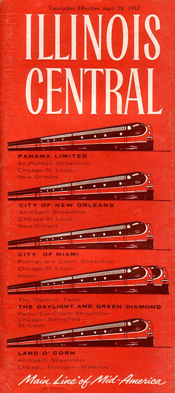
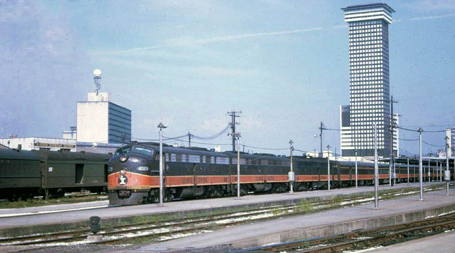
Illinois Central
Illinois Central Gulf
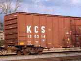
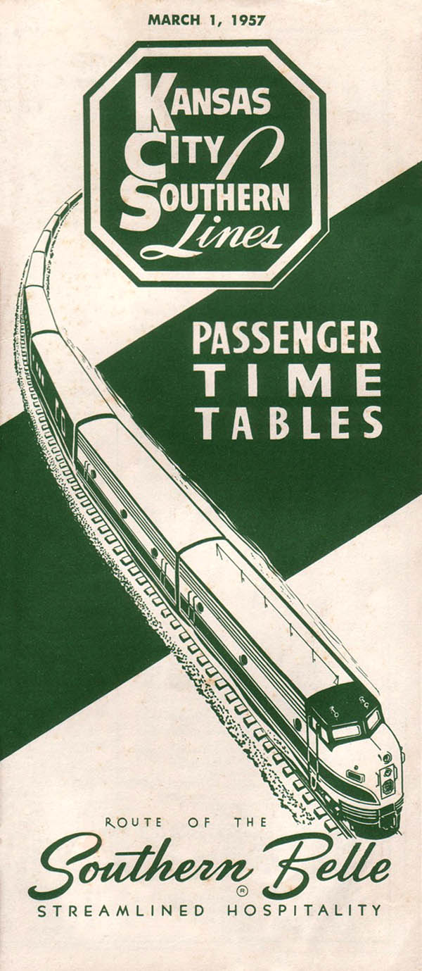
Kansas City Southern
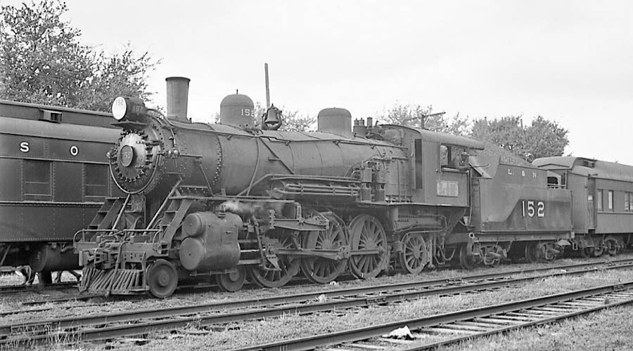
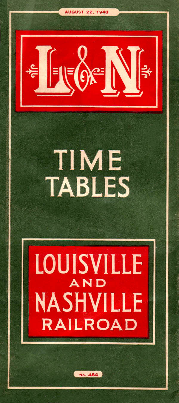
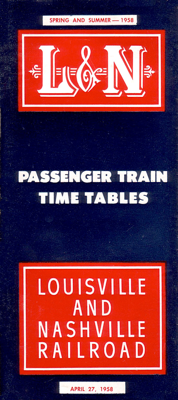
Louisville & Nashville
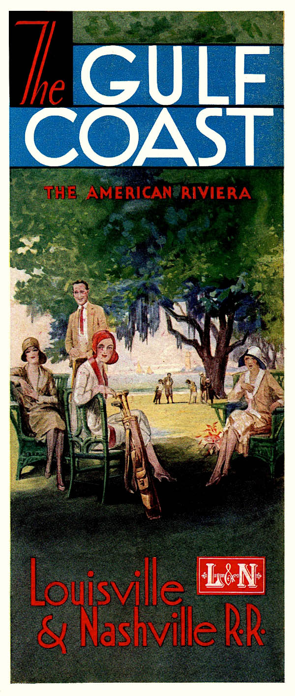
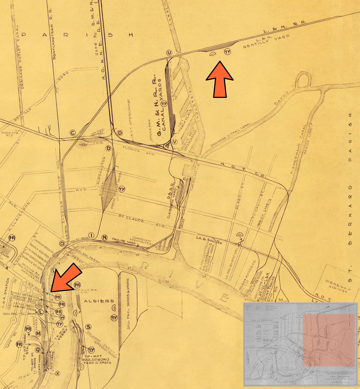
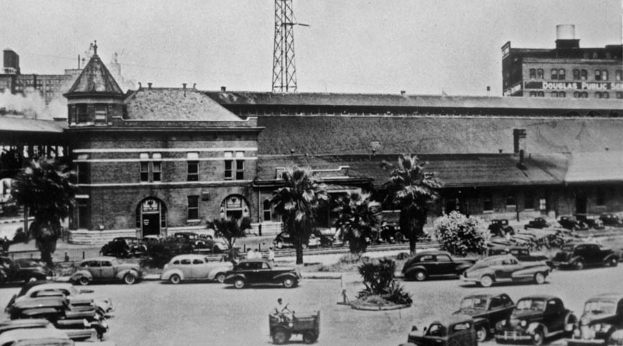
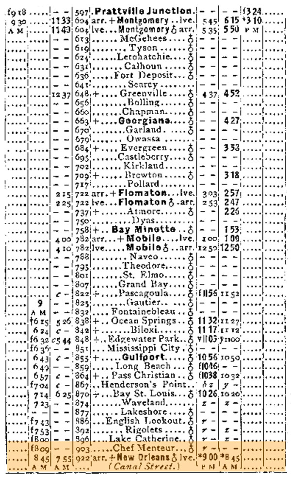
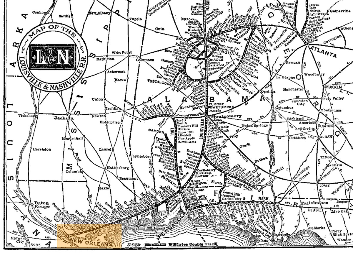
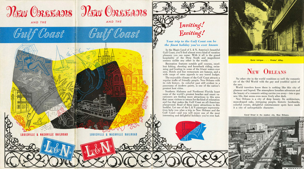
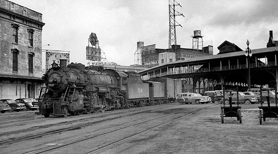
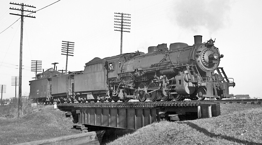
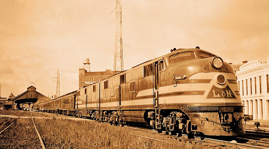
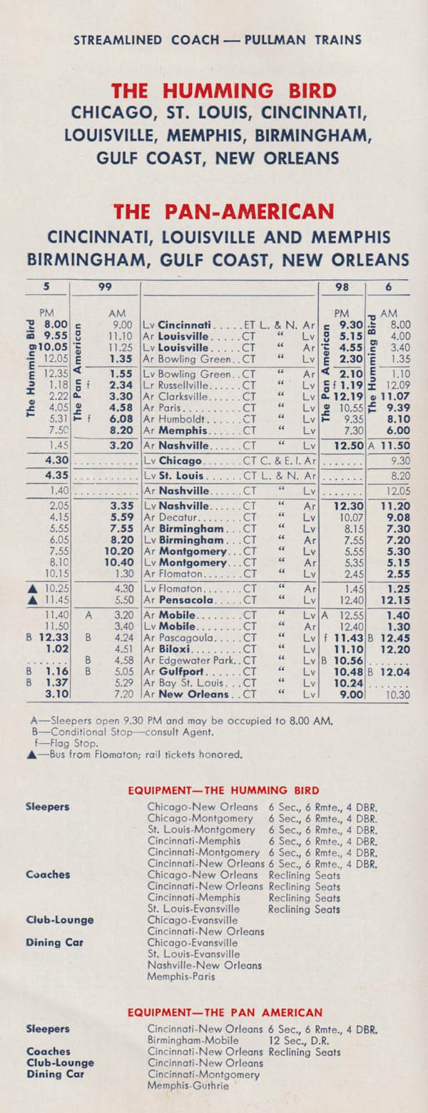
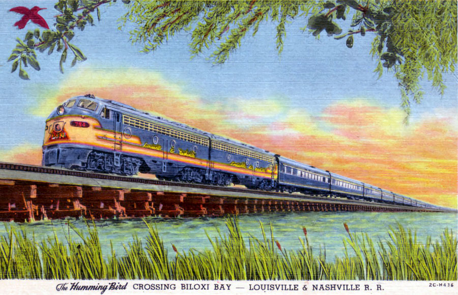
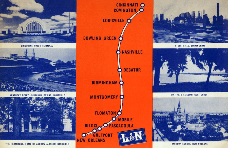
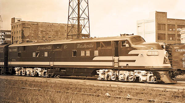
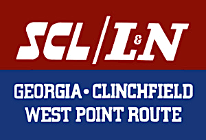
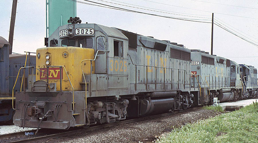
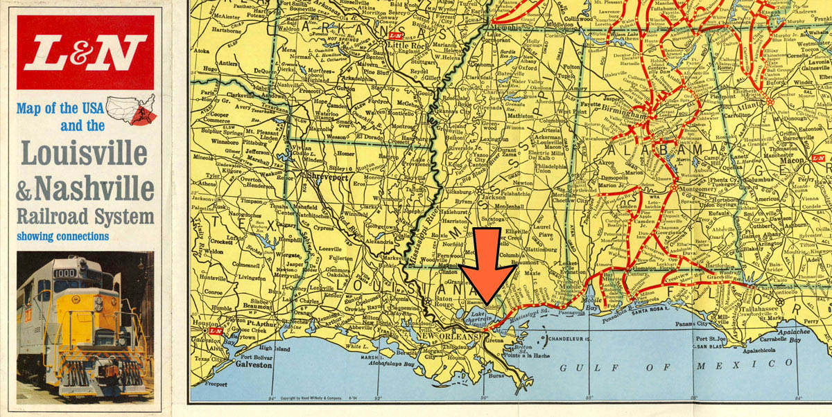
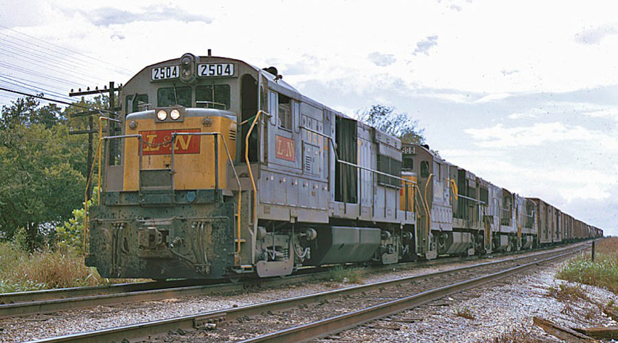
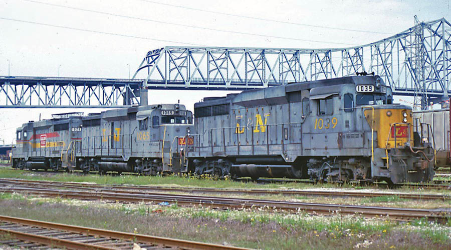
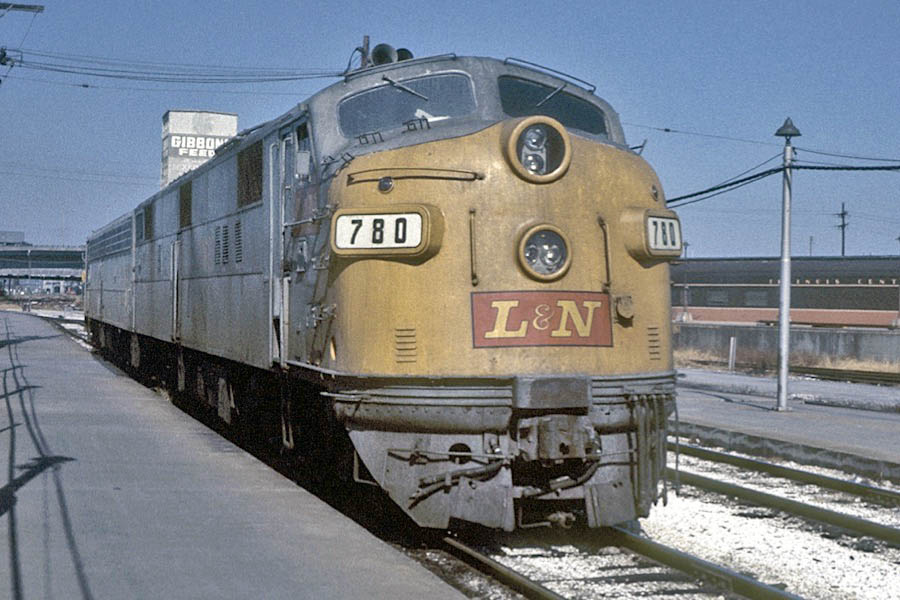
 Dubbed the "Old Reliable," the prosperous Louisville & Nashville Railroad built a successful railroad network stretching from St. Louis and Cincinnati in the north to Pensacola and New Orleans in the south. The road reached the Big Easy from a major junction in Flomaton, Alamaba, through Mobile, and then along the Mississippi Gulf Coast into the city. Freight traffic made use of two major yards in the city: Gentilly Yard out in the northeast and Julia Street yard downtown near the Mississippi River. New Orleans was the L&N's southwestern terminus, therefore a major interchange point for westbound traffic. Until the construction of the New Orleans Union Passenger Terminal in the 1950s, L&N passenger trains terminated in the railroad own's station in the French Quarter, along the river. Major named trains serving the city included the Humming Bird, the Piedmont, and the Pan-American. The L&N came under the control of the Seaboard Coast Line Railroad in the 1970s, and later was a constituent in the major CSX Transportation merger of the 1980s.
1932 timetable / collection
New Orleans, La / Jan 1952 / Michael Palmieri collection
L&N map detail / adapted RWH
1943 timetable
New Orleans, La / collection
1940 Official Guide map / collection
collection
New Orleans, La / Jan 1951 / Michael Palmieri collection
New Orleans, La / Jun 1947 / Michael Palmieri collection
collection
1956 timetable / collection
collection
collection

collection
New Orleans, La / May 1952 / Michael Palmieri collection
L&N advertisement / collection

New Orleans, La / Oct 1978 / Michael Palmieri collection
1978 Official Guide ad / collection
1964 L&N system map clipping / adapted RWH
New Orleans, La / Oct 1972 and Mar 1980 / Michael Palmieri collection
See also our complete Louisville & Nashville Fallen Flag scrapbook in Mainlines
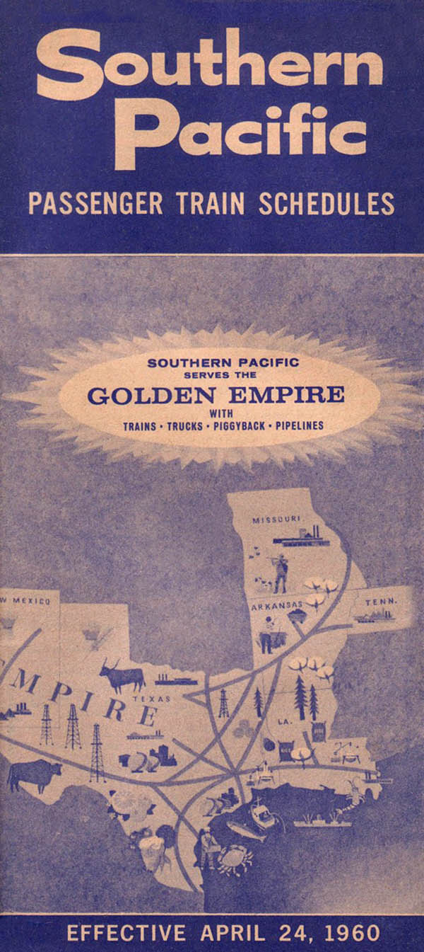
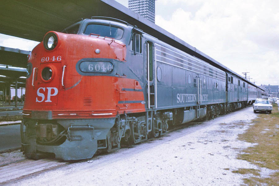
Southern Pacific
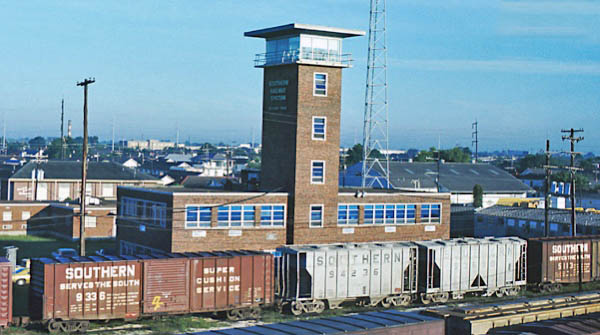
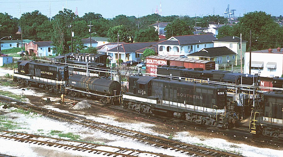
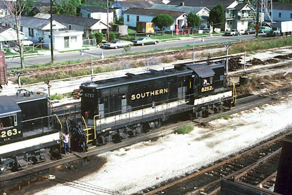
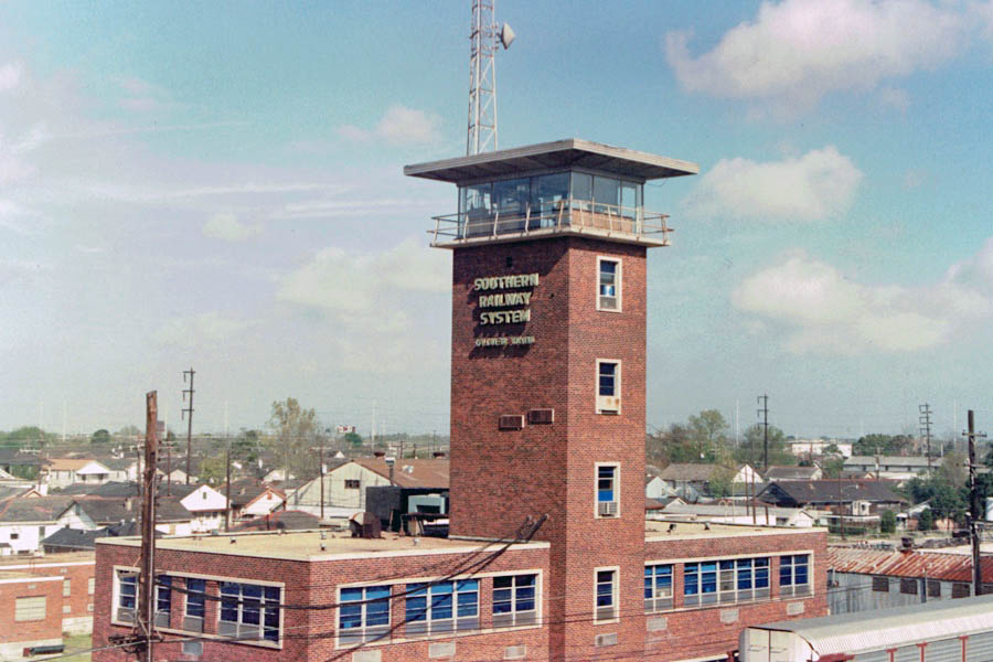
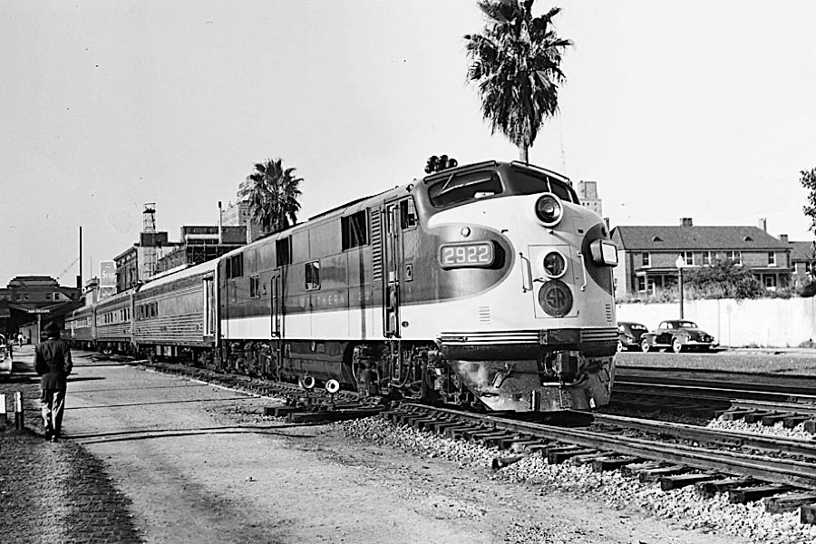
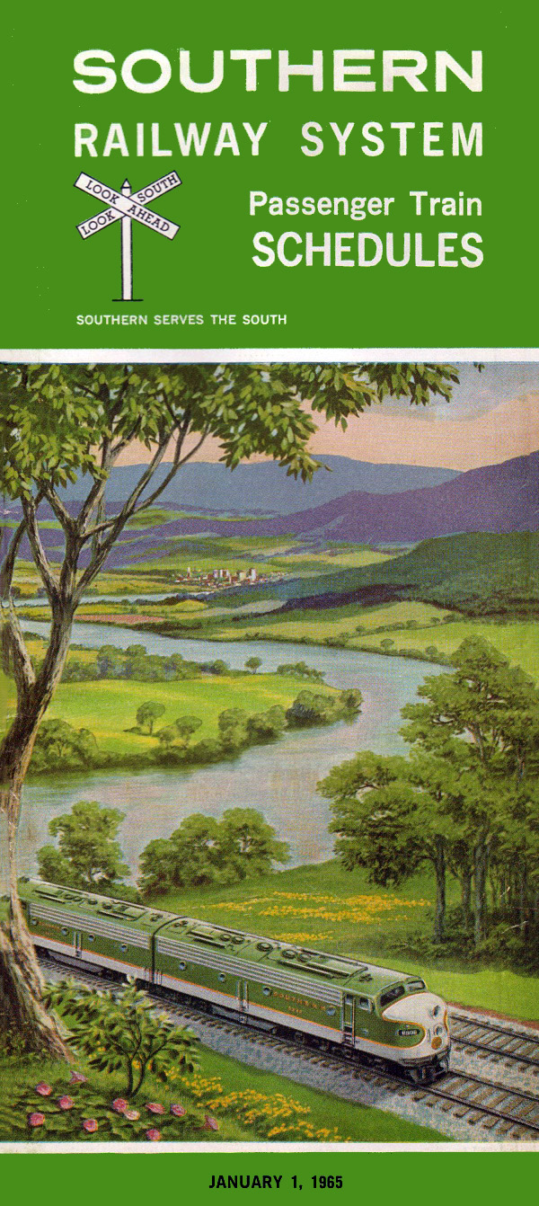
Southern Railway
SOU map detail / adapted RWH
Seabrook, La / Dec 1978 / Michael Palmieri 
Seabrook, La / Nov 1974 / Michael Palmieri
Seabrook, La / Oct 1978 / Michael Palmieri
1971 timetable / collection
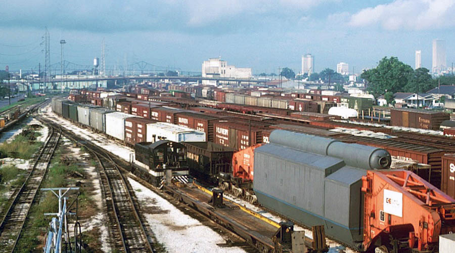
New Orleans, La / Jun 1974 / Michael Palmieri
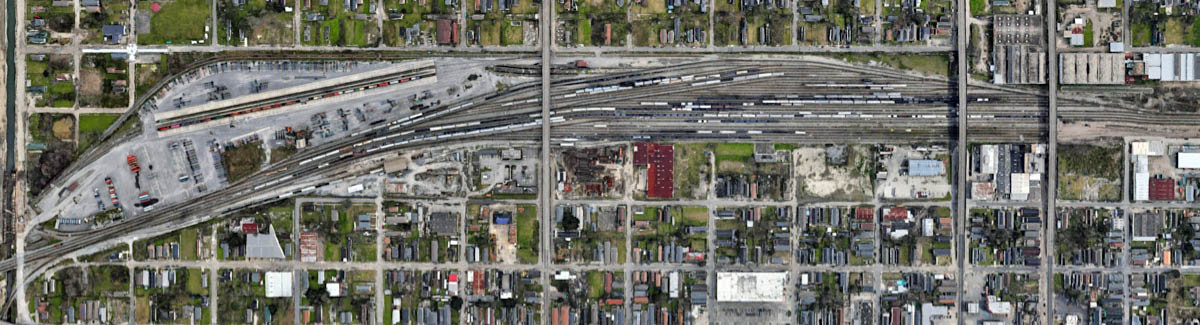
Oliver Yard overhead / Google Maps
New Orleans, La / Jun 1975 / Michael Palmieri
New Orleans, La / Jun 1981 / Michael Palmieri
New Orleans, La / Sep 1980 / Michael Palmieri
New Orleans, La / Jul 1990 / RWH
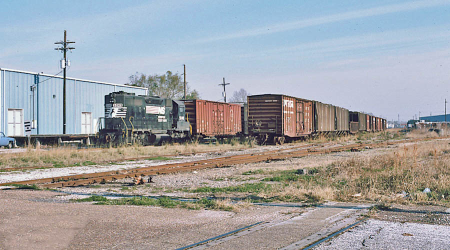
New Orleans, La / May 2000 / JCH
New Orleans, La / May 2000 / JCH
New Orleans, La / May 2000 / JCH
New Orleans, La / May 2000 / JCH
New Orleans, La / May 2000 / JCH
New Orleans, La / May 2000 / JCH
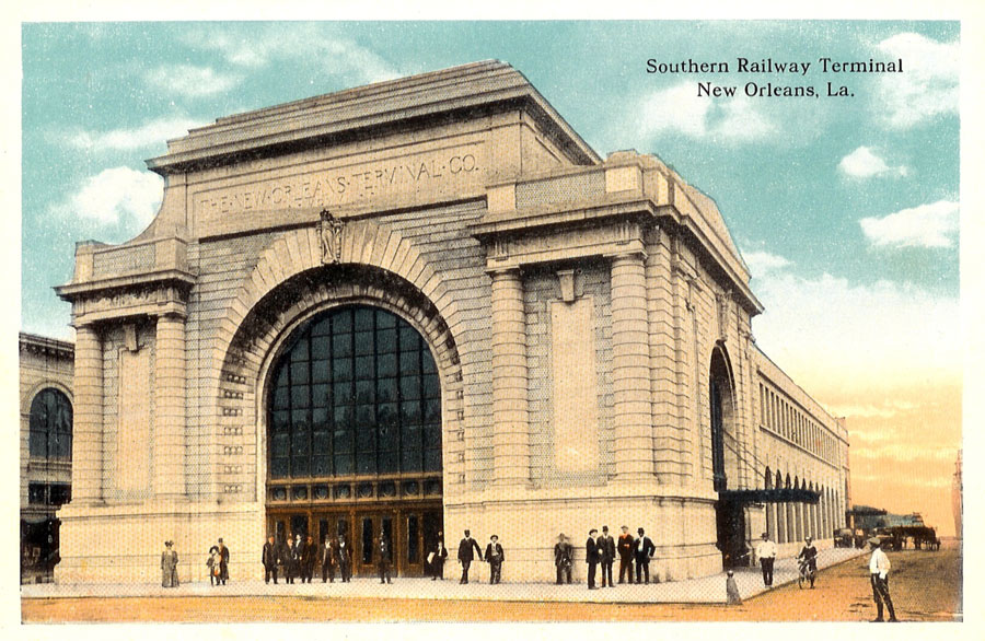
postcard / collection

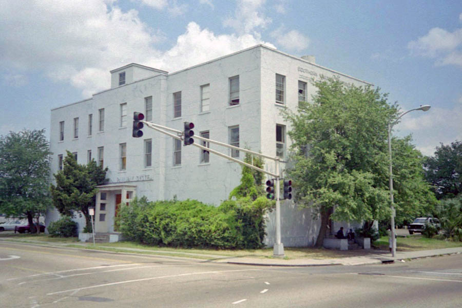
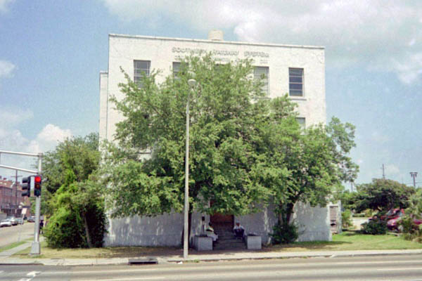
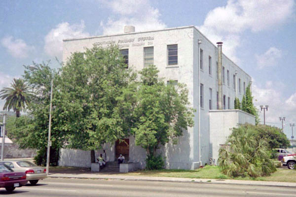
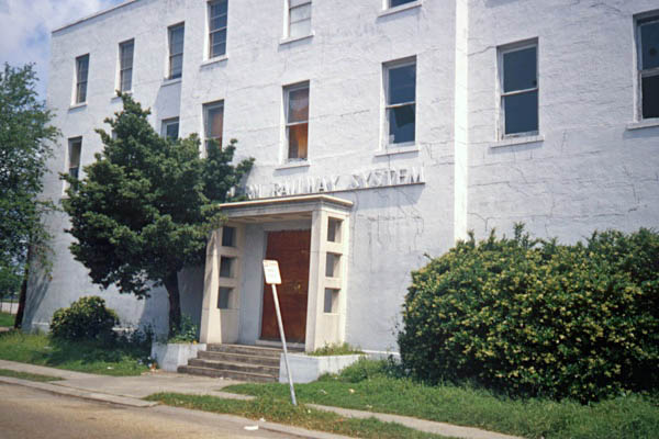
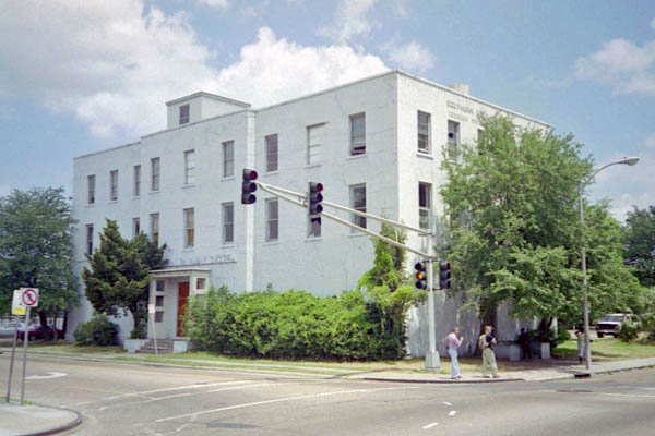
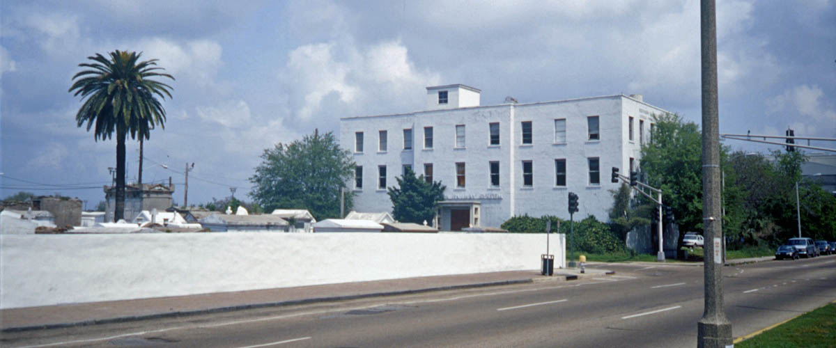
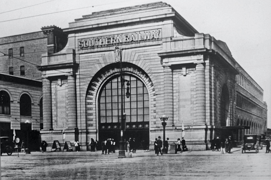
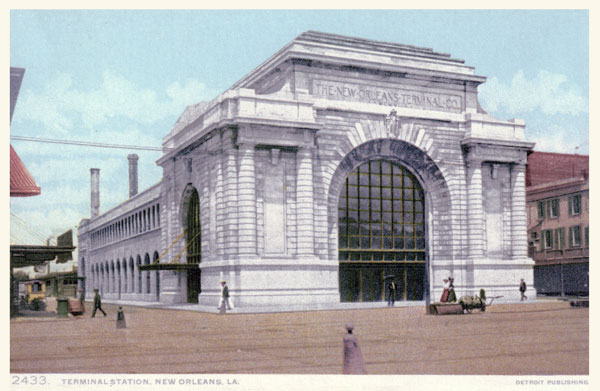
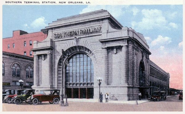
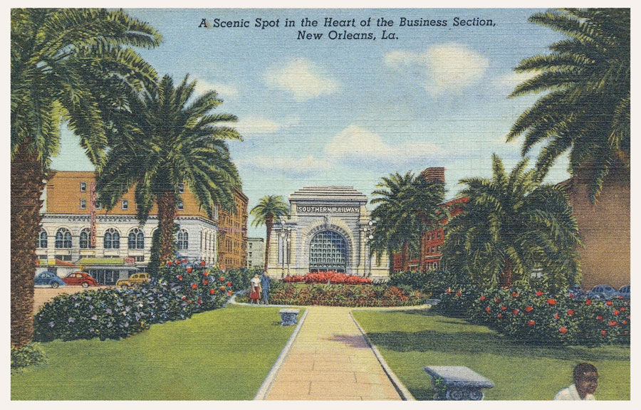
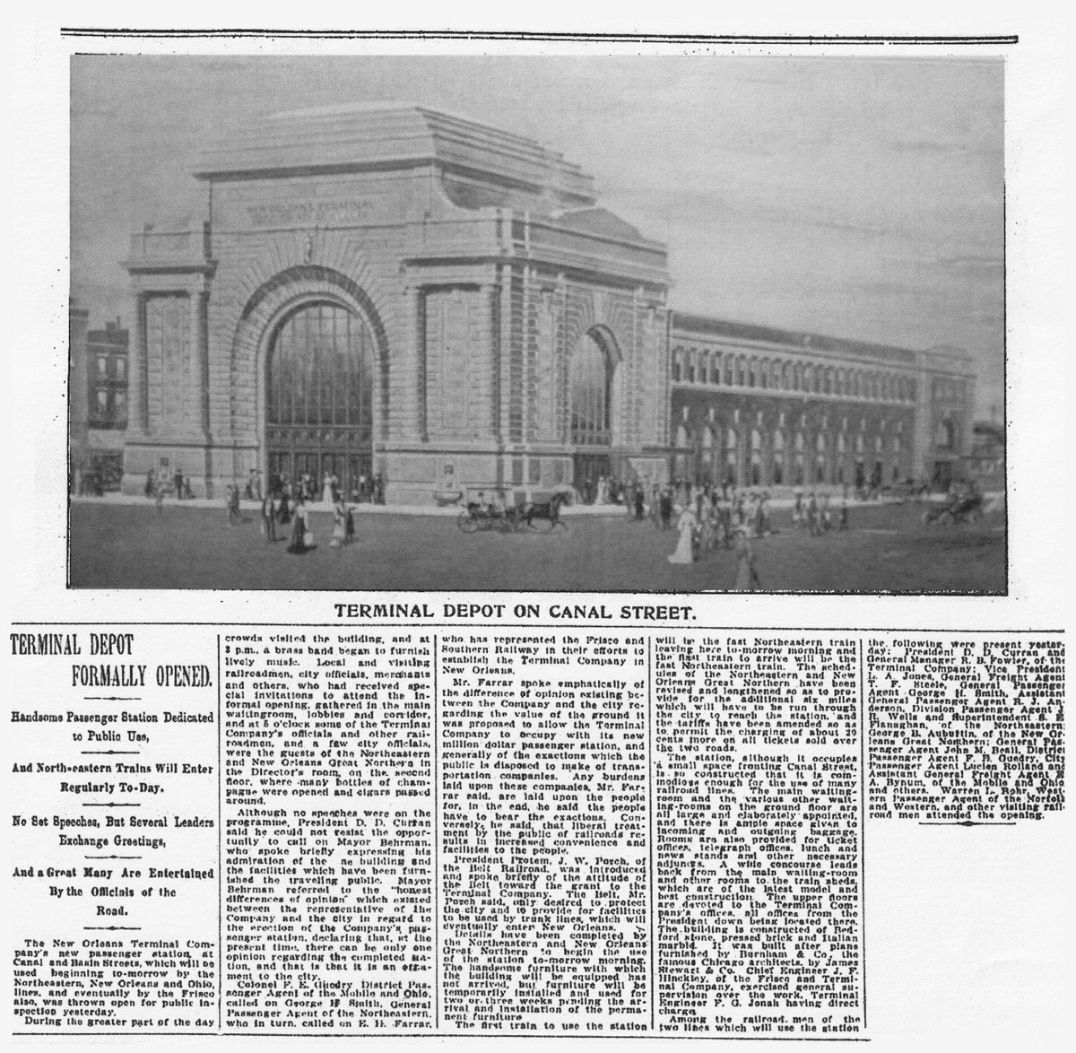
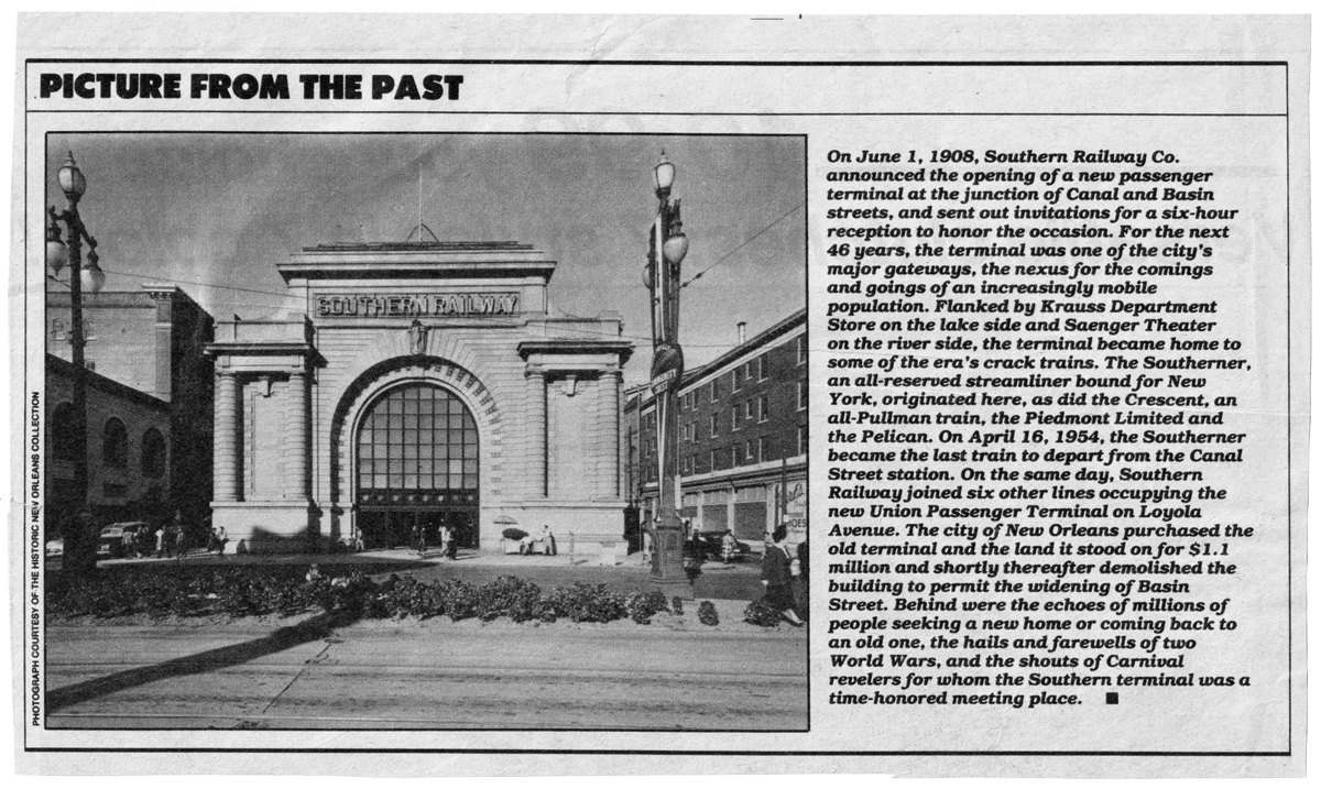
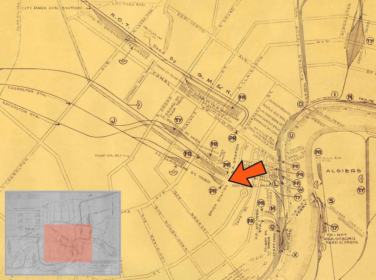
The Southern Railroad Terminal, also known as the Terminal Station, was constructed at 1125 Canal Street in 1908. The building was designed by Daniel Burnham, the architect for Washington D.C.'s Union Station. The station served the Southern Railway's subsidiaries, the New Orleans and Northeastern Railroad Company and the New Orleans Terminal Company. In the 1940's, the station's signature train was "The Southerner," which departed New Orleans daily for the east coast.
from SPV Comprehensive Railroad Atlas
/ collection
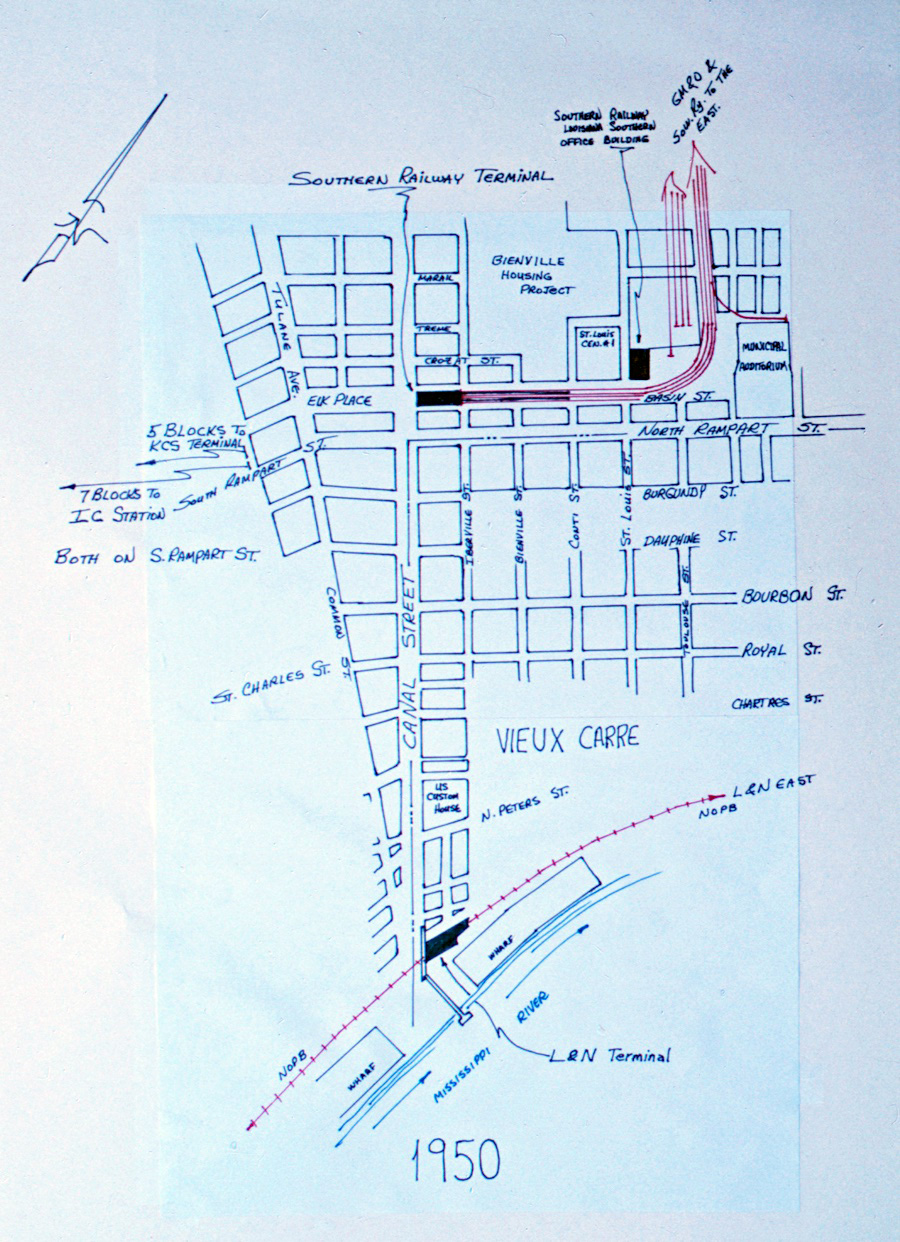
1950 Terminal Station area street map / JCH

Click to see the Terminal Station former location plotted on a Google Maps page
Terminal Station / New Orleans, La / collection
postcard / collection
postcard / collection
collection
 Article
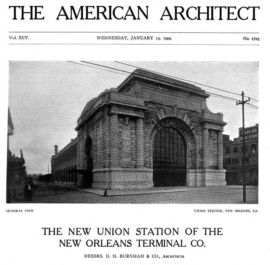
The New Union Station of the New Orleans Terminal Co.
The American Architect — January 1909
On Canal street, the main business thoroughfare of New Orleans, and close to the commercial center of the city, is the new Union station of the New Orleans Terminal Co. The station building is 82 feet wide by 235 feet long. The work was commenced in midsummer, 1907, and is now practically complete. This may be cited as an example of the rapidity of modern building construction. Well-organized methods, mechanical skill and executive ability are accomplishing remarkable results throughout the country, and the fact that a structure of this magnitude, from its beginning to its completion, can be safely and satisfactorily erected in less than eighteen months is a matter worthy of note.
The architecture of the building, as will be seen, is a sane adaptation of the modern French. The building typifies in a large sense the purpose for which it was erected, and in this respect teaches, in a quiet way, a lesson to more pretentious structures erected for a similar purpose. The problem of the adaption of design to purpose, location and climate is often difficult. We feel that in the present instance, the results achieved are eminently satisfactory. The setting of the building is such that the architectural excellence of its lines can be viewed to good advantage. On each side of this terminal there is a street 45 feet in width, while the main façade faces a wide parked approach, some two blocks long.
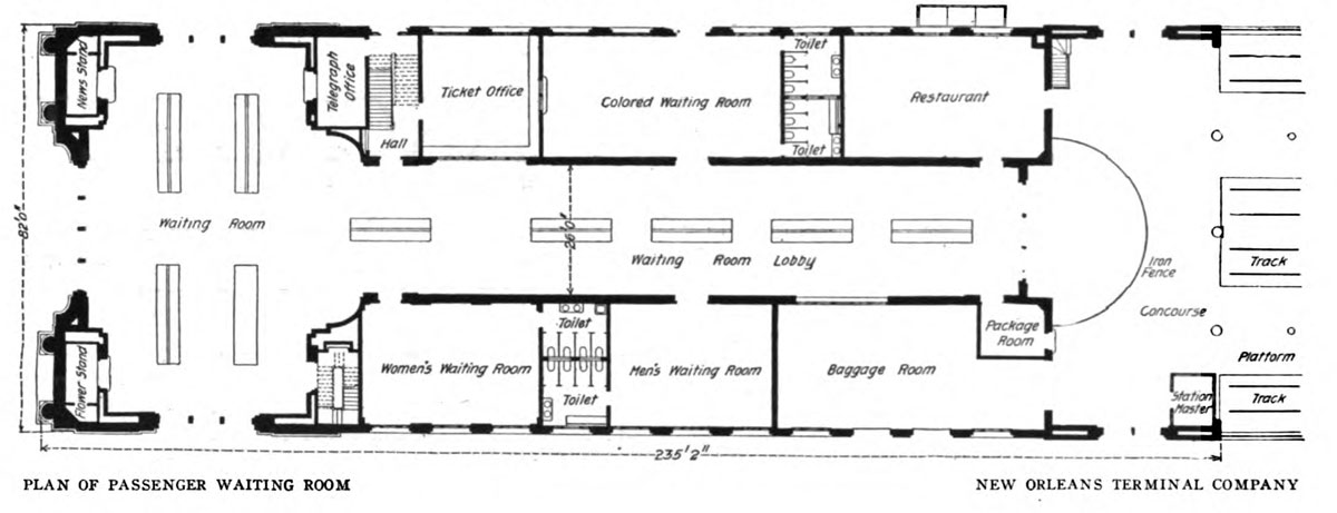
Through the main entrance, the archway of which is 30 feet wide by 40 feet high, the traveler enters the main waiting room. This room is 40 feet wide, 80 feet long, and has a clear height to the central dome of 52 feet. On the side streets there are arched entrances 3o feet high. As will be seen by reference to the plans, this waiting room is accessible on all sides by large open- ings, thus providing the most desirable feature in railway terminals, ease of ingress and egress by large num- bers without undue crowding and confusion during the so-called "rush hours" of daily traffic.
Centrally through the building is the main waiting-room lobby, while grouped on each side are the various rooms and offices necessary to the prompt and efficient transaction of passenger railway service. The concourse, placed at the end of the waiting room, has exits to the side streets to avoid interference with outgoing traffic. It is 80 feet long by 35 feet wide. The foundation, the setting of which was much complicated by the necessity of taking care of an old drainage canal, some 22 feet in width and which runs length-wise under the building, is of concrete on piling.
The lower courses of the Canal street exterior and the main structure on the side streets are of granite, the upper of Bedford stone. The remainder of the building is of brick and stone. The brick used is of a specially made gray color harmonizing with the stone, the ensemble being a most restful and artistic result. The interior construction of the main waiting room shows a central dome, from which barrel vaults extend to eath of the four sides of the room.
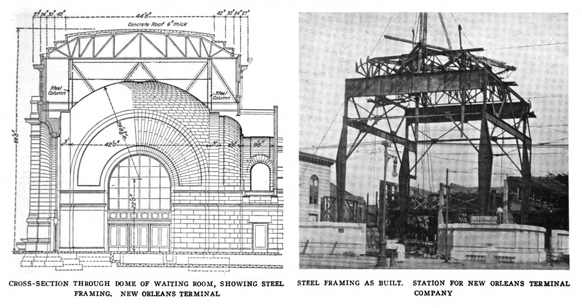
To a height of 12 feet above the floor, the side walls are finished in marble; above is cement, in imitation of stone, treated to harmonize with the marble. Here, again, one notices the satisfactory treatment of color values and the restful character of the tones employed. The floor of the main waiting room is mosaic tiled, as are also the smaller waiting rooms and offices. These smaller rooms have plaster walls.
The main waiting room has a steel frame to carry the dome and attic roof. To adapt this to the floor plan and superstructure was an interesting engineering problem. The solution has been to support this steel frame at four points only, the supporting columns being symmetrically placed as indicated on the first floor plans. Reference to the sectional view of waiting room will show that these four points are well within the lines of the attic walls, and these are carried by cantilever members and suitable girders. Above these girders, and resting on them, are the steel roof trusses, of which there are six — three in each direction. These carry a concrete roof 6 inches thick, including a skim coat of 1 inch, the concrete spans being arched between I-beam purlins as shown.
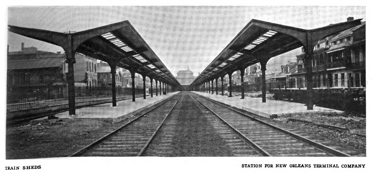
There are four tracks entering the station. These are protected by inverted umbrella sheds, 704 feet long. The cast-iron supporting columns are anchored to concrete blocks. The tracks are separated from the streets by an ornamental iron fence.
Messrs. D. H. Burnham & Co., of Chicago, were the architects of the building.
The American Architect and Building News #95 — January 1909 — Public Domain
postcard / collection
from New Orleans Picayune newspaper
(May 1908) / collection
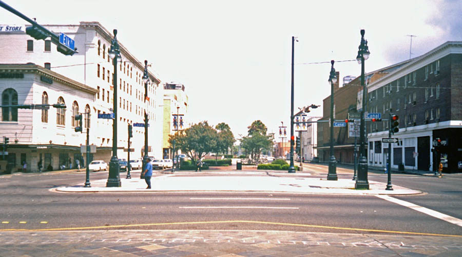
Canal Street front / New Orleans, La / May 2000 / JCH
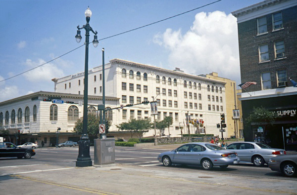
Canal angle view / New Orleans, La / May 2000 / JCH
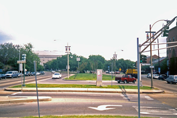
outbound right of way / New Orleans, La / May 2000 / JCH
New Orleans Times-Picayune / collection
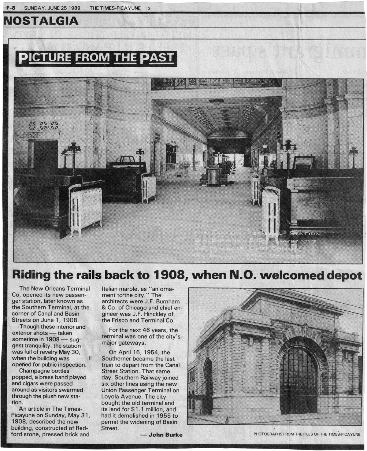
New Orleans Times-Picayune - Jun 1989 / collection
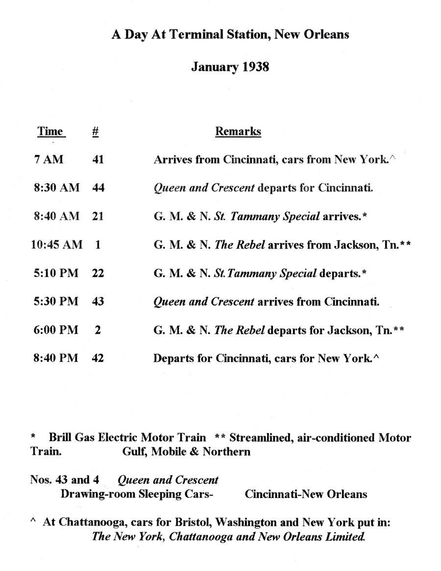
1938 Terminal Station notes / JCH
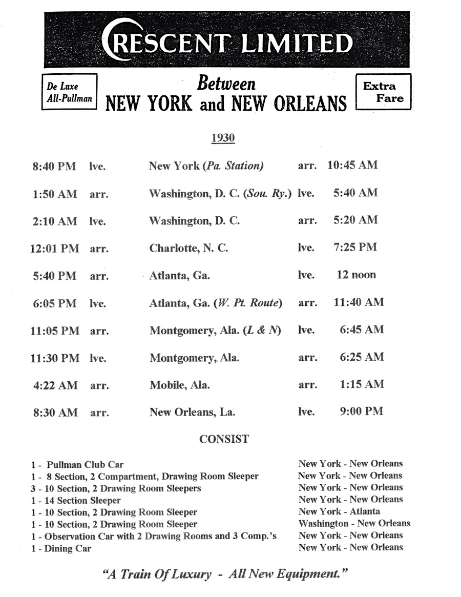
1930 Crescent Limited notes / JCH
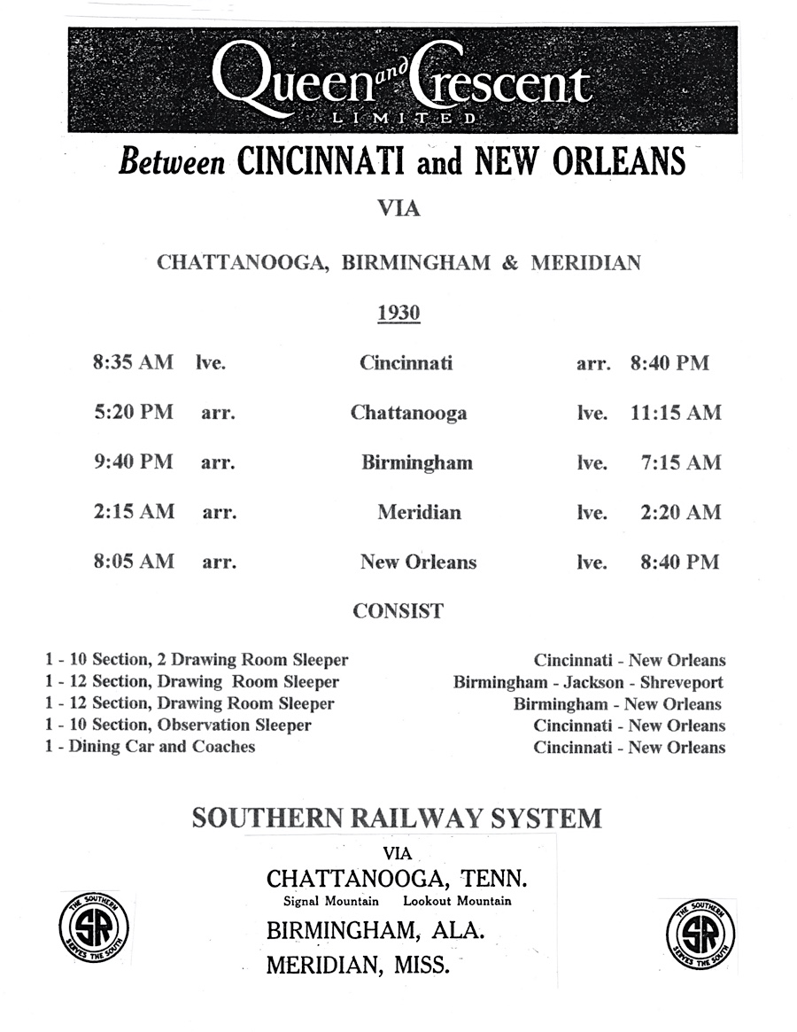
1930 Queen & Crescent notes / JCH
The Southerner
New Orleans, La / Oct 1950 / William Harry / Michael Palmieri collection
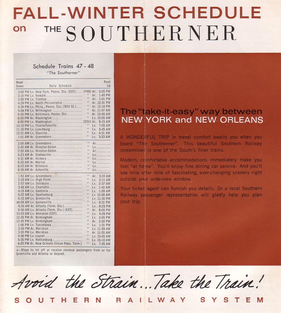
Southerner timetable ad / collection
New Orleans, La / Jul 1977 / Michael Palmieri
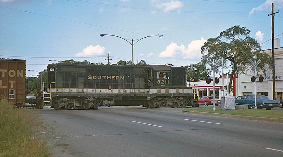
Southern Railway GP7 8211 crosses North Carrollton Avenue while working on the Bernadotte Branch (above). This was one of four GP7's (8210-8213) built in May 1950 for the Southern's Georgia Southern & Florida subsidiary. Prior to the opening of New Orleans Union Passenger Terminal in 1954, this line was used by Southern and GM&O passenger trains for access to the Southern's Terminal Station on Basin Street at Canal Street.
Norfolk Southern GP38-2 5049 was working on the railroad's St. Louis Street branch at North St. Patrick Street (below). Up until 1954, this line was used by Southern and GM&O passenger trains for access to Terminal Station on Canal Street, and the tracks on the right of the geep were the remnants of Bernadotte Yard. Notice the Southern Railway whistle post on the left.
Michael Palmieri
New Orleans, La / Jan 1988 / Michael Palmieri
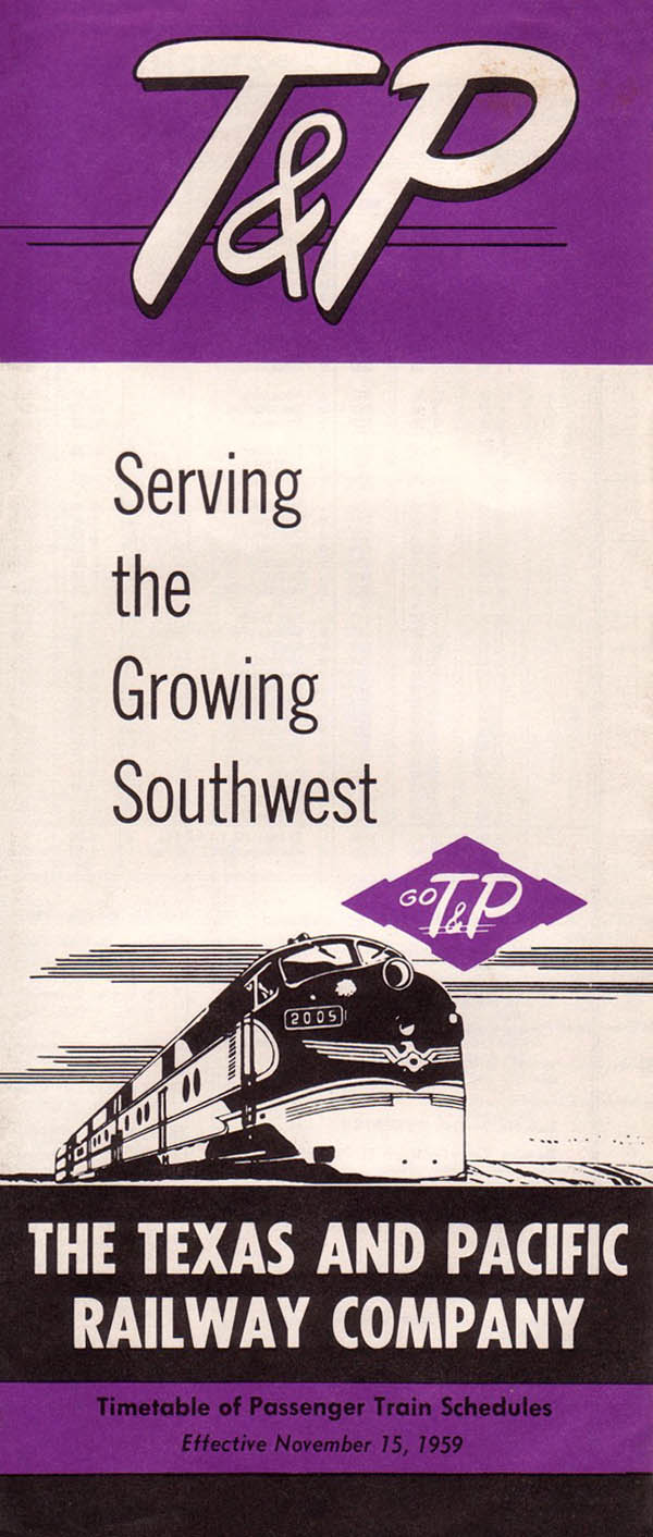
Texas & Pacific
Union Passenger Terminal
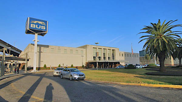
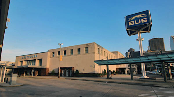
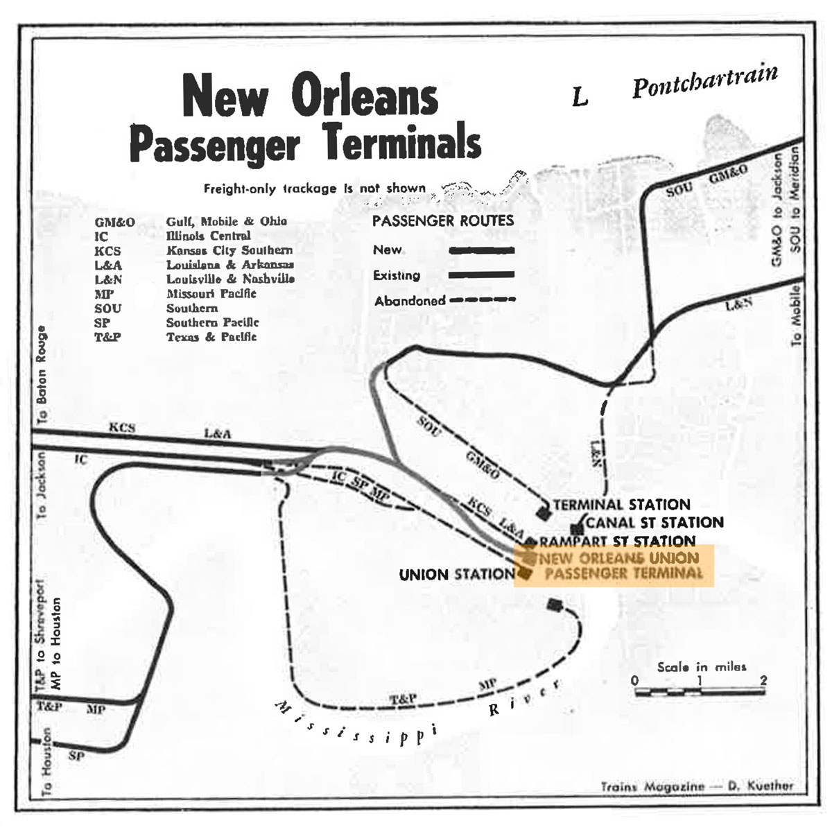
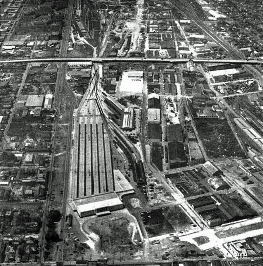
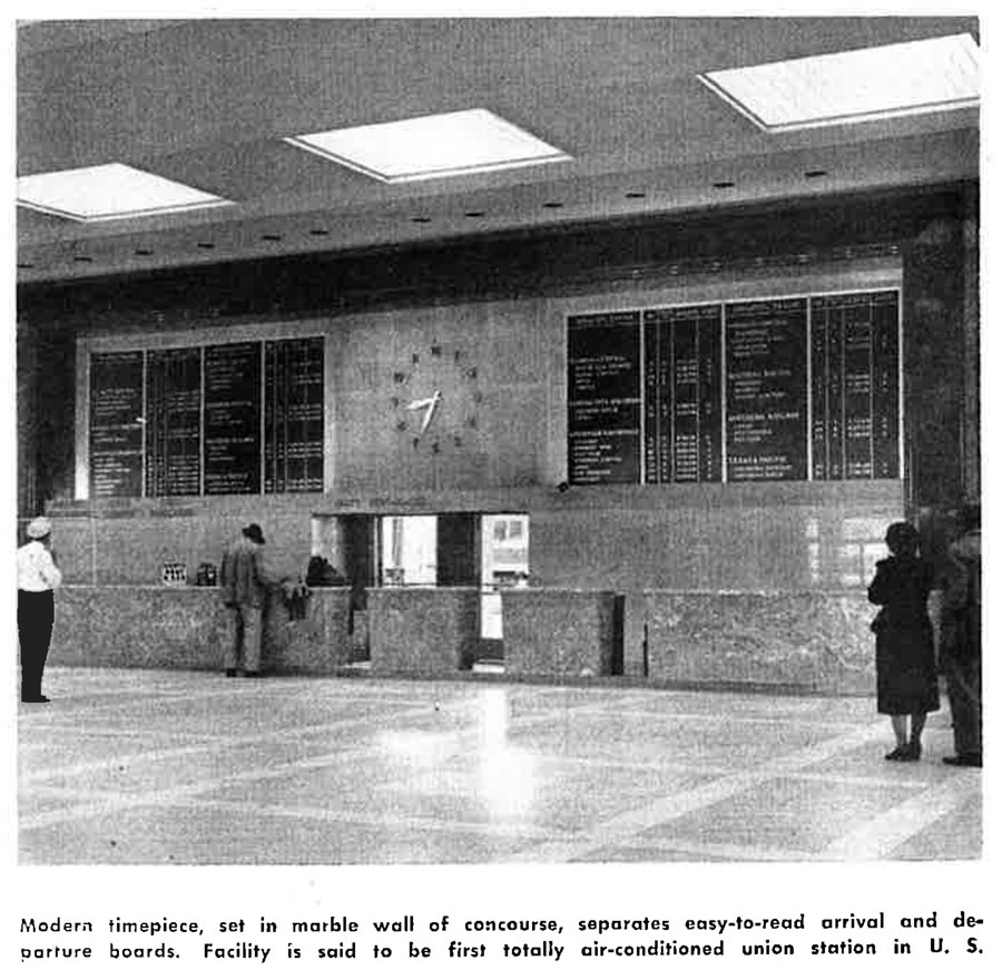
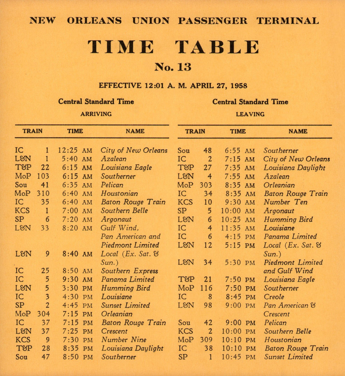
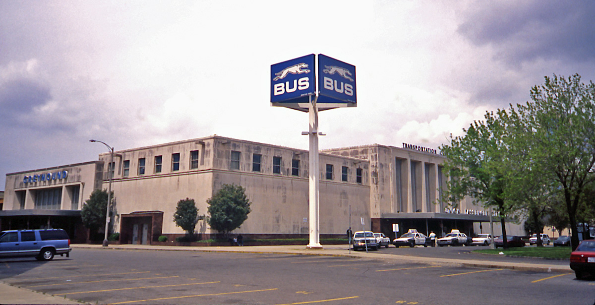
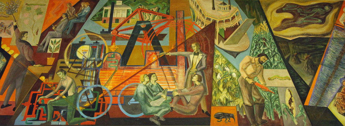
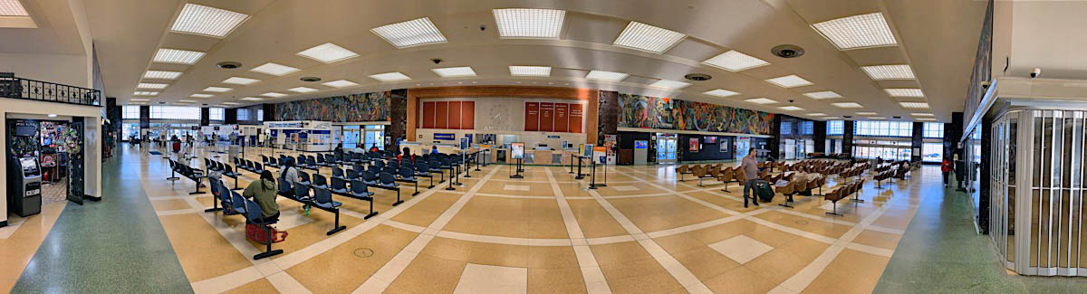
 The New Orleans Union Passenger Terminal (NOUPT) was opened in 1954 to consolidate passenger rail operations from the Crescent City's fiver other terminal railroad stations — Union Station, the Southern Railway Terminal, Texas & Pacific Station, Louisiana & Arkansas Station, and Louisville & Nashville Station. It was one of the last union stations built in the United States, and bears the mark of the era's architectural style. Today it serves as a southern hub for Amtrak operations, including the City of New Orleans, the Crescent, and the Sunset Limited. Amtrak operates a coach and engine yard near the terminal.
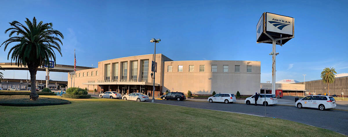
New Orleans, La / Nov 2019 / RWH

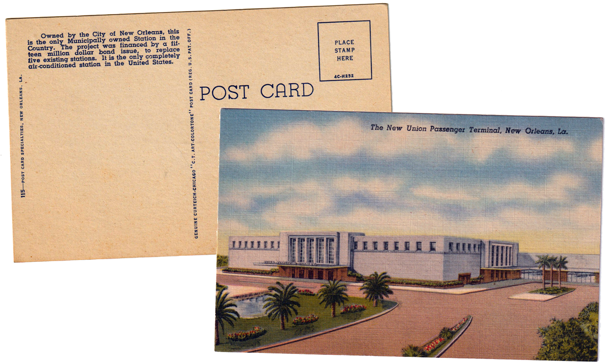
postcard / collection
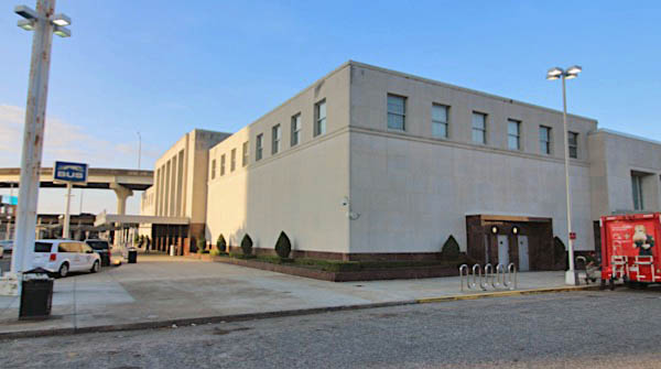
New Orleans, La / Nov 2019 / RWH
from  magazine (Sep 1954) / collection
Avondale, La / Mar 1954 / collection
NOUPT map detail / adapted RWH
from magazine (Sep 1954) / collection
from magazine (Sep 1954) / collection
collection
New Orleans, La / 2001 / JCH
New Orleans, La / Nov 2019 / RWH
Southern Pacific's Sunset Limited
New Orleans, La / Jun 1968 / Michael Palmieri collection
Illinois Central's Panama Limited
New Orleans, La / May 1970 / Michael Palmieri collection
Louisville & Nashville's Gulf Wind
New Orleans, La / Oct 1970 / Michael Palmieri collection
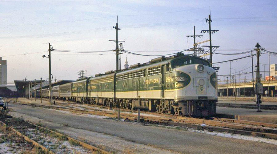
Southern Railway's Southern Crescent
New Orleans, La / Sep 1972 / Michael Palmieri collection
See our complete New Orleans Union Passenger Terminal featured scrapbook in Mainlines
Amtrak
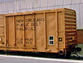
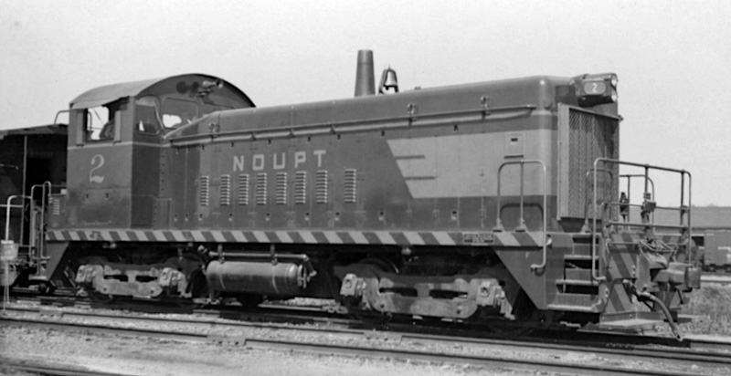
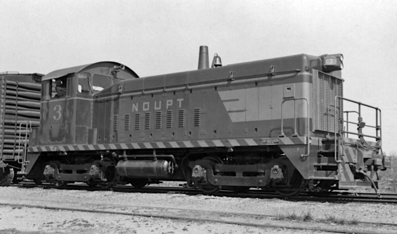
New Orleans Public Belt
Louisiana Southern
New Orleans & Gulf Coast
O Scale 2000 meeting
 Snapshots
Links / Sources
- links
- links
- links
- links