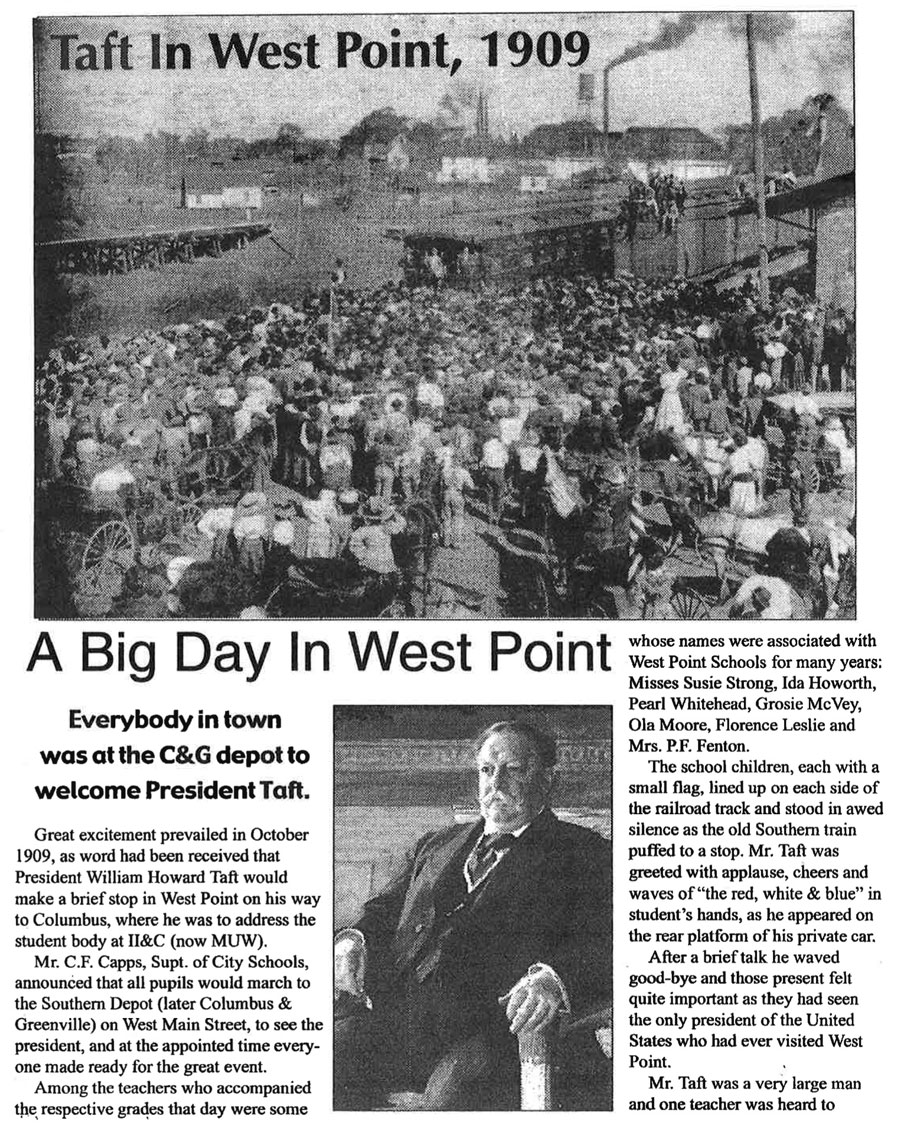
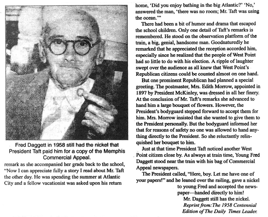
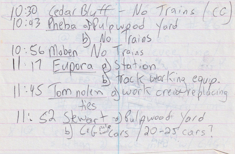
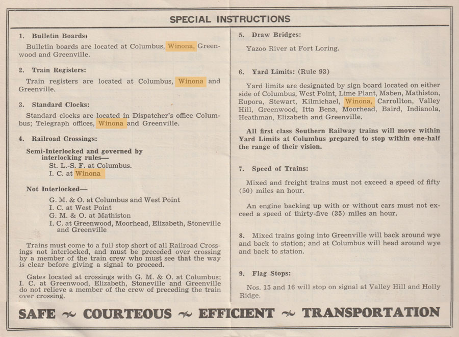
 |
Columbus & Greenville Railway Eastern Towns |

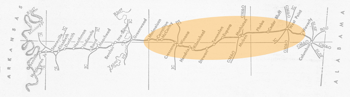
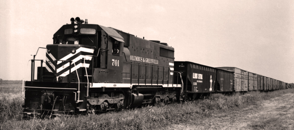
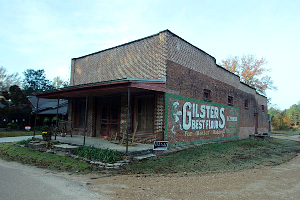
 ompany letterhead in the post-ICG era of the Columbus & Greenville boasted that the little road offered "unparalleled service from the Delta to the hills." In terms of geographical competition, at least, that statement proved literal throughout its corporate history. Contributing to its eccentricity, the C&G lived its entire life as an east-west shortline in a north-south mainline context. Including its namesake terminals, the Delta Route crossed other bigger railroads eight times in its 170-mile trek from the Alabama state line in the east to the mighty Mississippi River in the west. Before the era of Class 1 consolidations, these diamonds on the eastern end of the line represented a rich variety of Deep South railroads: Southern, Frisco, Mobile & Ohio, Gulf Mobile & Northern, and Illinois Central.
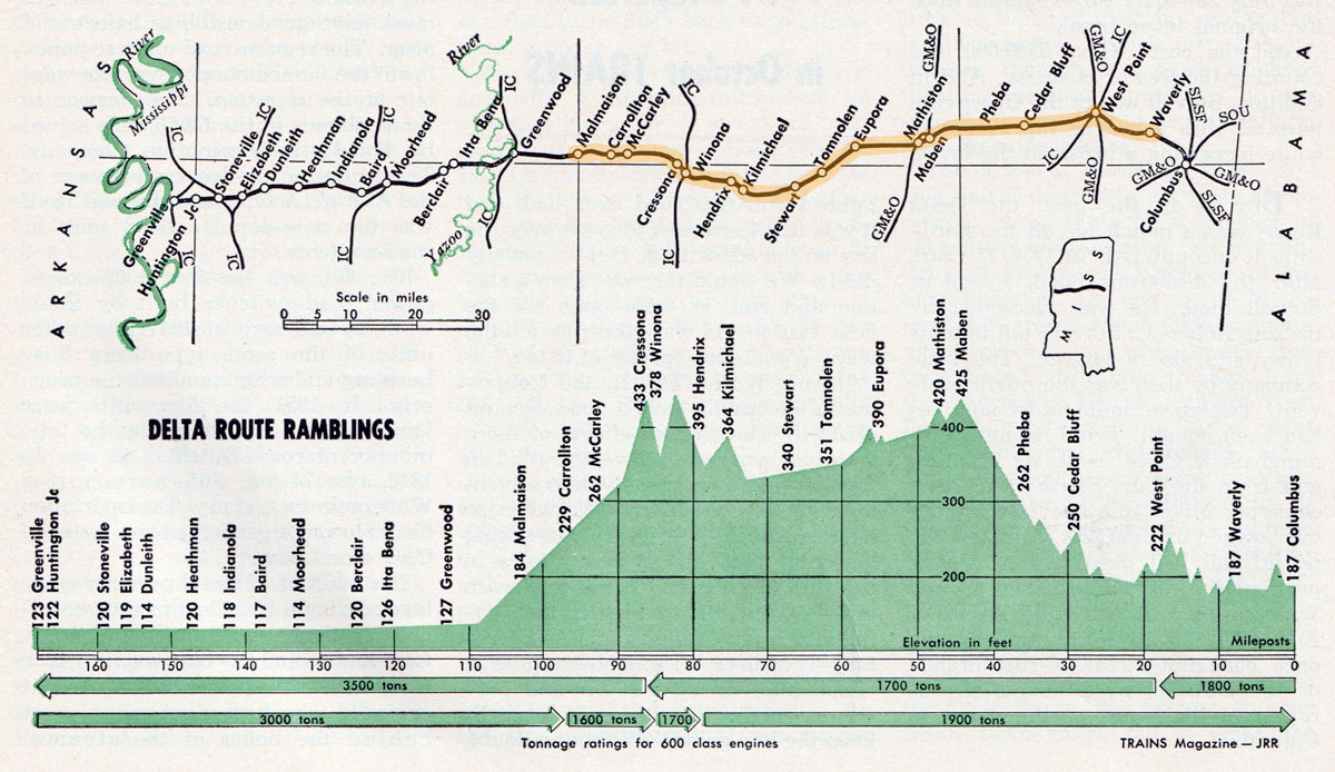
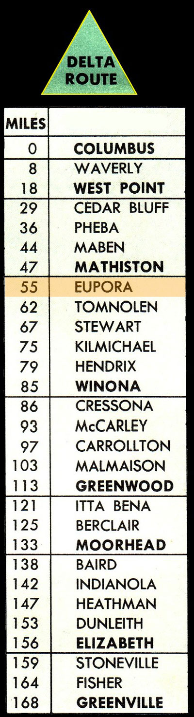
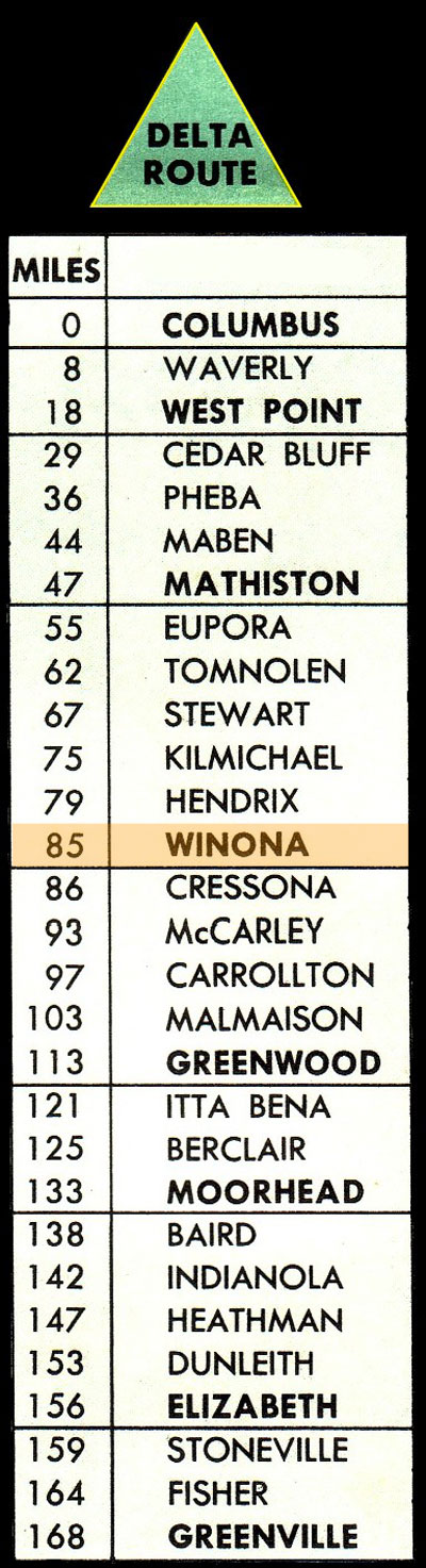
In terms of physical profile, the C&G climbed 255 feet in elevation over 45 miles as it moved westward from the foothills of the Tombigbee River basin near Columbus. From Mathiston through Eupora and on to Winona, the right-of-way plied the highest points on the line — the highest, still a mere 447' feet above sea level. After Winona, the line came down from the hills to the banks of the Big Sand Creek and Greenwood, dropping some 307 feet in 30 miles.
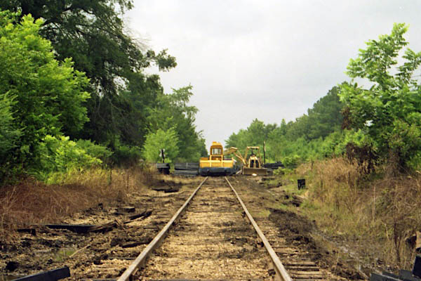
In 2001, a bridge collapse near Carrollton combined with a longer trend of customer decline on the eastern end of the railroad to cause the C&G to embargo the line from just west of West Point to downtown Greenwood — more than half the total length of the original Georgia Pacific mainline. This created a bifurcated shortline, with extensive local switching and service in the Columbus area and service in the Delta from Greenwood to Greenville.
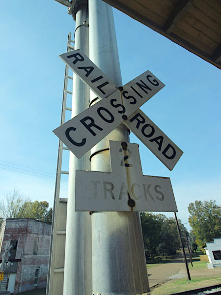
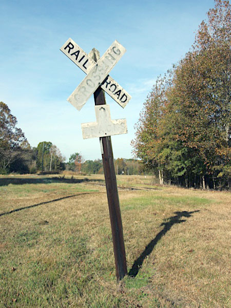
Sibleyton, Ms / Sep 1972 / collection
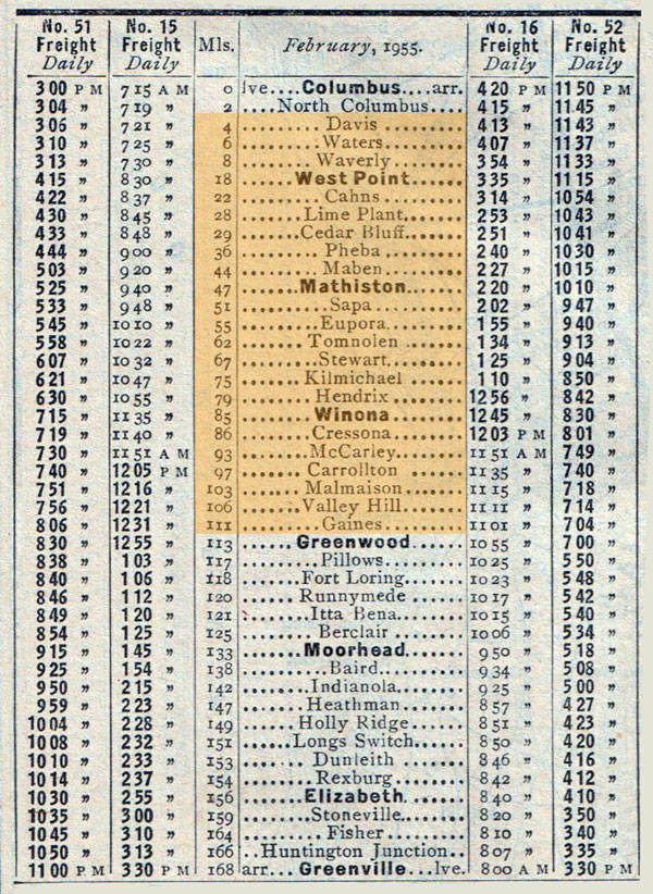
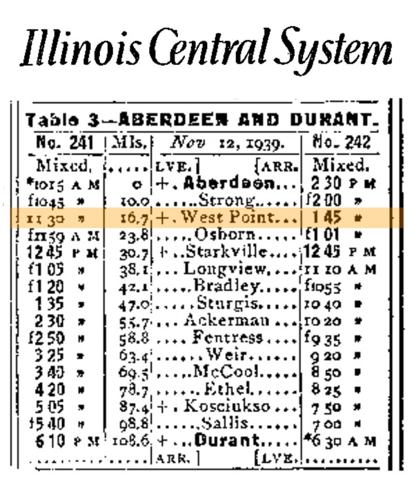
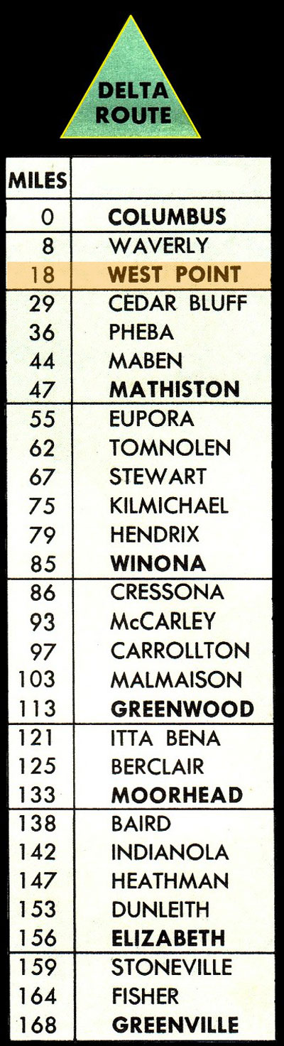
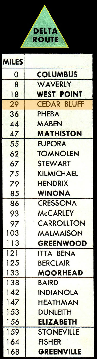
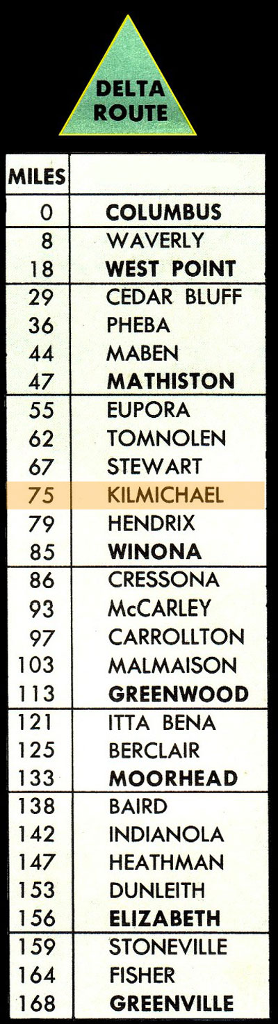
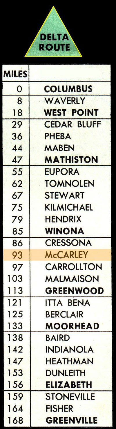
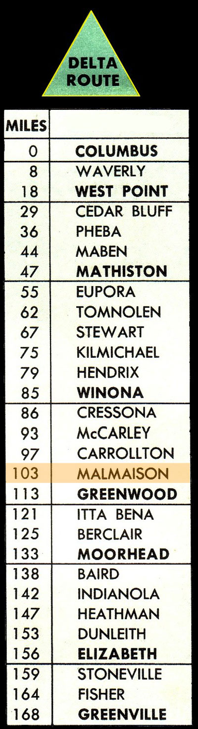
1955 route listing / collection
from  magazine - Sep 1958 / collection
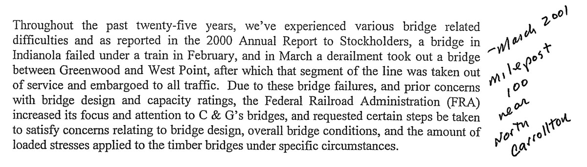
Sadly, you are correct that 90-odd miles of Columbus & Greenville are not currently being operated. In Spring of 2001 a trestle collapsed under a train near milepost 100, just west of Carrollton. The wreck was not particularly serious as these things go, but it did bring home the poor condition of many C&G bridges. Since traffic over the old C&G mainline from West Point to Greenwood had been declining for years (and indeed most local business had disappeared) the railroad embargoed the track between those points. I am enclosing a letter mailed to C&G stockholders shortly after this happened. While I believe the letter indicates the track would soon be abandoned, I don't believe this happened. In fact, under current laws, if track is not operated for three years, it can then be abandoned virtually without a fight. While the three year period was up in 2004, an abandonment notice was not filed to my knowledge. The large majority of C&G business is currently west of Greenwood (mostly at Heathman, the catfish food people, and at Greenville), at West Point (reached by trackage rights over the KCS from Columbus) and on the Lux Valley operation east of Columbus.
Louis Saillard, March 2005
clipping from Roger Bell Stockholder's Report - 2001 / collection
 Inspection Photos
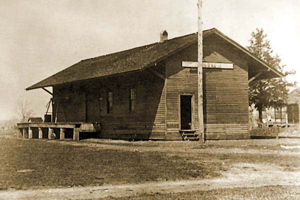
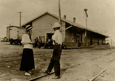 In the spring of 1917, agents of the Interstate Commerce Commission travelled the Southern Railway in Mississippi (precursor to the C&G) from end to end. Going town to town on nothing more than a small 2-axle gasoline motorcar, the agents took pictures of almost every structure along the line. This Mississippi tour was part of a larger ICC effort of the time to evaluate the state of the nation's railroads. These inspection images (such as the Waverly depot, below) are indicated by the notation "1917 inspection," and we are grateful to have in our C&G collection copies of these historic prints.
 Waverly
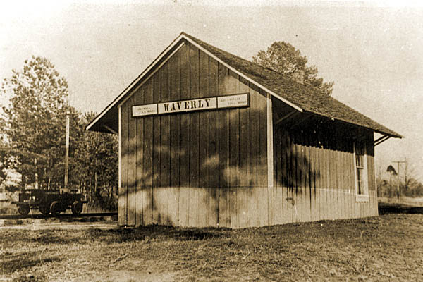
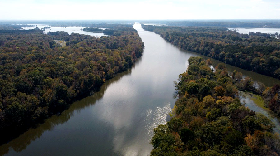
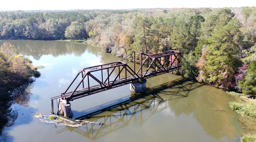
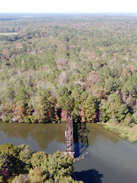
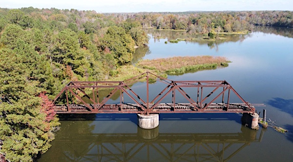
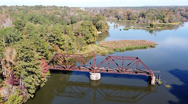
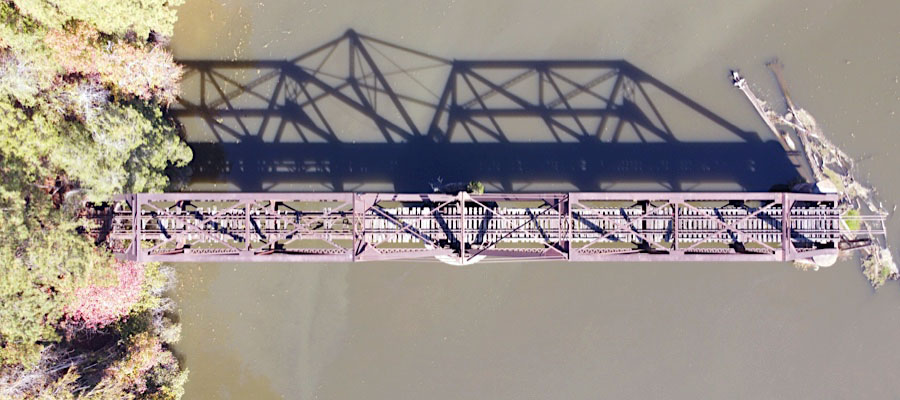
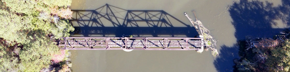
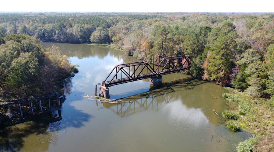
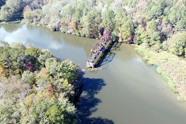
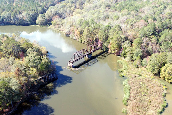
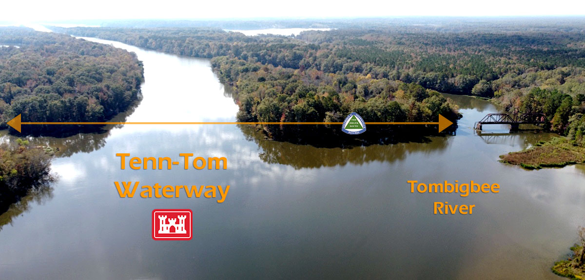
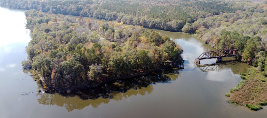
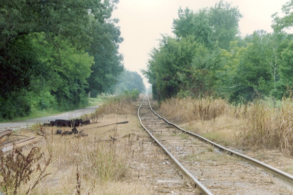
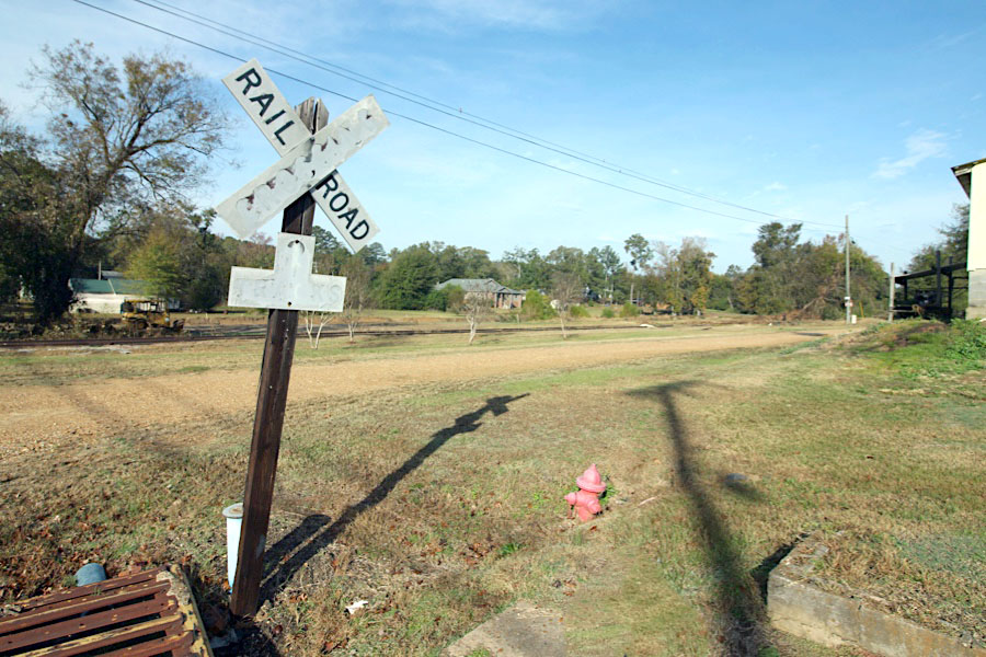
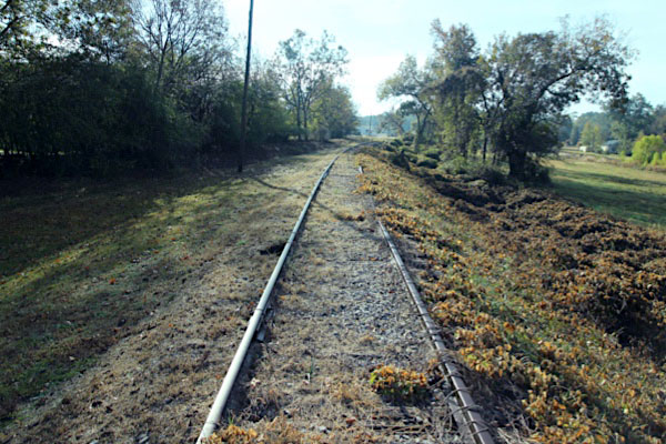
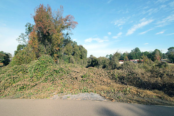
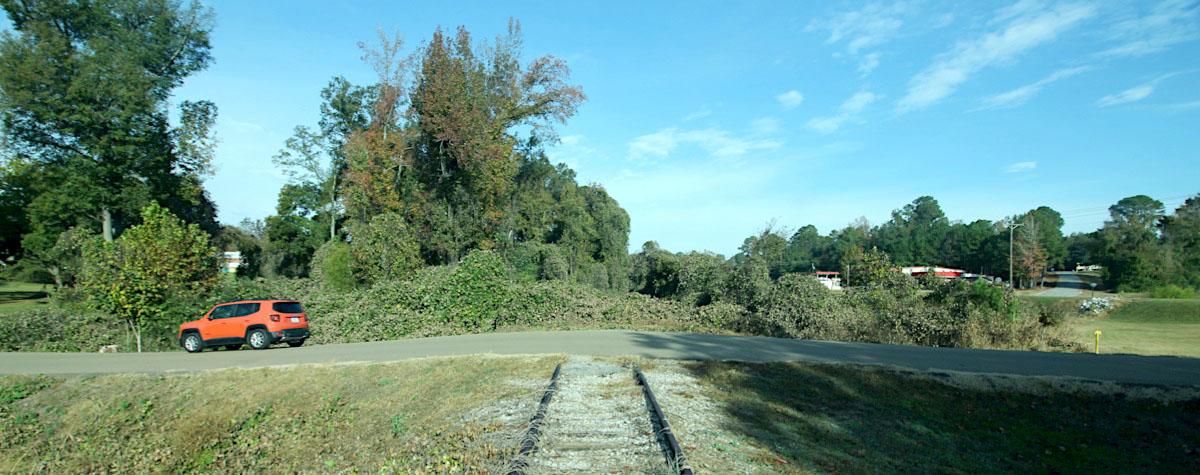
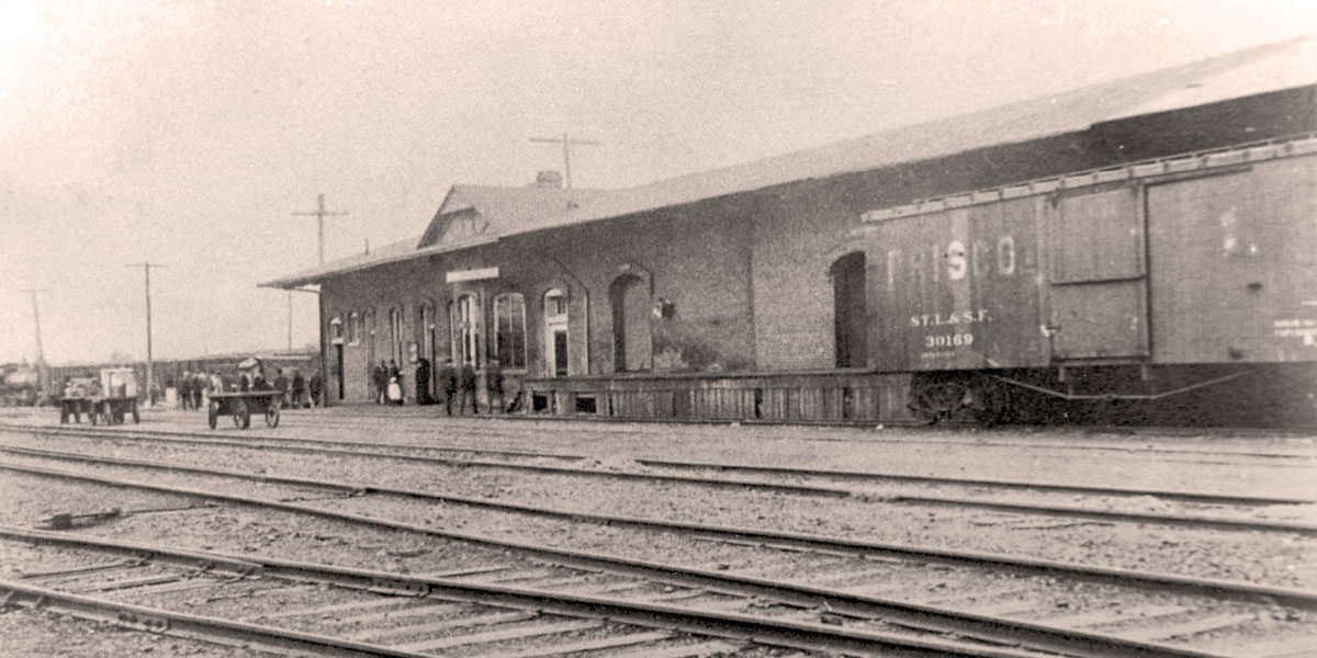
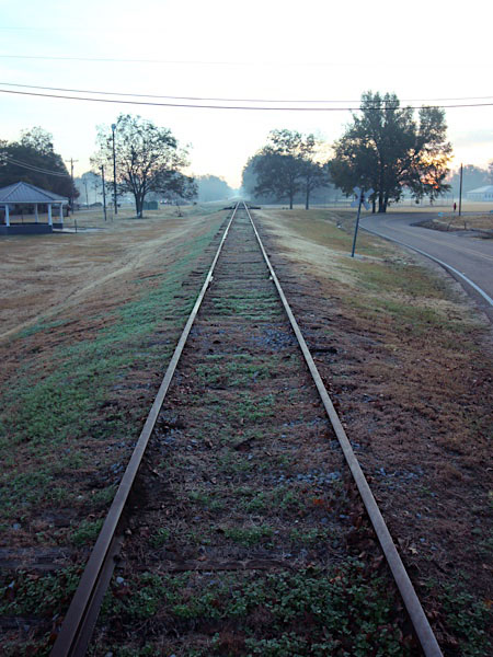
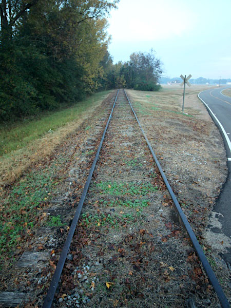
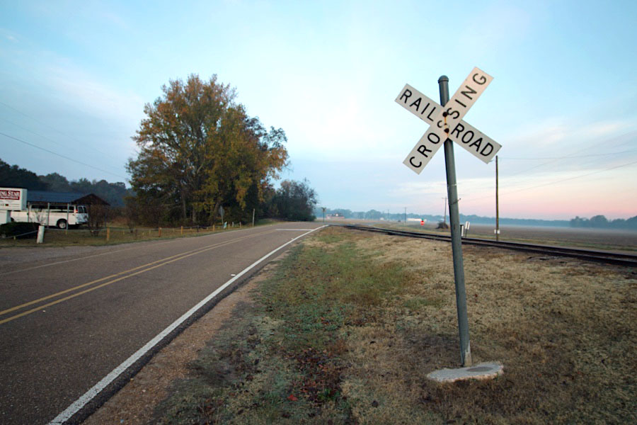
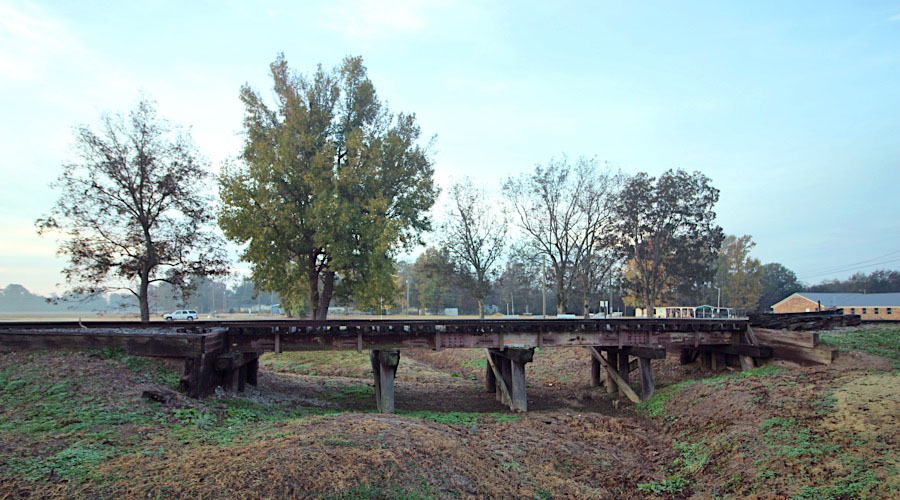
 rior to the 1980s, Waverly was the first community after Columbus on the eastern end of the line. Here the shortline crossed the Tombigbee River on a center-swing through-truss bridge. In 1983 the bridge was abandoned when the river was widened as a part of the Tennessee-Tombigbee River project. After that, Delta Route trains traversed the Gulf & Mississippi line (former Mobile & Ohio) from Columbus to Artesia, then from Artesia to West Point, before rejoining the original C&G mainline west to Ceder Bluff. This extensive route change made the Waverly to West Point section of the mainline irrelevant, and to the right of way is overgrown and in many places illusive. However, as of 2022, the center-swing bridge structure is still in place over the original (smaller) Tombigbee waterway.
Waverly depot / 1917 inspection / collection
Waverly (also Mullens Bluff, Waverley, Waverley Plantation) is an unincorporated community in Clay County, Mississippi, located on the former Southern Railway. Waverly was once home to a church, saw mill, and grist mill. A ferry once operated in Waverly that was used to cross the Tombigbee River. A post office operated under the name Waverly from 1879 to 1906
Waverly, Ms / Nov 2022 / RWH
Nov 2022 / RWH
Waverly, Ms / Nov 2022 / RWH
Waverly, Ms / Nov 2022 / RWH

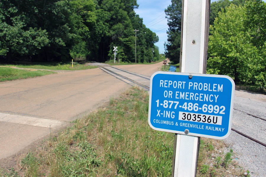
Click to see the former Decker Road crossing plotted on a Google Maps page
from The Delta Route: A History of the Columbus & Greenville Railway
/ collection
Dec 2003 / Chris Martin
Waverly, Ms / Dec 2003 / Chris Martin
Waverly, Ms / Dec 2004 / Chris Martin
Waverly, Ms / Nov 2022 / RWH
![]() The Tennessee–Tombigbee Waterway (popularly known as the Tenn-Tom) is a 234-mile artificial U.S. waterway built in the 20th century from the Tennessee River to the junction of the Black Warrior-Tombigbee River system near Demopolis, Alabama. The Tennessee–Tombigbee Waterway links commercial navigation from the nation's midsection to the Gulf of Mexico. The major features of the waterway are 234 miles of navigation channels, a 175-foot-deep cut between the watersheds of the Tombigbee and Tennessee rivers, and ten locks and dams. The locks are 9 by 110 by 600 feet, the same dimension as those on the Mississippi above Lock and Dam 26 at Alton, Illinois. Under construction for 12 years by the U.S. Army Corps of Engineers, the Tennessee–Tombigbee Waterway was completed in December 1984 at a total cost of nearly $2 billion. The Tenn-Tom encompasses 17 public ports and terminals, 110,000 acres of land, and another 88,000 acres managed by state conservation agencies for wildlife habitat preservation and recreational use.
The Tennessee–Tombigbee Waterway (popularly known as the Tenn-Tom) is a 234-mile artificial U.S. waterway built in the 20th century from the Tennessee River to the junction of the Black Warrior-Tombigbee River system near Demopolis, Alabama. The Tennessee–Tombigbee Waterway links commercial navigation from the nation's midsection to the Gulf of Mexico. The major features of the waterway are 234 miles of navigation channels, a 175-foot-deep cut between the watersheds of the Tombigbee and Tennessee rivers, and ten locks and dams. The locks are 9 by 110 by 600 feet, the same dimension as those on the Mississippi above Lock and Dam 26 at Alton, Illinois. Under construction for 12 years by the U.S. Army Corps of Engineers, the Tennessee–Tombigbee Waterway was completed in December 1984 at a total cost of nearly $2 billion. The Tenn-Tom encompasses 17 public ports and terminals, 110,000 acres of land, and another 88,000 acres managed by state conservation agencies for wildlife habitat preservation and recreational use.
RWH adaptation
Waverly, Ms / Nov 2022 / RWH
Click to see the former Tombigbee River Bridge structure plotted on a Google Maps page
Nov 2022 / RWH
Waverly, Ms / Nov 2022 / RWH
Waverly, Ms / Nov 2022 / RWH
Waverly, Ms / Nov 2022 / RWH
Waverly, Ms / Nov 2022 / RWH
Waverly, Ms / Nov 2022 / RWH
Waverly, Ms / Nov 2022 / RWH
Waverly, Ms / Nov 2022 / RWH
downriver view / Waverly, Ms / Nov 2022 / RWH
Waverly, Ms / Nov 2022 / RWH
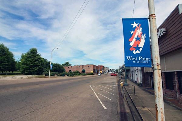
 West Point
![]() The charm of West Point will hold you spellbound, as you stroll along her quaint downtown sidewalks and through her picturesque parks. West Point embodies what was best about America a generation ago. Neighbors are friendly, family values are held close, and the cost of living is affordable. Although we enjoy four distinct seasons, our community is blessed with a moderate winter which does not hamper an active lifestyle.
The charm of West Point will hold you spellbound, as you stroll along her quaint downtown sidewalks and through her picturesque parks. West Point embodies what was best about America a generation ago. Neighbors are friendly, family values are held close, and the cost of living is affordable. Although we enjoy four distinct seasons, our community is blessed with a moderate winter which does not hamper an active lifestyle.
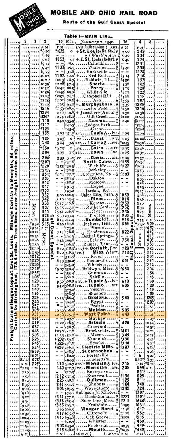
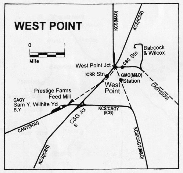
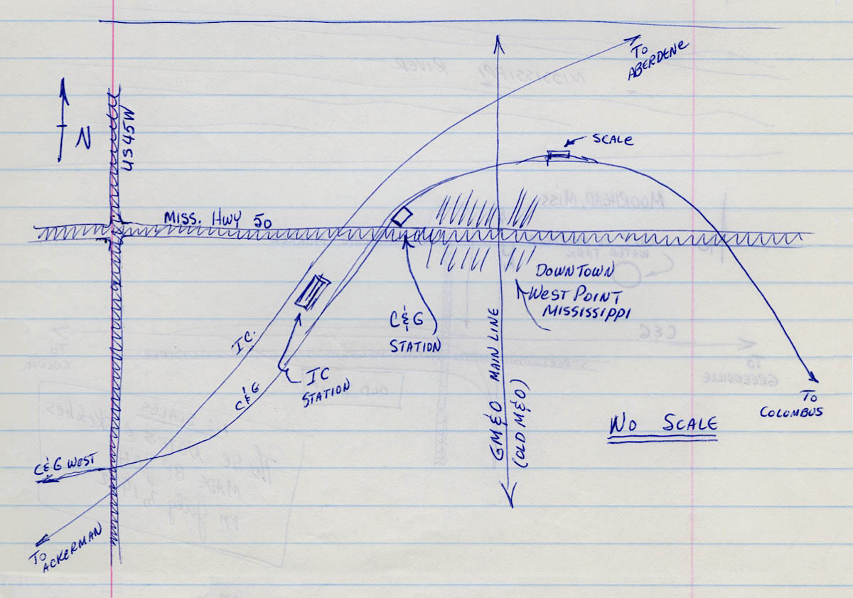
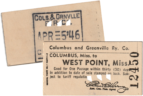
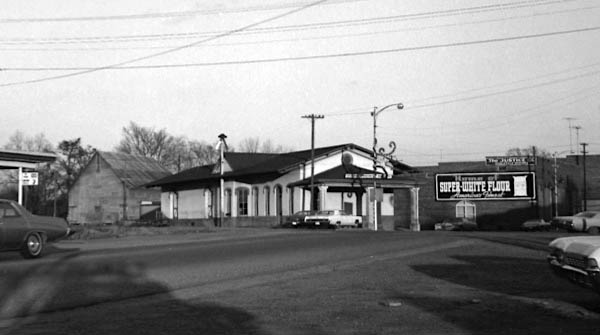
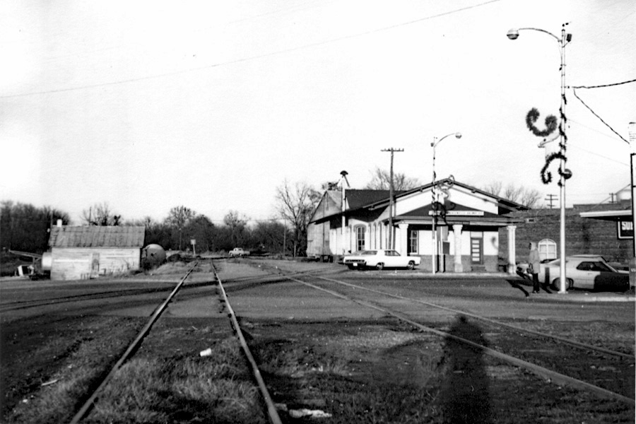
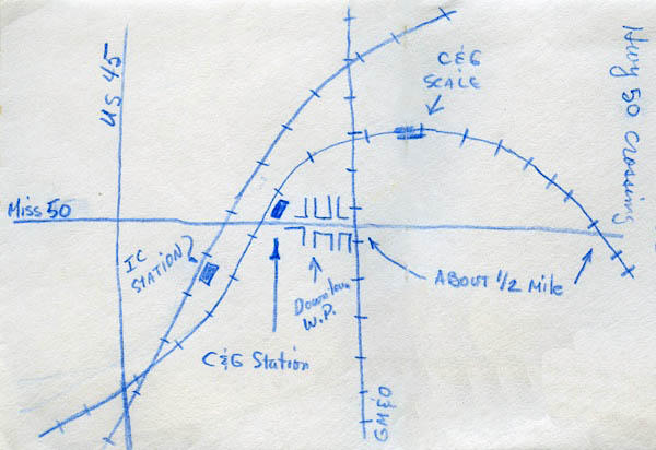
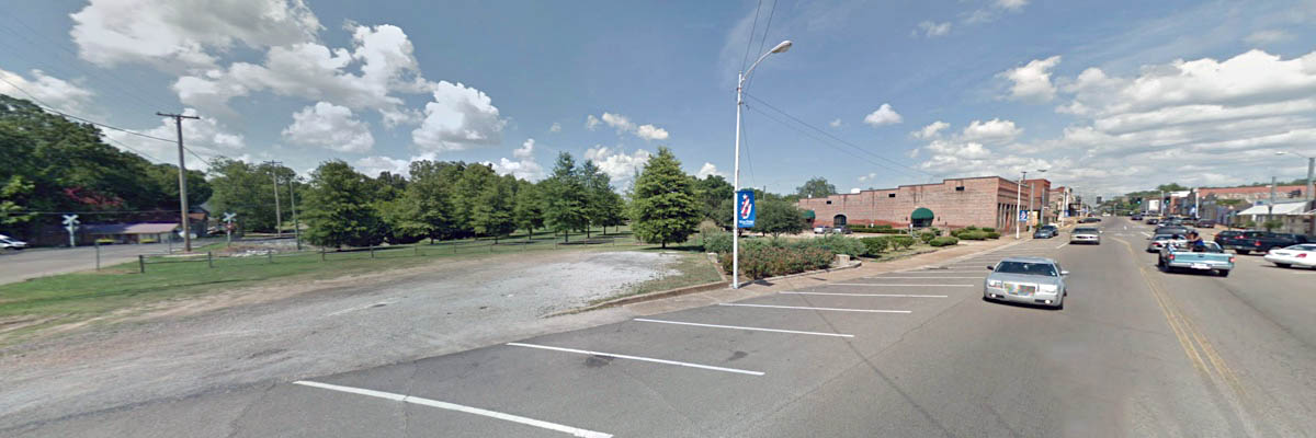
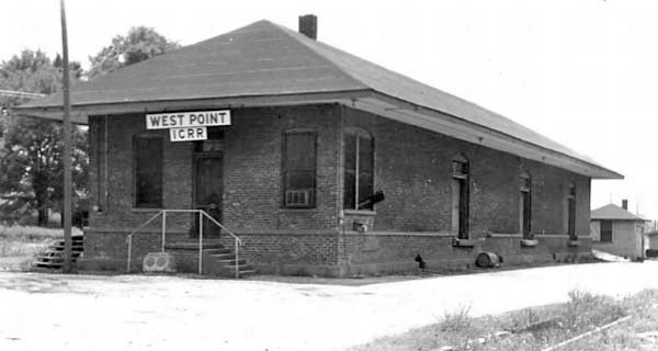
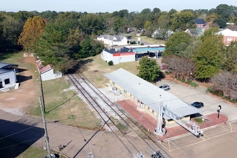
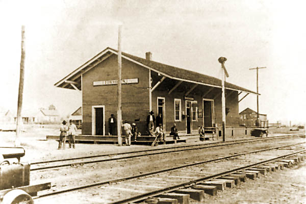
Moving westward from Columbus along the railroad, the town of West Point was the first major community after the Tombigbee River and the first interchange point out on the line. Here the C&G met the Mobile & Ohio mainline (later Gulf, Mobile & Ohio) and an Illinois Central secondary route between Kosciusko and Aberdeen. As noted above, prior to 1983, C&G trains leaving Columbus approached West Point directly from the east through Waverly. After the Waverly bridge was decommissioned, C&G movements detoured through Artesia then northward to West Point on the old M&O mainline. The Columbus & Greenville depot in West Point, built by the Southern Rwy in Mississippi and located on Main Street, was demolished by the Illinois Central Gulf in the early 1970s. When the C&G was reorganized, a caboose was de-trucked and located in town to serve as a local office.
1940 Official Guide ad / collection
1940 Official Guide ad / collection
from SPV Comprehensive Railroad Atlas
/ collection
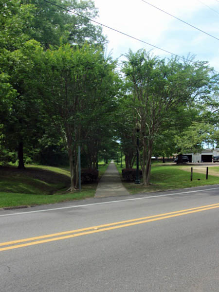
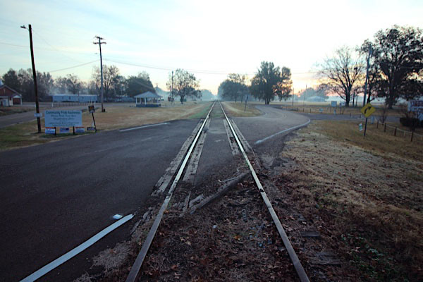
![]() The Columbus & Greenville mainline east of West Point and through downtown has been abandoned. Beginning at South Eshman Avenue on the east side of town, the right-of-way is now the Kitty Bryan Dill Memorial Parkway — one of the earliest rails-to-trails projects in the state of Mississippi. The 3.75 mile trail marks the C&G route through town all the way to the site of the former Mobile & Ohio crossing, where it leaves the shortline right-of-way and turns southeast to follow the old M&O routing.
The Columbus & Greenville mainline east of West Point and through downtown has been abandoned. Beginning at South Eshman Avenue on the east side of town, the right-of-way is now the Kitty Bryan Dill Memorial Parkway — one of the earliest rails-to-trails projects in the state of Mississippi. The 3.75 mile trail marks the C&G route through town all the way to the site of the former Mobile & Ohio crossing, where it leaves the shortline right-of-way and turns southeast to follow the old M&O routing.
West Point, Ms / Jun 2020 / RWH

See also our Kitty Bryan Dill Memorial Parkway scrapbook in Preservation
West Point railroad notes / 1972 / JCH
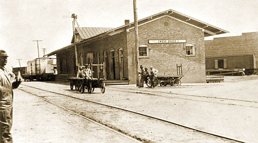
West Point depot / 1917 inspection / collection
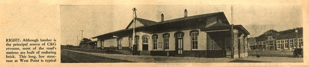
from Railroad Magazine
- Aug 1944 / collection
Click to see the site of the former C&G depot plotted on a Google Maps page
West Point, Ms / Aug 1968 / Fred Goff 
West Point, Ms / 1971 / JCH
West Point, Ms / 1971 / JCH
West Point, Ms / 1978 / Louis Saillard 
West Point, Ms / Jun 2020 / RWH
West Point notes / JCH
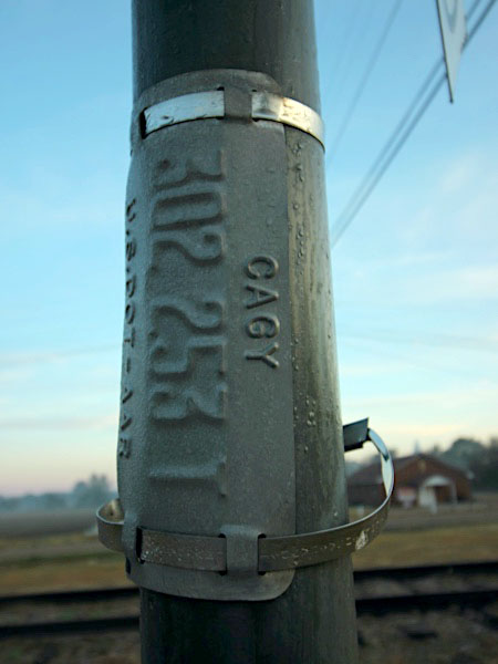
location of former CAGY depot / Google Maps
from TomBigbee Country Magazine
/ Milton Winter collection
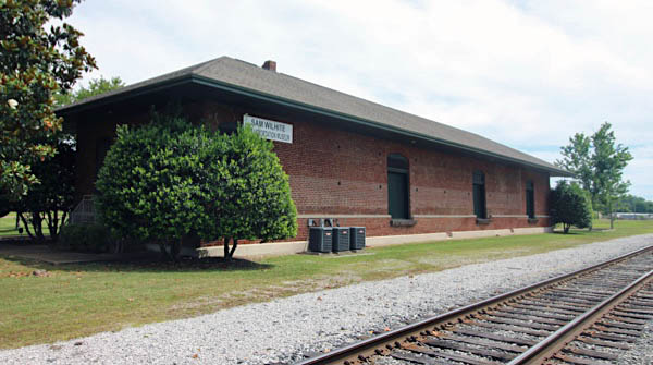
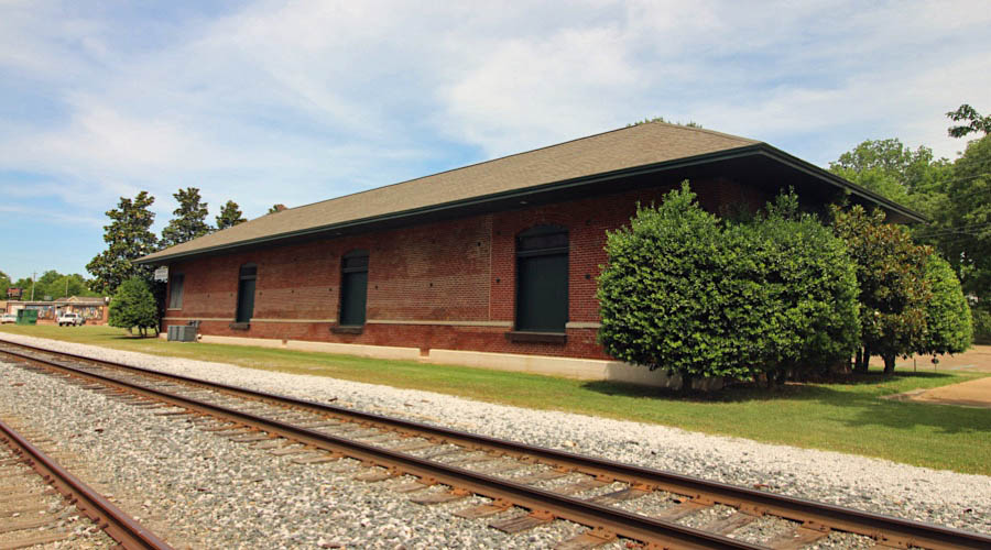
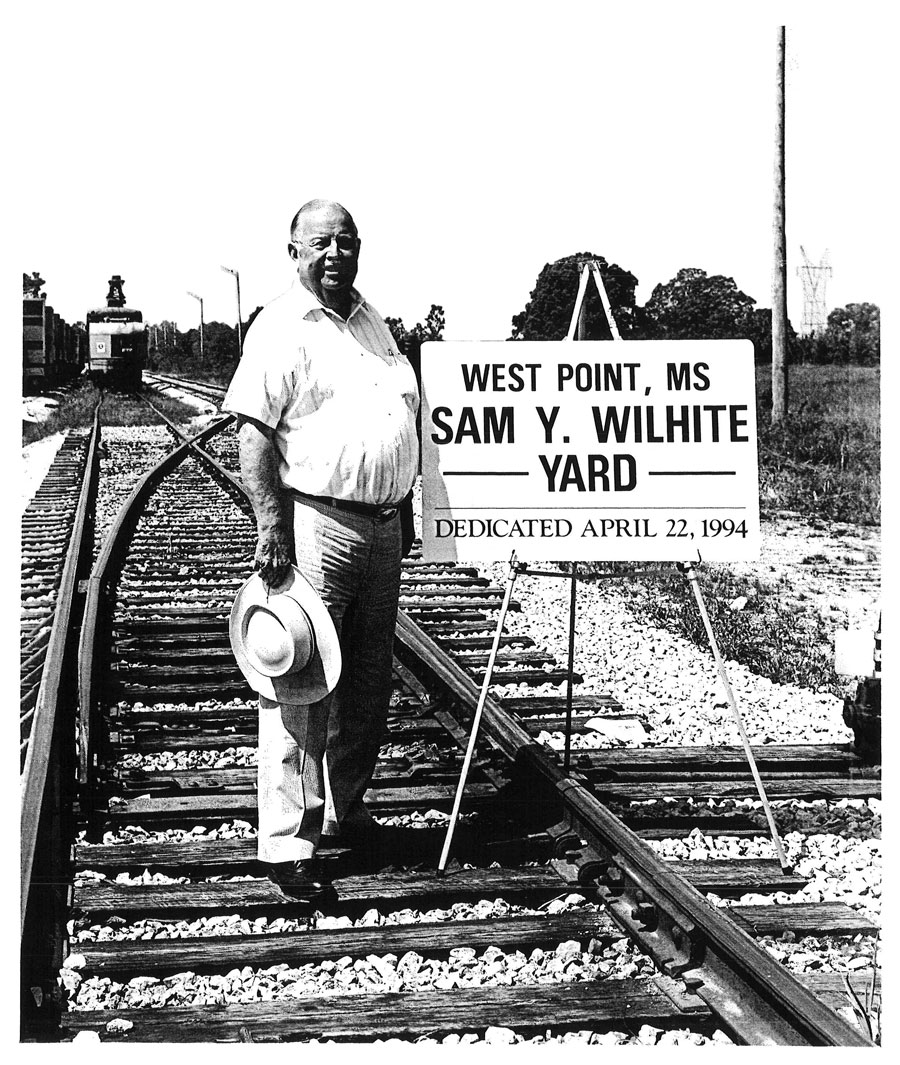
Sam Wilhite Museum
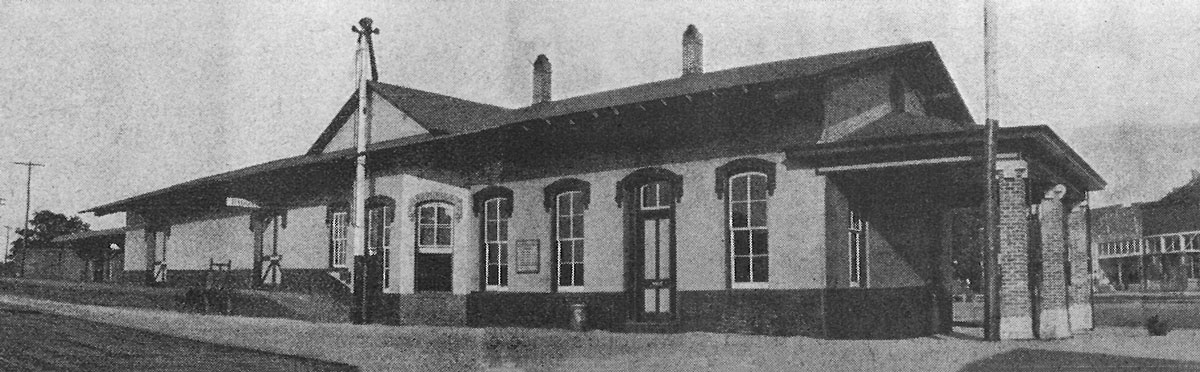
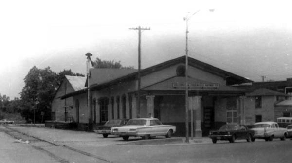
The former Illinois Central depot still remains in West Point, now called the Sam Wilhite Transportation Museum in honor of the longtime Delta Route chairman and president who steered the shortline through the 1970s and 80s. Wilhite was a native of West Point.
IC depot / West Point, Ms / Aug 1972 / Fred Goff
West Point, Ms / Jun 2020 / RWH
West Point, Ms / Jun 2020 / RWH
See also our Sam Wilhite Transportation Museum scrapbook in Preservation
Old White Road crossing / West Point, Ms / Jun 2020 / RWH
Click to see this location plotted on a Google Maps page
West Point, Ms / Jun 2020 / RWH
West Point, Ms / Jun 2020 / RWH
West Church Hill Road crossing / West Point, Ms / Jun 2020 / RWH
Click to see this location plotted on a Google Maps page
eastbound view / Jun 2020 / RWH
westbound view / Jun 2020 / RWH
collection
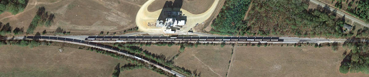
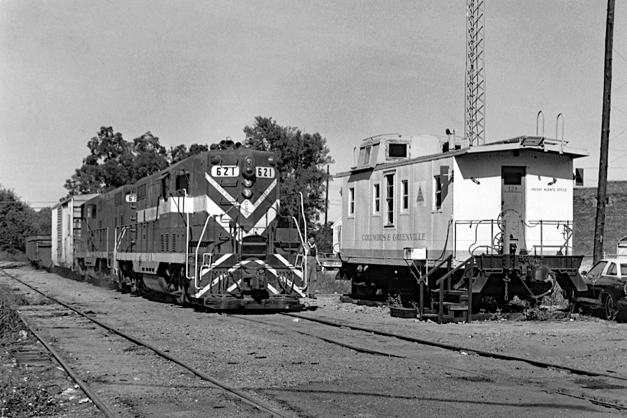
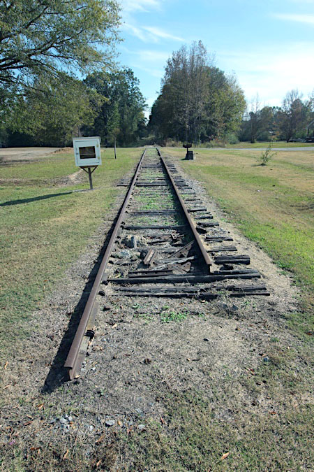
Sam Y. Wilhite yard
West Point, Ms / Google Maps
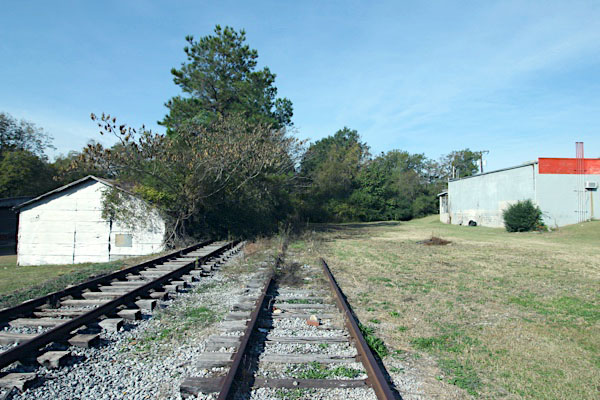
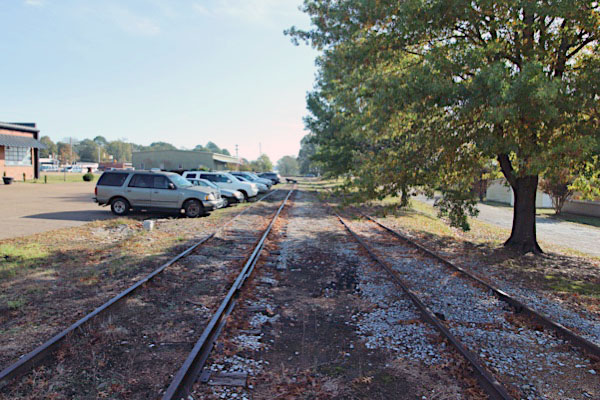
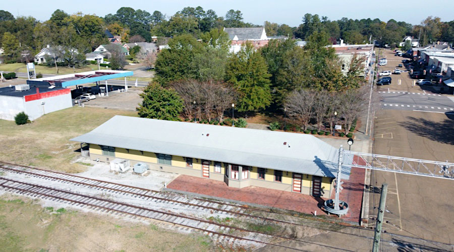
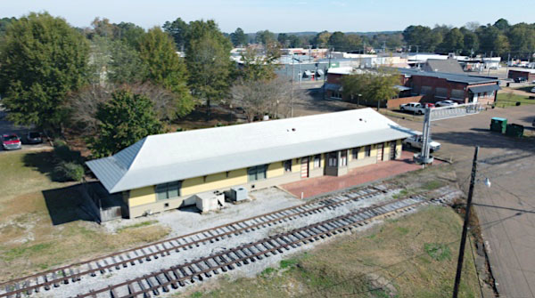
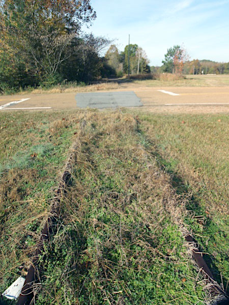
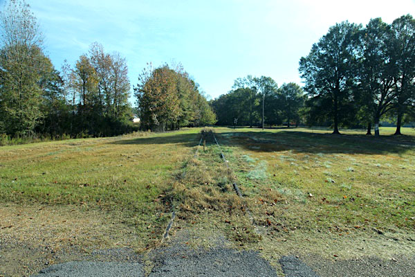
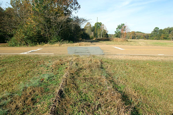
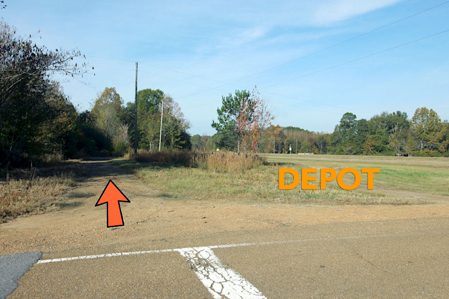
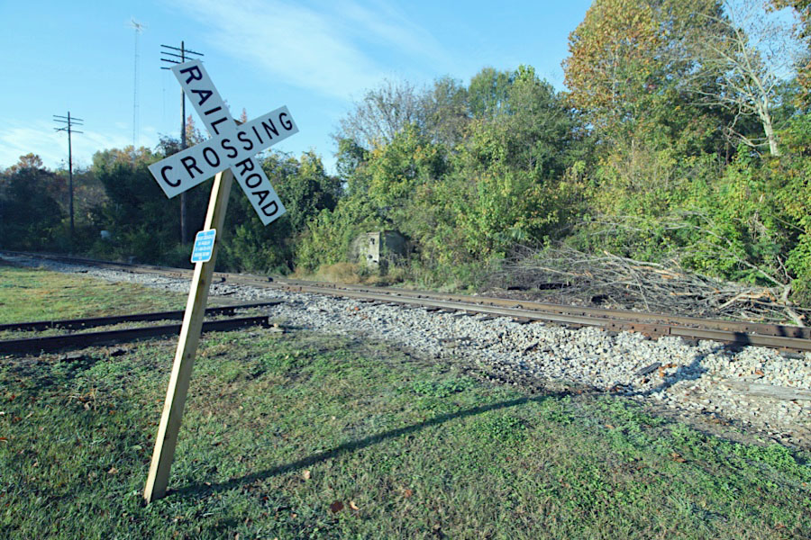
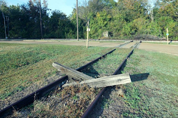
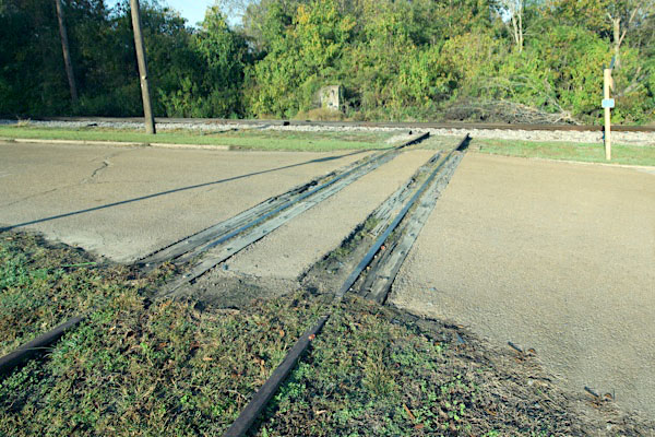
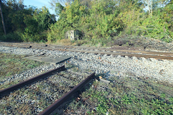
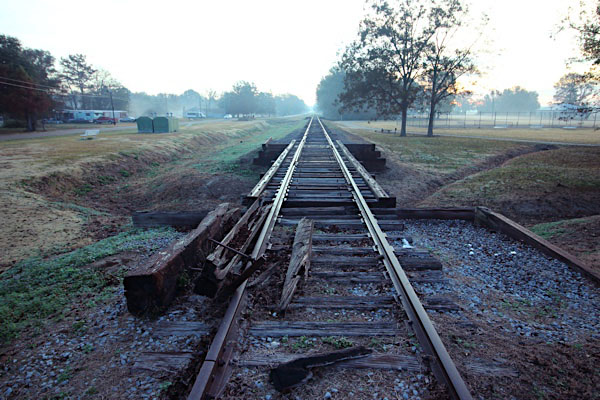
The Sam Y. Wilhite yard (above) and the Prestage Farms unloading facility (below) now represent the westernmost edge of the Columbus-based (eastern) section of the currently bifurcated Columbus & Greenville. Whereas formerly the mainline continued west from this point across the state, since 2001 it has been out of service from this location all the way to Greenwood, Mississippi.
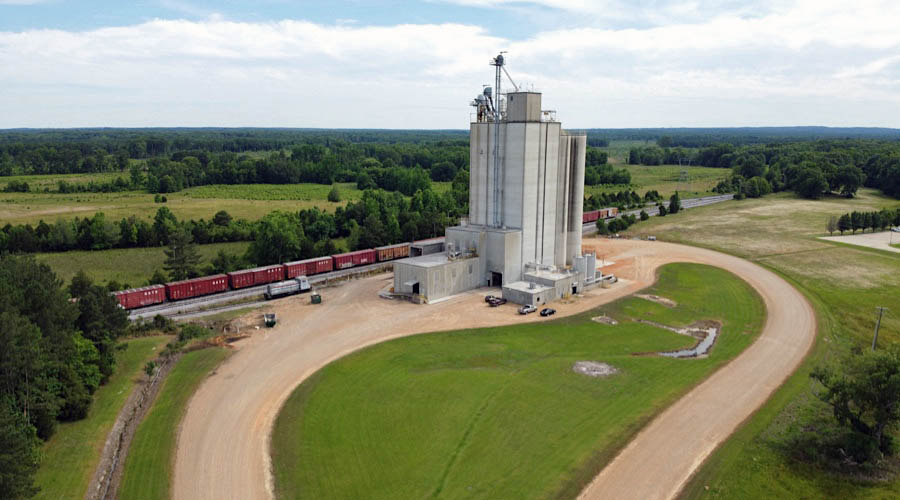
 Shipper Spotlight: Prestage Farms
![]() Prestage Farms of Mississippi, Inc. is a pork production division that has over 200 employees and contracts with farm families in Mississippi and Alabama. The division began operations in 1991. Today it serves the company as a 45,000 sow farrow-to-wean operation supplying pigs to the Iowa finishing division as well as multiplication gilts to North Carolina, South Carolina, Mississippi, and Oklahoma.
Prestage Farms of Mississippi, Inc. is a pork production division that has over 200 employees and contracts with farm families in Mississippi and Alabama. The division began operations in 1991. Today it serves the company as a 45,000 sow farrow-to-wean operation supplying pigs to the Iowa finishing division as well as multiplication gilts to North Carolina, South Carolina, Mississippi, and Oklahoma.
West Point, Ms / Jun 2020 / RWH
Click to see the Prestage Farms facility plotted on a Google Maps page
West Point, Ms / Jun 2020 / RWH
West Point, Ms / Nov 1026 / Chris Thompson
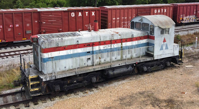
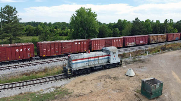
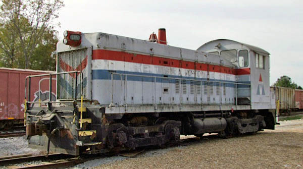
Delta Western #105
West Point, Ms / Jun 2020 / RWH


Delta Western #105
to Delta Western #105

westbound view / West Point, Ms / Jul 1989 / RWH
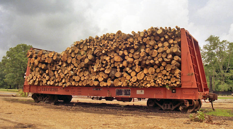
Columbus & Greenville #12090
West Point, Ms / Jul 1989 / RWH
 Mhoon's Valley
Mhoons Valley, Ms / 1917 inspection / collection
Mhoons Valley, Ms / Jul 1989 / RWH
Click to see Mhoons Valley plotted on a Google Maps page
 Cedar Bluff
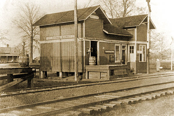
Cedar Bluff depot / Cedar Bluff, Ms / 1917 inspection / collection
Click to see Cedar Bluff plotted on a Google Maps page

Jul 1989
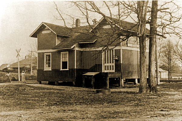
 Pheba
Pheba

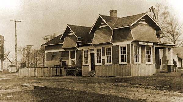
Pheba depot / Pheba, Ms / 1917 inspection / collection
Pheba, Ms / Nov 2022 / RWH
Click to see the former Pheba-Beasley Road crossing plotted on a Google Maps page
Nov 2022 / RWH
Pheba, Ms / Nov 2022 / RWH
Pheba, Ms / Nov 2022 / RWH
Nov 2022 / RWH
Nov 2022 / RWH
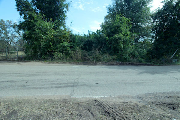
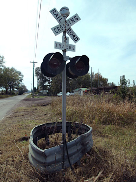
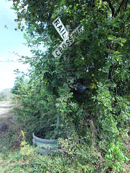
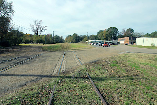
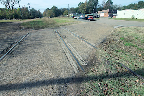
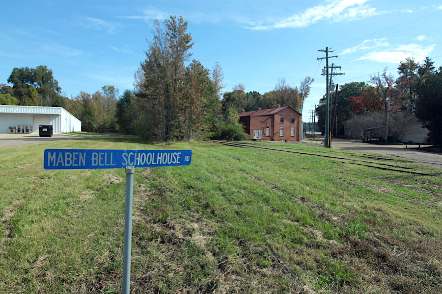
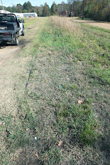
 Maben
Maben

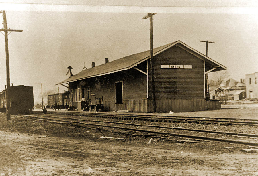
Maben depot / 1917 inspection / collection
Maben, Ms / Jul 1989 / RWH
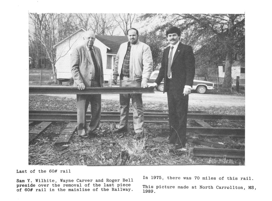
1889 60-pound rail / Aug 2006 / R Spencer
Maben, Ms / Nov 2022 / RWH
Click to see the former Maben-Bell Schoolhouse Road crossing plotted on a Google Maps page
Nov 2022 / RWH
Maben, Ms / Nov 2022 / RWH
Maben, Ms / Nov 2022 / RWH
Maben, Ms / Nov 2022 / RWH
Maben, Ms / Nov 2022 / RWH
Maben, Ms / Nov 2022 / RWH
Click to see the former Maben Starkville Road crossing plotted on a Google Maps page
Maben, Ms / Nov 2022 / RWH
Nov 2022 / RWH
Maben, Ms / Nov 2022 / RWH
Maben, Ms / Nov 2022 / RWH
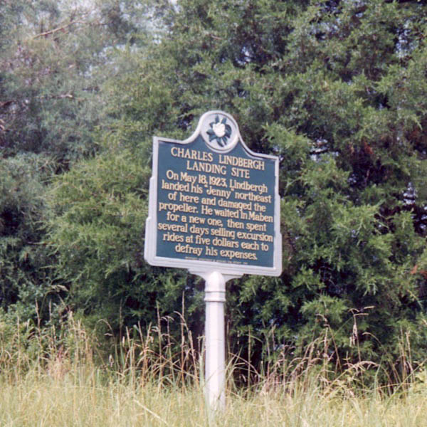
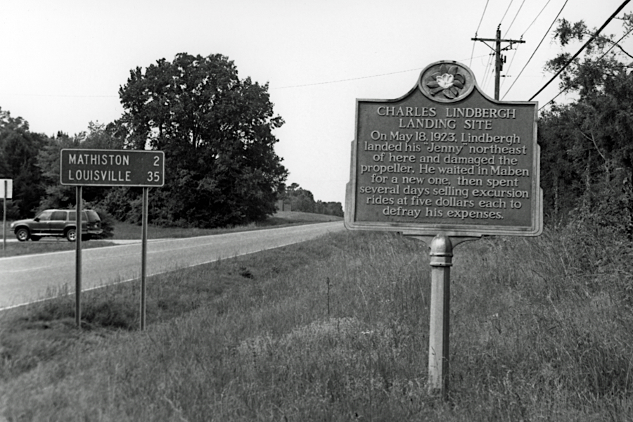
Lindbergh Landing
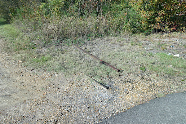
Maben, Ms / Jul 1989 / RWH
collection

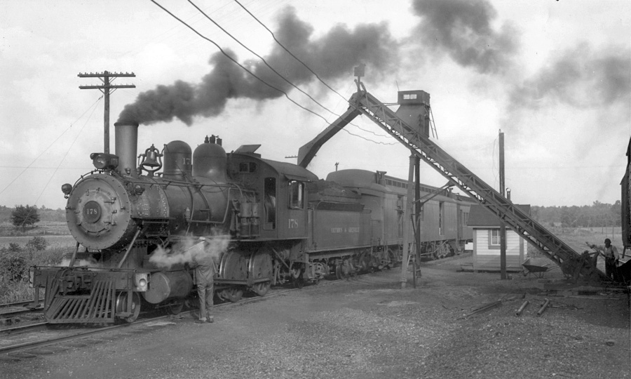
 In the summer of 1989, Ralph and I were on U.S. 82 following the C&G between West Point and Eupora, and I remarked to Ralph that Charles Lindbergh, in his book We, related how he ran out of gas in his "Jenny" biplane and landed in a field somewhere near our location. He was lost, but had been following the C&G mainline. He managed to land in a field near the railroad, but damaged his propellor and was forced to spend a few weeks in nearby Maben until he could get a replacement prop. Ralph shrugged off my remark as mere trivia. Just then we crested a hill and saw a historical marker up ahead. We stopped, and it told about that particular incident. The spot very likely looked then like it had back in 1923 when it happened. Needless to say, I crowed about that sign for a long time.
Maben, Ms / May 2003 / Louis Saillard
Click to see the Lindbergh Landing historical marker plotted on a Google Maps page

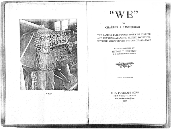
 small but dark storm area was drifting in my direction, and only a mile or two away. I wanted to get my plane into a grove of pine trees at one side of the slope behind me, and tie the wings down before strong wind gusts arrived. So I opened my throttle, blew the tail around, and taxied across the little meadow at the highest speed I dared. It was too late to stop or ground-loop when I saw a ditch ahead, almost completely hidden by grass. I had barely time to pull the throttle shut. There was the crash of wood as my wheels dropped in and the propeller struck the ground. The tail rose, like a seesaw run amuck, until it was almost vertical in air. I though my Jenny was turning upside down. Then it settled back to an angle of some forty-five degrees. I climbed out of the cockpit down to the wing, and then to the ground, and surveyed my damaged plane. It was splattered with mud, but I could find nothing broken aside from the propeller. If I’d followed my landing tracks, or if I’d even been ten feet farther over, I wouldn’t have hit the ditch at all. Raindrops began to patter on fabric. Northwest treetops were boiling in the wind. The rudder drummed against the flippers with a heavy puff. Several men and boys came running up. What’s the name of the nearest town? I asked. Well suh, if you go nawtheast, you come to the city of Maben. If you go sauthwest, you come to the city of Mathiston. When you all landed, you jist about split the difference between ’em. What’s the closest big city? Well suh, if you go ’bout a hundred miles sauth, you come to Meridian. That’s about the biggest un we got ’round heah. Meridian, Mississippi! That’s where I’d started from — I’d flown north instead of west! I thought they were going to say I was in Louisiana.
Charles A. Lindbergh / The Spirit of St. Louis / 1953
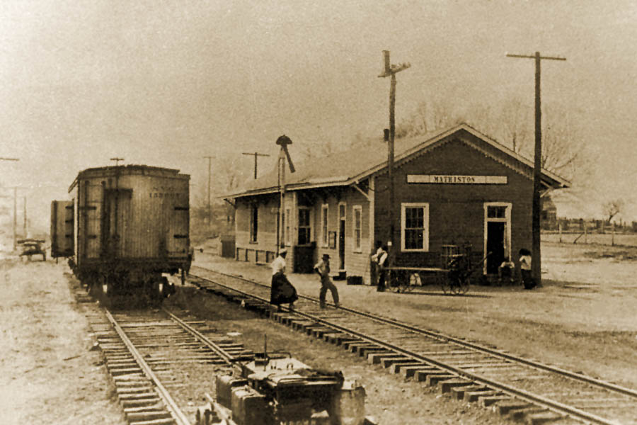
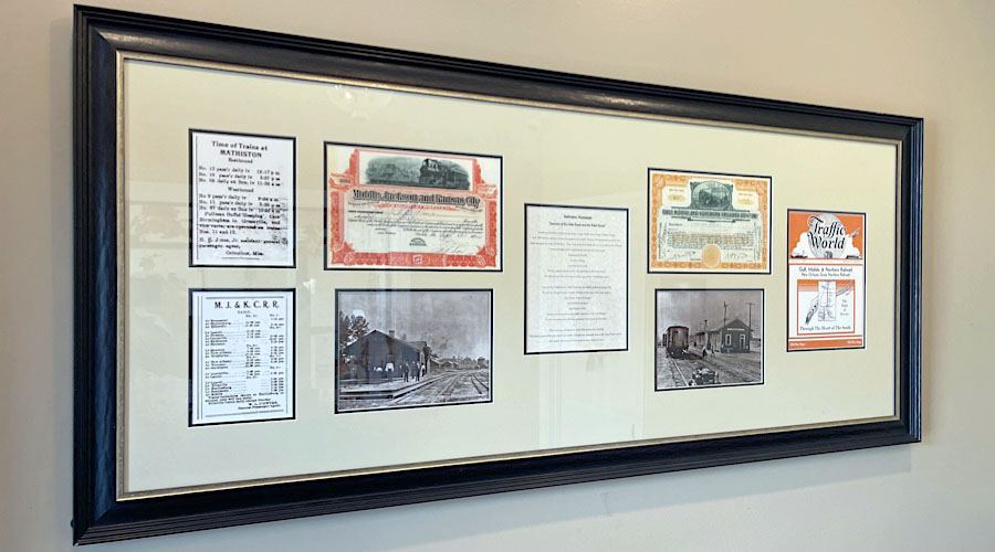
 Mathiston
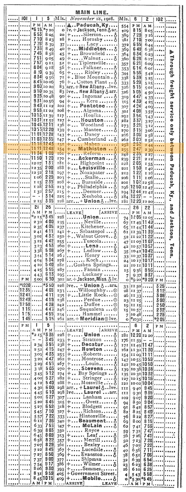
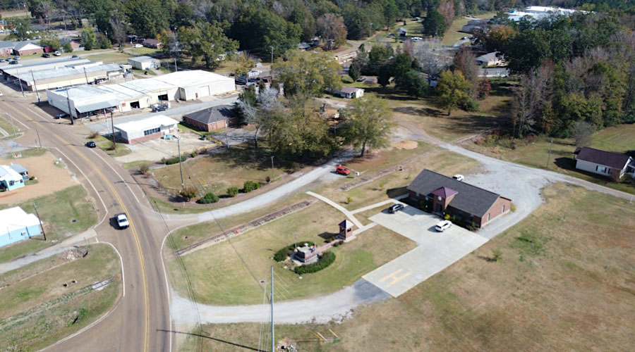
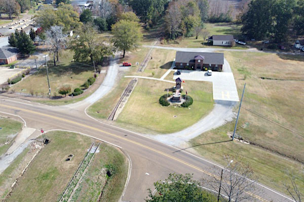
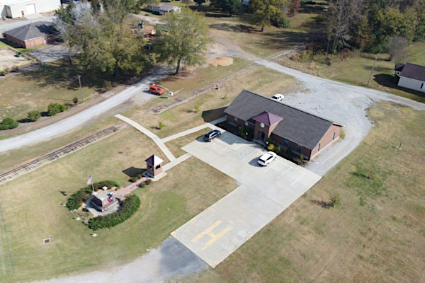
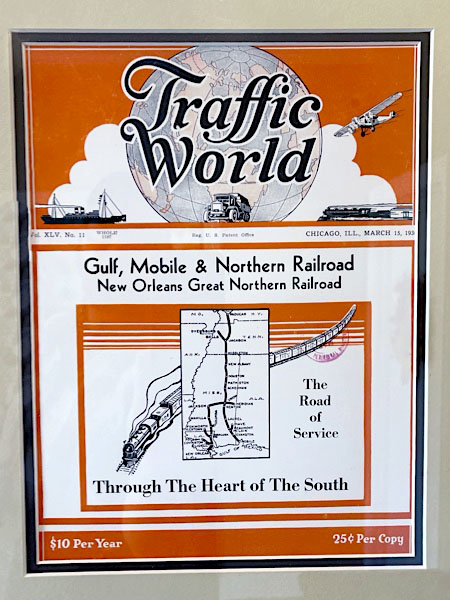
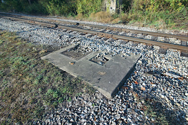
 n the early decades of the Columbus & Greenville, Mathiston, Mississippi, was the Delta Route's only connection to the Gulf, Mobile & Northern railroad. The GM&N mainline stretched south-to-north from Mobile on the coast to Jackson, Tennessee, and finally on to Paducah, Kentucky. The route crossed the C&G nearly 50 miles west of Columbus. The interchange featured an impressive wooden observation tower. After the formation of the Gulf, Mobile & Ohio in 1940, the Mathiston crossing become redundant given the former Mobile & Ohio junction at West Point (above). In the Illinois Central Gulf era, the former GM&O mainline through this location was downgraded to a segmented branchline and the Mathiston interchange was removed. The concreate base and stop pole of the former protection gate (shown below) are today the only remnants of the railroad crossing.

Mathiston depot / Mathiston, Ms / 1917 inspection / collection
1930 Official Guide ad / collection
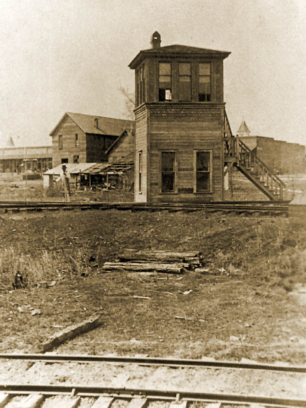
junction tower / 1917 inspection / collection
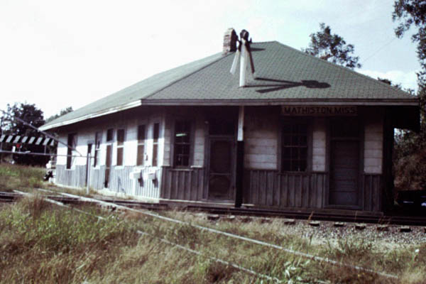
joint depot / Mathiston, Ms / Jul 1974 / Joe Marascalco
Mathiston, Ms / Jul 1981 / David Hurt
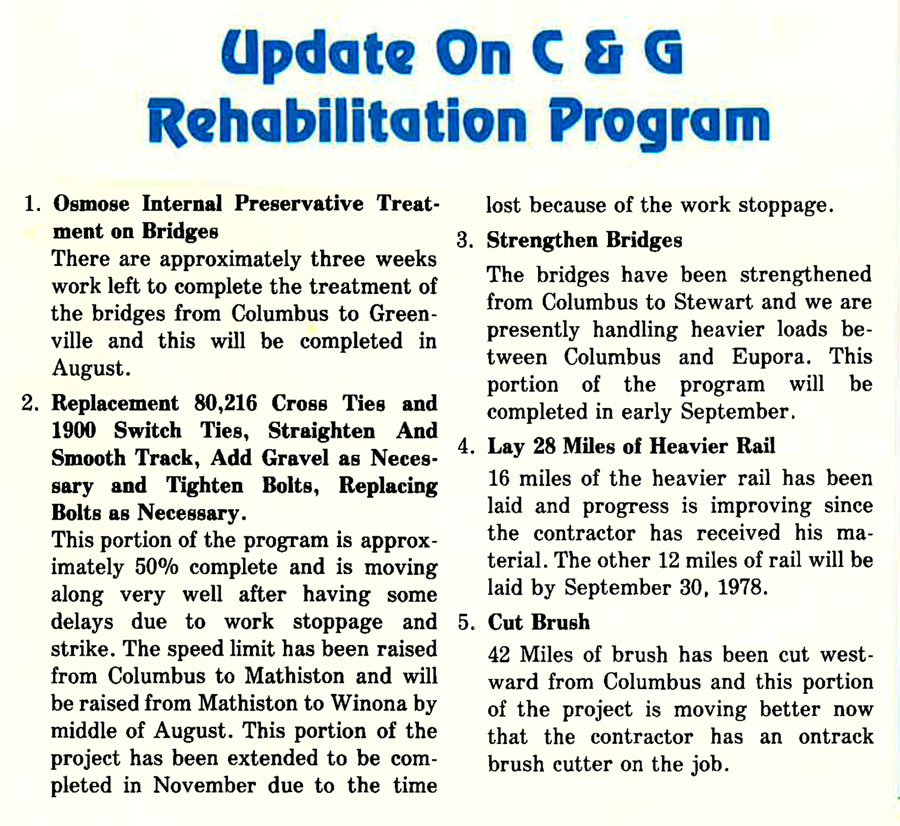
from CAGY company newsletter - Aug 1978 / collection
Mathiston, Ms / Nov 2022 / RWH
Click to see this former Mathiston diamond area plotted on a Google Maps page
Nov 2022 / RWH
Nov 2022 / RWH
Mathiston, Ms / Nov 2022 / RWH
Mathiston, Ms / Nov 2022 / RWH
Mathiston, Ms / Nov 2022 / RWH
Mathiston, Ms / Nov 2022 / RWH
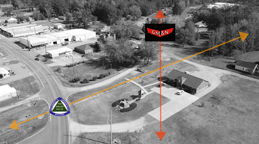
northeast overhead view of C&G and GM&N crossing / Nov 2022 / RWH
Mathiston, Ms / Nov 2022 / RWH
Mathiston, Ms / Nov 2022 / RWH
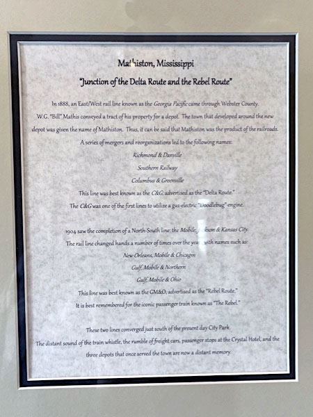
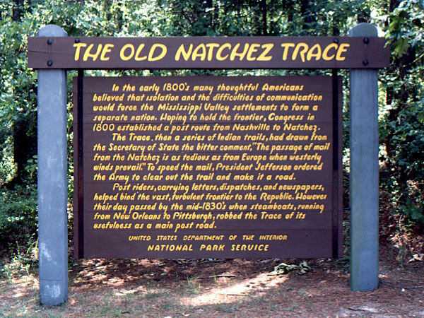 Located along the historic Old Natchez Trace, the area that became Mathiston was about one mile north of a famous trading post owned by Choctaw Chief David Folsom in the early 1800s. In 1889, the Georgia Pacific Railway established a route for an east/west rail line that ran just north of the Big Black River through Webster County.
William Gideon “Bill” Mathis donated land for the purposes of establishing a depot near a spot of land that was known as “Natchez Trace” and adjacent to the famous original Natchez Trace. On Saturday, May 25, 1889, Mr. Mathis planned a community meal, prayer service and a sale of lots for the new town around the depot that the railroad had named “Mathiston” in his honor. In addition, he donated lots for a school and churches. He was the first marshal as well as the first depot agent. In February 1890, the legislature officially declared Mathiston a municipality. The town grew and influence with the introduction of a rail crossing in 1905 after the Mobile, Jackson, and Kansas City Railroad came into existence. Thus, it may be said that Mathiston owes its existence to the railroad industry.
From the early days of the railroads, to the modern settings of today, Mathiston has endured and is now thriving with an increase in business and industry, growth in population and efforts to increase our cultural and recreational opportunities. We are proud of our past and look forward to sharing with our citizens the bright future that is ahead.
Mathiston, Ms / Nov 2022 / RWH
Nov 2022 / RWH
Nov 2022 / RWH
Nov 2022 / RWH
Mathiston, Ms / Nov 2022 / RWH
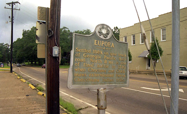
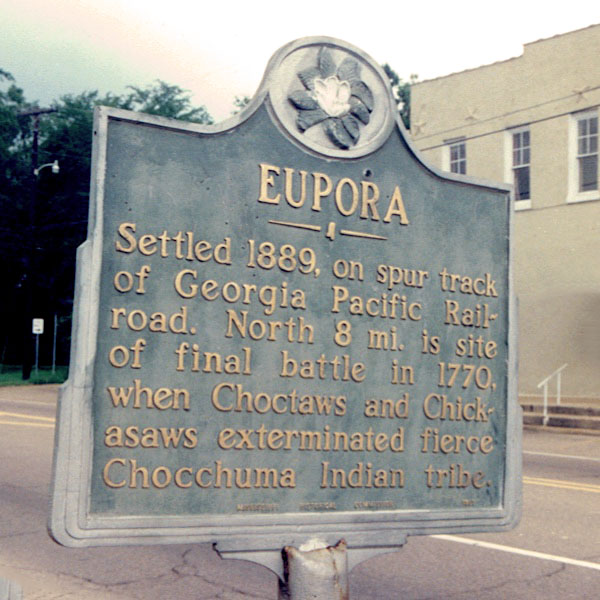
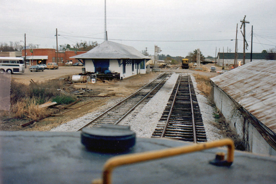
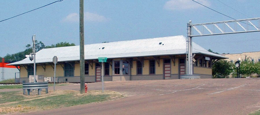
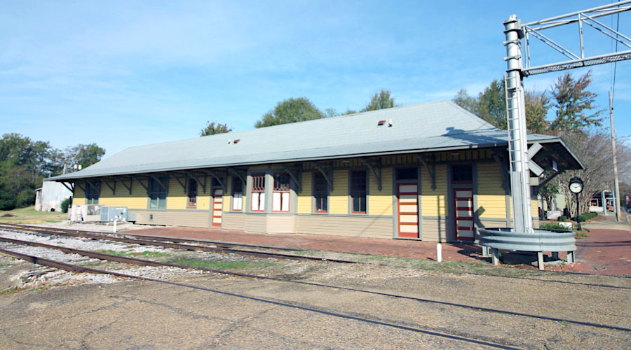
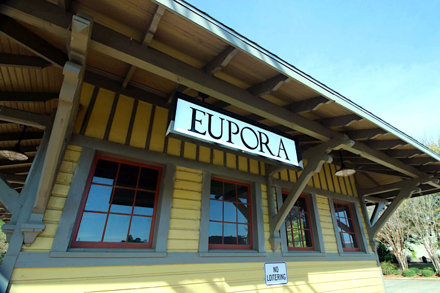
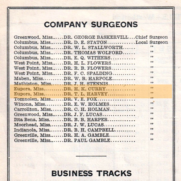
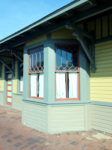
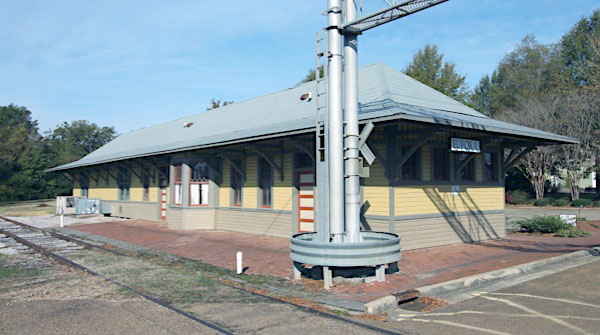
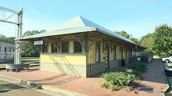
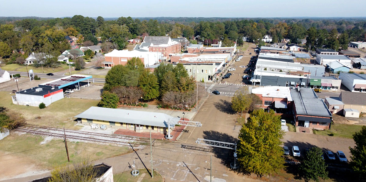
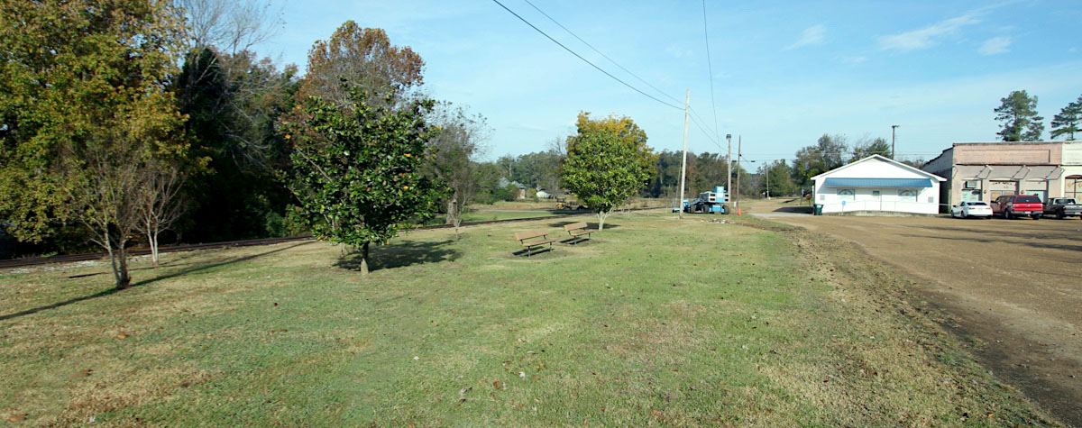
 Eupora
 Eupora is a sleepy, historic town nestled between two of Mississippi's most prominent public Universities at the intersection of Highways 9 and 82 which offers a small town feel in an accessible location. We also offer desirable public schools with B ratings, a North Mississippi Medical Center with Emergency Care Facility and a caring, close knit community readily accepting newcomers in this time of involvement and growth.
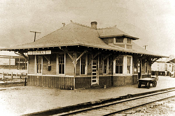
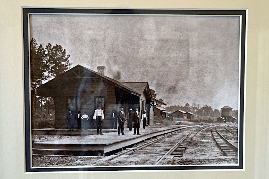
Eupora depot / Eupora, Ms / 1917 inspection / collection
Eupora freight house / Eupora, Ms / 1917 inspection / collection
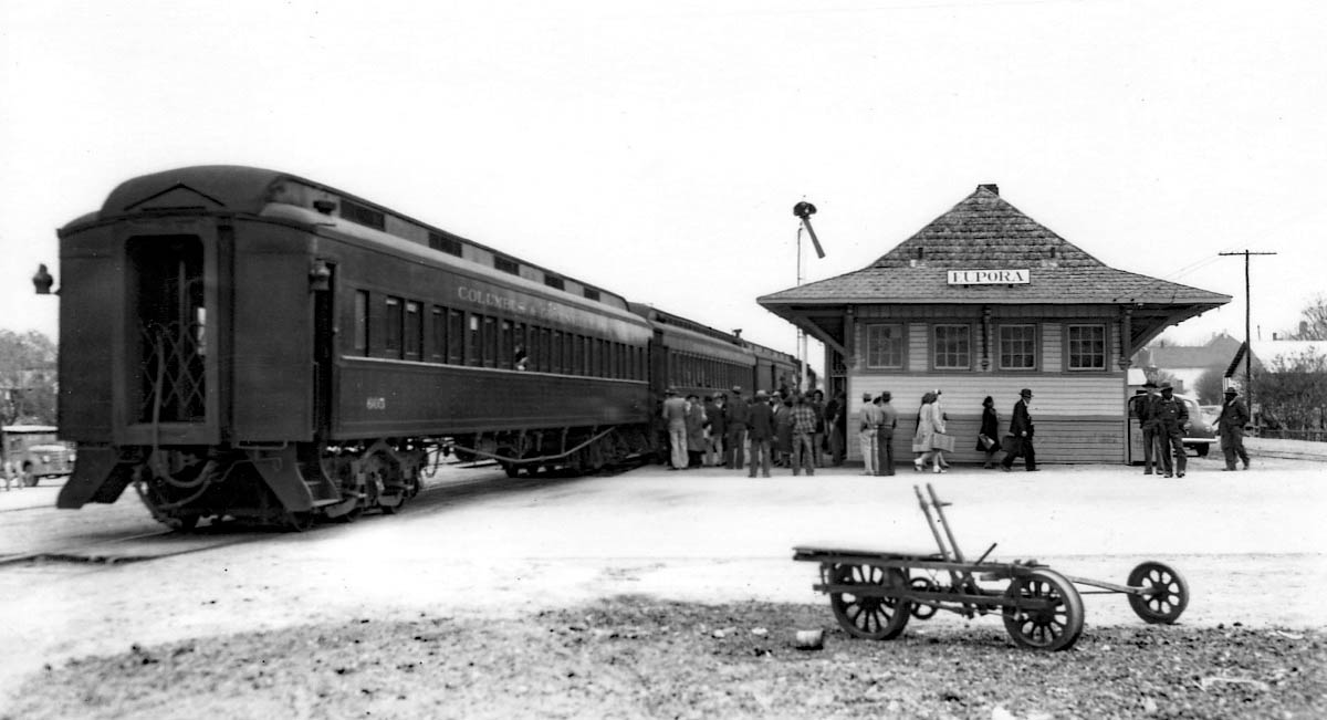
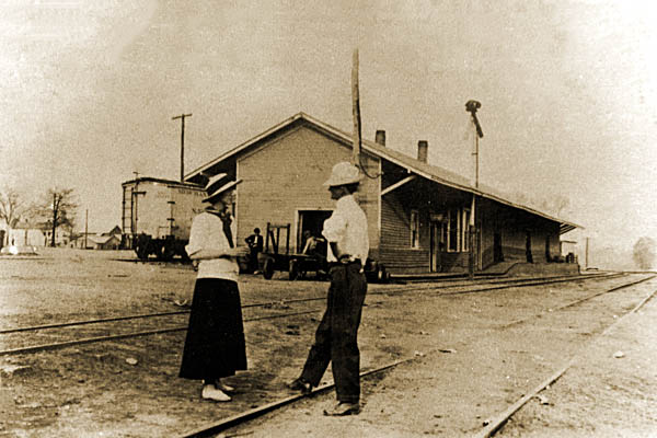
Eupora, Ms / 1944 / collection
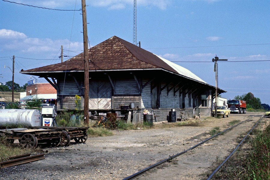
Eupora, Ms / Oct 1982 / Gerhard Anderson
Eupora, Ms / Oct 1982 / Bernie Feltman
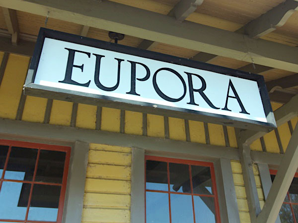
Click to see the Eupora depot area plotted on a Google Maps page
Eupora, Ms / Jul 1989 / RWH
Eupora, Ms / Jul 1989 / RWH
Eupora, Ms / Jul 1989 / RWH
Jul 1989 / RWH
westbound view / Eupora, Ms / Jul 1989 / RWH
eastbound view / Eupora, Ms / Nov 1989 / RWH
Eupora, Ms / Aug 2006 / R Spencer
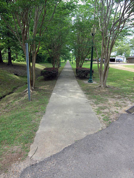
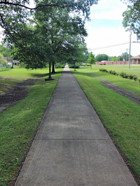
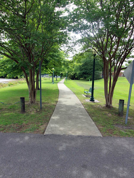
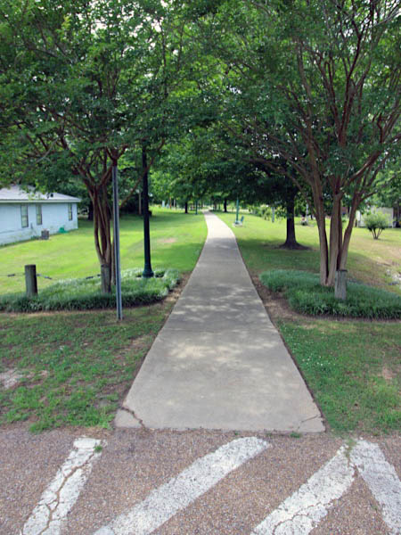
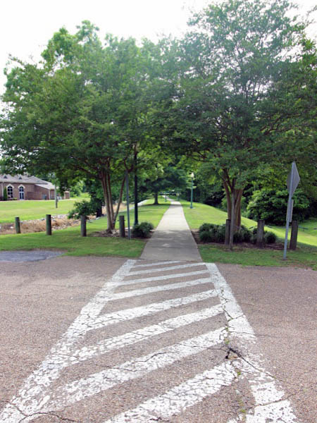
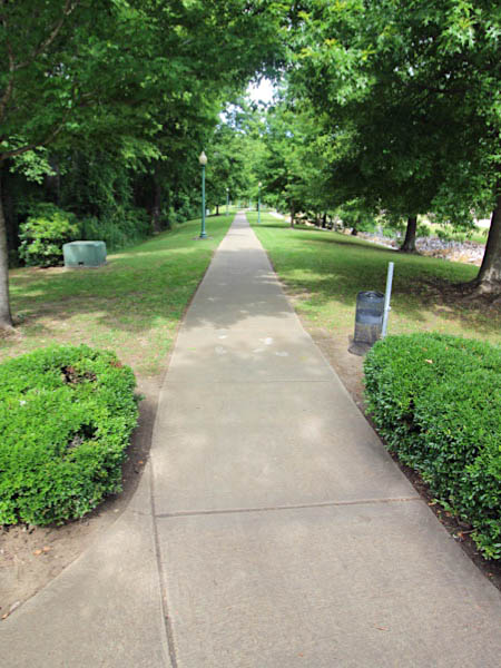
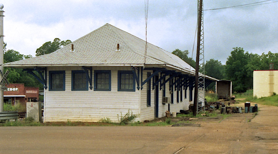
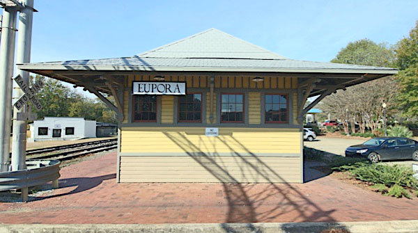
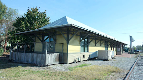
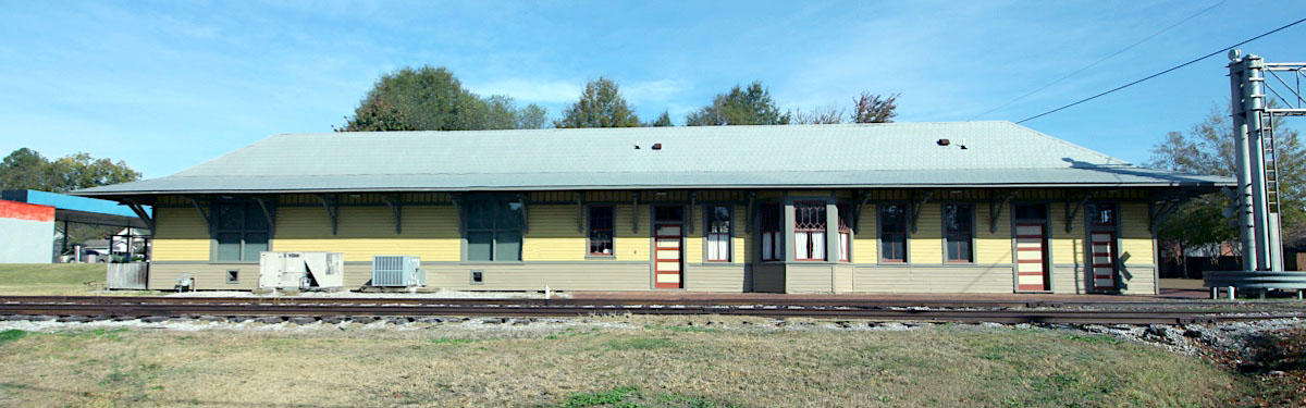
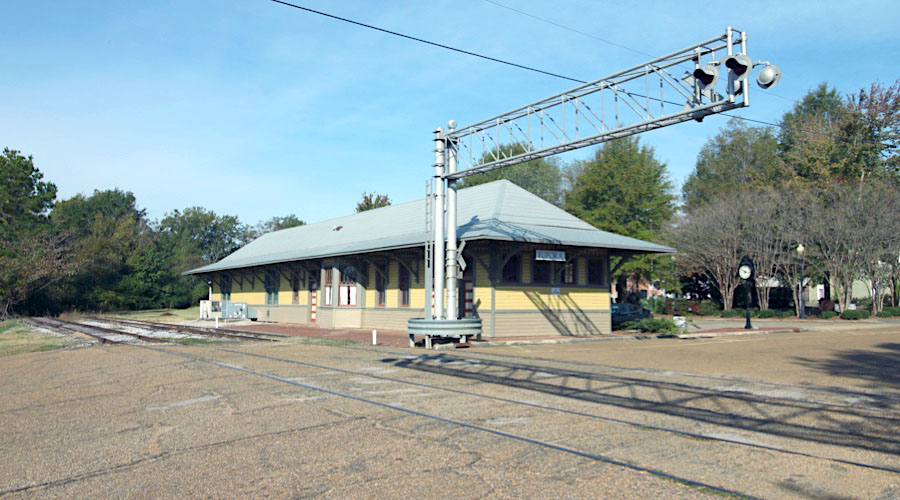
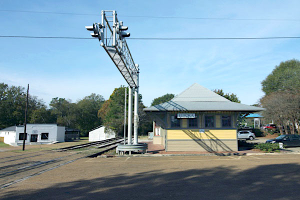
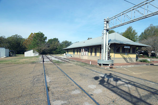
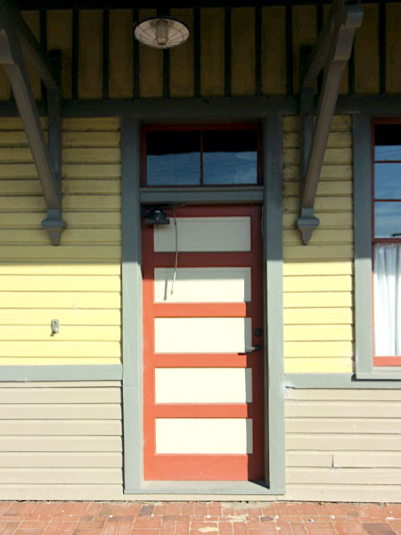
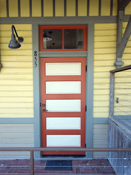
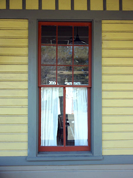
 The Eupora Depot, a former Columbus and Greenville Passenger Depot, was acquired by the City of Eupora with the help of the Eupora Beautification Committee. Funded by the Mississippi Department of Transportation Enhancement Grant the building was fully restored from the foundation to the roof. The remaining building fabric was restored, including beaded board wall and ceiling in the office/ticket areas, cabinetry, doors and windows, brackets, exterior siding and much of the wood trim. New elements were incorporated into the building to meet the functional needs of the facility. The freight room was enclosed with flush boards to provide a multiple purpose room for the community. The wood storage cell was developed into a small kitchen area. New partitions were sensitively added to provide bathrooms, storage and utility spaces. A large undeveloped parking area was removed north of the depot and a small town park was developed in the location of the original city park which was removed 40 years ago. This park has brought the community together and allowed a local industry to generously give back to the community through donations to the park. The depot and park restoration [in 2002] has helped spur additional development in downtown Eupora.
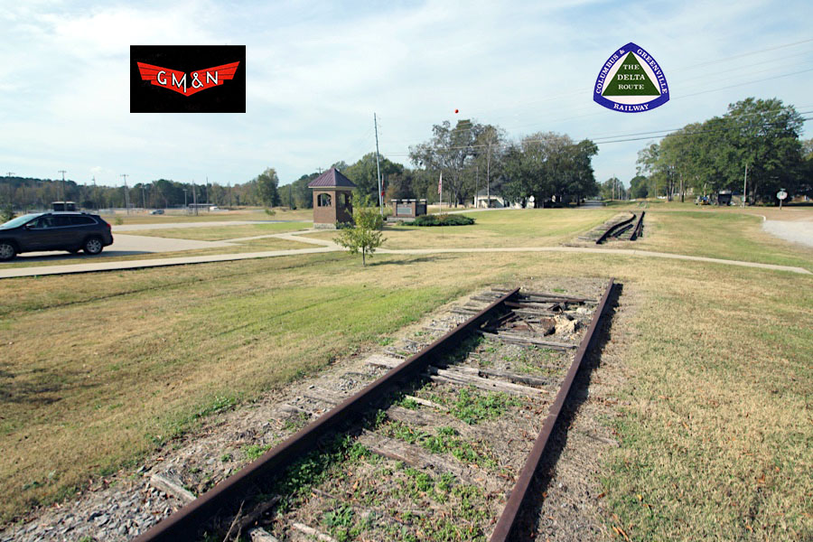
Eupora, Ms / Nov 2022 / RWH
Nov 2022 / RWH
1947 timetable / collection
Nov 2022 / RWH
Eupora, Ms / Nov 2022 / RWH
Eupora, Ms / Nov 2022 / RWH
Eupora, Ms / Nov 2022 / RWH
Eupora, Ms / Nov 2022 / RWH
Eupora, Ms / Nov 2022 / RWH
Eupora, Ms / Nov 2022 / RWH
Nov 2022 / RWH
Eupora, Ms / Nov 2022 / RWH
Eupora, Ms / Nov 2022 / RWH
Nov 2022 / RWH
Eupora, Ms / Nov 2022 / RWH
Eupora, Ms / Nov 2022 / RWH

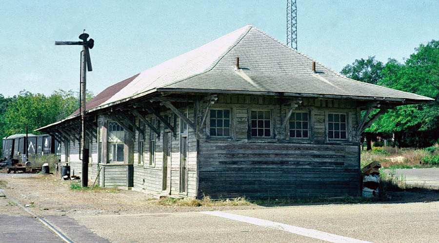
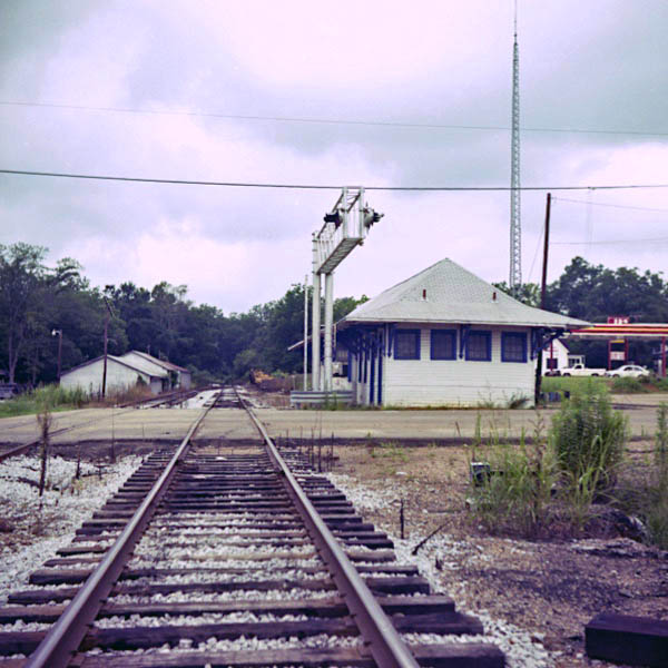
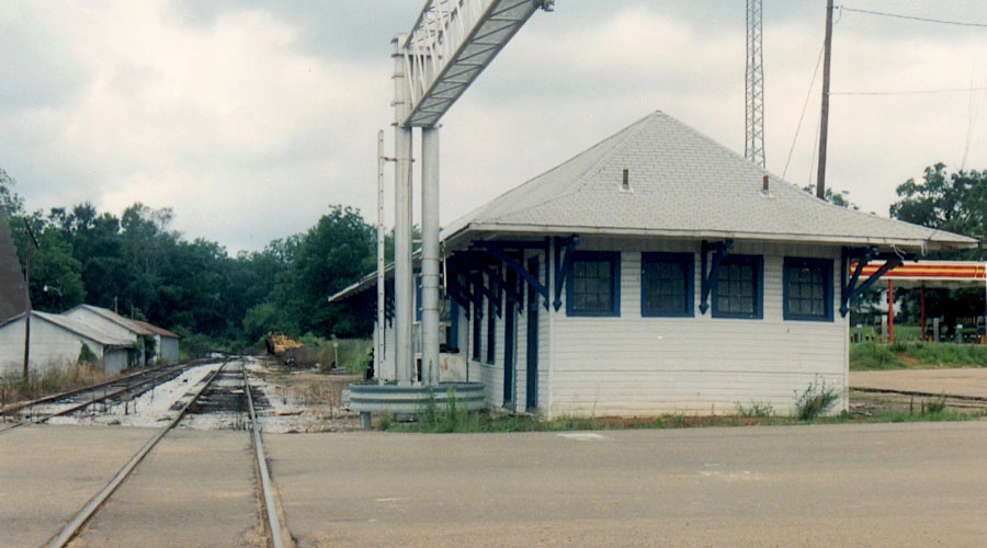
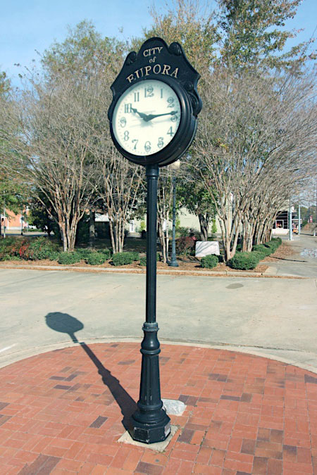
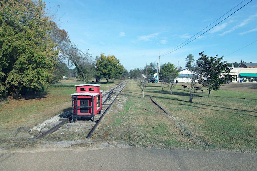
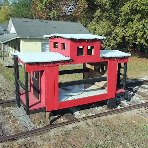
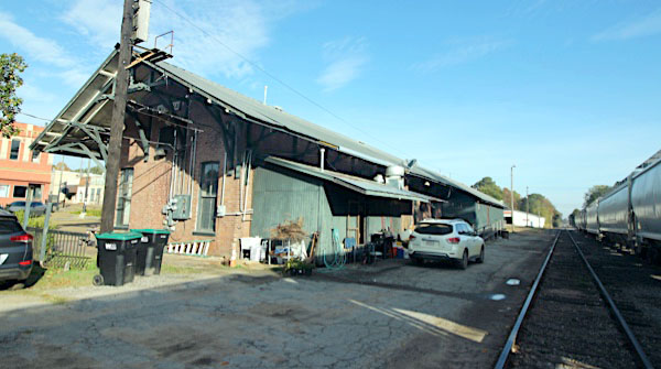
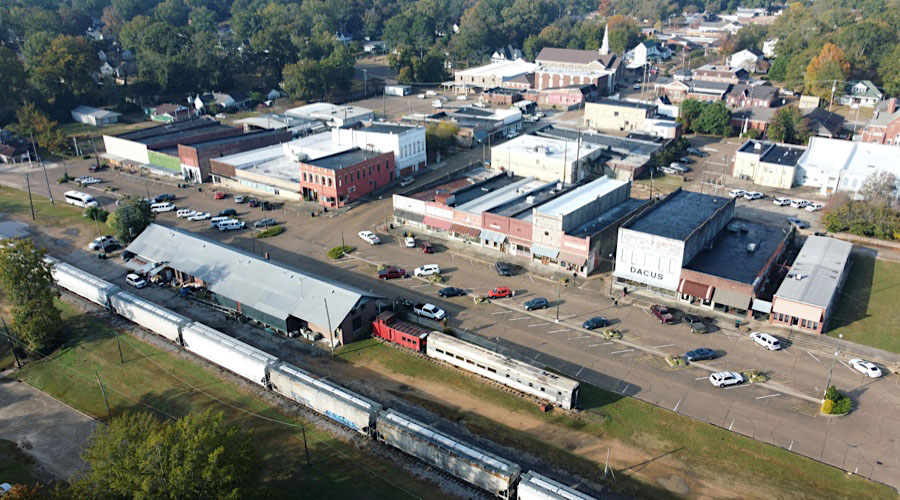
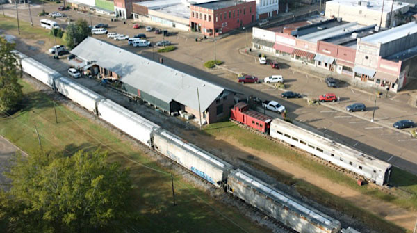
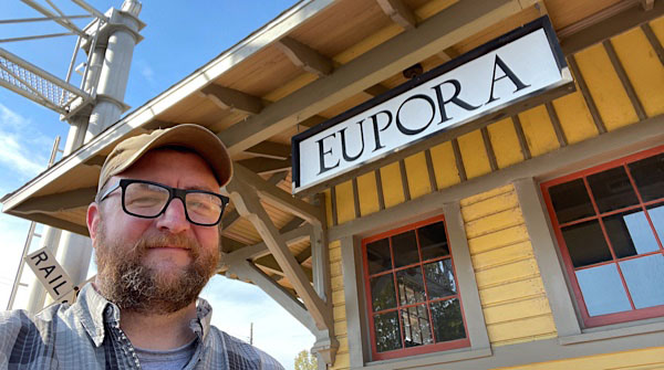 The beautiful Eupora depot: the last remaining bright spot on the eastern end of the Delta Route.
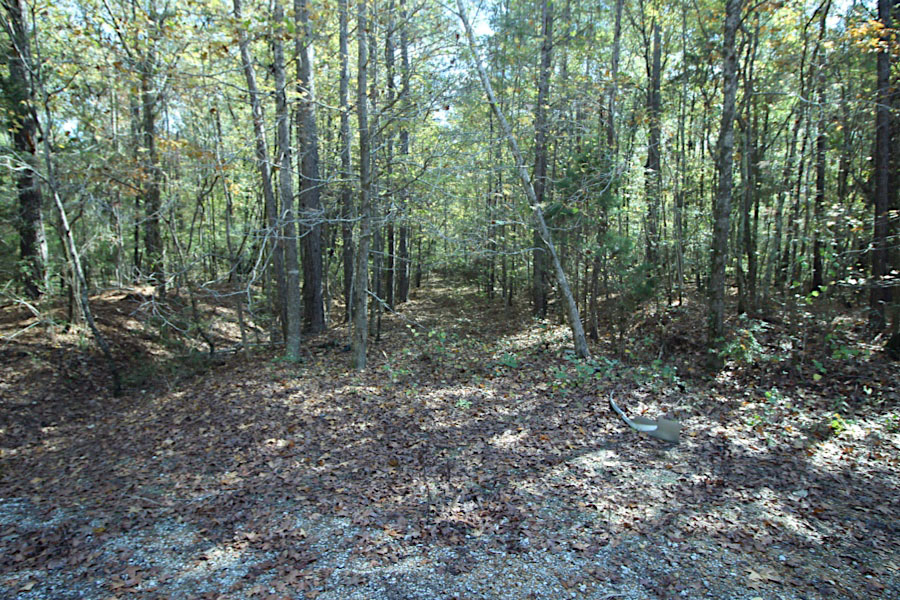
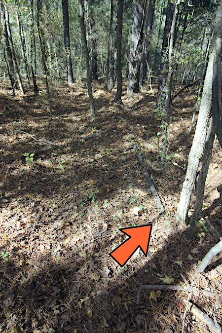
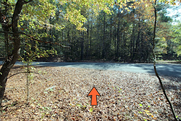
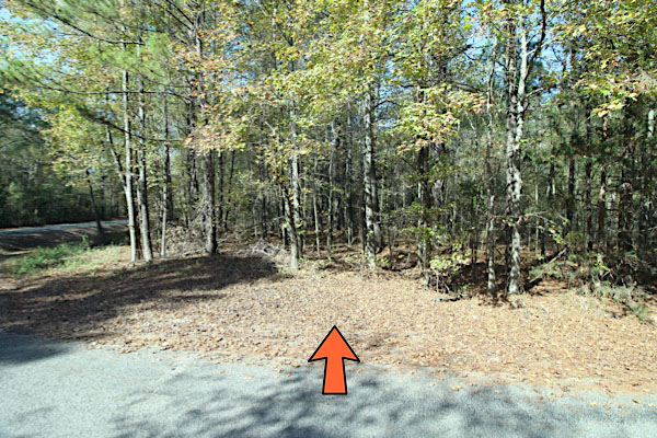
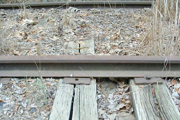
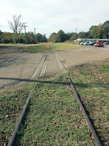
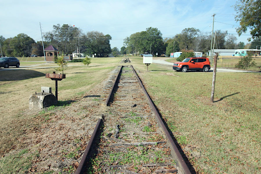
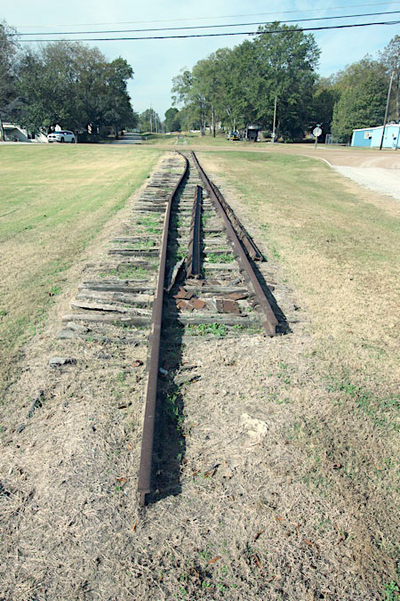
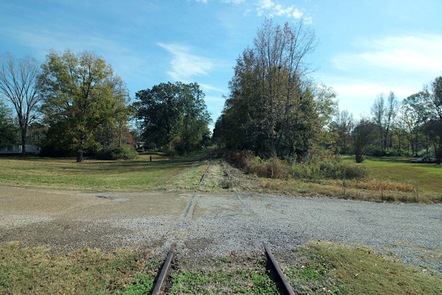
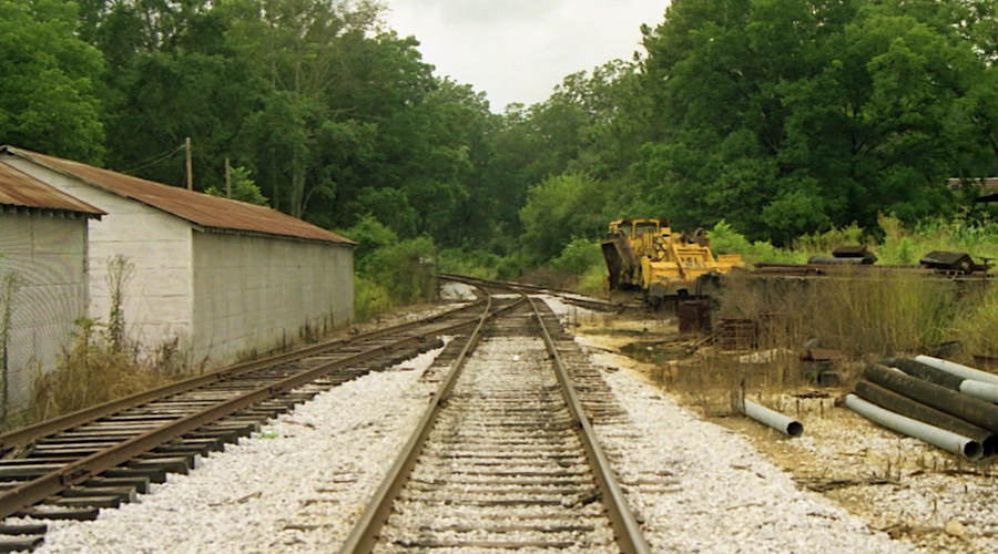
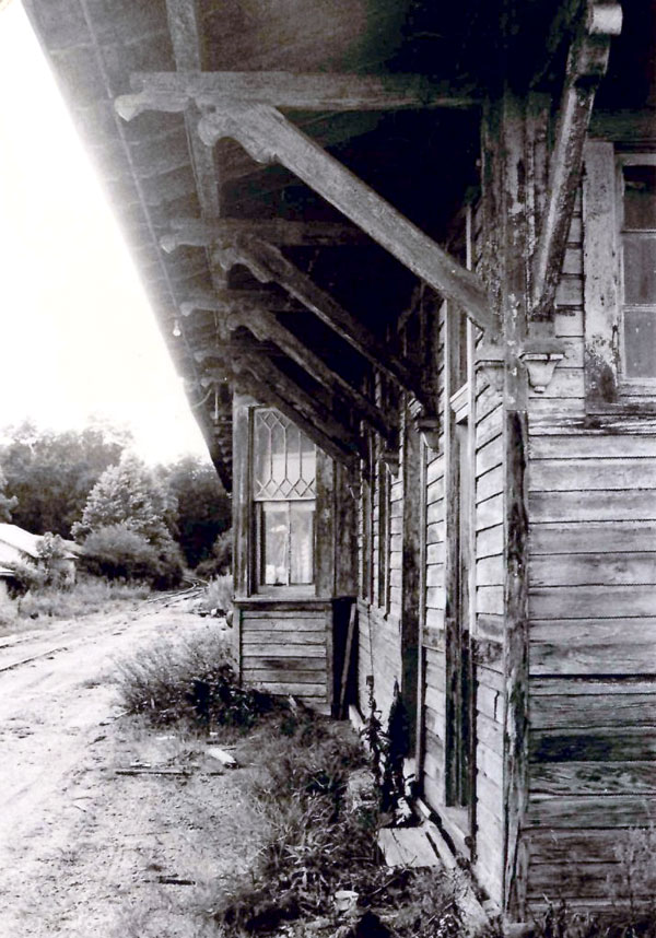
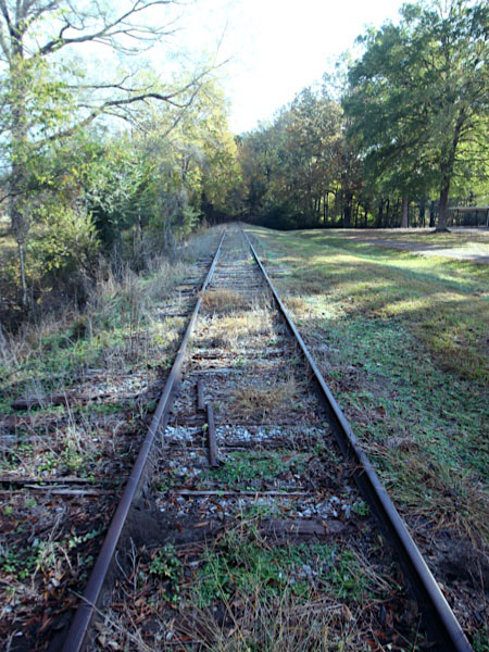
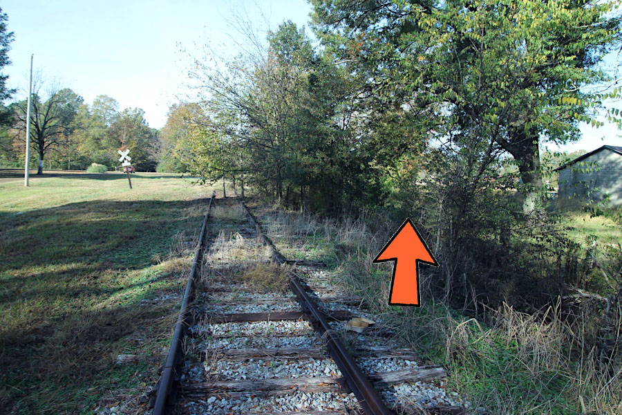
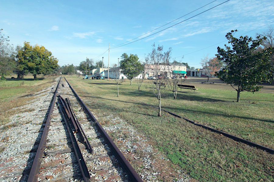
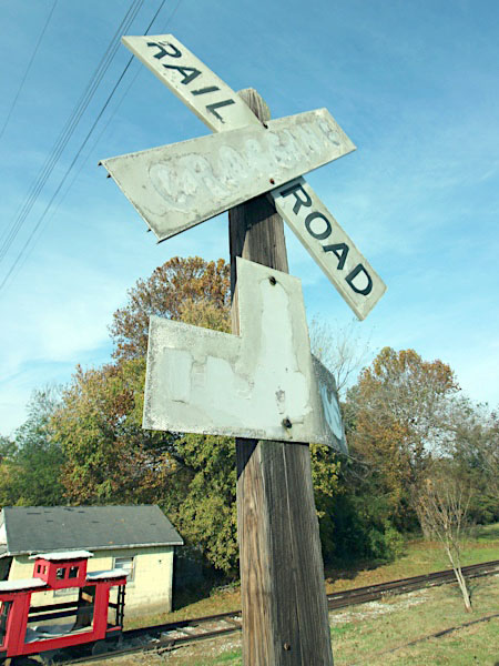
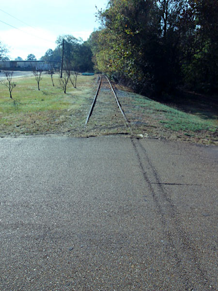
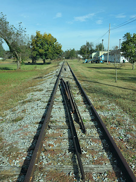
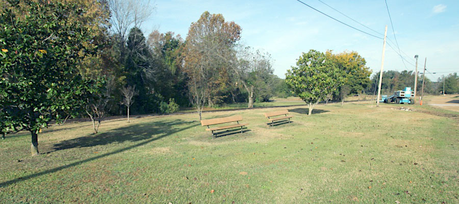
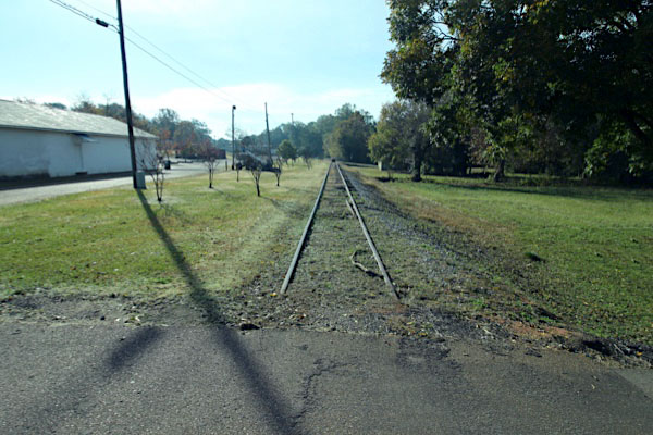
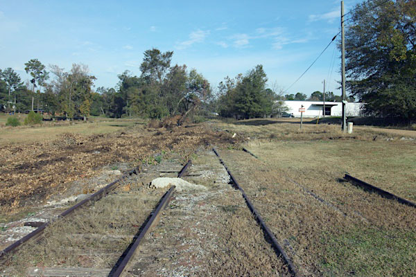
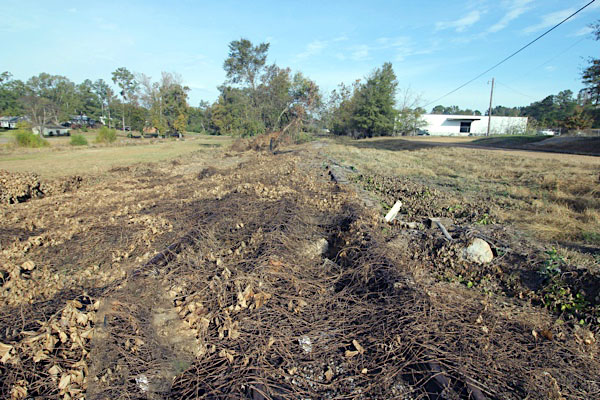
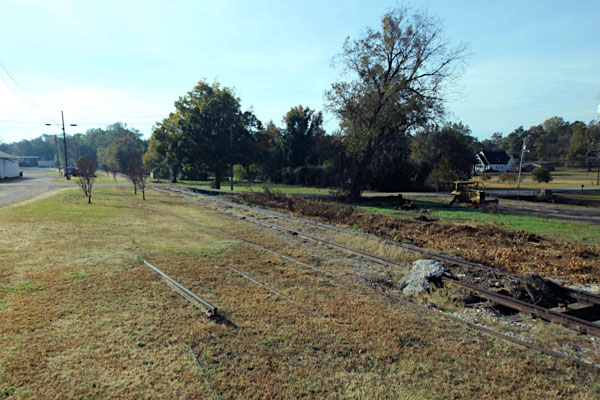
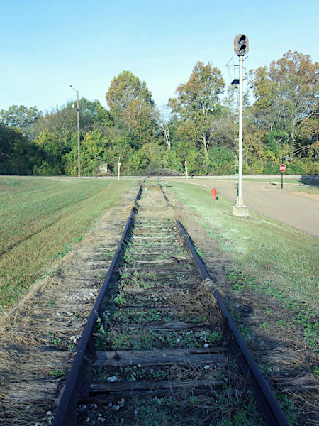
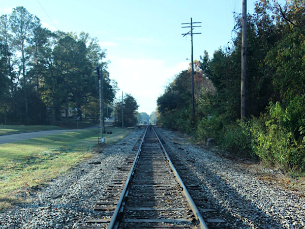
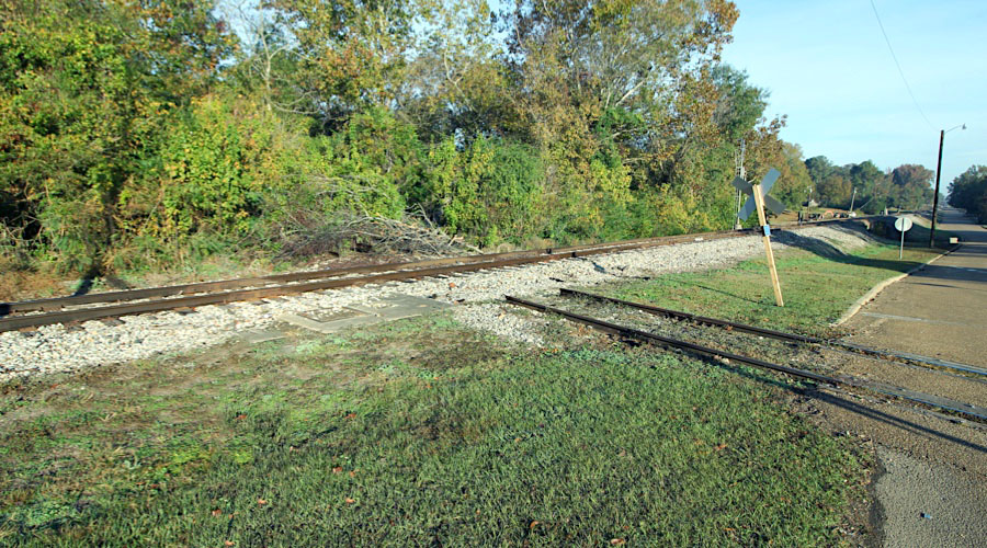
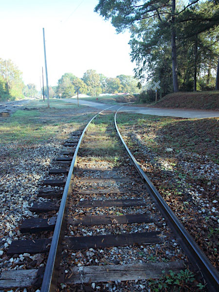
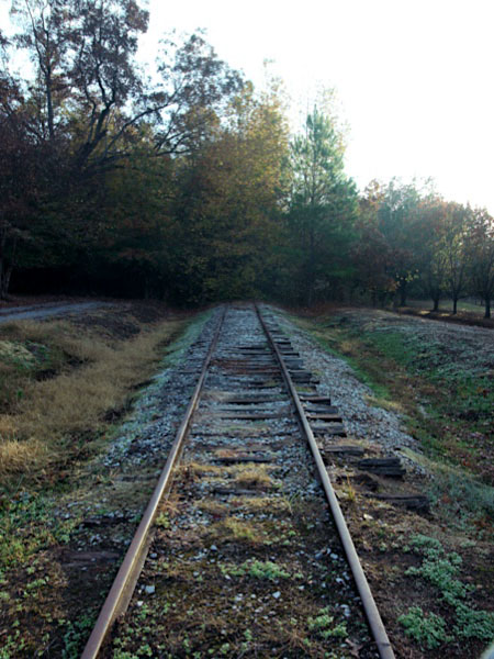
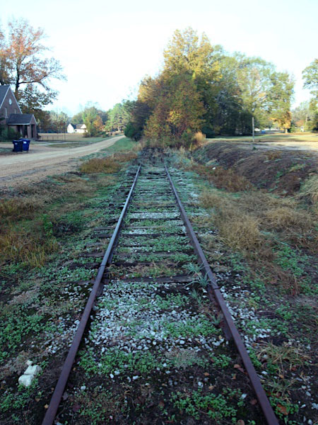
A fall conference in Arkansas afforded me a drive back home across northern Mississippi, so I used the trip to complete a photo documentation project I began in the summer of 2020. That summer I drove from Greenwood west to Greenville, documenting the current CAGY mainline in every west end ommunity. This time I again started in Greenwood, but this trip I went east — town by town, village by village — as far as the Tenn-Tom Waterway at Waverly. This was the reverse of a trip my father and I made in the summer of 1989, when we drove from Columbus to Greenville and made location shots in many (but not all) communities. More than 30 years after that trip, and 20 years after the CAGY embargoed the eastern end of the mainline, I was pleased to find several places along the old main where Delta Route rail is not only visible but still serviceable. However, most of the right of way in this region is significantly overgrown and, in too many places, completely obscured. More grade crossing than not have been paved over since 2001; more than once, I had to rely on maps to even know if I was standing on former C&G ground.
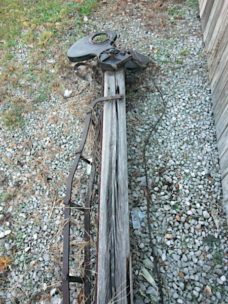
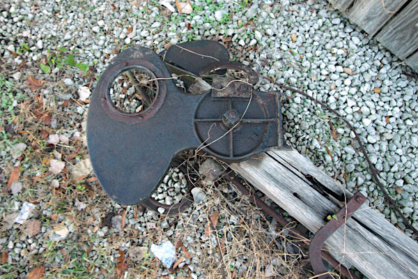
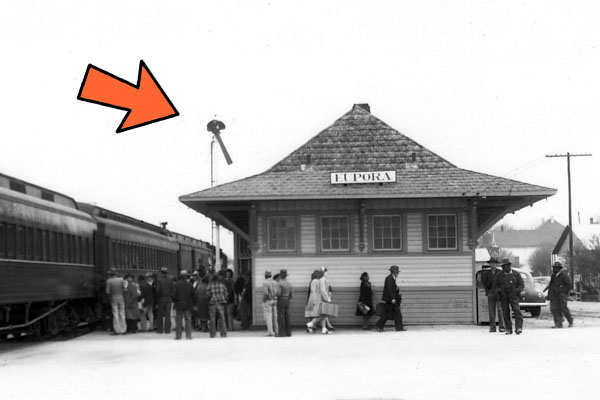
This decay of mainline made the Eupora depot, restored in 2002, a welcome respite. My first visit to Eupora was during the '89 scouting trip noted above. Less than 6 months later, I was back ... this time arriving by train. Eupora was the destination for the fall NRHS excursion which started in Greenwood early on a Saturday morning and culminated at the Eupora depot just before sunset. Back then, the depot was in poor shape. But these days, the building is looking great: the anchor for other revitalization projects in downtown Eupora. I was especially tickled to find the old semaphore signal pole still lying around behind the building.
The rails adjacent to the depot only go a few hundred feet west before disappearing into thick overgrowth, but still I have no doubt that Adam Tonquin Stovall would be pleased that at least one artifact of his original C&G mainline east of Greenwood still stands tall.
Nov 2022 / RWH
Eupora, Ms / Nov 2022 / RWH
Eupora, Ms / Nov 2022 / RWH
Eupora, Ms / Nov 2022 / RWH
Eupora, Ms / Nov 2022 / RWH
Nov 2022 / RWH
Nov 2022 / RWH
1944 / collection
Nov 2022 / RWH
Nov 2022 / RWH
Eupora, Ms / Nov 2022 / RWH
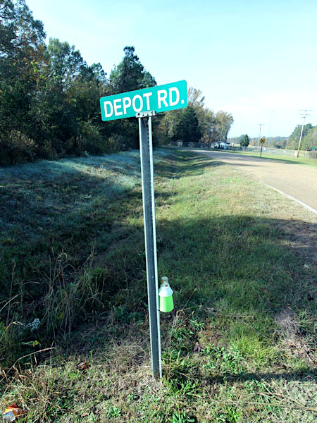
 Tomnolen
Tomnolen depot / Tomnolen, Ms / 1917 inspection / collection
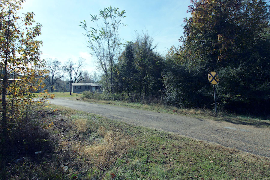
Tomnolen, Ms / Nov 2022 / RWH
Click to see the former Depot Road crossing plotted on a Google Maps page
Nov 2022 / RWH
Tomnolen, Ms / Nov 2022 / RWH
Tomnolen, Ms / Nov 2022 / RWH
Tomnolen, Ms / Nov 2022 / RWH
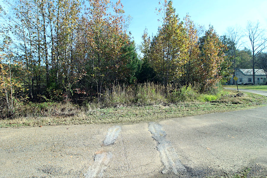
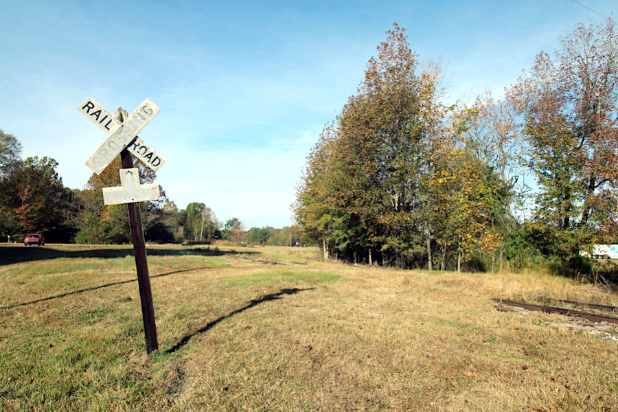
 Stewart

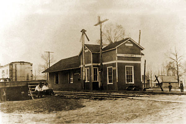
Stewart depot / Stewart, Ms / 1917 inspection / collection
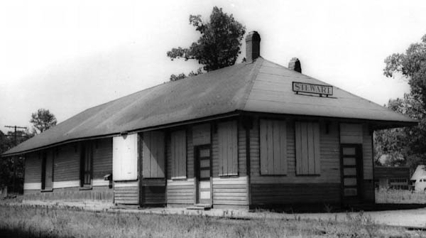
Stewart, Ms / May 1954 / Fred Goff
Stewart, Ms / Nov 2022 / RWH
Click to see the former Huntsville Road crossing area plotted on a Google Maps page
Nov 2022 / RWH
Stewart, Ms / Nov 2022 / RWH
Stewart, Ms / Nov 2022 / RWH
mainline west and depot location / Stewart, Ms / Nov 2022 / RWH
Nov 2022 / RWH
Nov 2022 / RWH
Nov 2022 / RWH
house track lead / Stewart, Ms / Nov 2022 / RWH
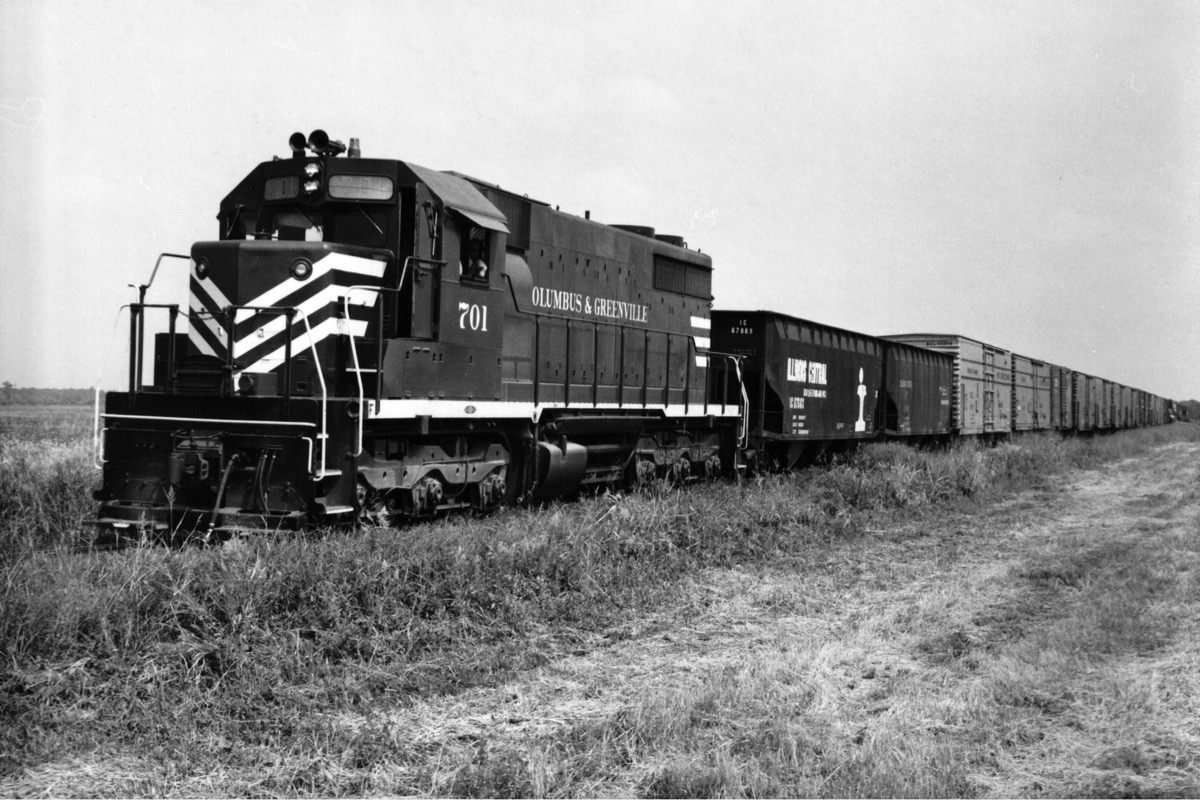
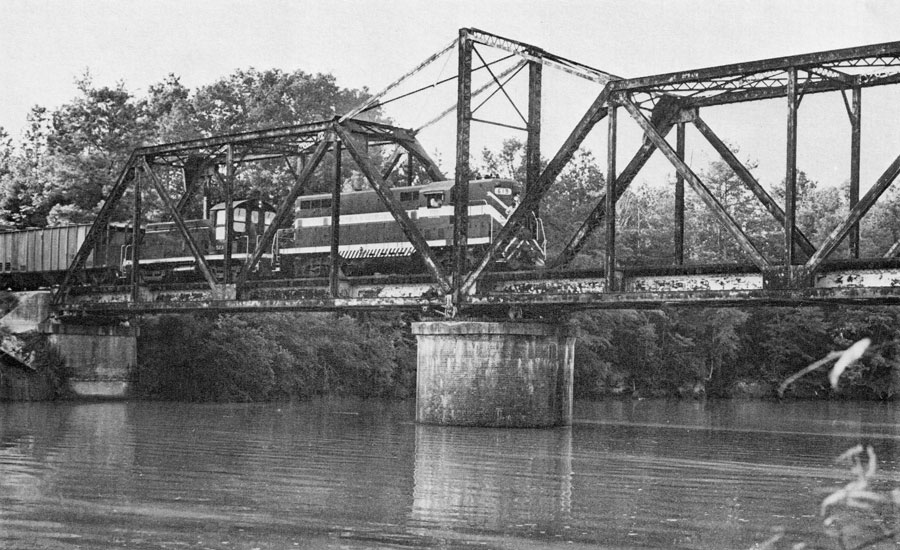
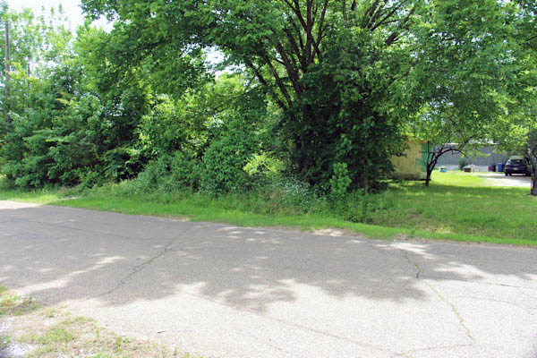
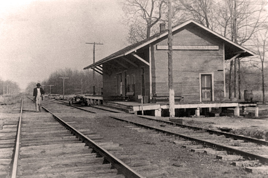
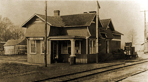
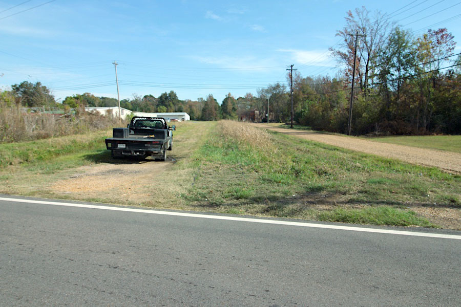
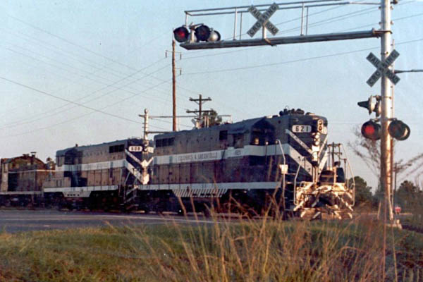
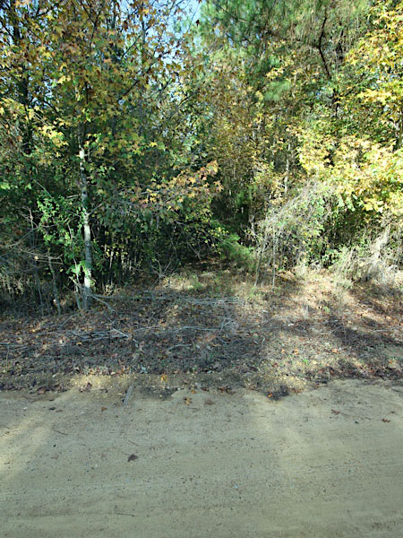
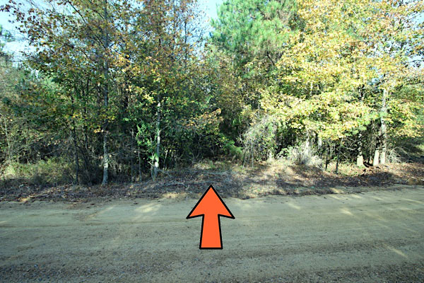
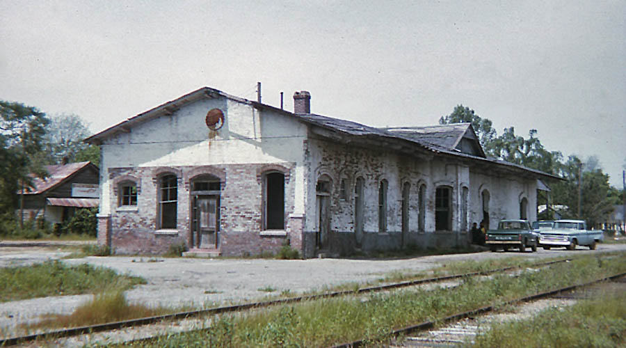
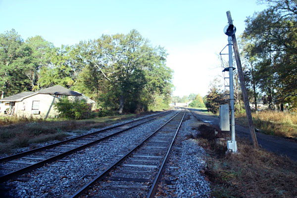
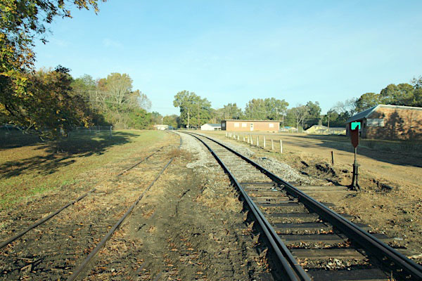
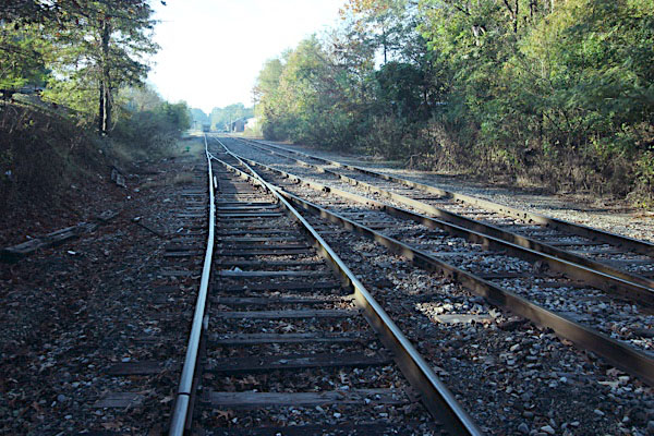
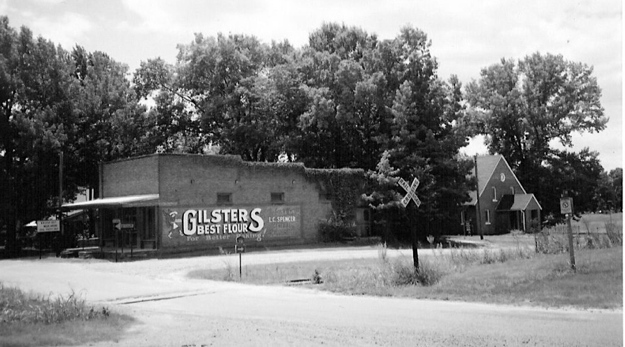
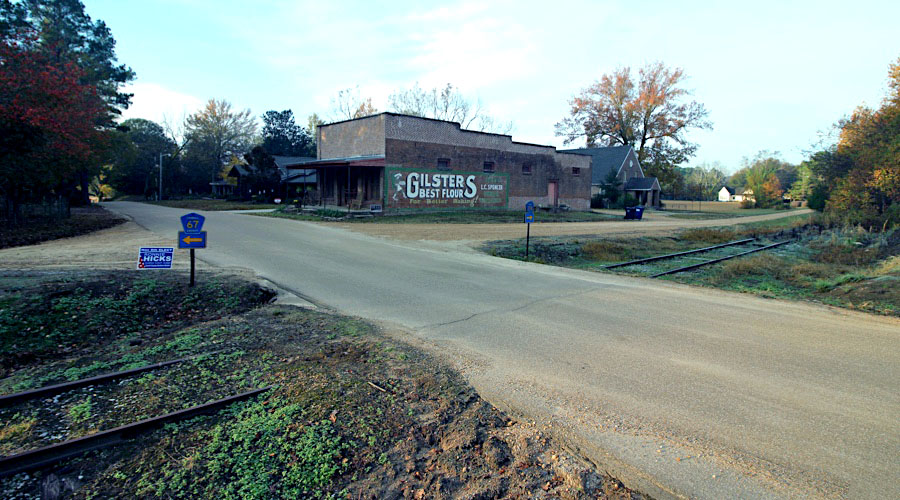
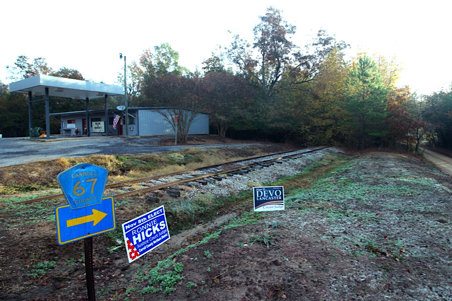
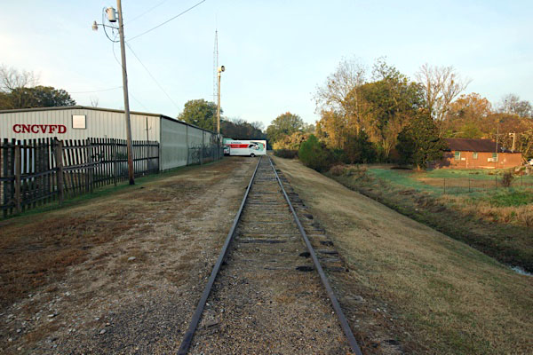
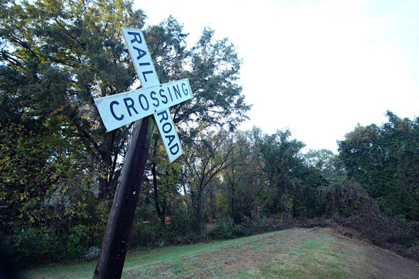
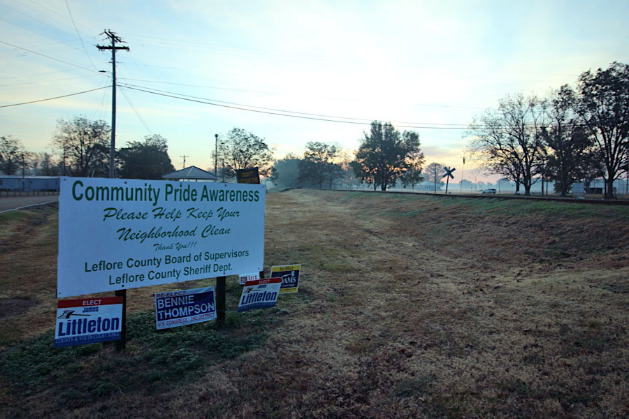
Sibleyton, Ms / Sep 1972 / collection
 Kilmichael
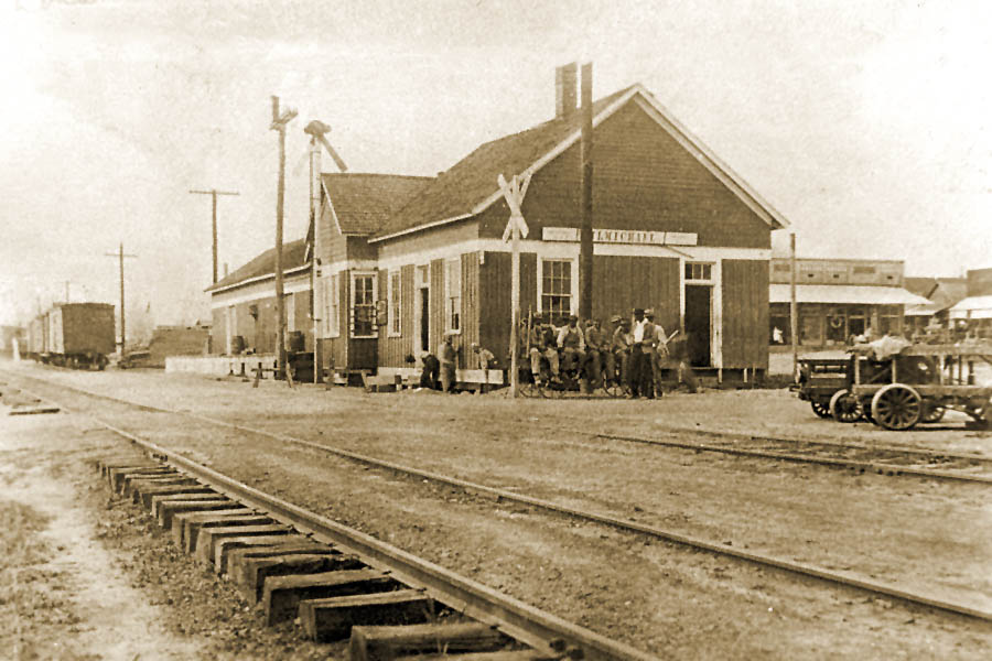
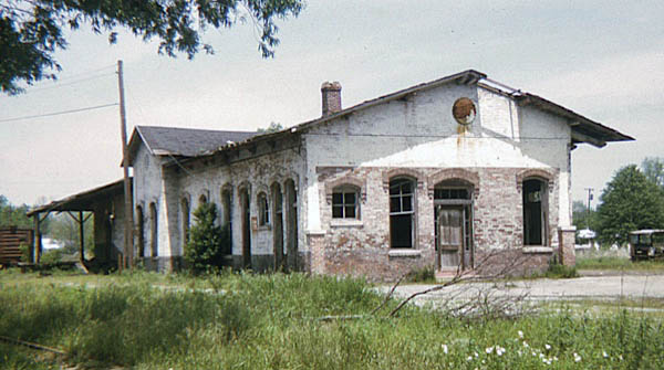
Kilmichael depot / Kilmichael, Ms / 1917 inspection / collection
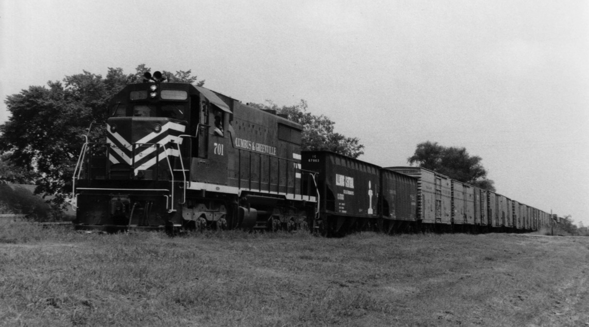
Kilmichael, Ms / Sep 1972 / collection
Kilmichael, Ms / Nov 2022 / RWH
Click to see the former Main Street crossing plotted on a Google Maps page
Kilmichael, Ms / Nov 2022 / RWH
Nov 2022 / RWH
Nov 2022 / RWH
Nov 2022 / RWH
Kilmichael, Ms / Nov 2022 / RWH
Nov 2022 / RWH
Kilmichael, Ms / Nov 2022 / RWH
Kilmichael, Ms / Nov 2022 / RWH
Kilmichael, Ms / Nov 2022 / RWH
Kilmichael, Ms / Nov 2022 / RWH
Kilmichael, Ms / Nov 2022 / RWH
Click to see the former West Stone Street crossing plotted on a Google Maps page
Kilmichael, Ms / Nov 2022 / RWH
 Hendrix
Nov 2022 / RWH
Hendrix, Ms / Nov 2022 / RWH
Hendrix, Ms / Nov 2022 / RWH
Click to see the Hendrix Road crossing plotted on a Google Maps page
 Winona
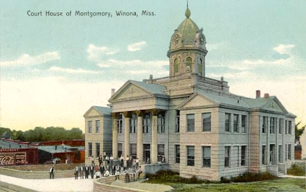 Welcome to the City of Winona, Mississippi. We are the original crossroads of North Mississippi! Winona is the only place in Mississippi where Hwy 82 intersects Hwy 51 and I-55. We are located approximately one hour and fifteen minutes north of Jackson, Mississippi and one hour and thirty minutes south of Memphis, Tennessee, on US Highway I-55 interstate.
Winona is located in Montgomery County, Mississippi, and is the county seat. As of the 2010 census, the city had a total population of 5,043. The name of the city comes from the Sioux word We-Noh-Nah meaning "first-born daughter."
Welcome to the City of Winona, Mississippi. We are the original crossroads of North Mississippi! Winona is the only place in Mississippi where Hwy 82 intersects Hwy 51 and I-55. We are located approximately one hour and fifteen minutes north of Jackson, Mississippi and one hour and thirty minutes south of Memphis, Tennessee, on US Highway I-55 interstate.
Winona is located in Montgomery County, Mississippi, and is the county seat. As of the 2010 census, the city had a total population of 5,043. The name of the city comes from the Sioux word We-Noh-Nah meaning "first-born daughter."
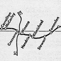
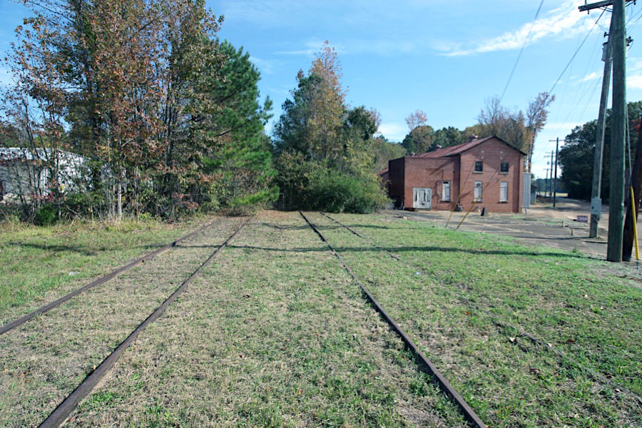
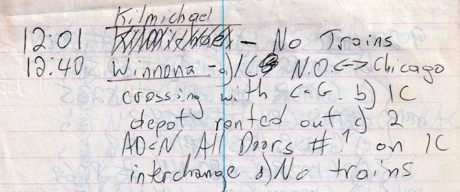
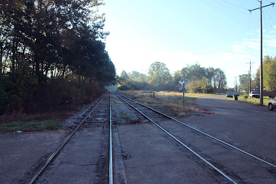
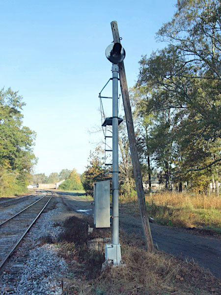
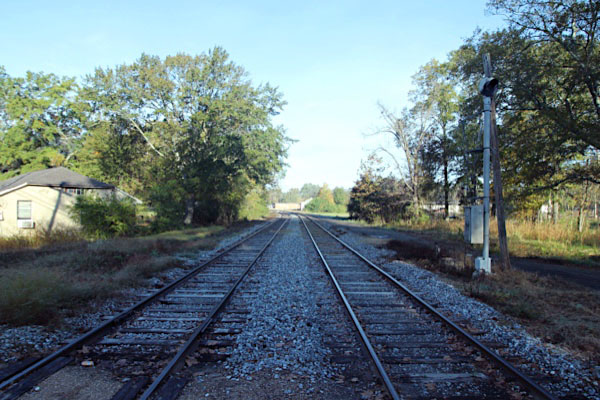
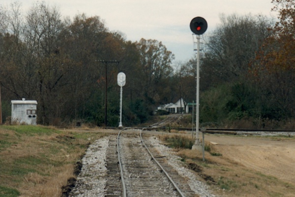
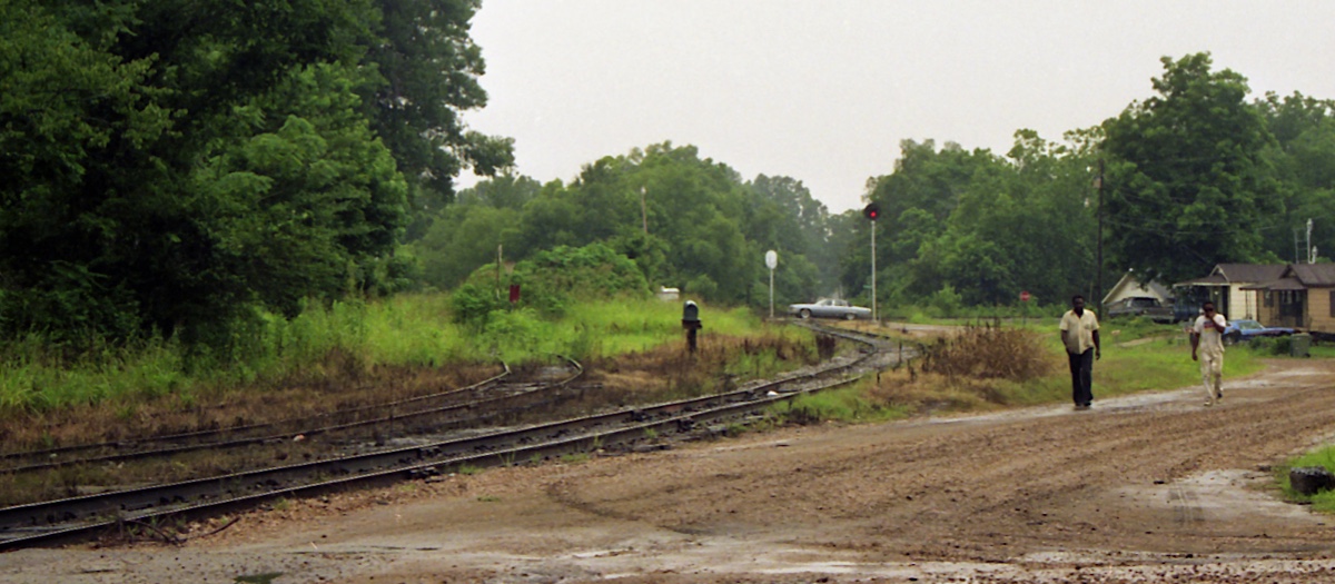
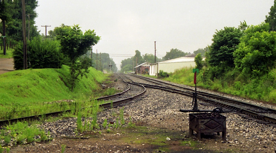
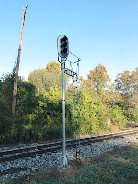
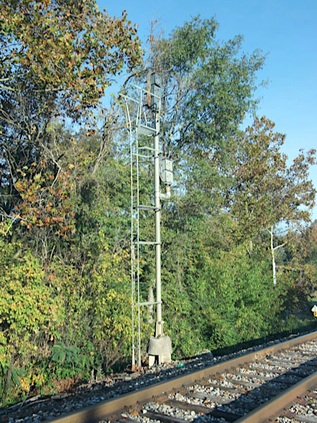
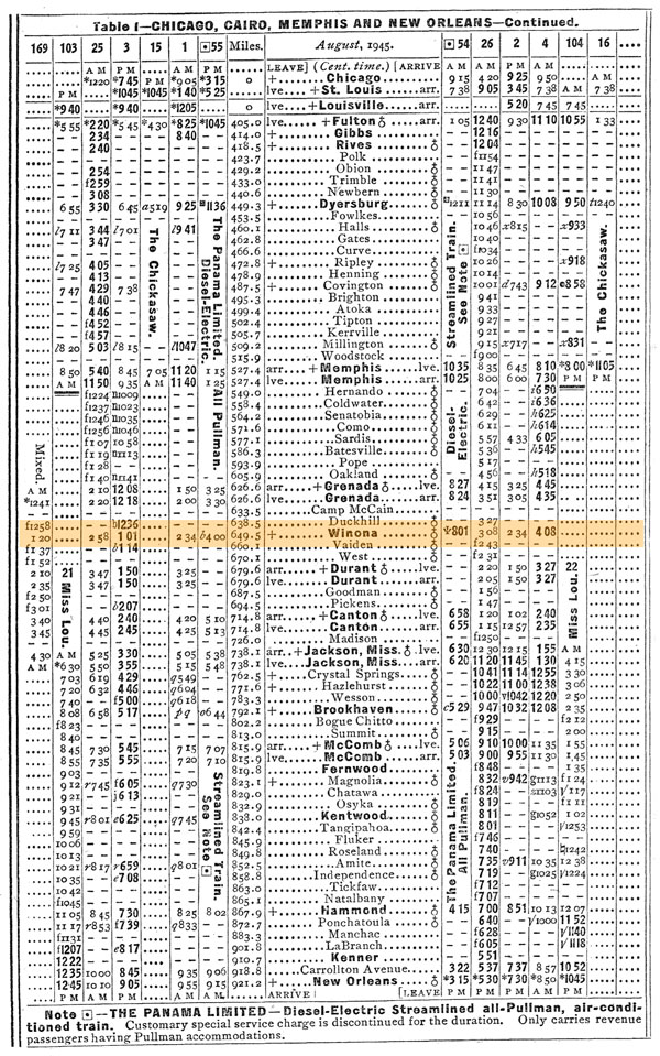
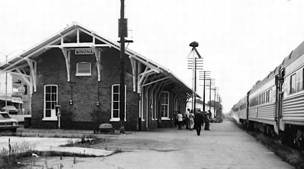
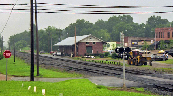
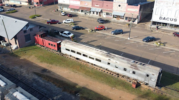
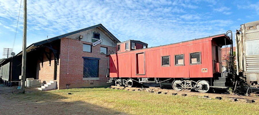
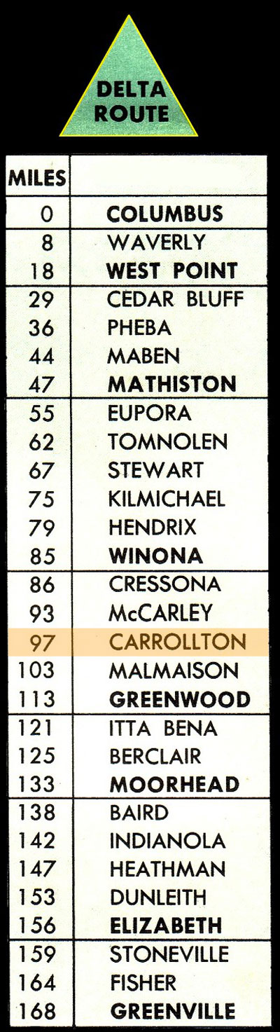
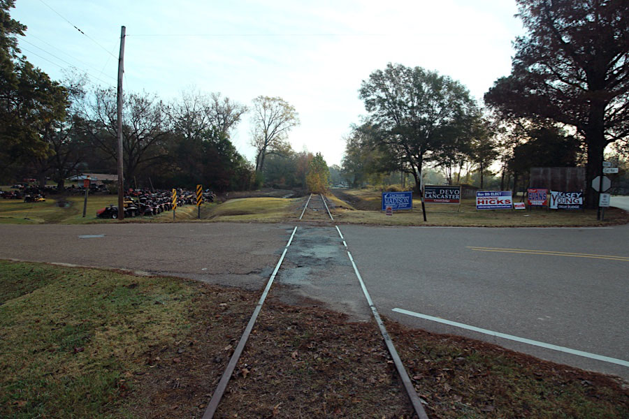
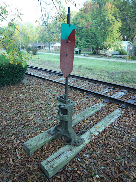
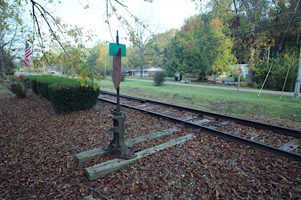
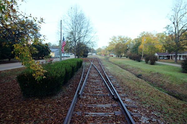
 ust one mile shy of being the halfway point on the Columbus & Greenville mainline, the town of Winona, Mississippi, in Montgomery County, was for decades a major interchange point for the Delta Route with the Illinois Central Railroad. The IC mainline from Jackson to Memphis crossed the shortline here, and in the early steam era the IC maintained a handsome wooden interlocking tower and a water plug at the diamond. At 359 feet above sea level, Winona was the last town westbound before the C&G made its moderate descent to the Mississippi Delta. Greenwood, the next community westbound of any size, sits at 127' in elevation. Winona was the site of summertime accident in 1946: Mixed train #109 and Mikado #506 picked a switch that had been left open in the small yard area. The train lurched down the spur at track speed, with the large Mike plowing off the end of the siding. The veteran engineer was killed in the wreckage. As of 2022, defunct signals still stand at the former diamond location, but no C&G buildings or artifacts remain. By contrast, the former IC depot (to the south of the C&G diamond) remains in use by several tenants. A streamlined coach and a wooden C&G caboose are on display at the IC depot.

Winona station / 1917 inspection / collection
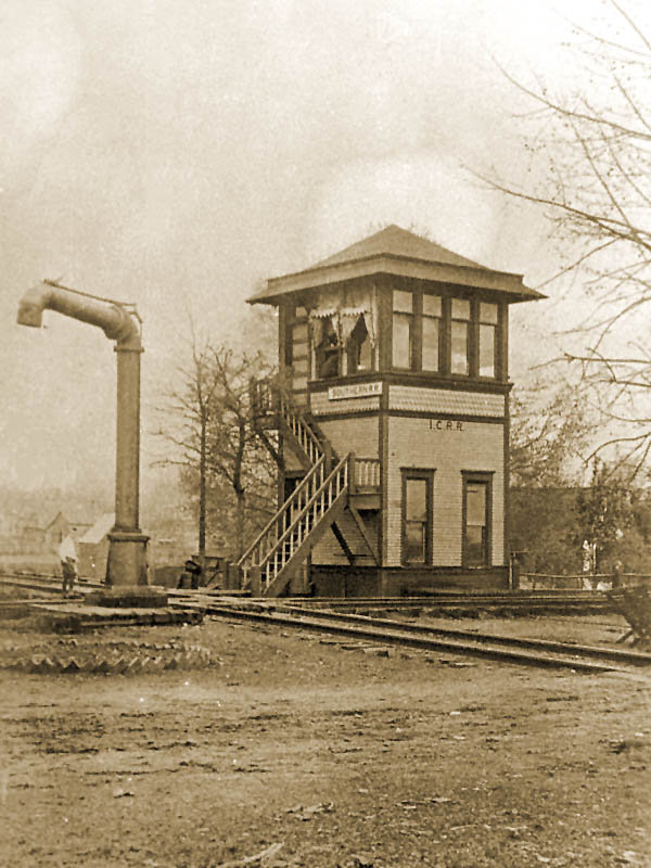
junction tower / 1917 inspection / collection
Winona, Ms / 1940 / collection
Winona, Ms / Apr 1973 / John Kirkpatrick
Winona, Ms / Apr 1973 / John Kirkpatrick
Winona, Ms / Apr 1973 / John Kirkpatrick
Winona, Ms / Mar 1982 / Rick Morgan
Jul 1989
Winona, Ms / Nov 2022 / RWH
Click to see the Greensboro Street crossing plotted on a Google Maps page
Nov 2022 / RWH
Winona, Ms / Nov 2022 / RWH
Winona, Ms / Nov 2022 / RWH
Winona, Ms / Nov 2022 / RWH
Nov 2022 / RWH
Winona, Ms / Nov 2022 / RWH
Winona, Ms / Nov 2022 / RWH
Winona, Ms / Nov 2022 / RWH
IC diamond
IC tower / 1917 inspection / collection
Winona, Ms / Jul 1989 / RWH
Winona, Ms / Jul 1989 / RWH
Winona, Ms / Jul 1989 / JCH
Winona, Ms / Jul 1989 / JCH
Dec 1989 / RWH
Click to see the Winona rail diamond area plotted on a Google Maps page
1947 company timetable / collection
Winona, Ms / Nov 2022 / RWH
Winona, Ms / Nov 2022 / RWH
Winona, Ms / Nov 2022 / RWH
Winona, Ms / Nov 2022 / RWH
Winona, Ms / Nov 2022 / RWH
Winona, Ms / Nov 2022 / RWH
Winona, Ms / Nov 2022 / RWH
Nov 2022 / RWH
Winona, Ms / Nov 2022 / RWH
Winona, Ms / Nov 2022 / RWH
section house / 1917 inspection / collection
Winona, Ms / Dec 1989 / RWH
Illinois Central depot
1945 Official Guide ad / collection
Winona, Ms / Jun 1975 / Fred Goff
Winona, Ms / Jul 1989 / RWH
Winona, Ms / Nov 2022 / RWH
Click to see the former Illinois Central depot plotted on a Google Maps page
Winona, Ms / Nov 2022 / RWH
Nov 2022 / RWH
Winona, Ms / Nov 2022 / RWH
Winona, Ms / Nov 2022 / RWH
Winona, Ms / Nov 2022 / RWH
See also our complete Columbus & Greenville caboose scrapbook in Rolling Stock
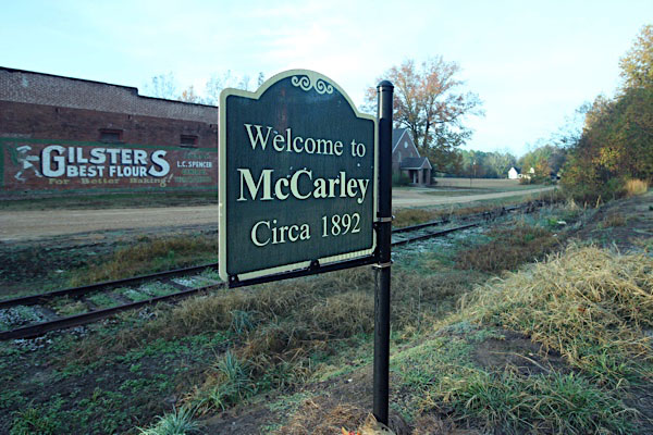
 McCarley
McCarley depot / McCarley, Ms / 1917 inspection / collection
McCarley, Ms / Jan 2004 / Heath Holmes
Click to see McCarley plotted on a Google Maps page
McCarley, Ms / Nov 2022 / RWH
Nov 2022 / RWH
Nov 2022 / RWH
McCarley, Ms / Nov 2022 / RWH
McCarley, Ms / Nov 2022 / RWH
McCarley, Ms / Nov 2022 / RWH
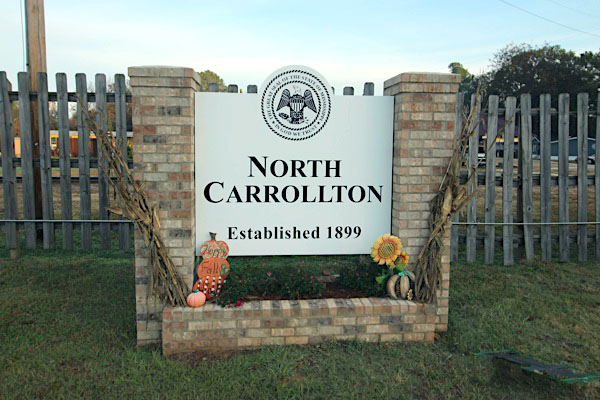
 North Carrollton
Carrollton, Mississippi, established in January 1834 and designated as the county seat of Carroll County, was incorporated on February 19, 1836. Located in North Central Mississippi and approximately eight miles east of the Mississippi Delta on U. S. Highway 82, Carrollton is proud to be the ancestral home of two U. S. Senators, one of whom was J. Z. George, a primary author of the present 1890 Mississippi Constitution. Carrollton also proudly claims to be the home of native author Elizabeth Spencer as well as noted “blues” composers Shell Smith and Willie Narmour. Boasting of the fact that Carrollton is restored and not renovated, Carrollton is one of the largest historic districts on the National Register of Historic Places in the United States. There are approximately eighteen historic sites located around Court Square, making a walking tour an enjoyable event.
 Carrollton, Mississippi, established in January 1834 and designated as the county seat of Carroll County, was incorporated on February 19, 1836. Located in North Central Mississippi and approximately eight miles east of the Mississippi Delta on U. S. Highway 82, Carrollton is proud to be the ancestral home of two U. S. Senators, one of whom was J. Z. George, a primary author of the present 1890 Mississippi Constitution. Carrollton also proudly claims to be the home of native author Elizabeth Spencer as well as noted “blues” composers Shell Smith and Willie Narmour.
Boasting of the fact that Carrollton is restored and not renovated, Carrollton is one of the largest historic districts on the National Register of Historic Places in the United States. There are approximately eighteen historic sites located around Court Square, making a walking tour an enjoyable event.
Carrollton, Mississippi, established in January 1834 and designated as the county seat of Carroll County, was incorporated on February 19, 1836. Located in North Central Mississippi and approximately eight miles east of the Mississippi Delta on U. S. Highway 82, Carrollton is proud to be the ancestral home of two U. S. Senators, one of whom was J. Z. George, a primary author of the present 1890 Mississippi Constitution. Carrollton also proudly claims to be the home of native author Elizabeth Spencer as well as noted “blues” composers Shell Smith and Willie Narmour.
Boasting of the fact that Carrollton is restored and not renovated, Carrollton is one of the largest historic districts on the National Register of Historic Places in the United States. There are approximately eighteen historic sites located around Court Square, making a walking tour an enjoyable event.
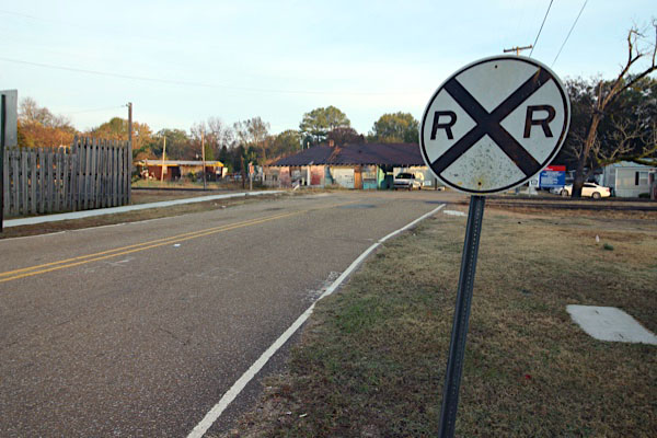
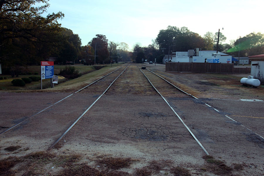
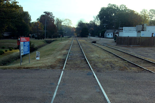
 ituated along the Big Sand Creek and almost 100 miles west of Columbus are the communities of Carrollton and North Carrollton, Mississippi (often used interchangeably in railroad publications). The C&G mainline bisected North Carrollton, and the community once boasted a handsome Southern Railway in Mississippi station and freight house fashioned with bricks and morter — in contrast to the numerous diminutive wooden depots that dotted the mainline. In 1912, in the Southern Railway era, train #51 with two locomotives and numerous cars struck a gathering of cattle and left a pile of wreckage and three crewman deaths in its wake.
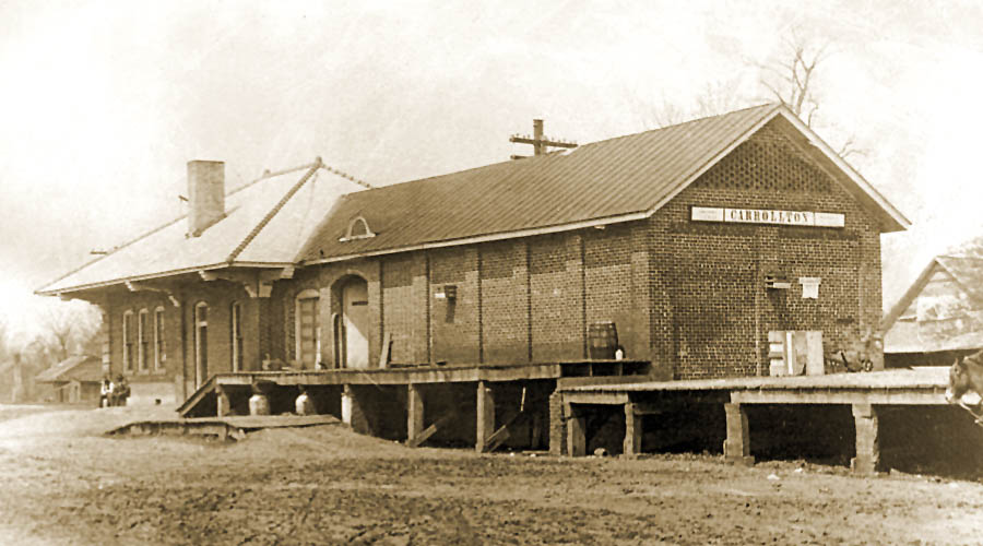
Carrollton depot / Carrollton, Ms / 1917 inspection / collection
Dec 1989 / RWH
Carrollton, Ms / Dec 1989 / RWH
North Carrollton, Ms / Dec 1989 / JCH
collection
North Carrollton, Ms / Nov 2022 / RWH
Click to see the Jefferson Street crossing plotted on a Google Maps page
Nov 2022 / RWH
Nov 2022 / RWH
North Carrollton, Ms / Nov 2022 / RWH
Nov 2022 / RWH
North Carrollton, Ms / Nov 2022 / RWH
North Carrollton, Ms / Nov 2022 / RWH
Nov 2022 / RWH
North Carrollton, Ms / Nov 2022 / RWH
North Carrollton, Ms / Nov 2022 / RWH
Click to see the George Street crossing area plotted on a Google Maps page
North Carrollton, Ms / Nov 2022 / RWH
North Carrollton, Ms / Nov 2022 / RWH
North Carrollton, Ms / Nov 2022 / RWH
Click to see the former Charleston Road crossing plotted on a Google Maps page
Nov 2022 / RWH
North Carrollton, Ms / Nov 2022 / RWH
North Carrollton, Ms / Nov 2022 / RWH
North Carrollton, Ms / Nov 2022 / RWH
 Malmaison
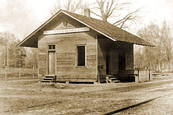
Malmaison depot / Malmaison, Ms / 1917 inspection / collection
 Browning
Browning, Ms / Nov 2022 / RWH
Click to see the former Browning Road crossing plotted on a Google Maps page
Nov 2022 / RWH
Nov 2022 / RWH
Browning, Ms / Nov 2022 / RWH
Nov 2022 / RWH
Browning, Ms / Nov 2022 / RWH
Browning, Ms / Nov 2022 / RWH
Browning, Ms / Nov 2022 / RWH
See next our Greenwood Mississippi scrapbook to continue along the Delta Route line