

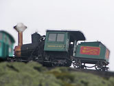


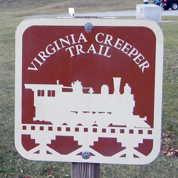
Virginia Creeper Trail"One trail ... by the hands of many" |

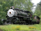
from The Last Steam Railroad in America /
photograph by O. Winston Link / collection
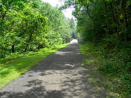
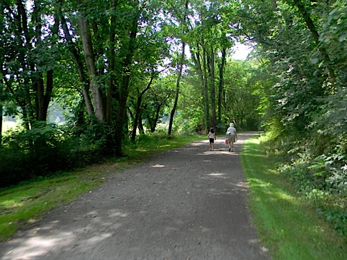
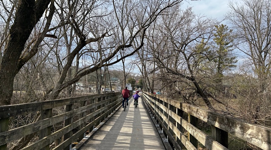
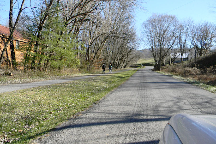
 A destination for visitors from across the US and a cherished asset for local residents, the Virginia Creeper Trail is best known as a biking trail, but in reality, the VCT is a multi-use trail with opportunities to bike, walk, run, fish, horseback ride, people watch, cross country ski and geocache, along with chances to observe and learn about the native fauna and flora, as well as the fascinating historical and economic role the railroad played in southwest Virginia.
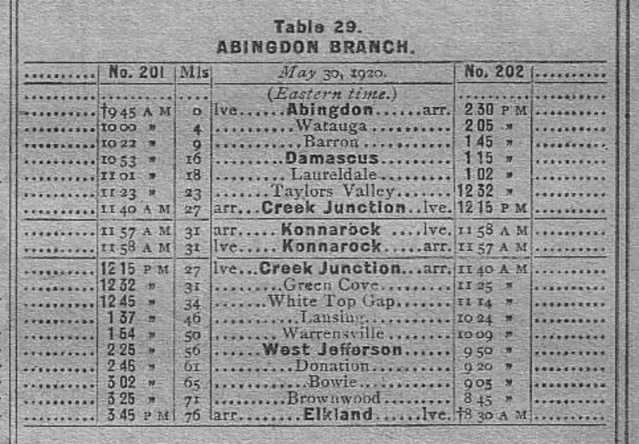
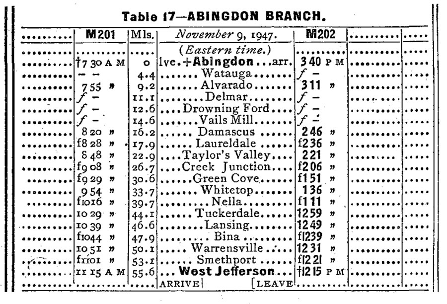
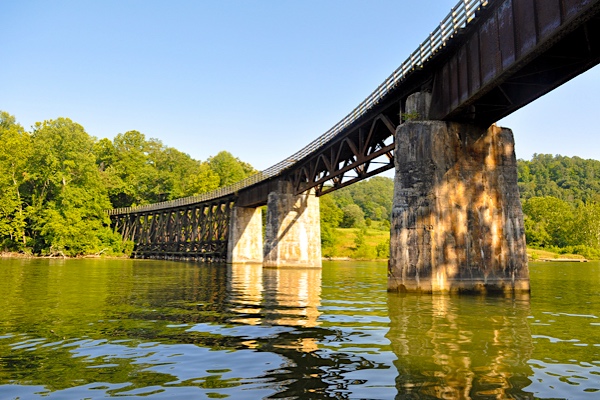
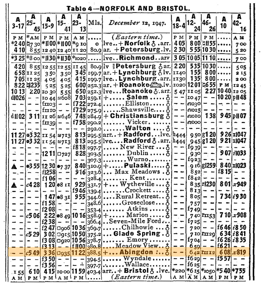
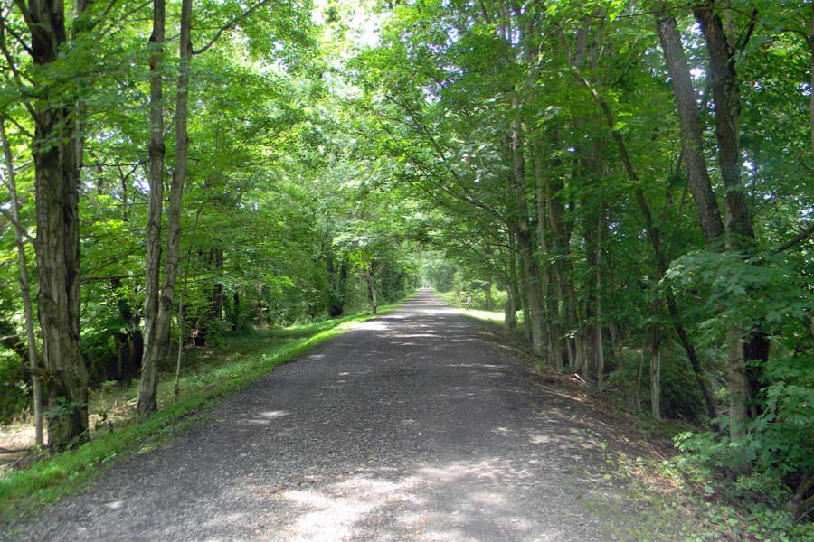
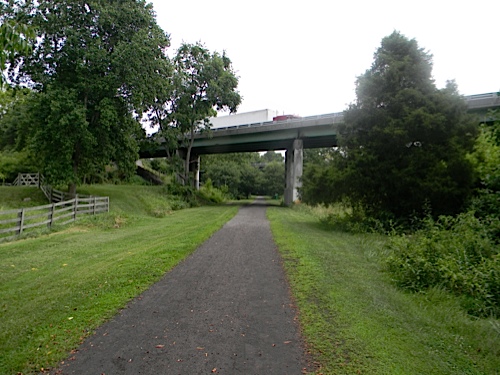
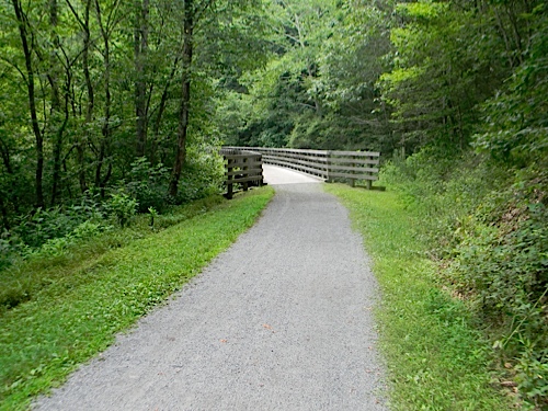
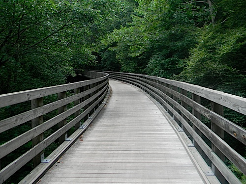
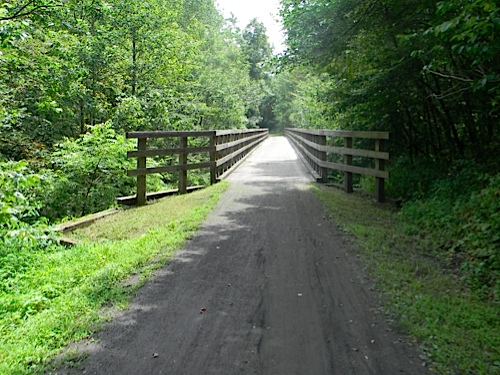
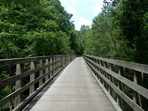
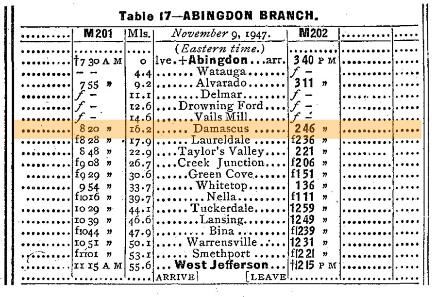
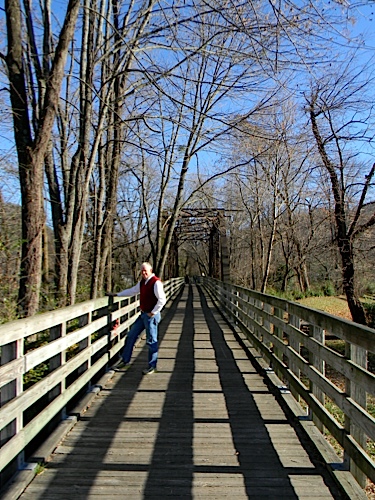
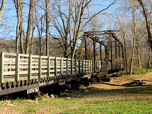
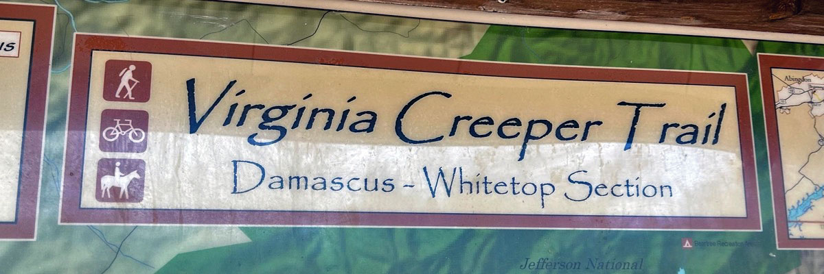
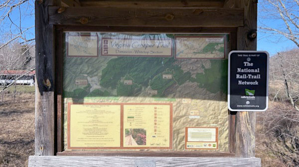
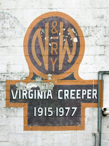
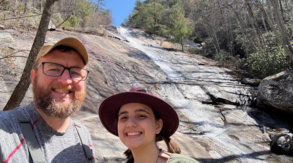
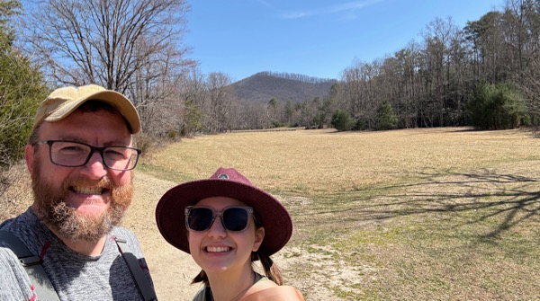
 The Virginia Creeper Trail is a 35 mile rail-to-trail experience starting in Abingdon, Virginia, and running eastward through Damascus, through the Mount Rogers National Recreation area, and ending just past the famous Whitetop Station at the Virginia-North Carolina state border. The trail accommodates hikers, cyclists, and equestrians, crossing a numerous restored railroad trestles as well as the Appalachian Trail. Famously operated since 1919 as the scenic "Abingdon Branch" of the Norfolk & Western Railway hosting regular mixed train service, the last steam engine was used on the line in 1956 and replaced with diesel power. By 1974, the railroad had petitioned the Interstate Commerce Commission to abandon the line due to low traffic and deteriorating right of way. Track removal began in 1977. The Creeper Trail as it exists today was completed in 1984 and is maintained by public-private partnerships between the U.S. Forest Service, the towns of Abingdon and Damascus, and "Creeper Keeper" trail volunteers. The Virginia Creeper Trail sustained severe damage from Hurricane Helene in September 2024, which led to its partial closure. Eighteen trestles have been destroyed and sections of the trail have completely washed away.

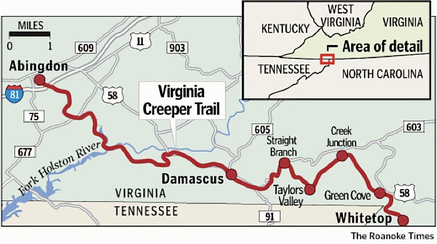
Virginia Creeper trail map / Roanoke Times / collection
Virginia Creep elevation chart / collection
collection
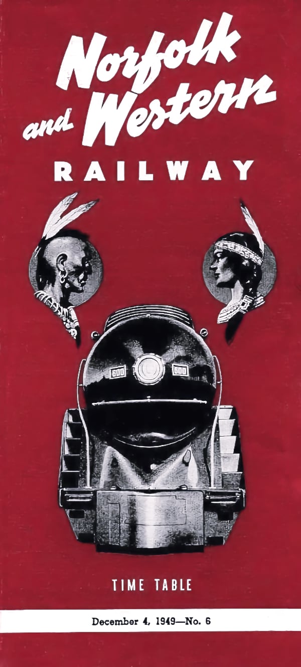
1910 Official Guide ad / collection
1948 Official Guide ad / collection
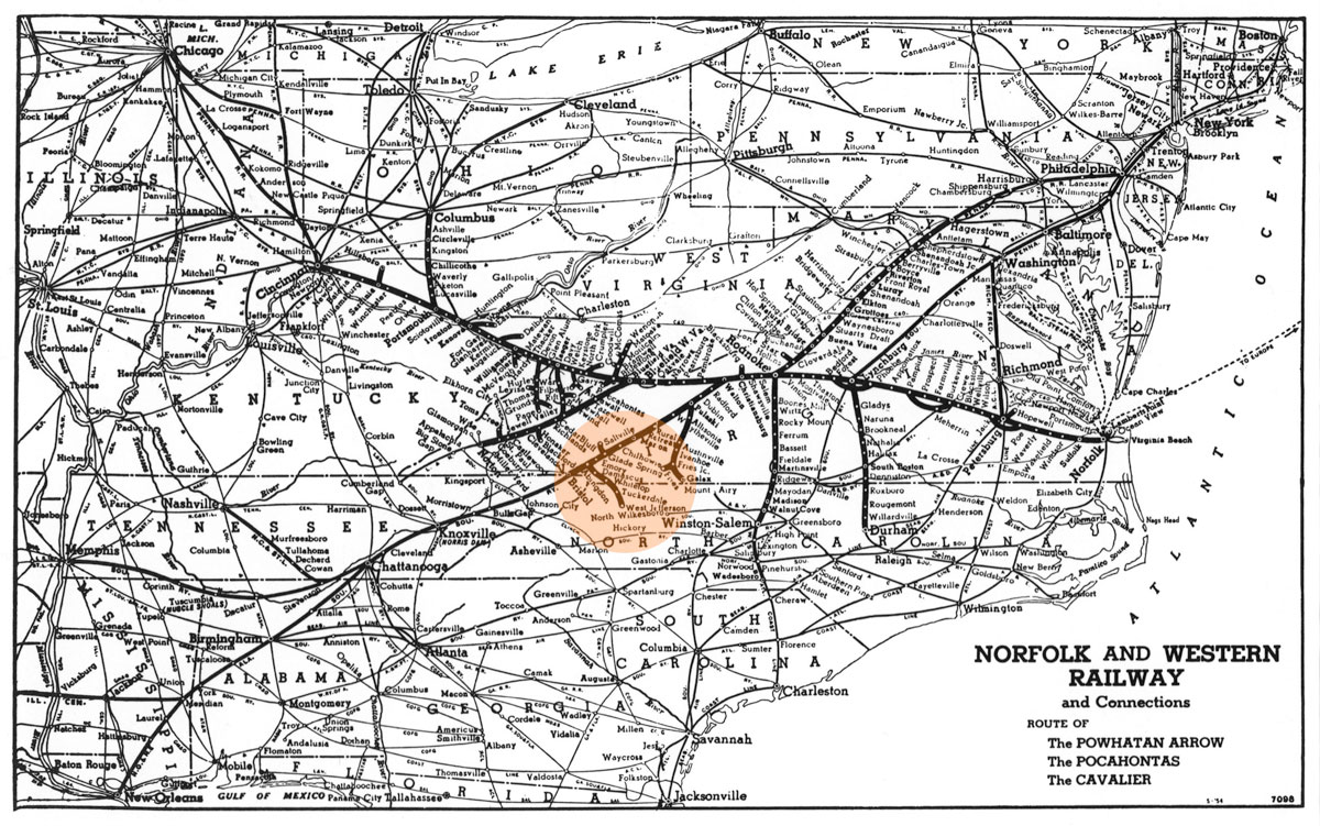
NW system map / collection

See also our complete Norfolk & Western Railway scrapbook in Mainlines
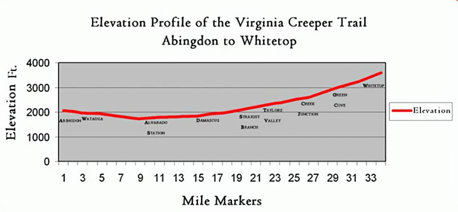
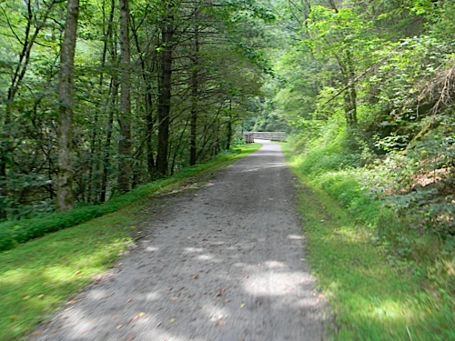
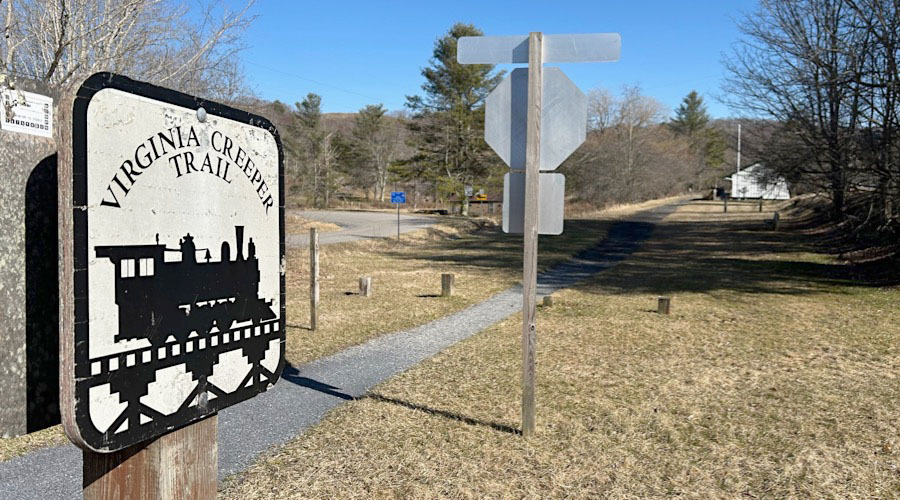
 The Virginia Creeper Trail is a 34-mile rail-trail that is considered one of the best bike trails in the nation. From Abingdon to Alvarado the trail crosses rolling farmland, and then slowly changes to a high mountain trail between Damascus, VA and Whitetop Station, inside Mount Rogers National Recreation Area.
The most popular activity on the trail is a pleasant, 17-mile bike ride from Whitetop Station to Damascus. With a 5% downhill grade most of the way, the ride is easy for beginners and families. Hikers and horseback riders also frequent the trail.
The Virginia Creeper Trail is a 34-mile rail-trail that is considered one of the best bike trails in the nation. From Abingdon to Alvarado the trail crosses rolling farmland, and then slowly changes to a high mountain trail between Damascus, VA and Whitetop Station, inside Mount Rogers National Recreation Area.
The most popular activity on the trail is a pleasant, 17-mile bike ride from Whitetop Station to Damascus. With a 5% downhill grade most of the way, the ride is easy for beginners and families. Hikers and horseback riders also frequent the trail.
Numerous outfitters in Damascus and Abingdon offer bike rentals and shuttle service to Whitetop Station. The towns also offer plenty of dining, lodging and entertainment for trail riders. For more information, visit the town websites linked above.
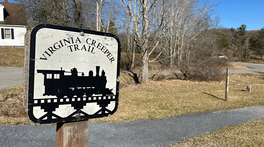
The trail got its unusual name from the early steam locomotives as they struggled slowly up steep grades, carrying lumber. Having failed to turn a profit since the Great Depression, the Creeper ran its last train on March 31, 1977. The trail gained new life in 1984, when it was designated a National Recreation Trail. Over 150,000 people use the trail annually, and in 2014 it was inducted in to the national Rail-Trail Hall of Fame.
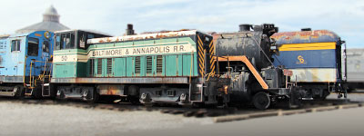
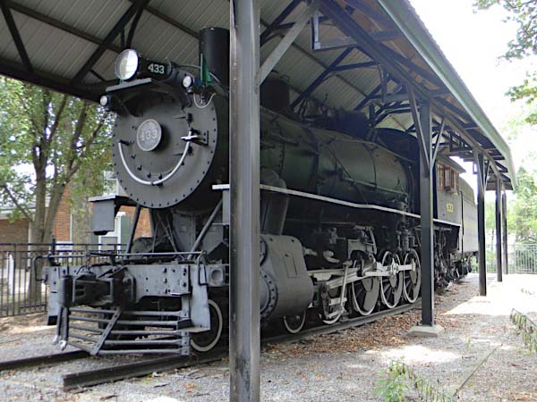
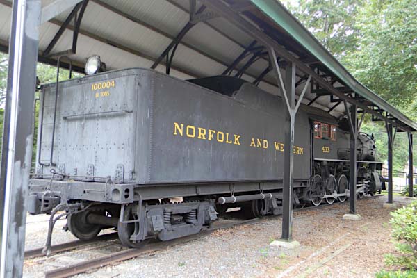
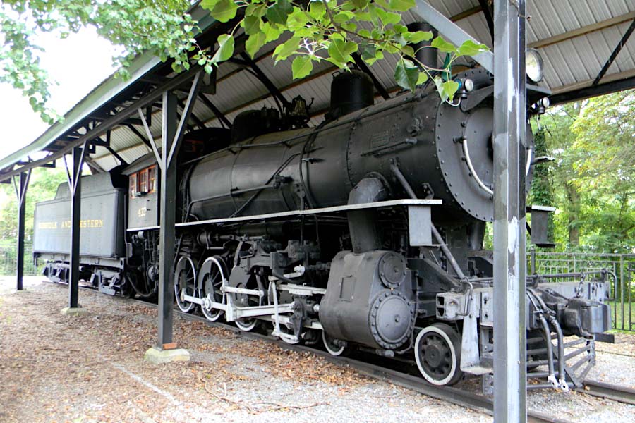
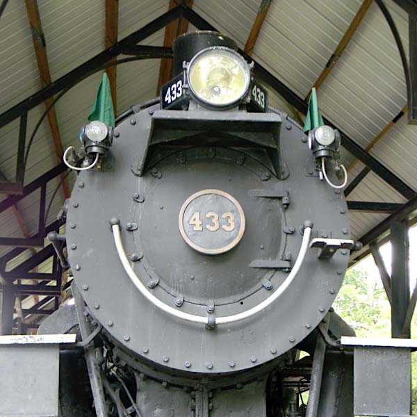
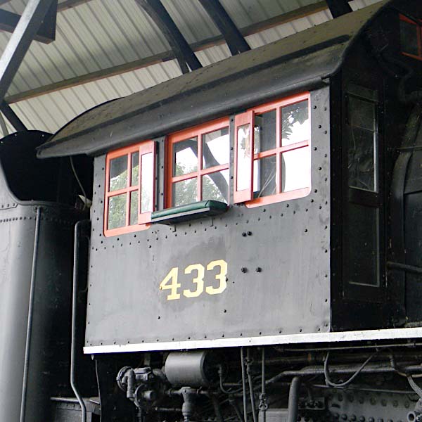
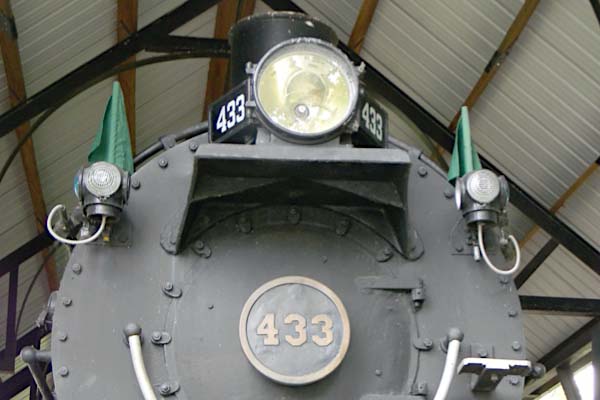
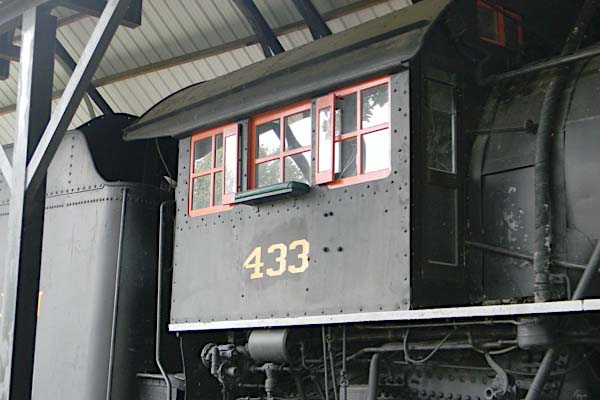
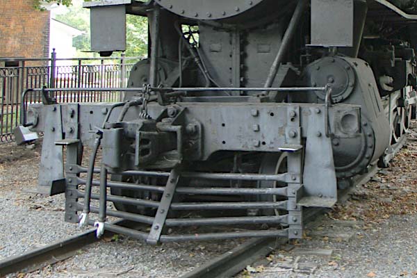
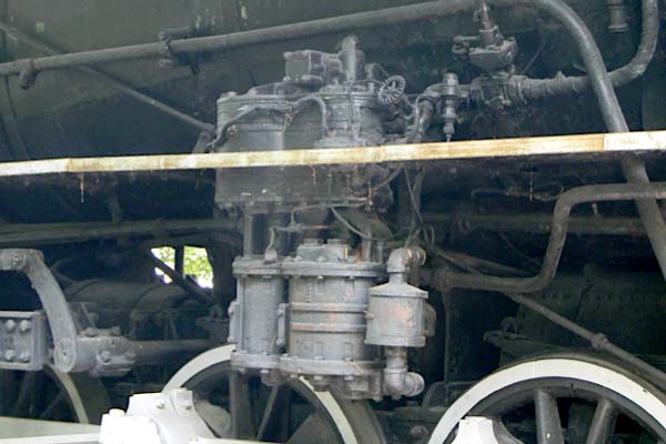
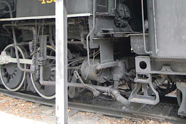
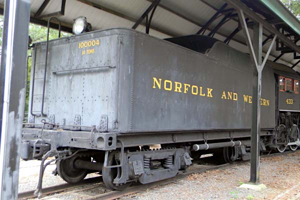
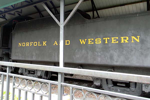
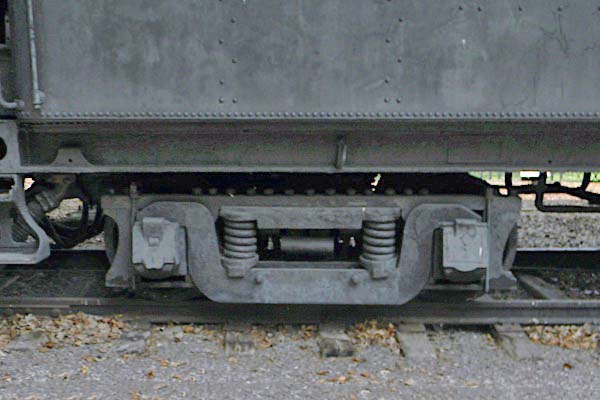
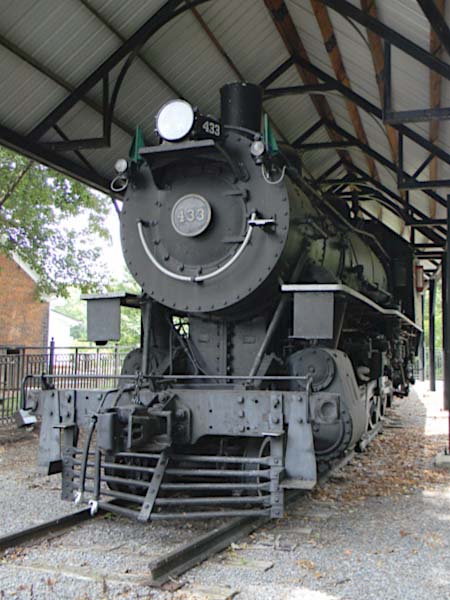
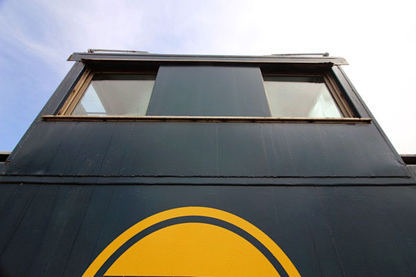
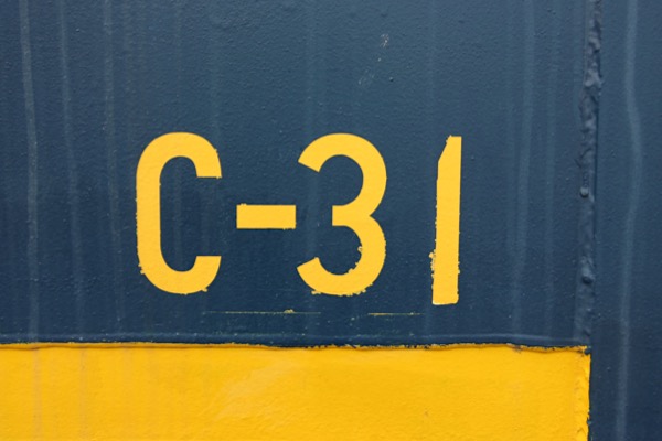
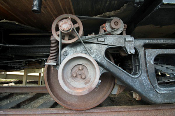
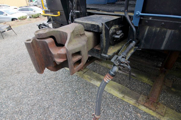
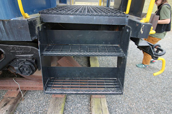
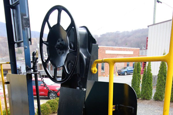
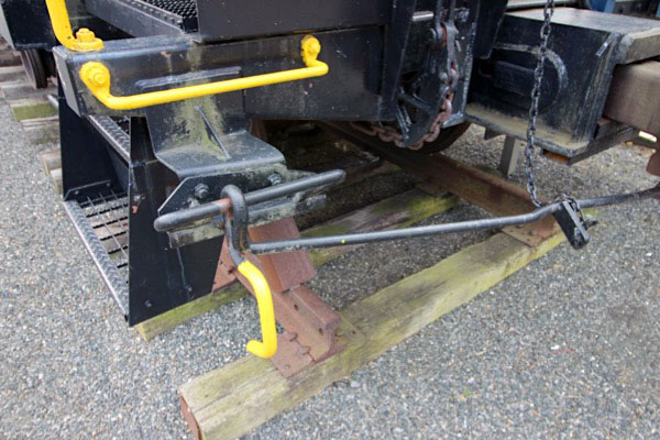
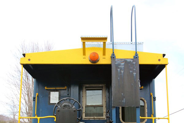
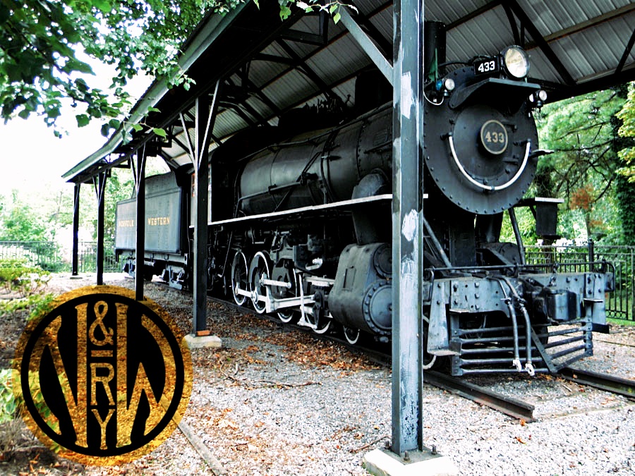
 Norfolk & Western #433
Norfolk & Western #433
Abingdon, Va / Jul 2011 / RWH


Norfolk & Western #433
to City of Abingdon VA, 1957
on static display at Creeper trailhead

Jul 2011 / RWH
Abingdon, Va / Jul 2011 / RWH
Abingdon, Va / Jul 2011 / RWH
Abingdon, Va / Jul 2011 / RWH

Click to see the locomotive display site plotted on a Google Maps page
from The Norfolk & Western Handbook - Wallace and Wiley / collection
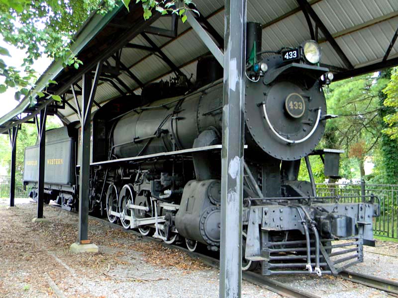
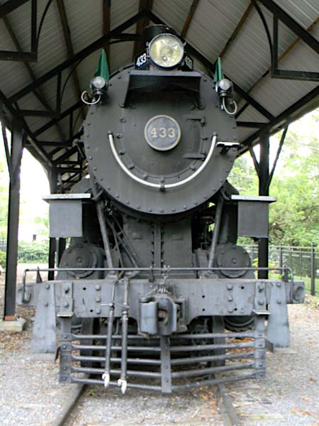
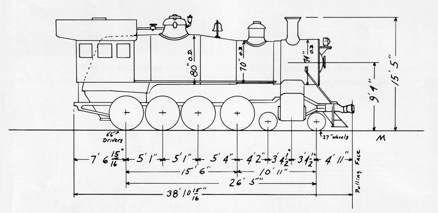
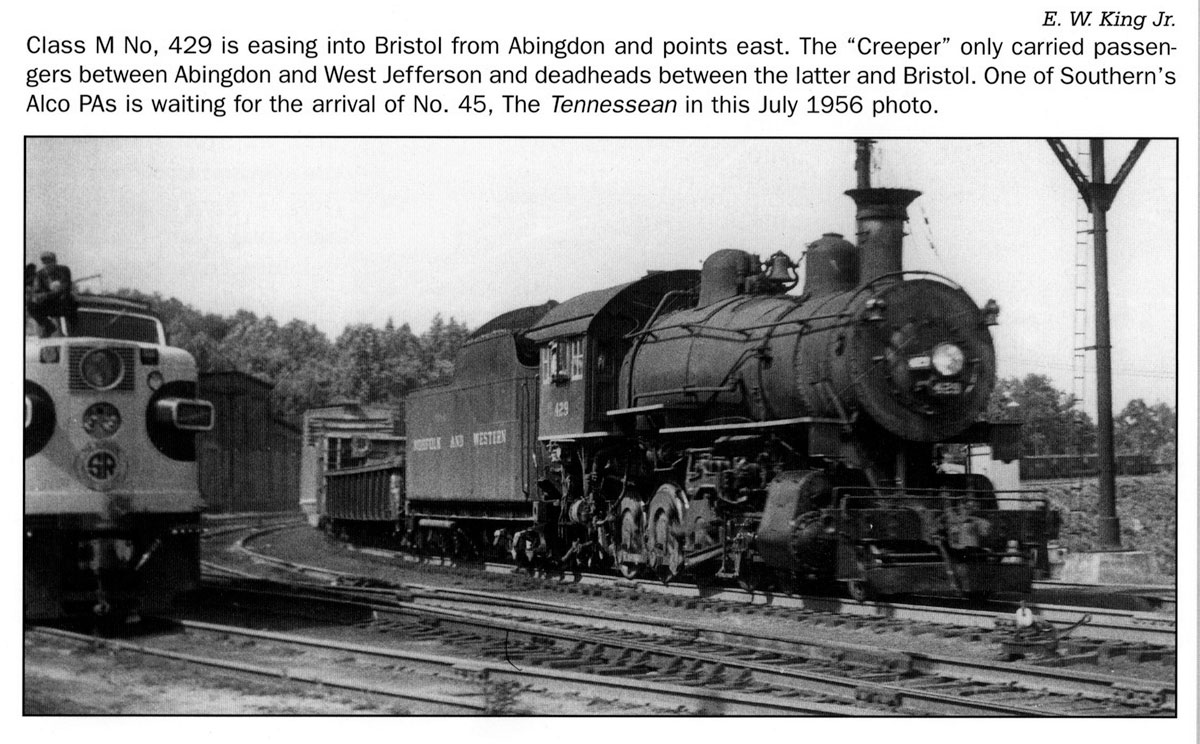
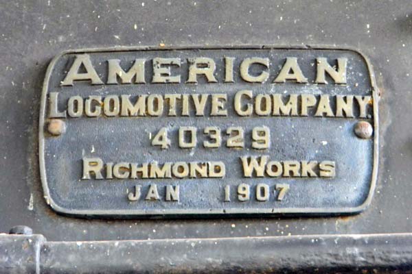
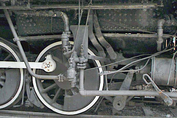
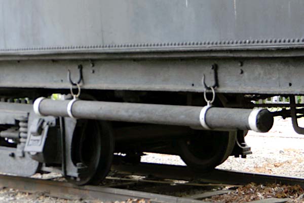
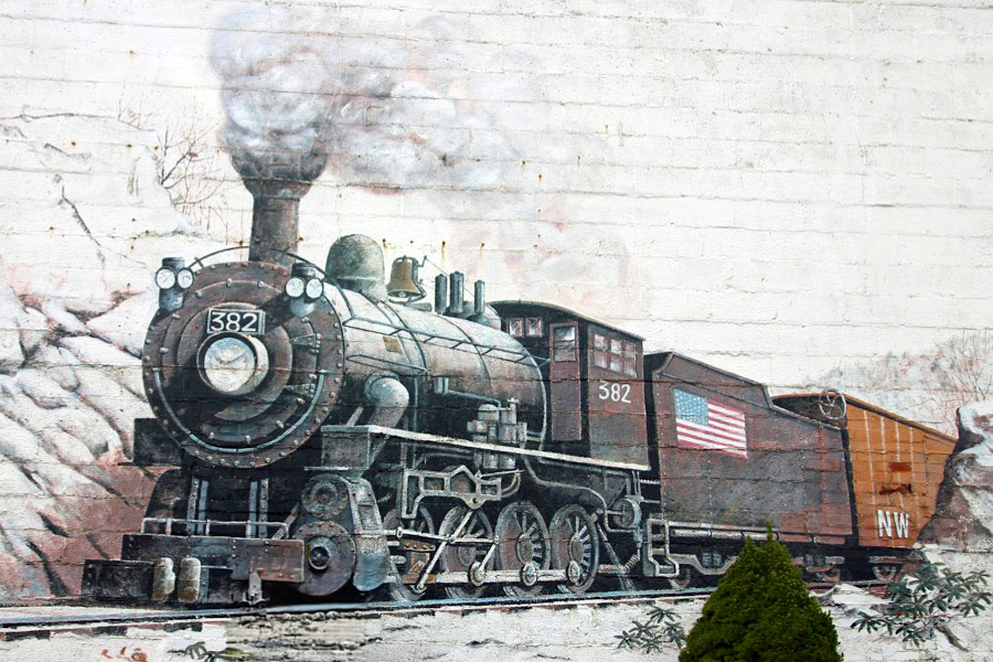
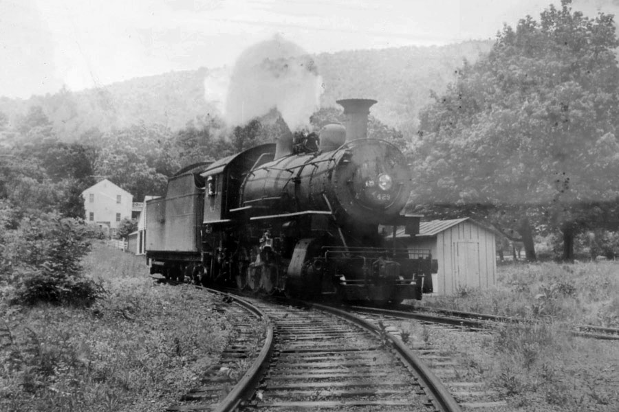
 Powering these trains were M class 4-8-0s — a distinction the "Creeper" shared with the "Huckleberry." Other branch lines occasionally used Ms but they do not appear to have been the motive power of choice. The consist included the obligatory combine and one or more coaches, plus 3 or 4 freight cars and a caboose. Longer and heavier trains required doubling one or more hills or else using Ms doubleheaded. Two Twelve Wheelers were used, for example, when the NRHS ran an excursion over the branch in 1957. The Ms lasted until the trains were dieselized in 1958; they had been assured long life because some of the wooden bridges could not tolerate heavier steamers.
William E Warden / Norfolk & Western Passenger Service
from Norfolk & Western Passenger Service / collection
Jul 2011 / RWH
Jul 2011 / RWH
Jul 2011 / RWH
Jul 2011 / RWH
Jul 2011 / RWH
Jul 2011 / RWH
Jul 2011 / RWH
Abingdon, Va / Jul 2011 / RWH
Jul 2011 / RWH
See also our complete Norfolk & Western Steam Survivors scrapbook in Mainlines
Abingdon, Va

![]() The site of present-day Abingdon is located on a well-traveled wilderness route called the Great Road, which many pioneers traveled through the Blue Ridge Mountains on the way to settle the new American frontier. In 1748-1750, the land was surveyed by Dr. Thomas Walker, who would later be partners with Peter Jefferson – father of Thomas Jefferson – in the Loyal Land Company. According to local legend, the area was named Wolf Hills by Daniel Boone in 1760 after his dogs were attacked by a pack of wolves.
The site of present-day Abingdon is located on a well-traveled wilderness route called the Great Road, which many pioneers traveled through the Blue Ridge Mountains on the way to settle the new American frontier. In 1748-1750, the land was surveyed by Dr. Thomas Walker, who would later be partners with Peter Jefferson – father of Thomas Jefferson – in the Loyal Land Company. According to local legend, the area was named Wolf Hills by Daniel Boone in 1760 after his dogs were attacked by a pack of wolves.
The Town of Abingdon was established by an act of the Assembly of Virginia in 1778. Two short years later, Abingdon played a role in helping the young nation gain its independence. Patriots from Virginia and North Carolina gathered at the Muster Grounds to begin a 300-mile march to Kings Mountain, South Carolina. The ensuing battle was a turning point in the Revolutionary War.
In 1860, Martha Washington College opened in a former private residence in Abingdon. The college closed in 1932, but the grand building affectionately known as “The Martha” re-opened as a hotel in 1935.
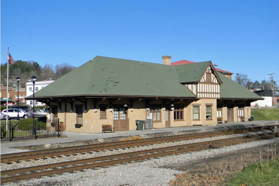
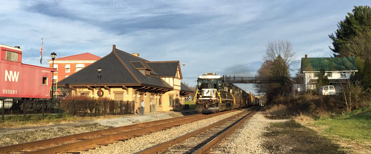
NW depot / Abingdon, Va / Nov 2011 / RWH

1948 Official Guide ad / collection
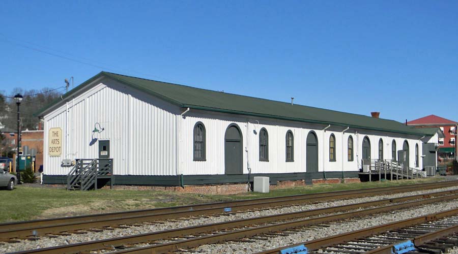
NW freight house / Abingdon, Va / Nov 2011 / RWH
Click to see the N&W depot and freight house area plotted on a Google Maps page
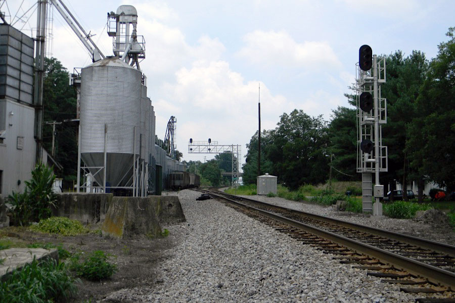
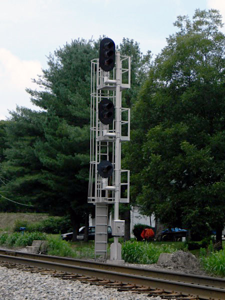
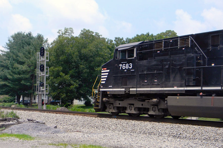
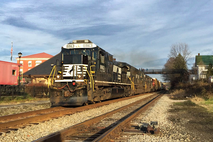
 NS Mainline Action
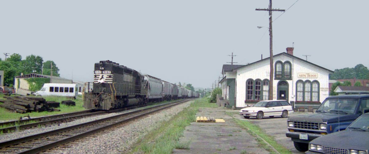
Abingdon, VA / Jun 1995 / JCH
Abingdon, Va / Jul 2011 / RWH
Jul 2011 / RWH
Abingdon, Va / Jul 2011 / RWH
Abingdon, VA / Dec 2015 / RWH
Abingdon, VA / Dec 2015 / RWH
Abingdon, VA / Dec 2015 / RWH
See also our complete Norfolk Southern featured scrapbook in Mainlines


1948 Official Guide ad / collection
Abingdon, Va / Jul 2011 / RWH
Jul 2011 / RWH
Abingdon, Va / Jul 2011 / RWH
Abingdon, Va / Jul 2011 / RWH
Abingdon, Va / Jul 2011 / RWH
Abingdon, Va / Jul 2011 / RWH
Watauga, Va / Jul 2011 / RWH
Watauga, Va / Jul 2011 / RWH
Watauga, Va / Jul 2011 / RWH
Abingdon, Va / Jul 2011 / RWH
Abingdon, Va / Mar 2025 / ETH
Abingdon wye
overhead view of former wye area / Google Maps
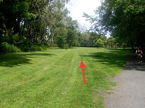
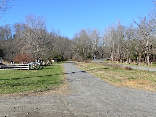
 Just east of Abingdon, the Norfolk & Western maintained a wye track arrangement for turning locomotives and equipment for proper orientation in and out of Bristol, Virginia. Tracks and roadbed surfaces are long gone, but the raised right-of-way can still be observed along the Creeper Trail.
Abingdon, Va / Jul 2011 / RWH

Abingdon, Va / Jul 2011 / RWH
Abingdon, Va / Jul 2011 / RWH
Abingdon, Va / Jul 2011 / RWH
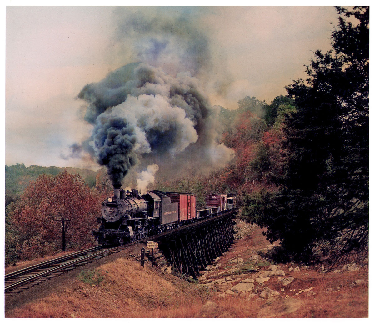
from The Last Steam Railroad in America /
photograph by O. Winston Link / collection
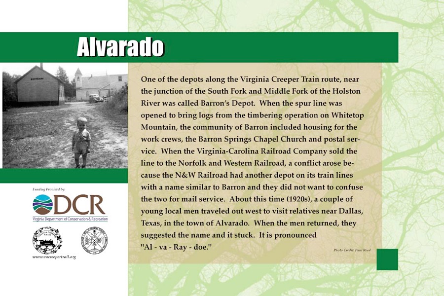
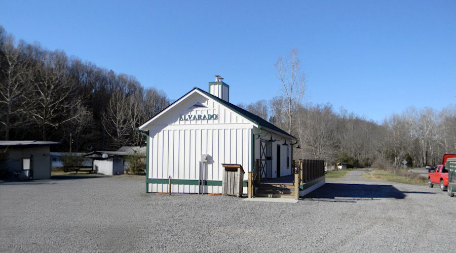
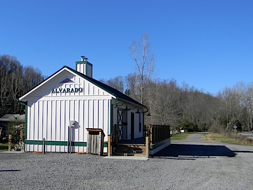
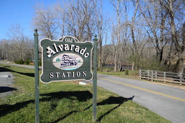
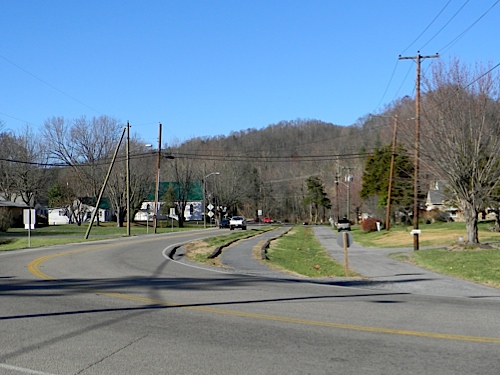
Alvarado, Va
1948 Official Guide ad / collection
A trail restroom facility has been constructed in Alvarado, Va in a style reminiscent of many of the smaller Norfolk & Western depots along the Creeper line and throughout the region.
web
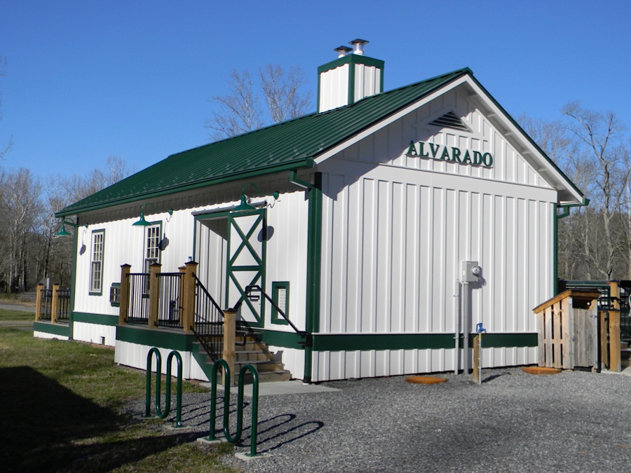
Alvarado, Va / Nov 2011 / RWH
Click to see the Alvarado facility plotted on a Google Maps page
Alvarado, Va / Nov 2011 / RWH
Alvarado, Va / Nov 2011 / RWH
Alvarado, Va / Nov 2011 / RWH
Alvarado, Va / Mar 2025 / ETH
Alvarado, Va / Nov 2011 / RWH
Alvarado, Va / Nov 2011 / RWH
Delmar, Va / Nov 2011 / RWH
Damascus, Va
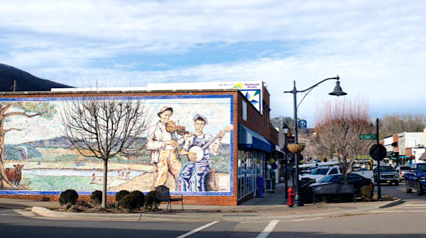
 Located halfway between mile marker 0 in Abingdon and mile marker 34 near Whitetop Station, Damascus is not just centrally located, it was once the historical hub of activity that birthed a rail line that later became the Virginia Creeper Trail. Damascus is a picturesque town with locals so friendly that through-hikers on the Appalachian Trail gave Damascus the moniker "Friendliest Town on the Trail". Damascus is also known as "Trail Town, USA" and for good reason – it is traversed not only by the Creeper Trail and the AT, but also by the Trans-America National Bicycle Trail, the Iron Mountain Trail, the Daniel Boone Heritage Trail, the Crooked Road Musical Heritage Trail, and Virginia's Birding and Wildlife Trail to name a few.
1948 Official Guide ad / collection
Damascus, Va / Nov 2011 / RWH
Nov 2011 / RWH
Nov 2011 / RWH
Damascus, Va / Nov 2011 / RWH
Nov 2011 / RWH
Nov 2011 / RWH
Damascus, Va / Nov 2011 / RWH
Nov 2011 / RWH
 Damascus is a small town with a BIG claim to fame: Several renowned trails intersect within our town limits, bestowing the honor of "Trail Town USA". As these trails pass through downtown Damascus, they bring along people, stories, and culture from all walks of life. Seven trails in the heart of Damascus:
- Virginia Creeper Trail
- Appalachian Trail (AT)
- Iron Mountain Trail
- Mid-Atlantic Backcountry Discovery Route
- TransAmerica Bicycle Trail / Route 76
- TransVirginia Bike Route
- The Crooked Road
Thanks to the efforts of our community — local government, dedicated staff, scores of volunteers, and residents — we've found ways to turn these trails and our other outdoor recreation resources into a source of local pride and community revitalization.
The trail town lifestyle is adventurous and creative, yet relaxed. From the many trails, parks, and public lands, to our shops and restaurants downtown, there is an adventure for everyone here. It's the kind of place where you'll find an adventure of your very own - one that makes you return again and again. We cherish this lifestyle and we know you will too.
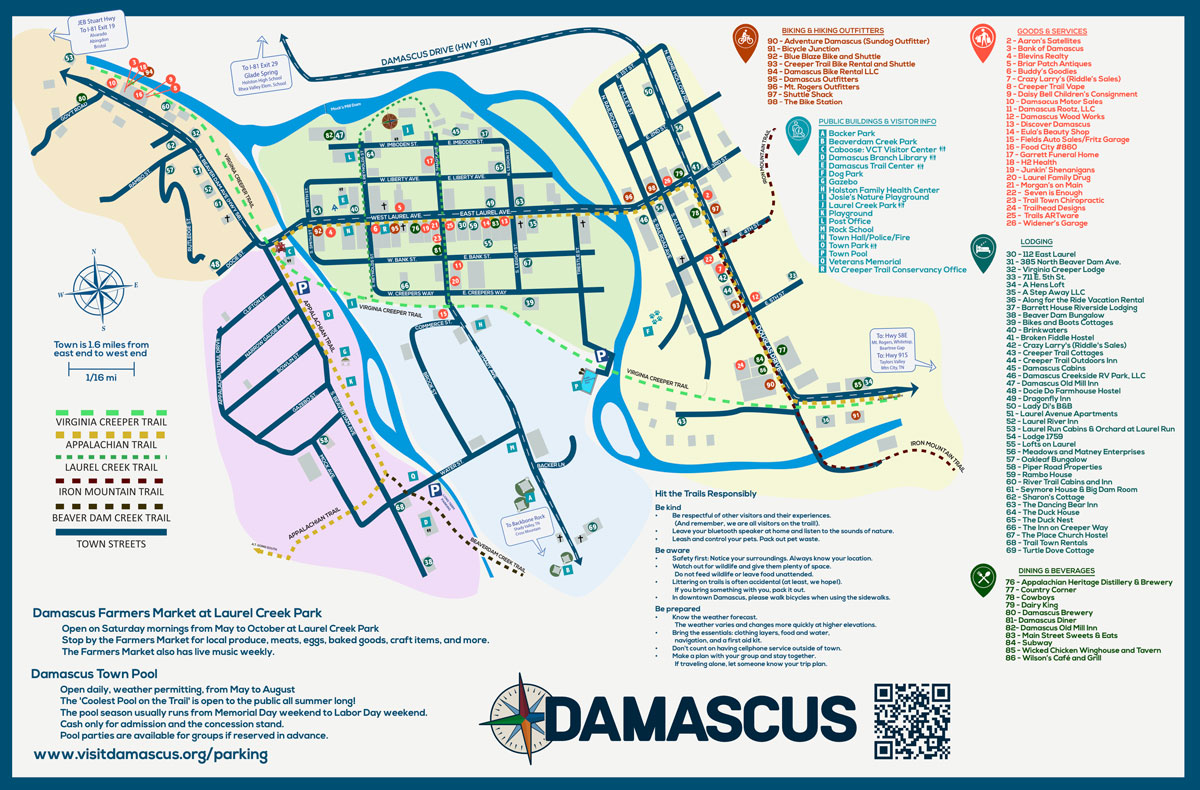
town map / web
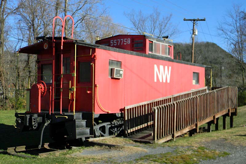
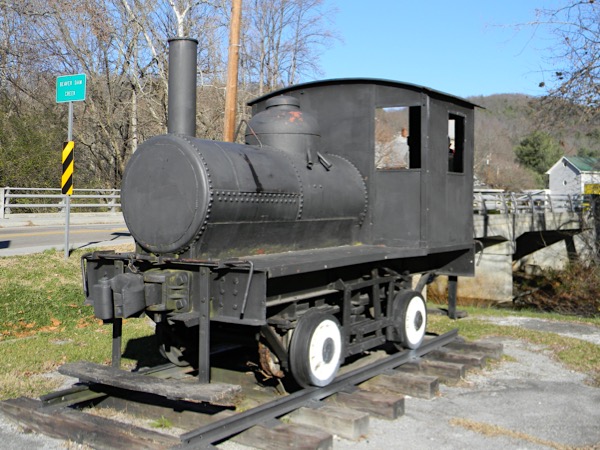
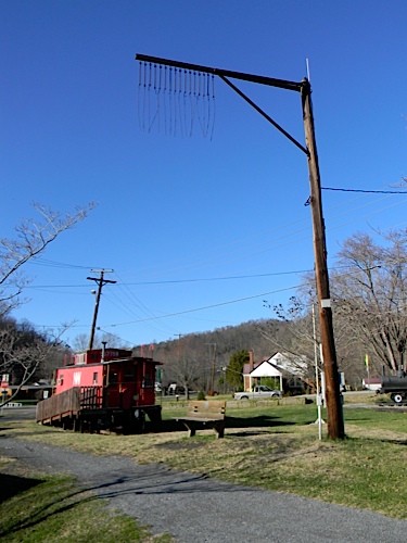
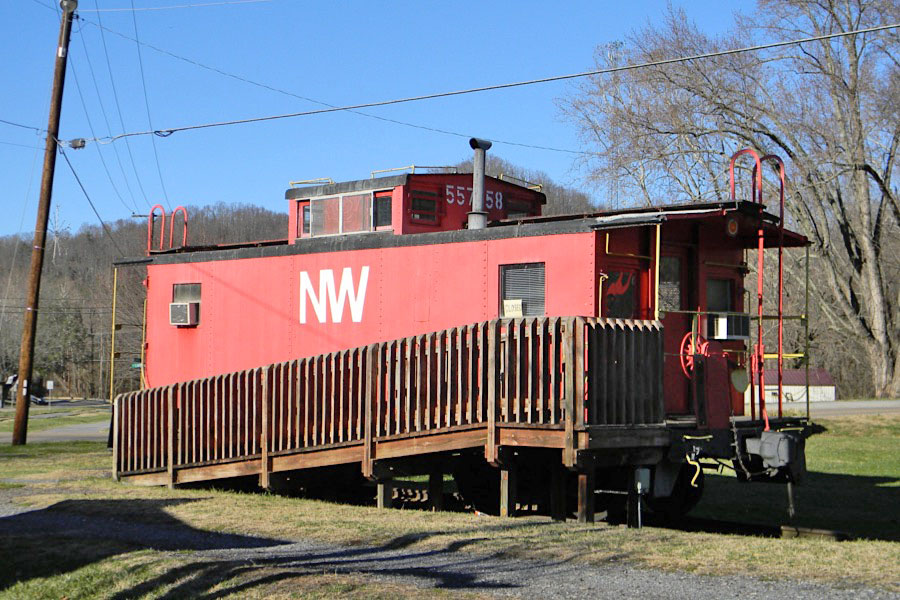
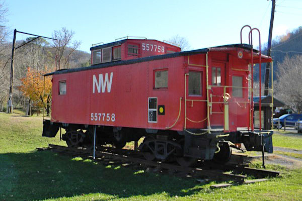
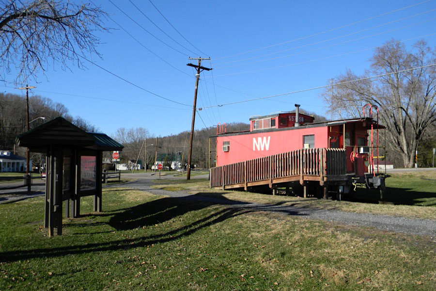
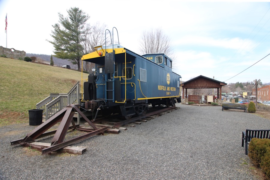
Norfolk & Western #557758
steel caboose / Damascus, Va / Nov 2011 / RWH
Nov 2011 / RWH
Damascus, Va / Nov 2011 / RWH
Damascus, Va / Nov 2011 / RWH
Damascus, Va / Nov 2011 / RWH
Click to see this location plotted on a Google Maps page
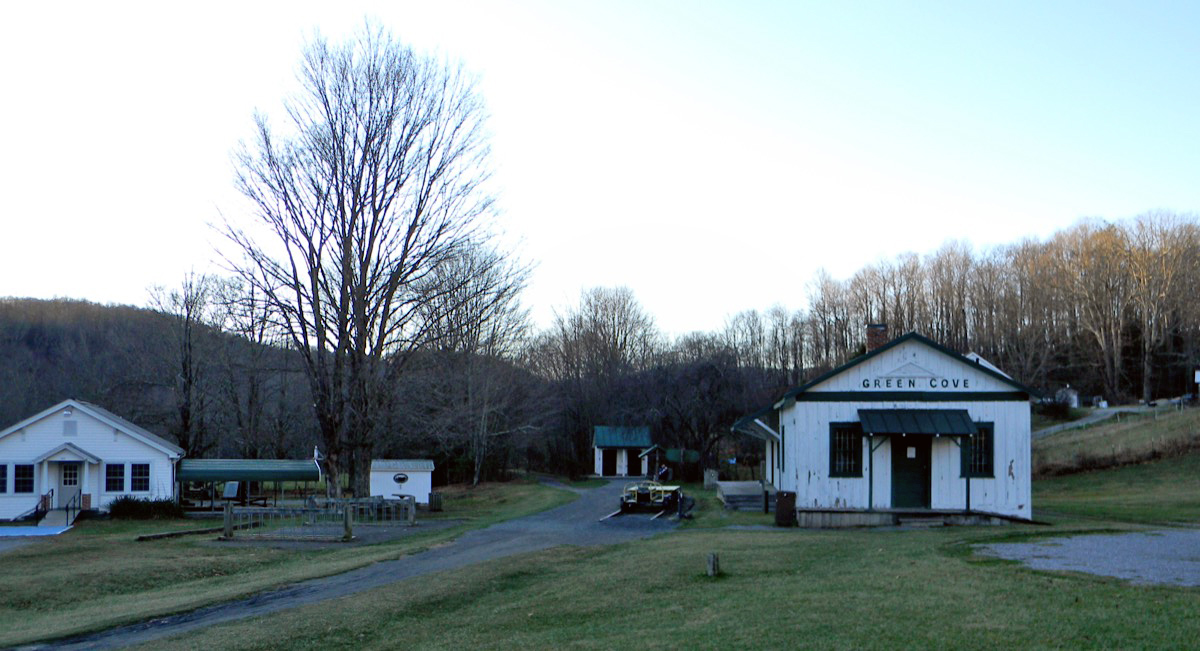
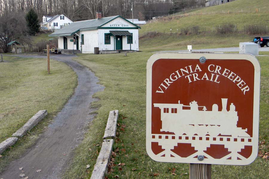
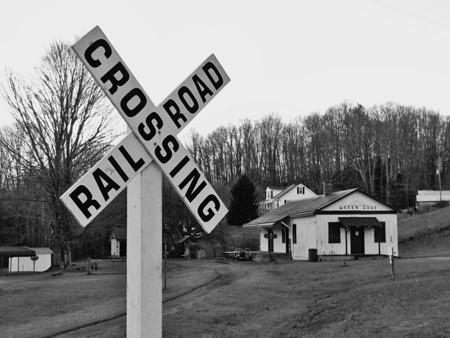
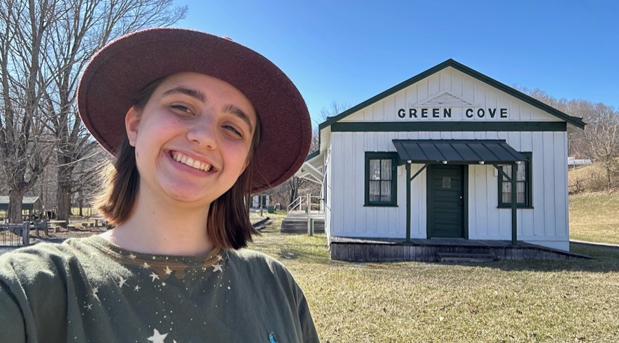
Green Cove, Va
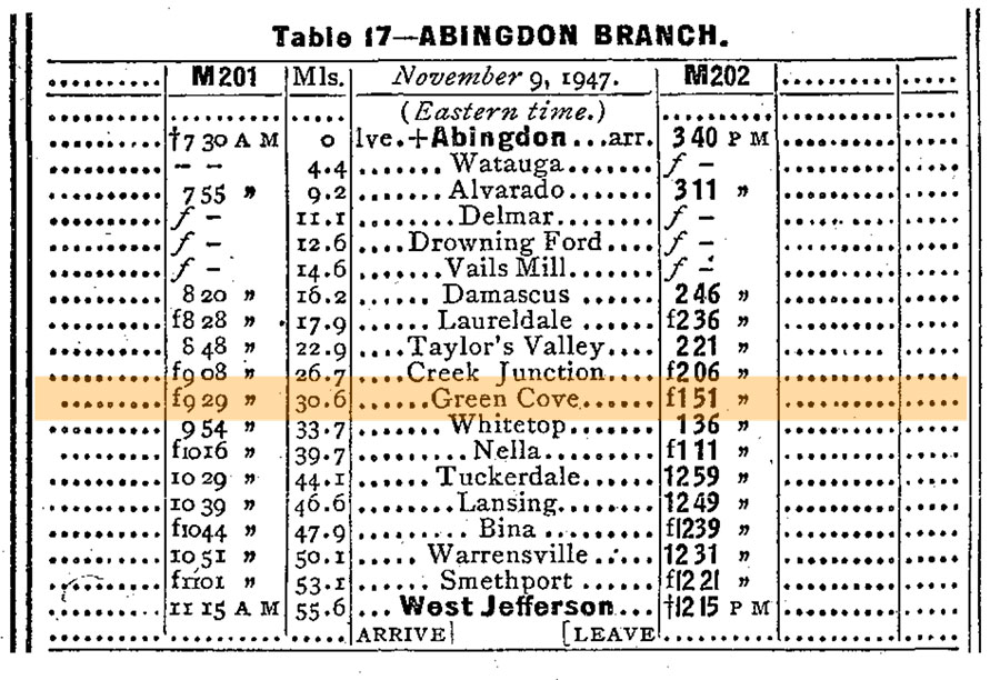
1948 Official Guide ad / collection
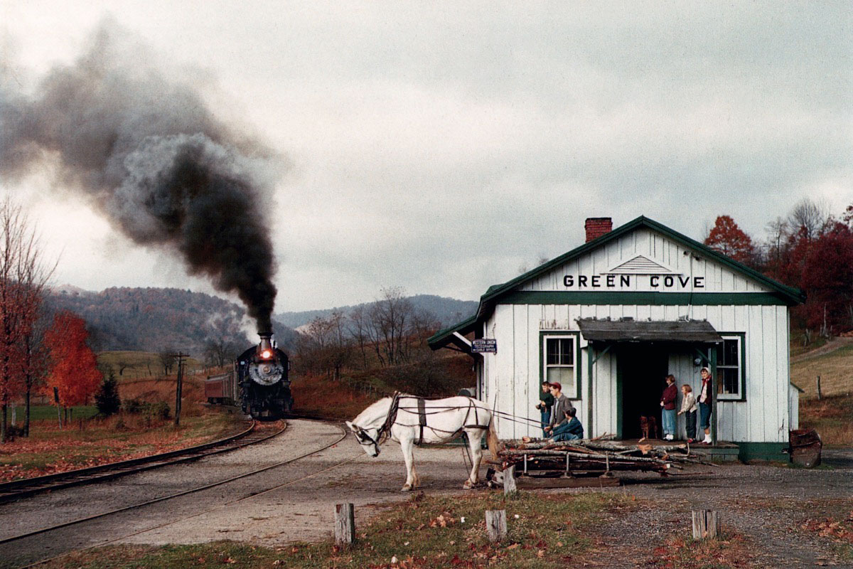
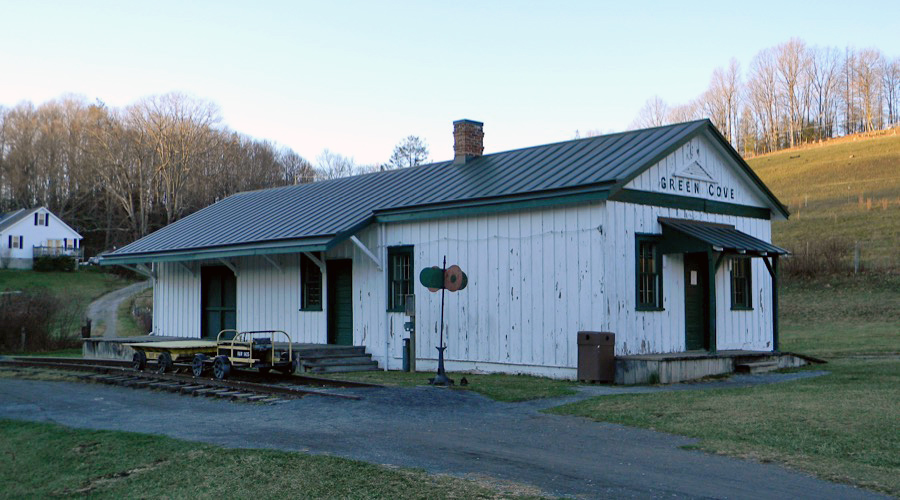
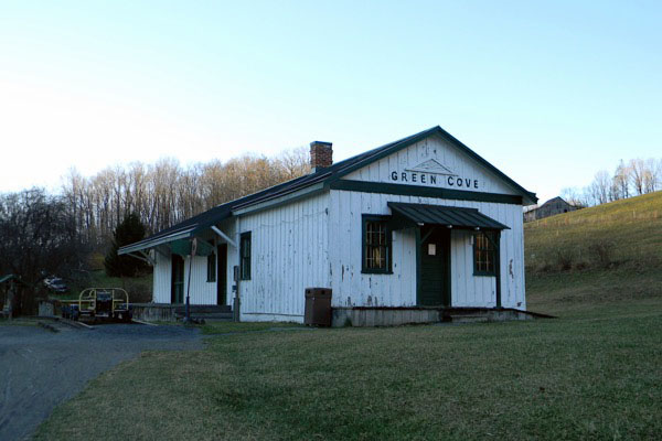
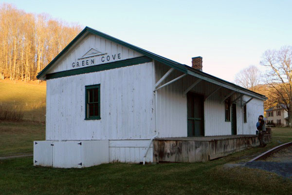
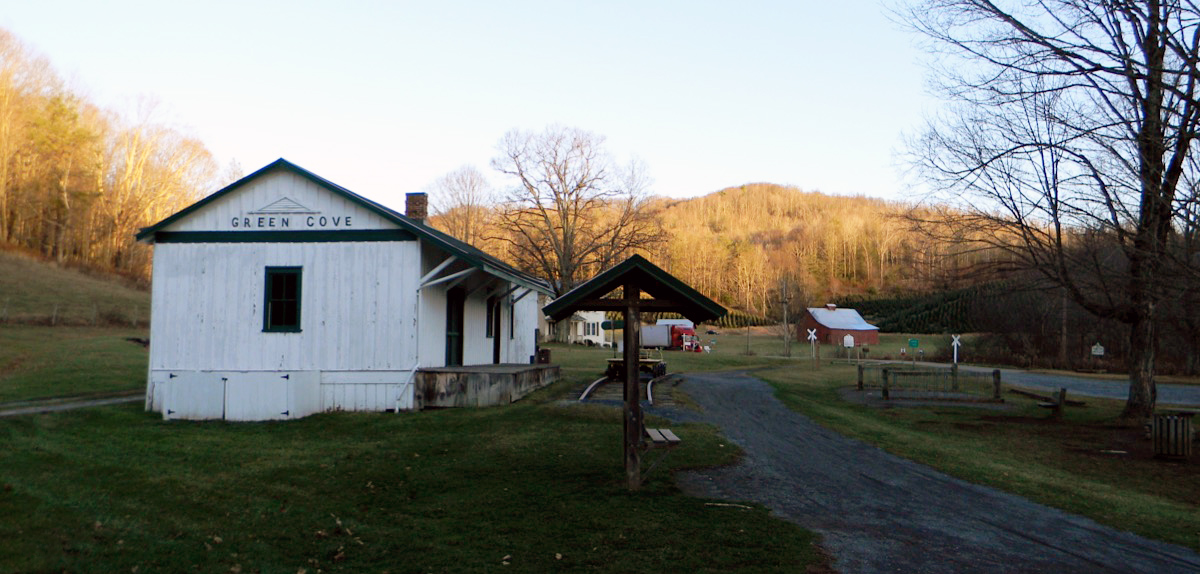
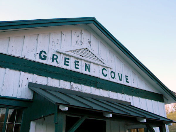
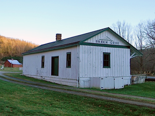
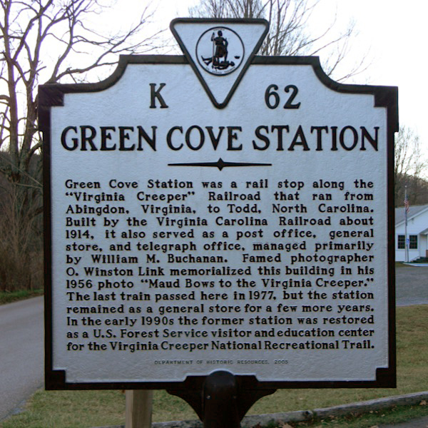
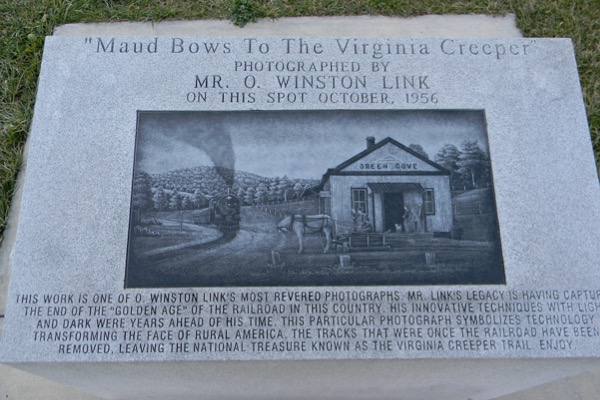
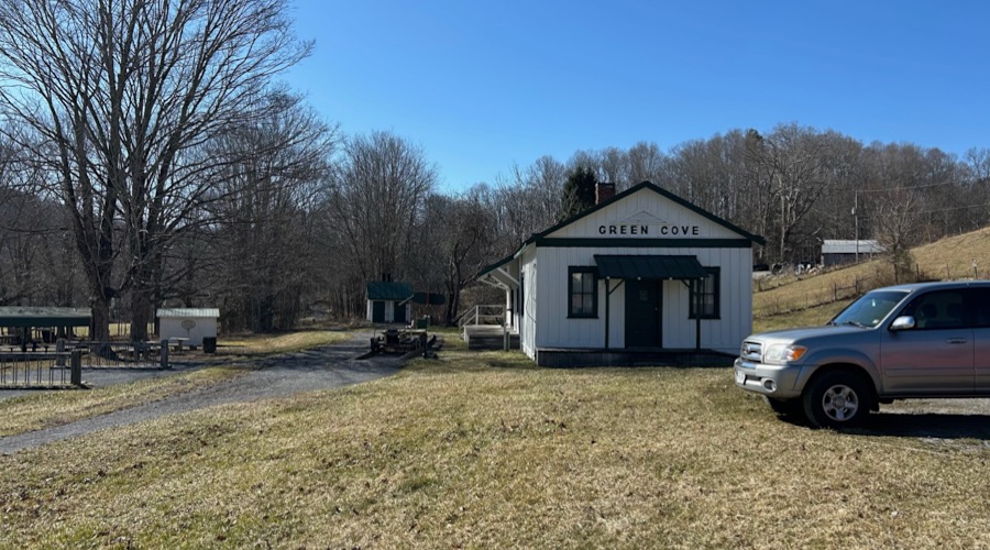
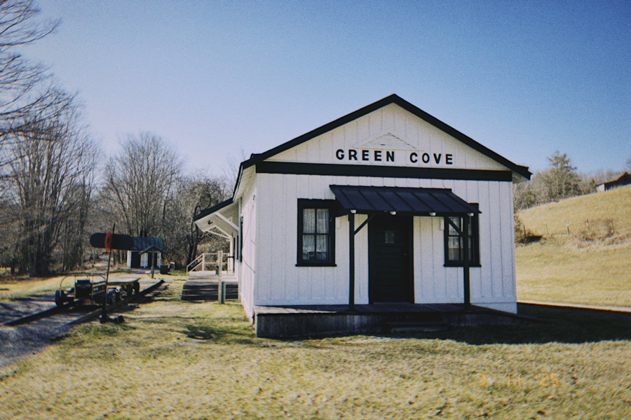
The Virginia-Carolina Railroad built Green Cove depot around 1914. It functioned as more than a railroad station, serving the community as a post office, general store, and telegraph office for the surrounding area. The station was memorialized in railroad photographer O. Winston Link’s “Maud Bows to the Virginia Creeper,” which he photographed in 1956 during the heyday of Norfolk & Western branchline steam on the route. The building remains and is now owned by the National Park Service.
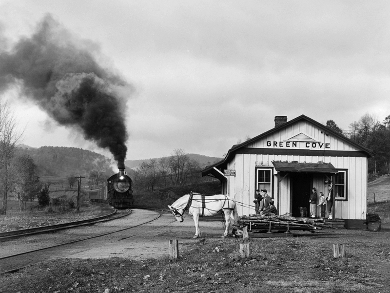
"Maud Bows to the Virginia Creeper"
Green Cove, Va / Oct 1956 / O. Winston Link / collection
Green Cove, Va / Nov 2011 / RWH
 Ogle Winston Link (December 16, 1914 – January 30, 2001), known commonly as O. Winston Link, was an American photographer, best known for his black-and-white photography and sound recordings of the last days of steam locomotive railroading on the Norfolk & Western in the United States in the late 1950s. A commercial photographer, Link helped establish rail photography as a hobby. He also pioneered night photography, producing several well-known examples including Hotshot Eastbound, a photograph of a steam train passing a drive-in movie theater, and Hawksbill Creek Swimming Hole showing a train crossing a bridge above children bathing.
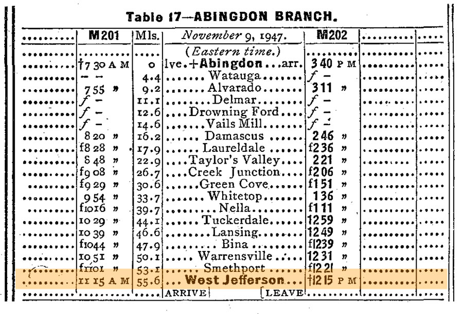
In addition to his black and white night shots, Link also recorded the single daytime train on the Norfolk & Western's hilly Abingdon Branch, serving the rural communities from Abingdon, Virginia, 55 miles south to West Jefferson, North Carolina. It was also on this line that most of his railroad color photography was done; a selection is included in The Last Steam Railroad in America. His familiar 1956 view of Maud Bows to the Virginia Creeper (Green Cove, Virginia) exists in black and white and color versions.
Green Cove, Va / Nov 2011 / RWH
Click to see the Green Cove depot plotted on a Google Maps page
Green Cove, Va / Nov 2011 / RWH
Green Cove, Va / Nov 2011 / RWH
Green Cove, Va / Nov 2011 / RWH
Nov 2011 / RWH
Green Cove, Va / Nov 2011 / RWH
Green Cove, Va / Nov 2011 / RWH
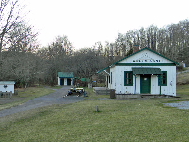
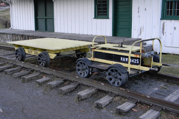
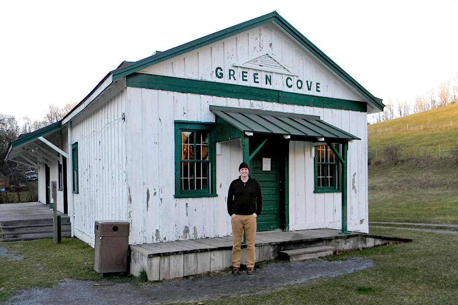
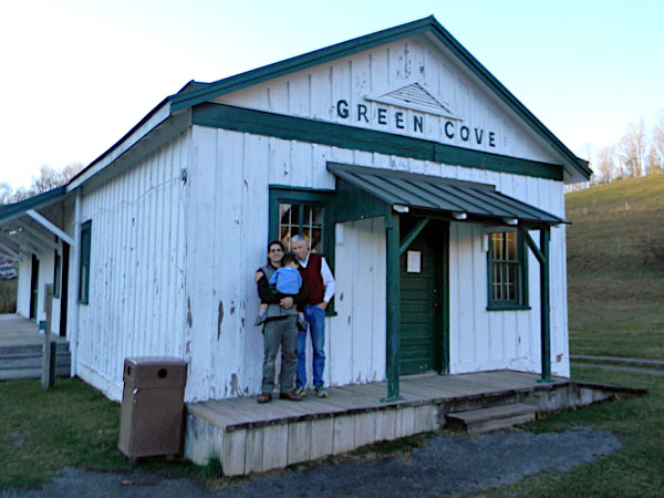
The Green Cove Station is the only original remaining depot building along the Virginia Creeper Trail. Privately owned, the depot served as post office, general store, and freight office. The owner, William Buchanan and his wife Mary, worked the depot assisted by their daughters. The station was the center point for the community communication and storytelling. Today, the US Forest Service operates the depot on a limited basis during the warmer seasons and still serves as a rest location with soft drinks, snacks and souvenirs for bikers and hikers. The Buchanan home is located to the right of the depot and is operated as a bed & breakfast by the granddaughter of William Buchanan.
Nov 2011 / RWH
Nov 2011 / RWH
Green Cove, Va / Nov 2011 / RWH
Nov 2011 / RWH
Green Cove, Va / Nov 2011 / RWH
Nov 2011 / RWH
Nov 2011 / RWH
Green Cove, Va / Nov 2011 / RWH
Green Cove, Va / Mar 2025 / ETH
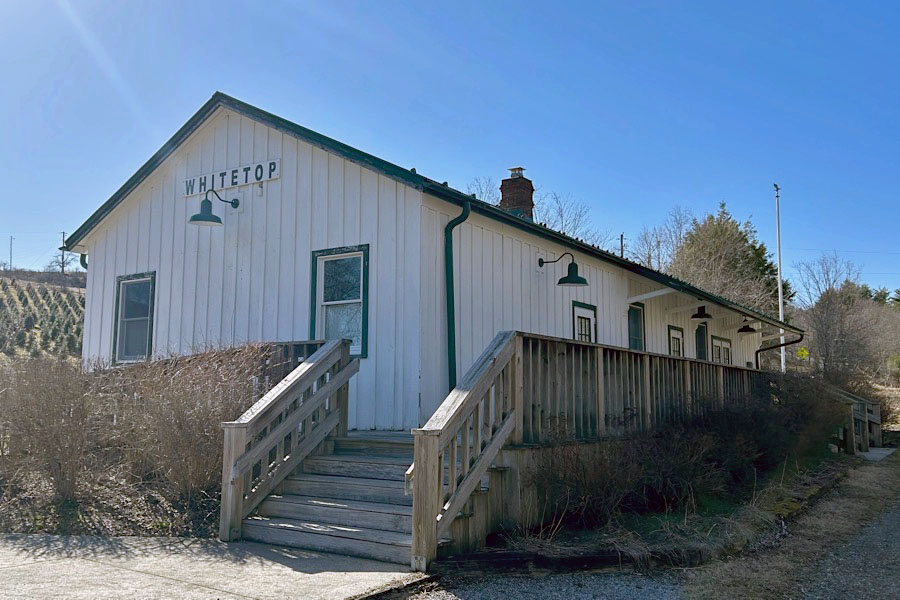
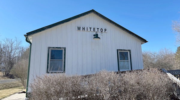
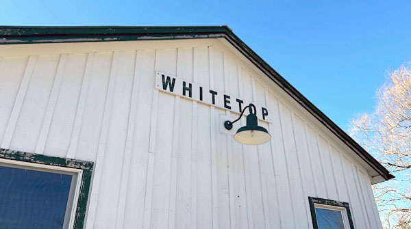
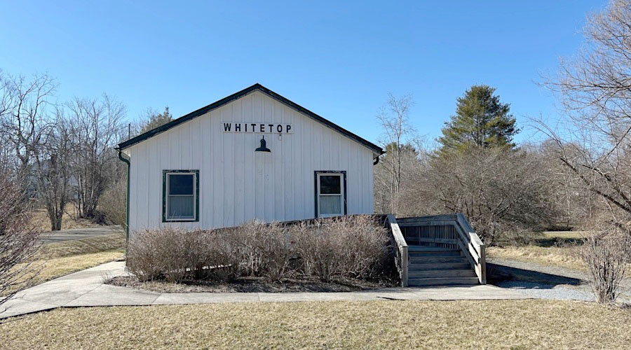
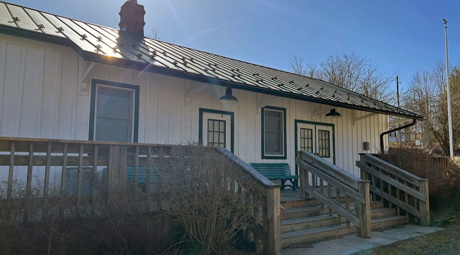
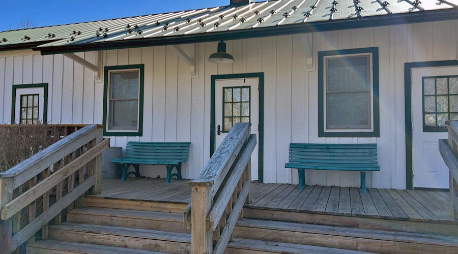
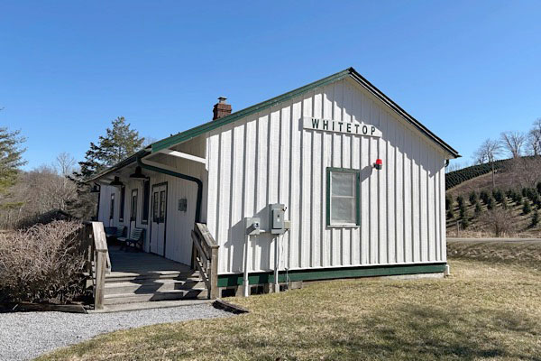
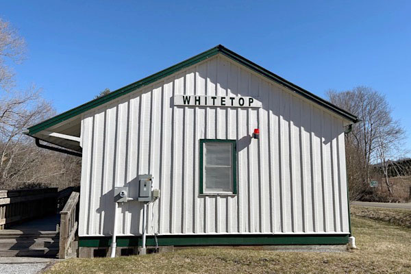
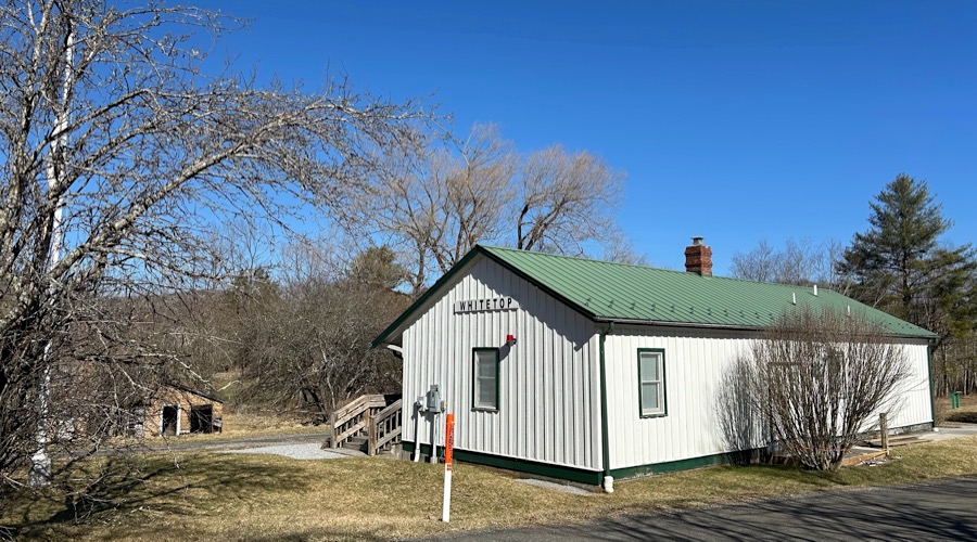
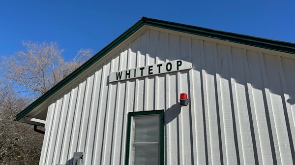
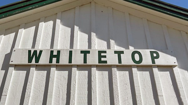
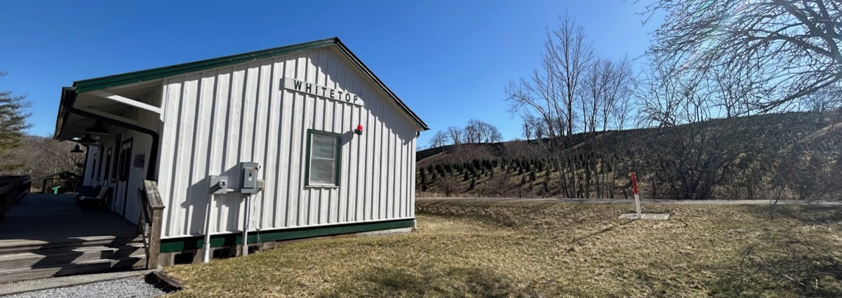
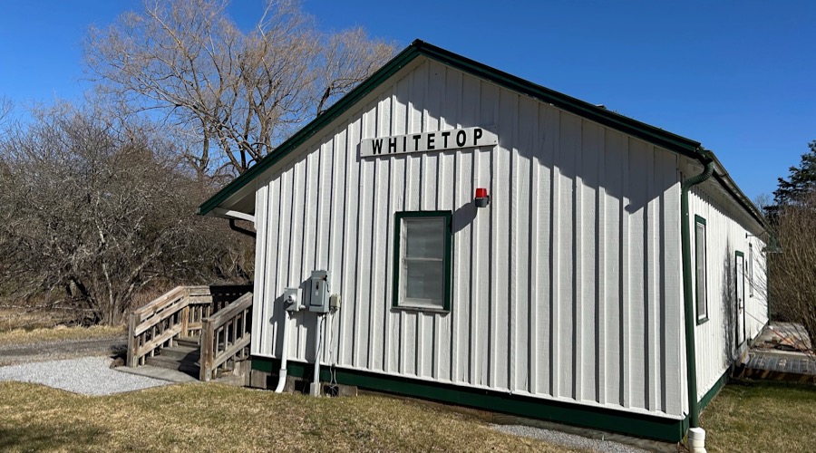
Whitetop, Va
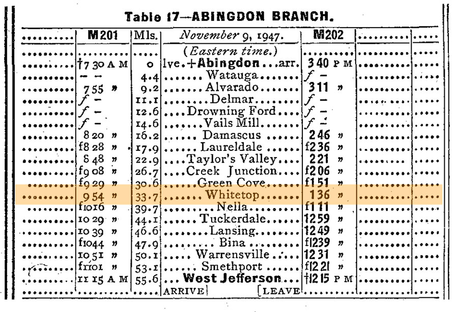
1948 Official Guide ad / collection
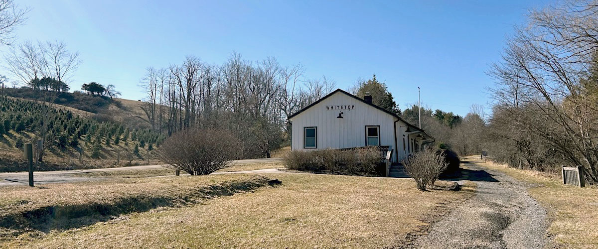
Whitetop, Va / Mar 2025 / ETH
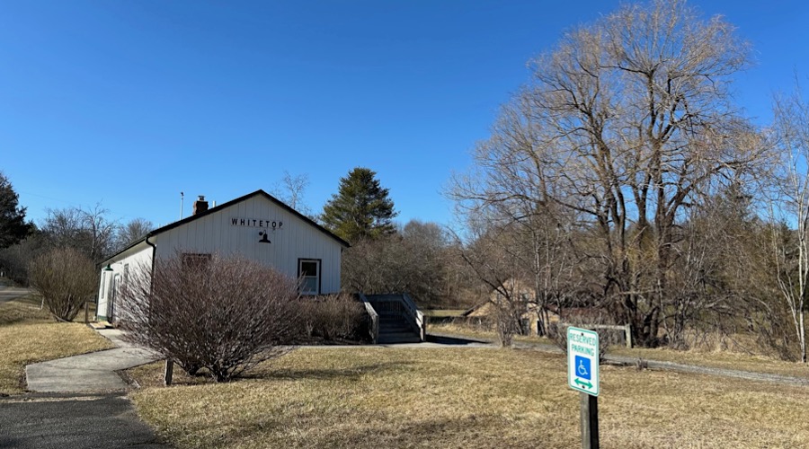
Whitetop, Va / Mar 2025 / ETH
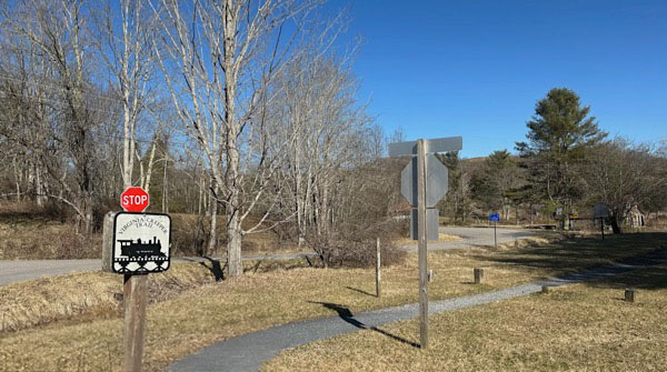
Whitetop, Va / Mar 2025 / ETH
Click to see the Whitetop depot area plotted on a Google Maps page
Whitetop, Va / Mar 2025 / ETH
Whitetop, Va / Mar 2025 / ETH
Mar 2025 / ETH
Whitetop, Va / Mar 2025 / ETH
Mar 2025 / ETH
Whitetop, Va / Mar 2025 / ETH
Whitetop, Va / Mar 2025 / ETH
Whitetop, Va / Mar 2025 / ETH
Mar 2025 / ETH
Mar 2025 / ETH
Whitetop, Va / Mar 2025 / ETH
Whitetop, Va / Mar 2025 / ETH
Mar 2025 / ETH
Whitetop, Va / Mar 2025 / ETH
Mar 2025 / ETH
Mar 2025 / ETH
Whitetop, Va / Mar 2025 / ETH
Whitetop, Va / Mar 2025 / ETH
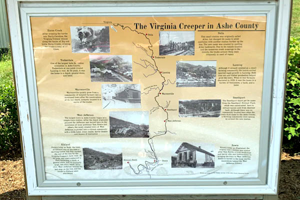
West Jefferson, NC
1948 Official Guide ad / collection
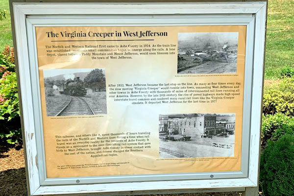
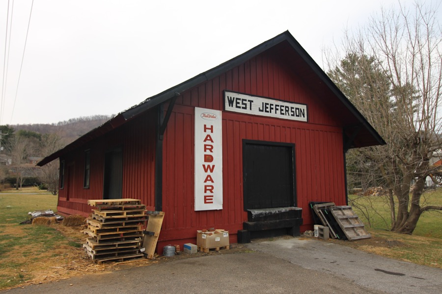
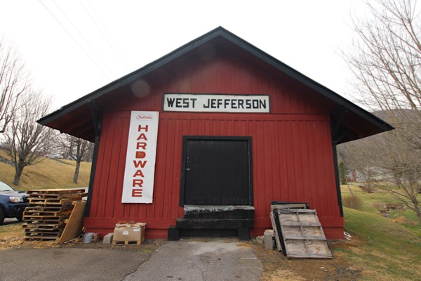
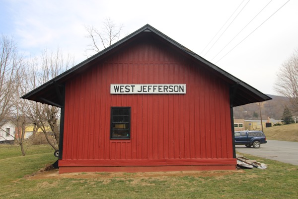
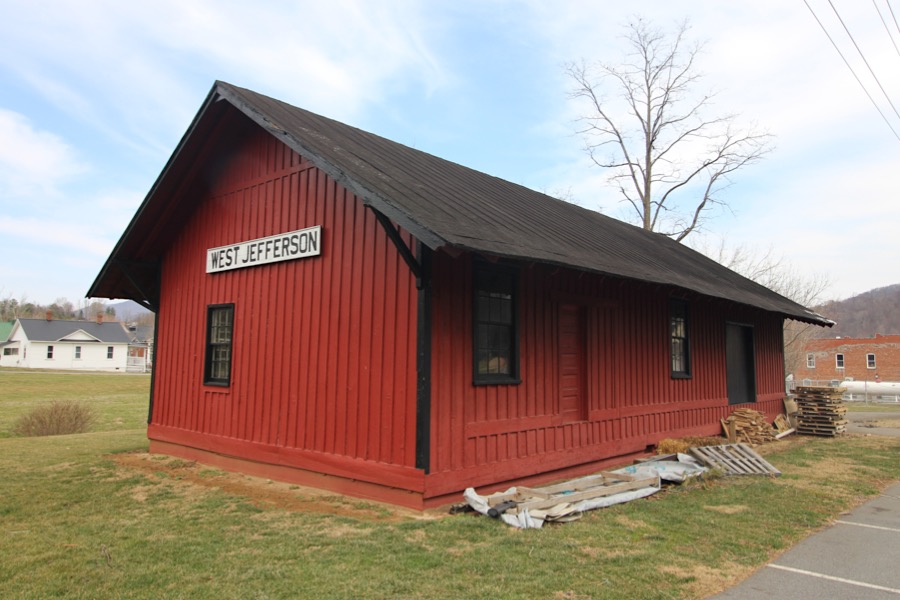
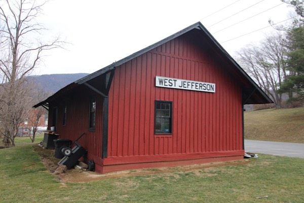
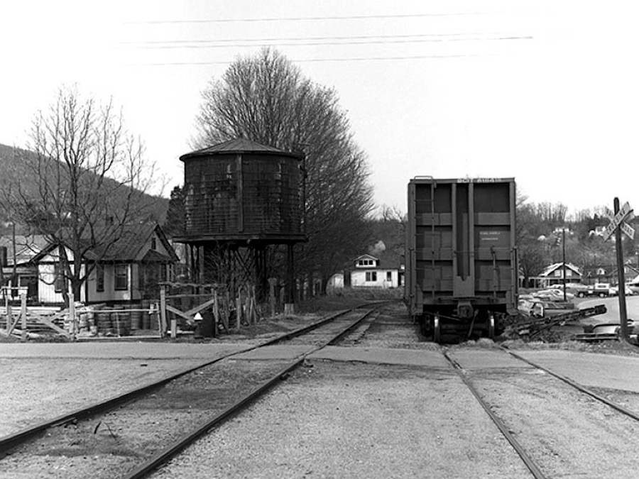
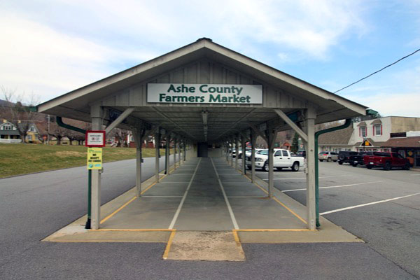
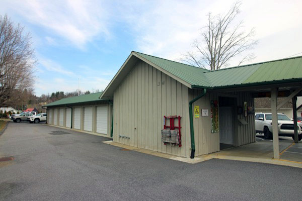
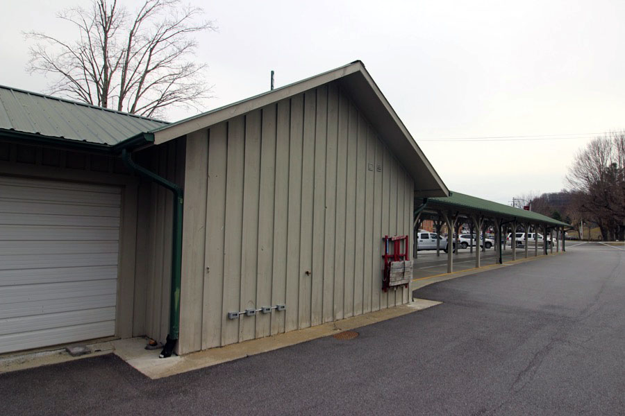
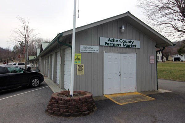
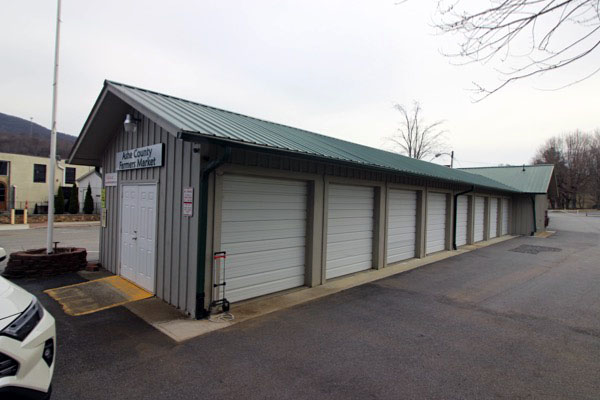
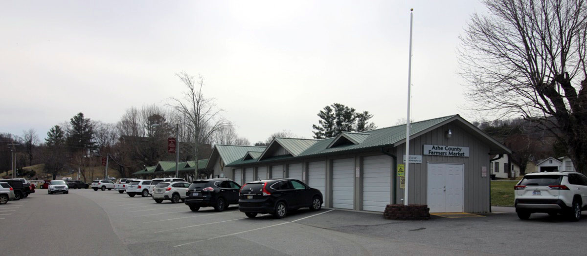
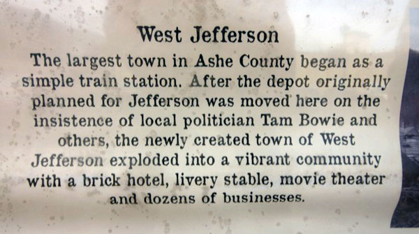
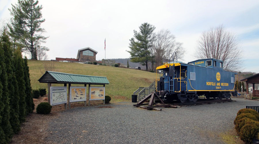
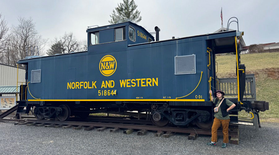
 Although beyond the scope of the Virginia Creeper Trail (which ends near the Virginia - North Carolina border, south of Whitetop depot), the town of West Jefferson was for decades the terminus of the Norfolk & Western's Abingdon Branch and today the town emphasizes that legacy in a variety of ways. A small park located at one of the former wye contains a retired N&W steel caboose. The footprint of the mainline and siding is in use today as a farmer's market, and a the former Virginia-Carolina Railroad depot has survived in a new location as a hardware store storage building.
 While other small towns have grown into cities or simply faded away, West Jefferson has remained the small town that is quintessential Americana. Our town is nestled within the majestic Blue Ridge Mountains of northwest North Carolina. Listed on the National Register of Historical Places, West Jefferson not only presents beautiful landscape and cool mountain breezes, but also gives visitors a sense of history as well as a mix of modern culture. Simply stroll about our town and discover what is so special about West Jefferson.
Long celebrated for the arts, West Jefferson is known for its arts district featuring an array of interesting murals, distinctive public art and numerous galleries. In addition to art galleries, West Jefferson offers a bustling downtown district featuring an eclectic selection of boutiques, exceptional eateries, antique shops, coffee and wine shops and even a craft beer brewery.
HawkinsRails thanks our beloved Ben Wells for use of his West Jefferson snapshots in our scrapbook

Aug 2021 / Ben Wells 
Aug 2021 / Ben Wells
Aug 2021 / Ben Wells
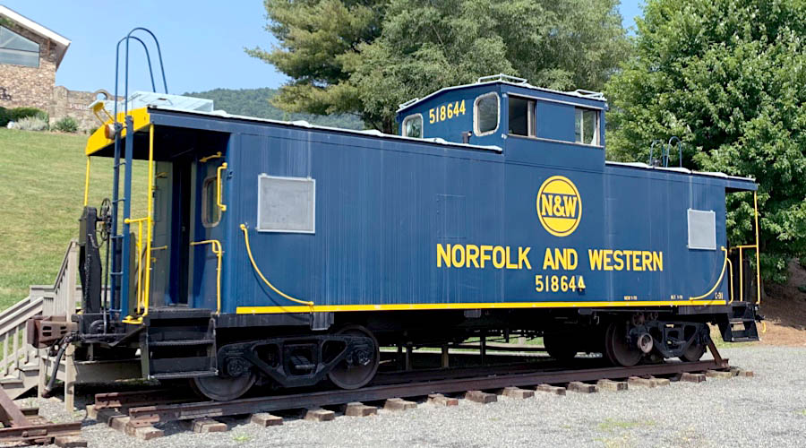
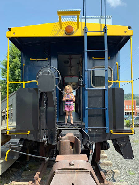
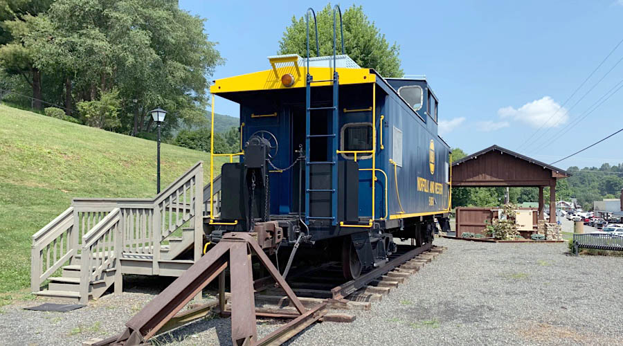
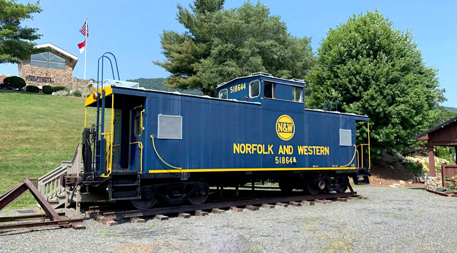
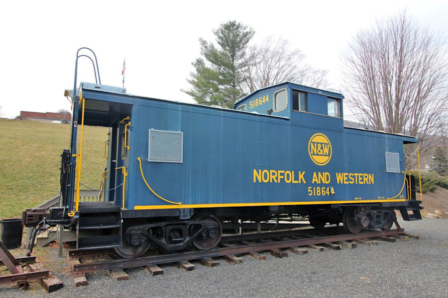
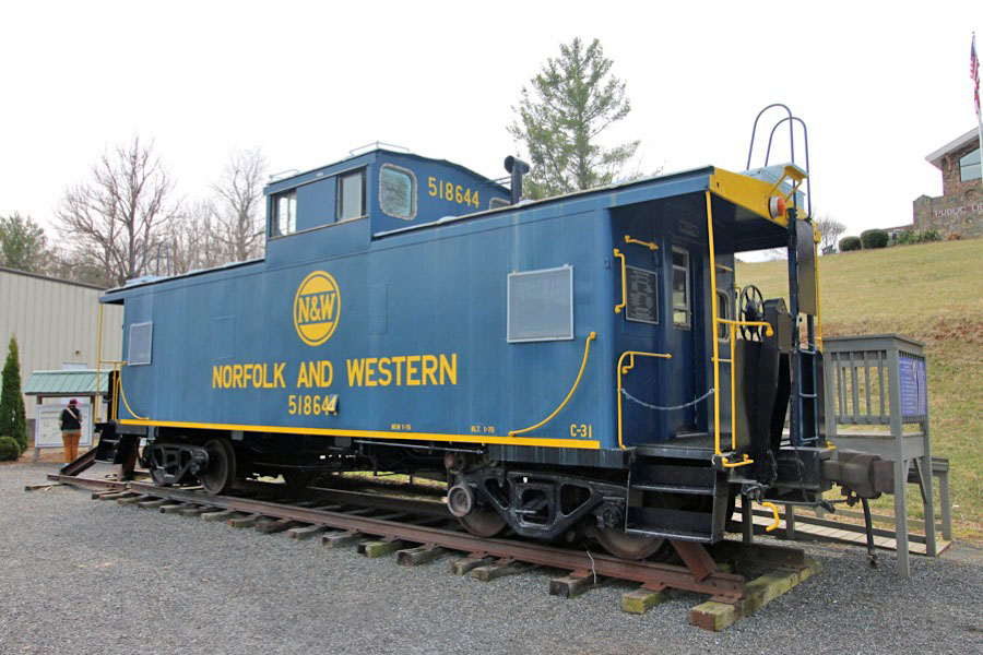
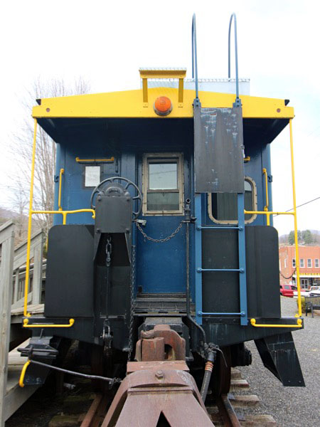
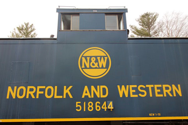
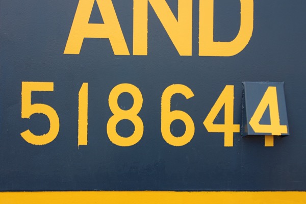
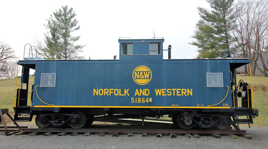
Norfolk & Western #518644
steel caboose / West Jefferson, NC / Aug 2021 / Ben Wells
Aug 2021 / Ben Wells
West Jefferson, NC / Aug 2021 / Ben Wells
West Jefferson, NC / Aug 2021 / Ben Wells
Depot
West Jefferson, NC / Mar 2025 / RWH
Click to see the former West Jefferson depot plotted on a Google Maps page
West Jefferson, NC / Mar 2025 / RWH
West Jefferson, NC / Mar 2025 / RWH
West Jefferson, NC / Mar 2025 / RWH
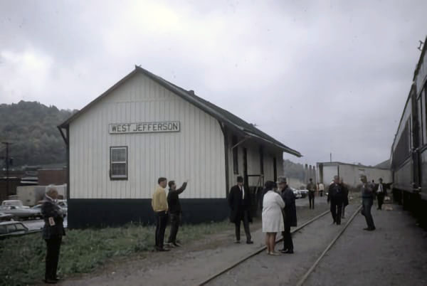
West Jefferson, NC / 1970 / Brian Ezzelle collection
 Then and Now
West Jefferson, NC / 1977 and 2025 / Mike Smith and RWH
Farmers' Market
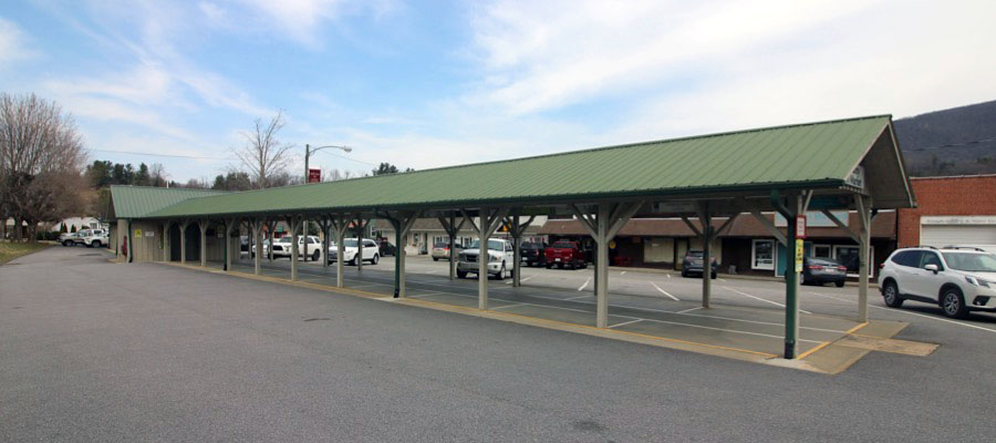
West Jefferson, NC / Mar 2025 / RWH
West Jefferson, NC / Mar 2025 / RWH
West Jefferson, NC / Mar 2025 / RWH
West Jefferson, NC / Mar 2025 / RWH
West Jefferson, NC / Mar 2025 / RWH
West Jefferson, NC / Mar 2025 / RWH
West Jefferson, NC / Mar 2025 / RWH
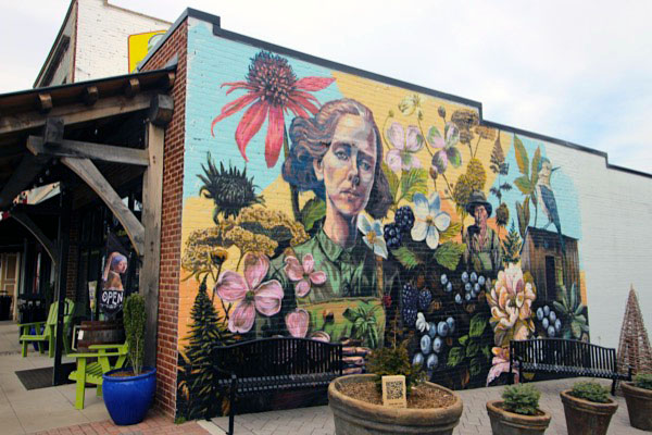
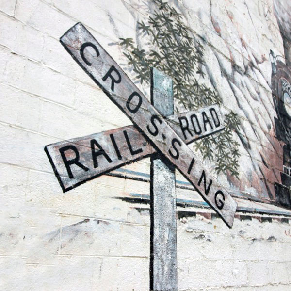
 One of the best ways to explore West Jefferson is to take a walking tour of its 15 murals interspersed throughout the downtown area. Designed and painted by local artists, the murals celebrate the region’s colorful mountain history.
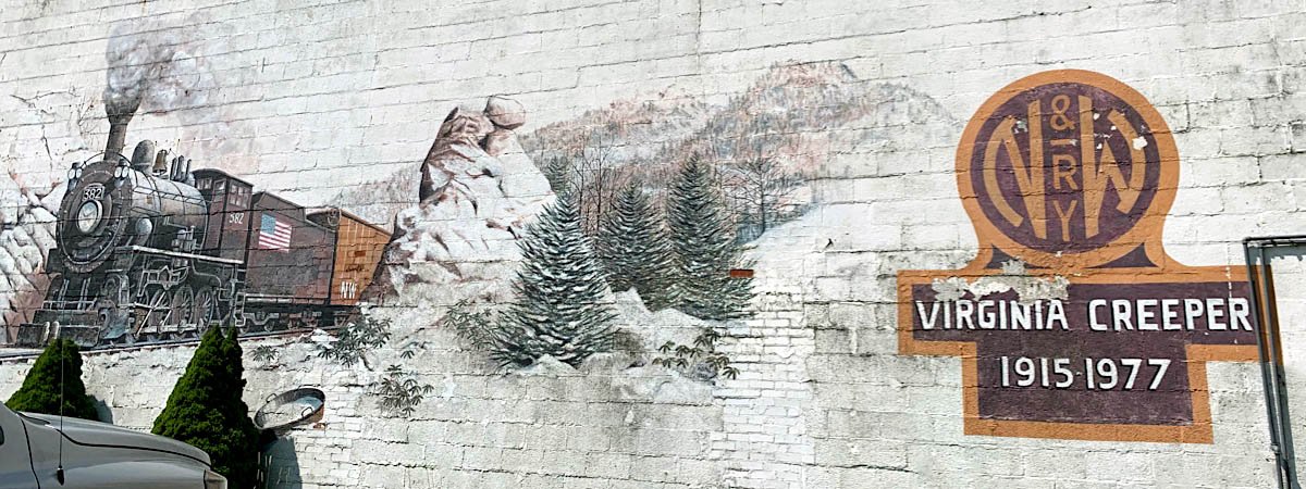
The beginning of the downtown mural project can be traced to 1996, when the publishers McFarland and Company, Inc., commissioned local artist Jack Young to paint the mural “History of Ashe Through the Ages.” This past July, local artist Mary Wells began to paint a new colorful flower mural as a replacement, since the building has undergone architectural changes.
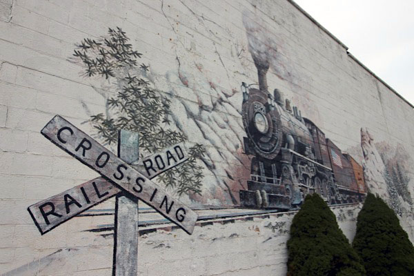
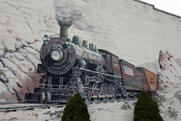
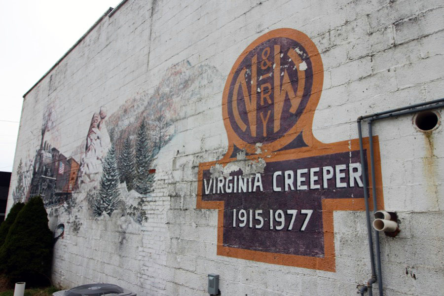
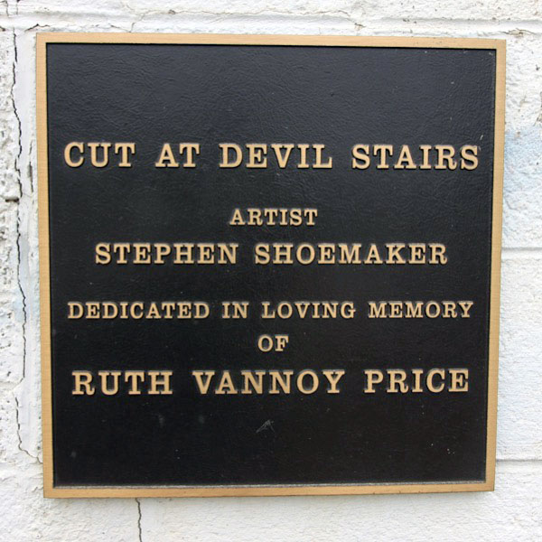
Stephan Shoemaker’s “Cut at Devil Stairs (2001),” which depicts a snowy train scene, a time when the railroad was an important part of Ashe County life.
Ashe High Country Realty / image RWH
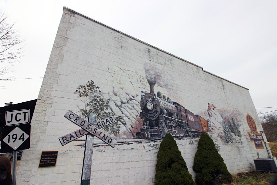
"Cut at Devil Stairs""
West Jefferson, NC / Mar 2025 / RWH
Click to see the Shoemaker Mural plotted on a Google Maps page
Mar 2025 / RWH
Mar 2025 / RWH
West Jefferson, NC / Mar 2025 / RWH
Mar 2025 / RWH
Mar 2025 / RWH
Mar 2025 / RWH
West Jefferson, NC / Mar 2025 / RWH
Back Street Park
West Jefferson, NC / Mar 2025 / RWH
Click to see the Back Street Park area plotted on a Google Maps page
Mar 2025 / RWH
Mar 2025 / RWH
West Jefferson, NC / Mar 2025 / RWH
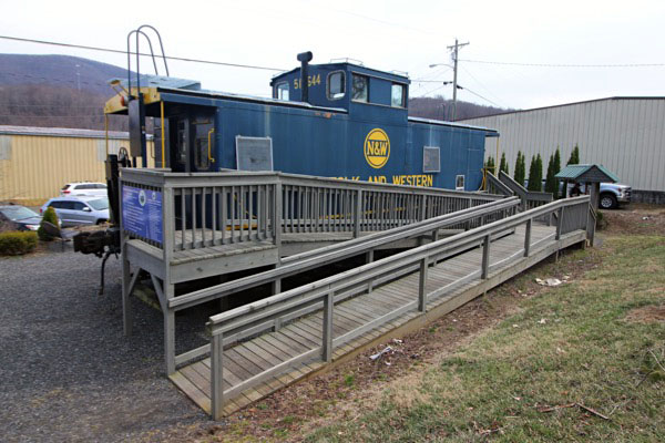
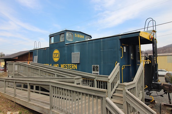
Norfolk & Western #518644
West Jefferson, NC / Mar 2025 / RWH
West Jefferson, NC / Mar 2025 / RWH
Mar 2025 / RWH
Mar 2025 / RWH
Mar 2025 / RWH
Mar 2025 / RWH
West Jefferson, NC / Mar 2025 / RWH
Lagniappe


Longing for Link
Green Cove, Va / Nov 2011 / RWH
Memories of the M Class
Abingdon, Va / Jul 2011 / RWH
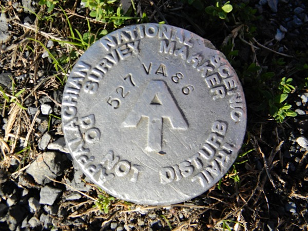
Do Not Disturb
Damascus, Va / Jul 2011 / RWH
Green Cove Primer
Green Cove, Va / Mar 2025 / ETH
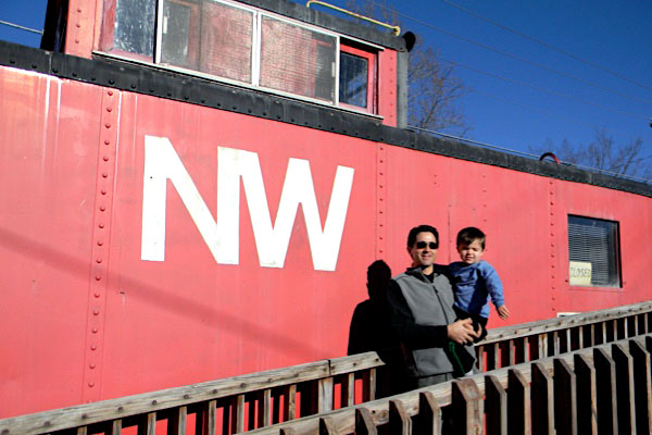
Julius Visits the Creeper
Green Cove, Va / Mar 2025 / ETH
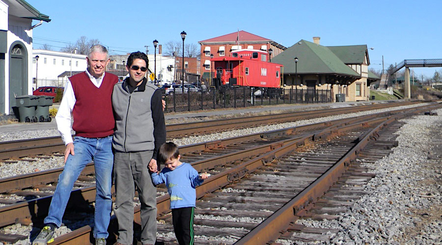
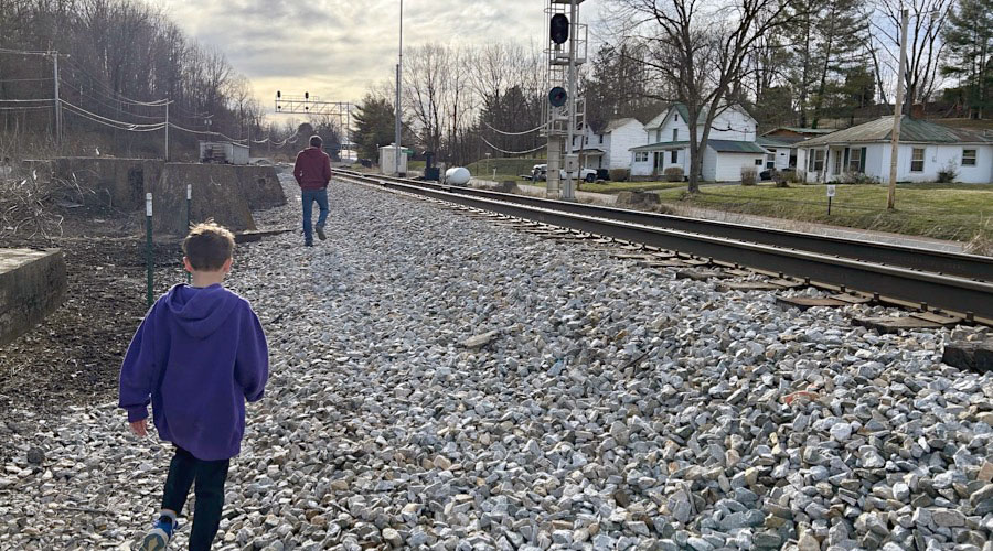
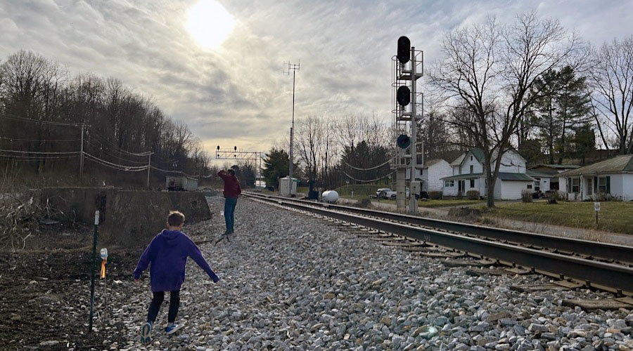
 Snapshots
Green Cove, Va / Nov 2011 / Will Hankins
Green Cove, Va / Nov 2011 / RWH
Damascus, Va / Nov 2011 / RWH
Abingdon, Va / Nov 2011 / RWH
Abingdon, Va / Mar 2025 / ETH
Green Cove, Va / Mar 2025 / ETH
Roaring Gap, NC / Mar 2025 / RWH
West Jefferson, NC / Mar 2025 / RWH
Links / Sources
- Virginia Creeper Trail official website
- Virginia Creeper Trail Guide informational site
- Creeper Trail Info
- Richard Smith's Virginia Creeper Trail website
- Wikipedia article for Virginia Creeper Trail

