 |
Rio Grande Southern Locations |
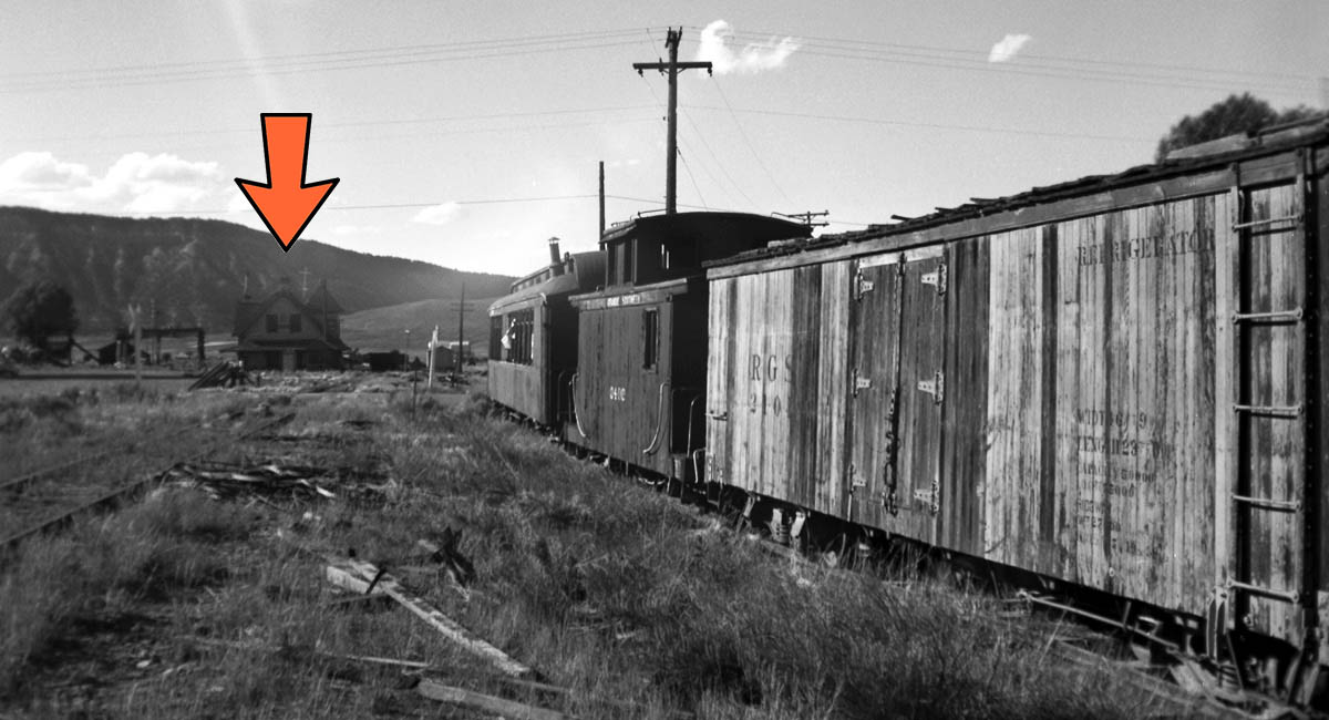
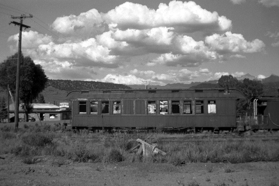
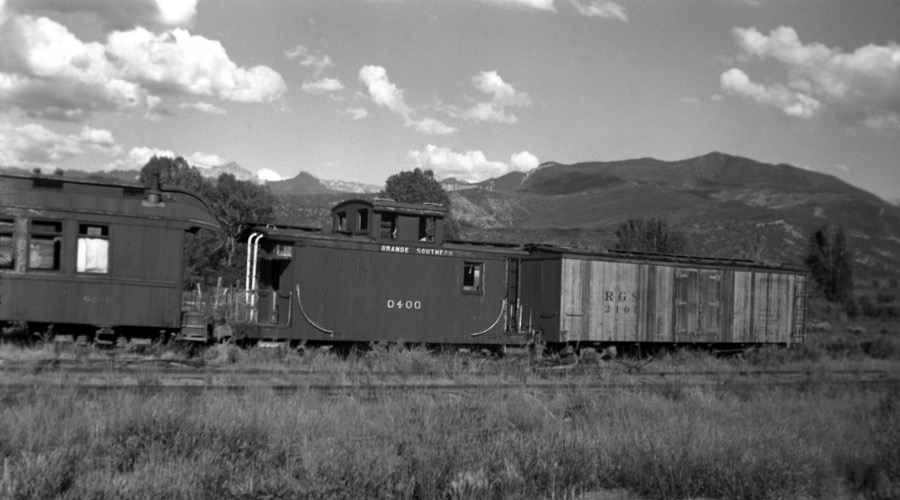
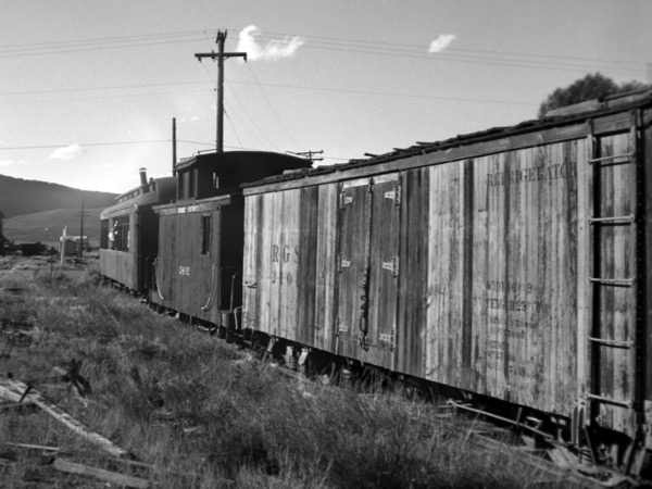
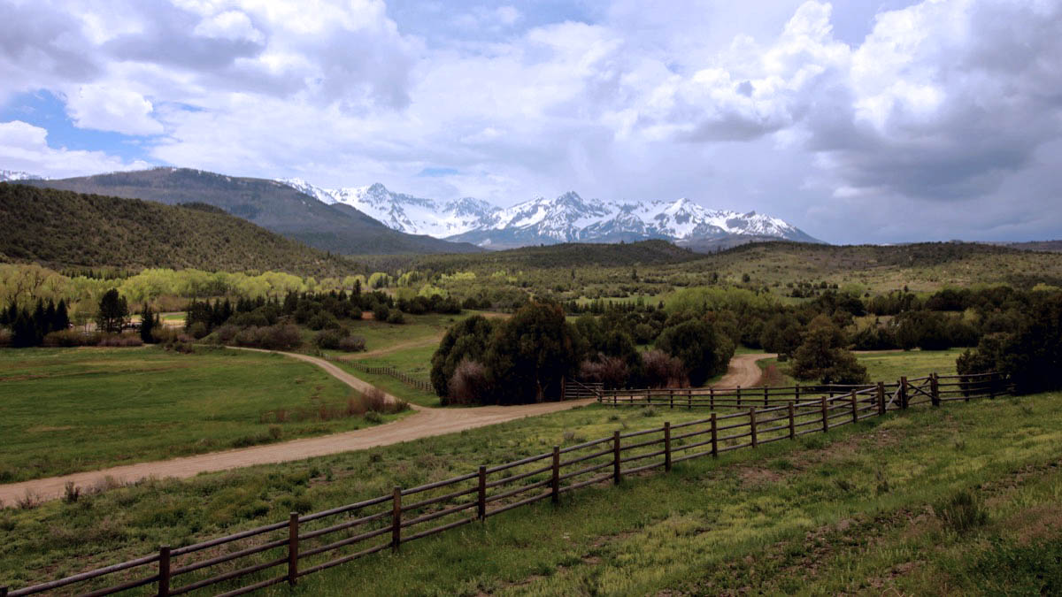
Trout Lake, Co / May 2023 / RWH

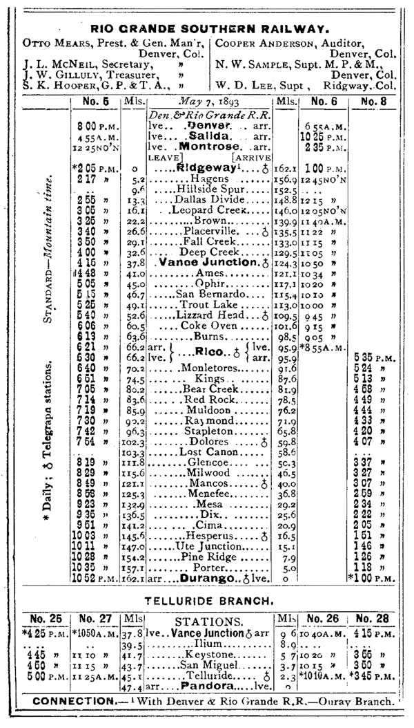
1893 Official Guide ad / collection

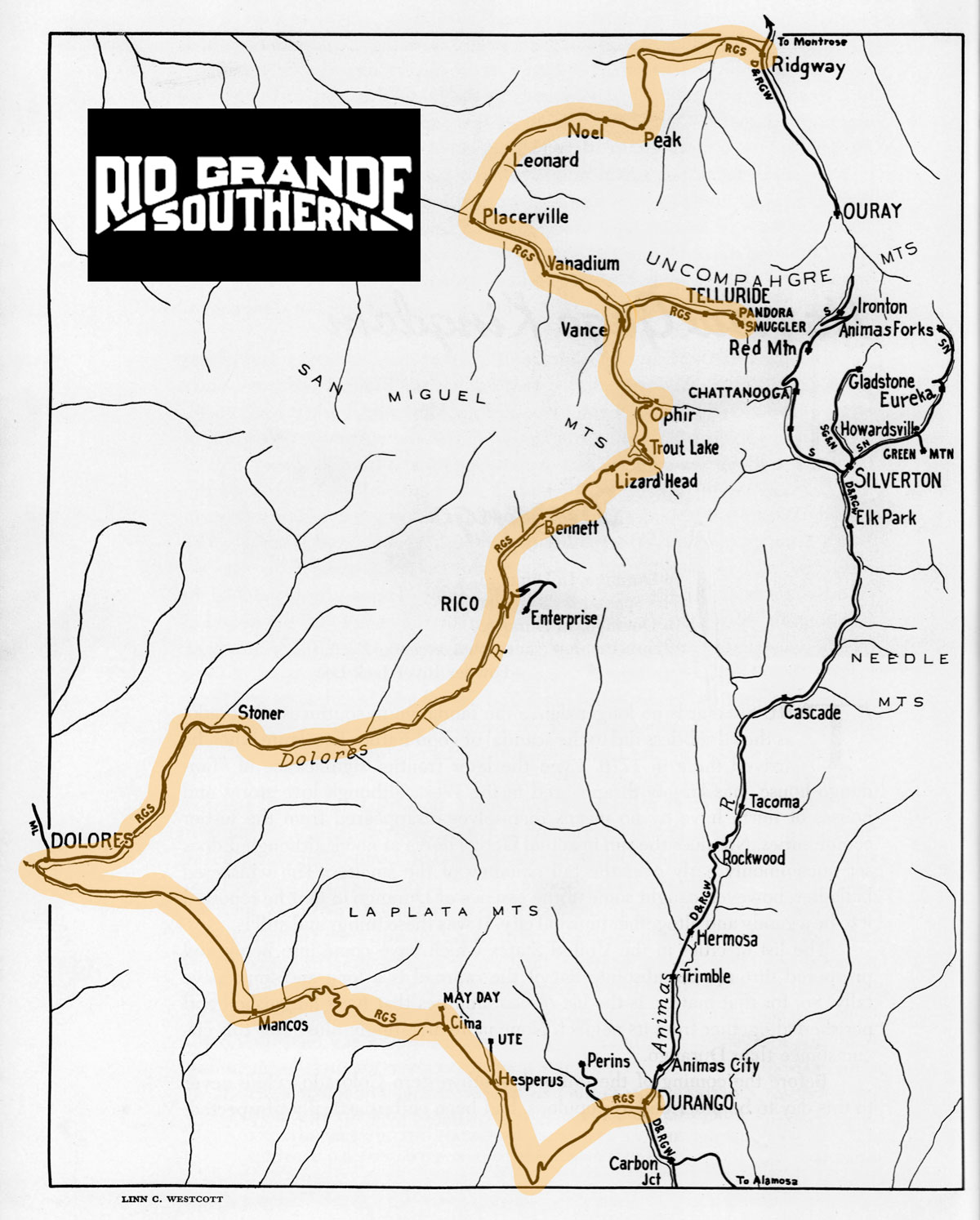
RGS route map / adapted by RWH from Mixed Train Daily by Lucius Beebe / collection
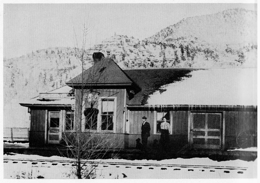
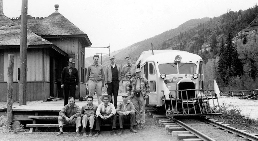
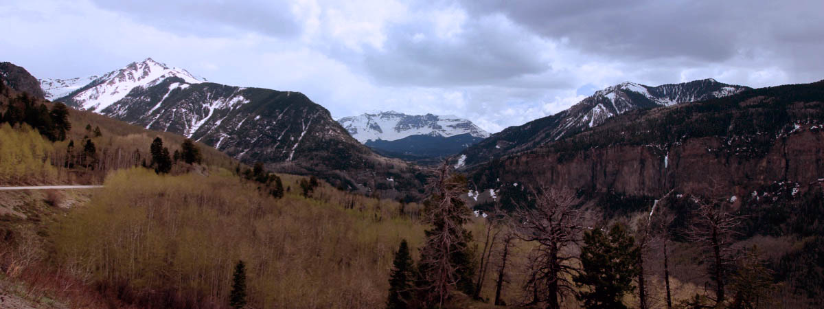
 Ridgway


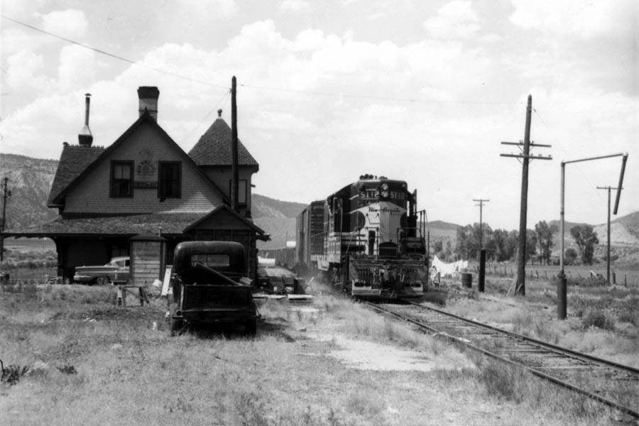
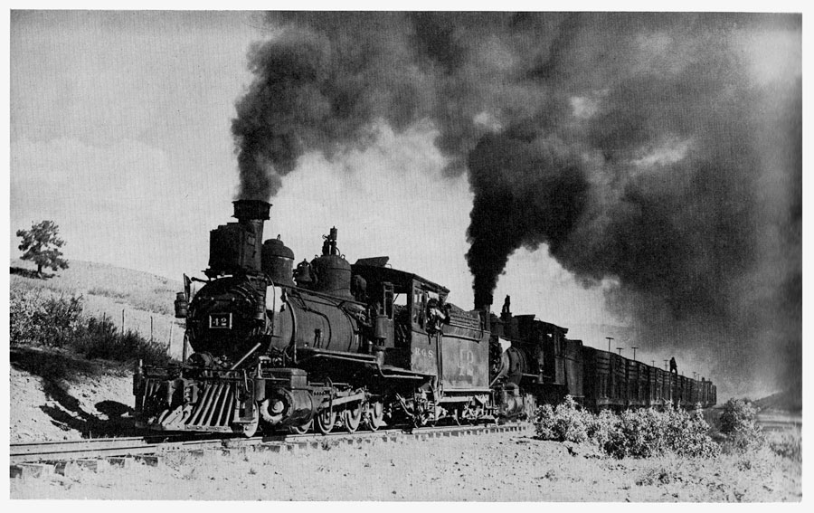
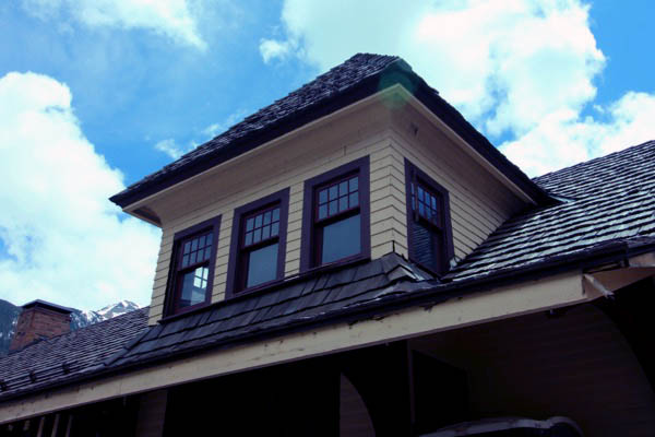
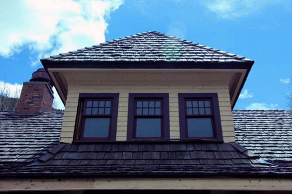
Ridgway, Co / Jun 1959 / JCH
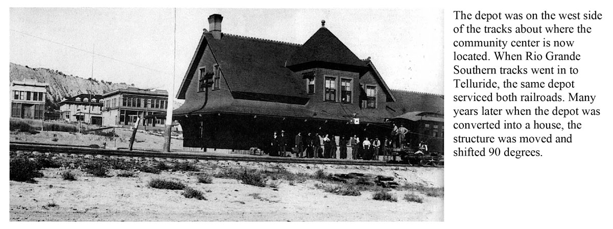
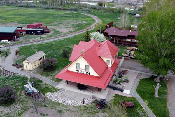
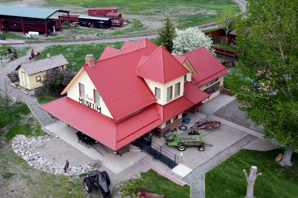
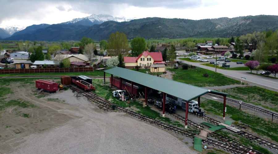
 The Town of Ridgway is a home-rule municipality with a population of slightly more than 1,000 people, located along the Uncompahgre River in the foothills of the San Juan Mountains in colorful southwest Colorado. Once home of the Ute Indians, the Town’s more recent heritage is one steeped in rich railroad and ranching history dating back to 1889, when the Rio Grande Southern Railroad was incorporated to provide rail service between Ridgway and the mining districts of Ouray, Telluride, Rico and Durango. The railroad company, wanting to develop a new town as a headquarters and hub for the growing ranch community, laid out what was to become the Town of Ridgway in 1890. One year later the Town was formally established and named after one of the railroad founders, Robert M. Ridgway.
Ridgway, Co / Jun 1959 / JCH
Ridgway, Co / Jun 1959 / JCH
Ridgway, Co / Jun 1959 / JCH
Ridgway, Co / Jul 1962 / Chris Ahrens 
collection
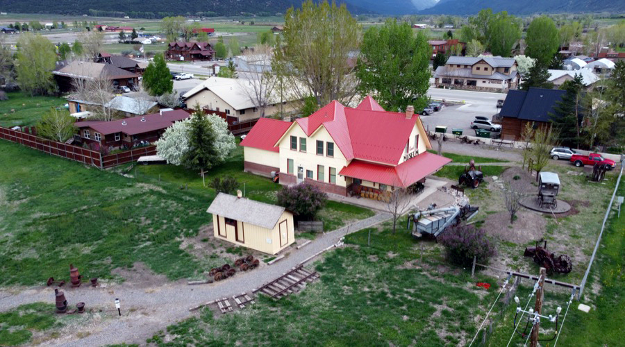
Ridgway, Co / May 2023 / RWH
Ridgway, Co / May 2023 / RWH
Ridgway, Co / May 2023 / RWH
Ridgway, Co / May 2023 / RWH

See also our complete Ridgway Railroad Museum scrapbook in Preservation
 Noel
Noel
from Narrow Gauge in the Rockies by Lucius Beebe & Charles Clegg / collection
Noel, Co / May 2023 / RWH
 Placerville
from Narrow Gauge in the Rockies by Lucius Beebe & Charles Clegg / collection
Placerville, Co / May 1950 / Narrow Gauge Discussion Forum
Sawpit
Sawpit, Co / May 2023 / RWH
Sawpit, Co / May 2023 / RWH
Sawpit, Co / May 2023 / RWH
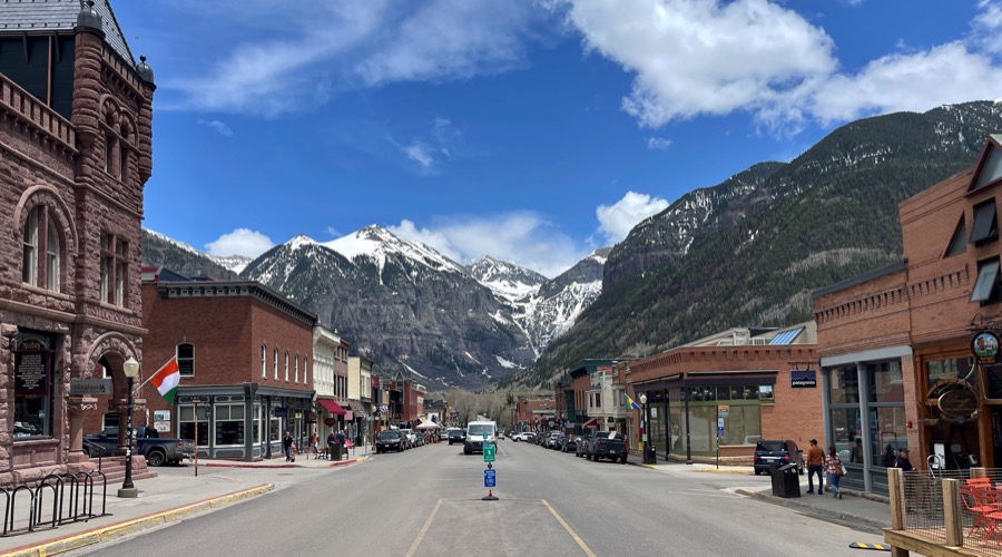
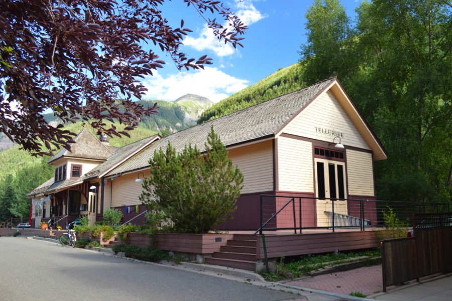
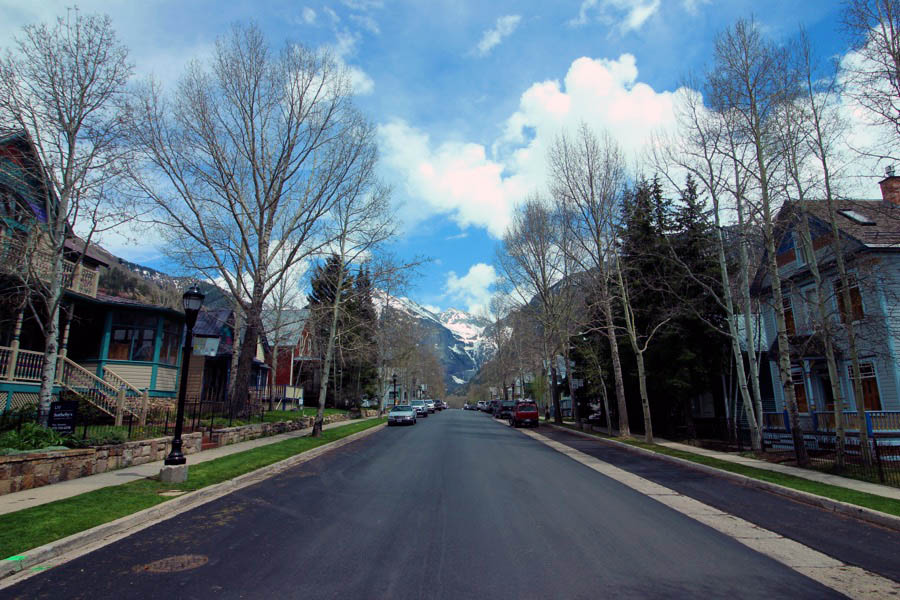
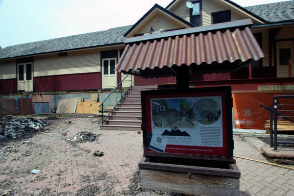
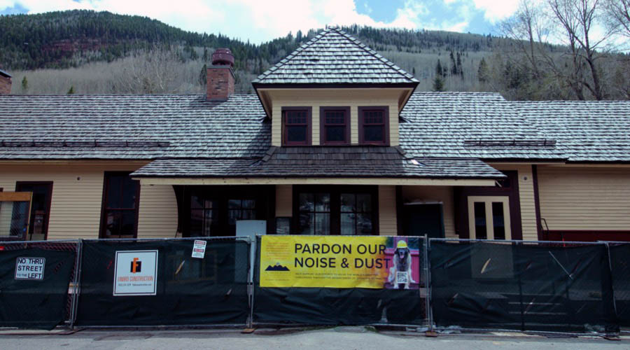
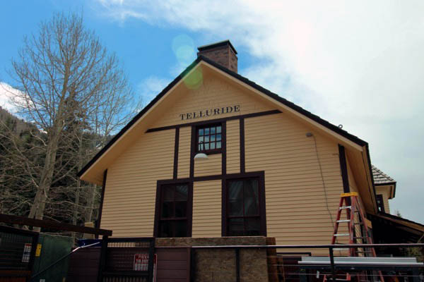
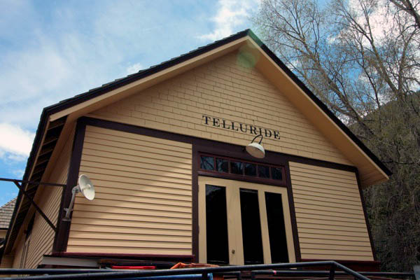
 Telluride

Telluride, Co / Jun 1959 / JCH
Telluride, Co / Jun 1959 and May 2023 / JCH and RWH
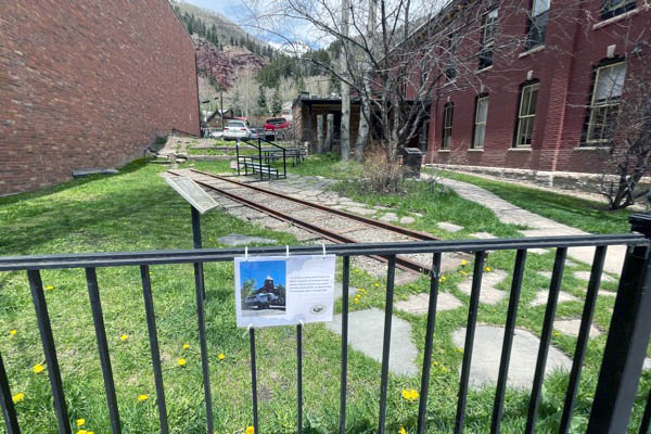
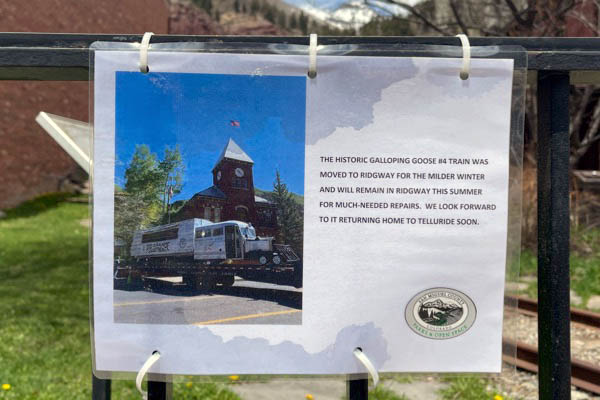
Click to see the former Galloping Goose display park plotted on a Google Maps page
May 2023 / RWH
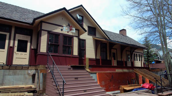
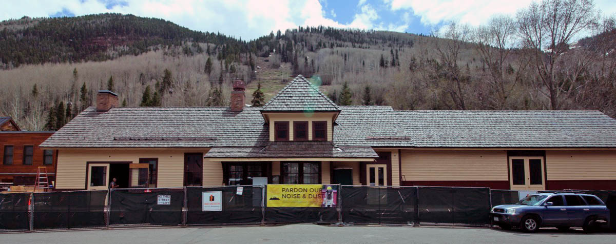
Telluride, Co / May 2023 / RWH
May 2023 / RWH
Telluride, Co / May 2023 / RWH
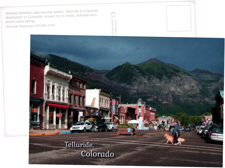
postcard / collection

![]()
 Located in southwest Colorado’s stunning San Juan Mountains, Telluride is renowned for its authentic, comfortable character and blend of refined culture and unpretentious attitude. From our famous festivals and outdoor activities to exceptional restaurants and fine hotels, the area serves up four seasons of destination fun. The town sits at 8,750 feet above sea level and has been designated a National Historic Landmark District.
Telluride is connected with neighboring Mountain Village by a free gondola transportation system—the only one of its kind in North America. At an elevation of 9,500 feet, Mountain Village is a pedestrian-friendly community and home to the Telluride Ski Resort headquarters, a world-class golf course, restaurants, lodging and shops.
Located in southwest Colorado’s stunning San Juan Mountains, Telluride is renowned for its authentic, comfortable character and blend of refined culture and unpretentious attitude. From our famous festivals and outdoor activities to exceptional restaurants and fine hotels, the area serves up four seasons of destination fun. The town sits at 8,750 feet above sea level and has been designated a National Historic Landmark District.
Telluride is connected with neighboring Mountain Village by a free gondola transportation system—the only one of its kind in North America. At an elevation of 9,500 feet, Mountain Village is a pedestrian-friendly community and home to the Telluride Ski Resort headquarters, a world-class golf course, restaurants, lodging and shops.
Telluride, Co / Jul 2012 / John Dyer
Click to see the Telluride depot area plotted on a Google Maps page
Telluride, Co / May 2023 / RWH
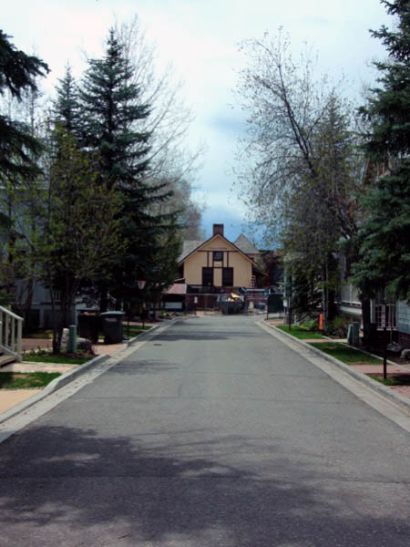
May 2023 / RWH
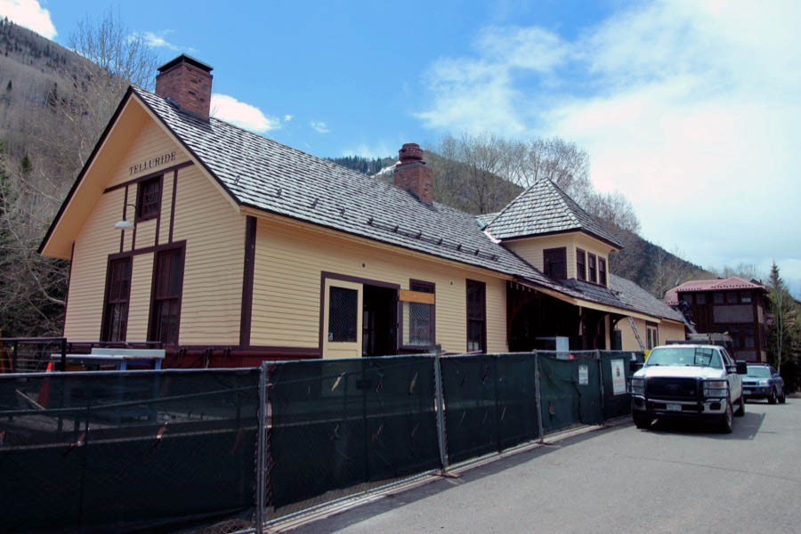
Telluride, Co / May 2023 / RWH

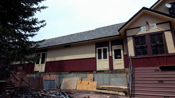
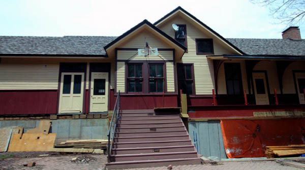
May 2023 / RWH
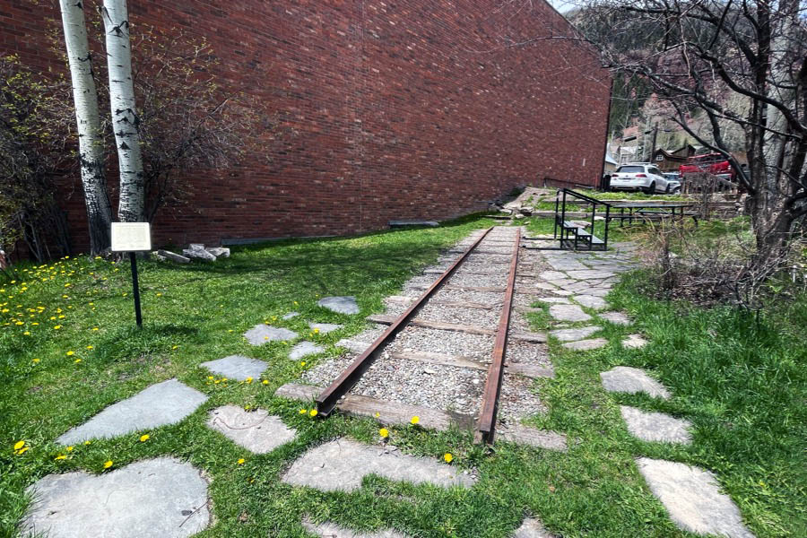
 Telluride began slowly because of its isolated location. In 1881, a toll road was opened by Otto Mears, which allowed wagons to go where only pack mules could go before. This increased the number of people in Telluride, but it was still expensive to get gold-rich ore out of the valley.
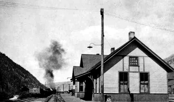
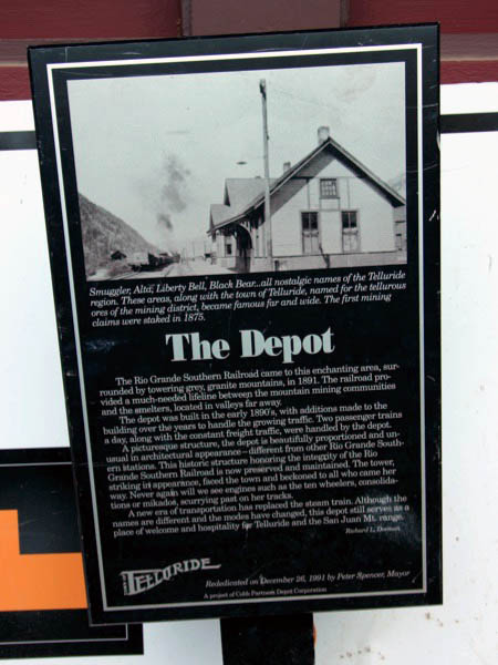
In 1891, the Rio Grande Southern Railroad, also begun by Mears, arrived in Telluride, eventually building a two-stall engine house, water facilities, a section house and a bunkhouse, sidings, and a depot. It continued further up the valley to end its Telluride branch at Pandora, serving the mines and the town until 1952. The cheaper and consistent transportation for passengers and freight allowed miners and goods to flow into the San Miguel town and ore to flow out to the mills and foundries elsewhere. This brought a brief but unprecedented boom to Telluride before the Panic of 1893.
Telluride, Co / May 2023 / RWH
May 2023 / RWH
Telluride, Co / May 2023 / RWH
Telluride, Co / May 2023 / RWH
Telluride, Co / May 2023 / RWH
May 2023 / RWH
May 2023 / RWH
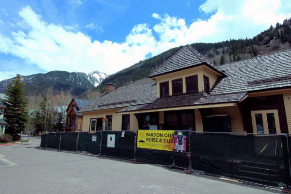
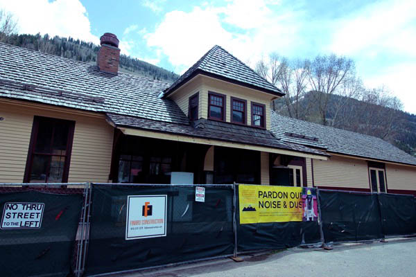
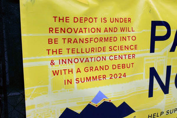
The Depot’s history runs as deep as the veins of gold and silver pulled from the Telluride valley. Constructed in 1891 during the mining boom, the Depot served as a connection to the rest of the world, bringing in people with fresh ideas and big dreams while exporting precious metals extracted from the high-alpine basins. When the railroad ceased operations in 1951, the building stood vacant for many years until Charles and Sue Cobb purchased the Depot in the late 1980’s and restored the dilapidated building. This was no small task as the building had no foundation and was essentially four walls supported by cables. Vogy’s House Moving transported the structure a few hundred feet up Townsend to sit while a foundation was constructed. When the foundation was complete, the building was moved back into place and set onto the new foundation.
May 2023 / RWH
May 2023 / RWH
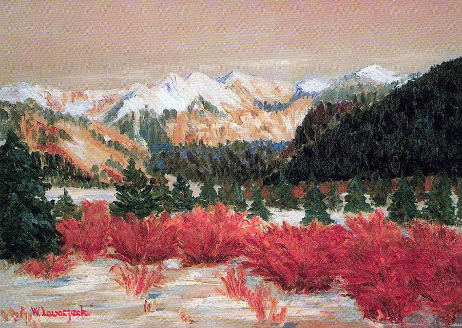

Towards Telluride / Waltraud Lawaczeck paintings / collection
 Ames
Ames
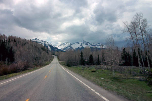
Ames, Co / May 2023 / RWH
Ames, Co / May 2023 / RWH
Ames, Co / May 2023 / RWH
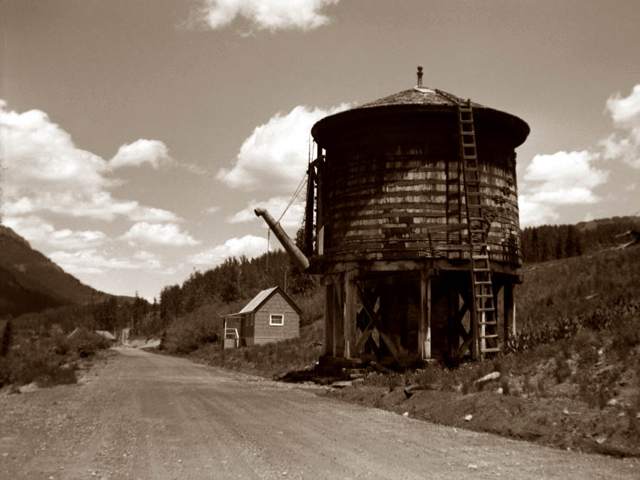
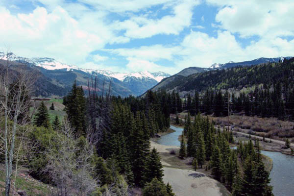
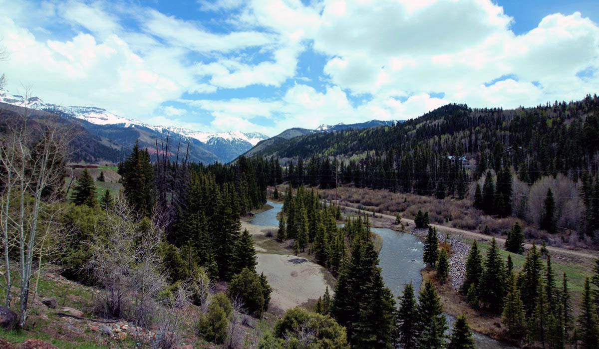
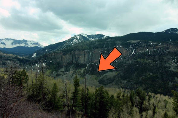
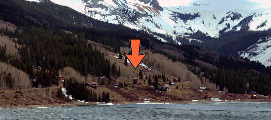
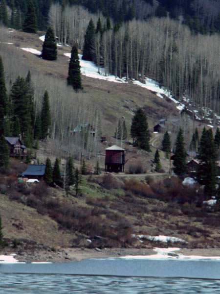
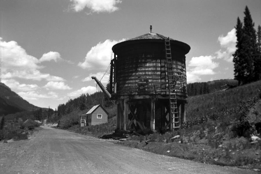
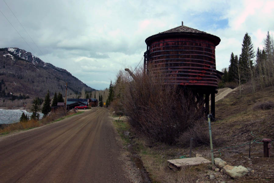
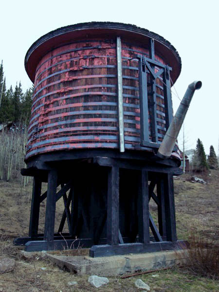
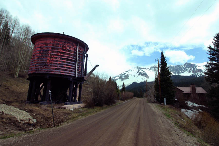
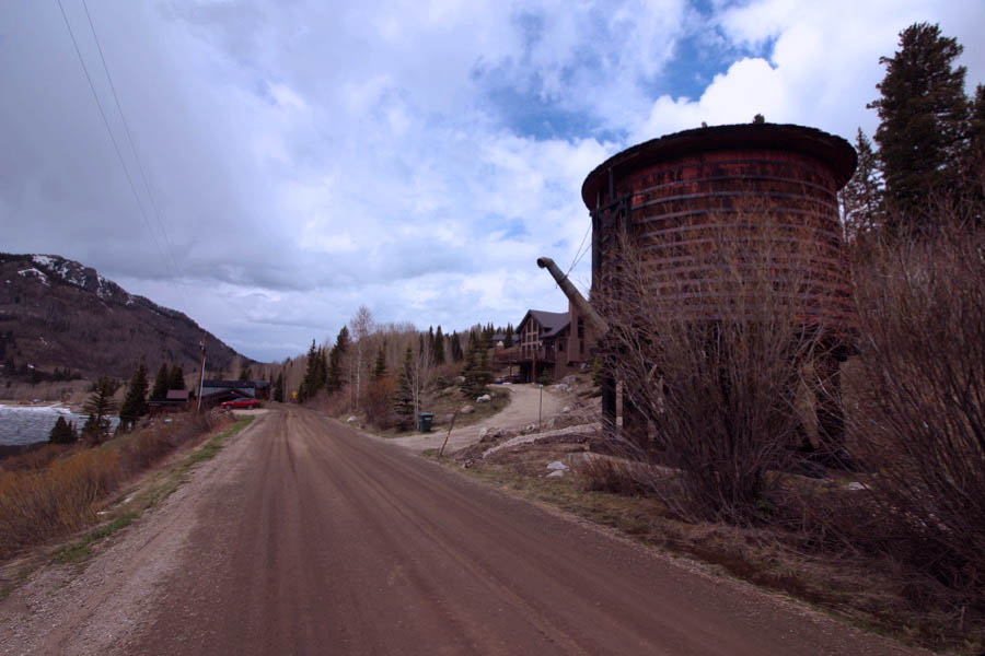
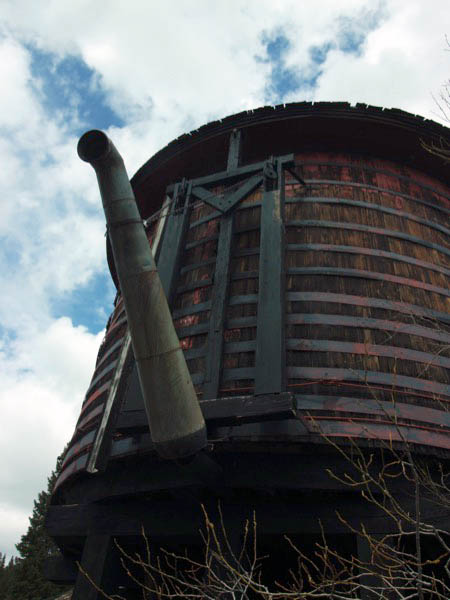
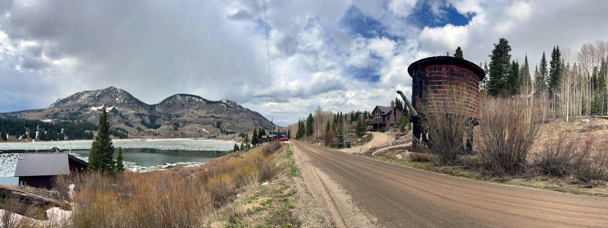
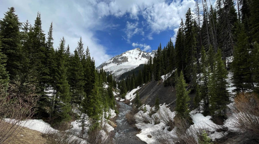
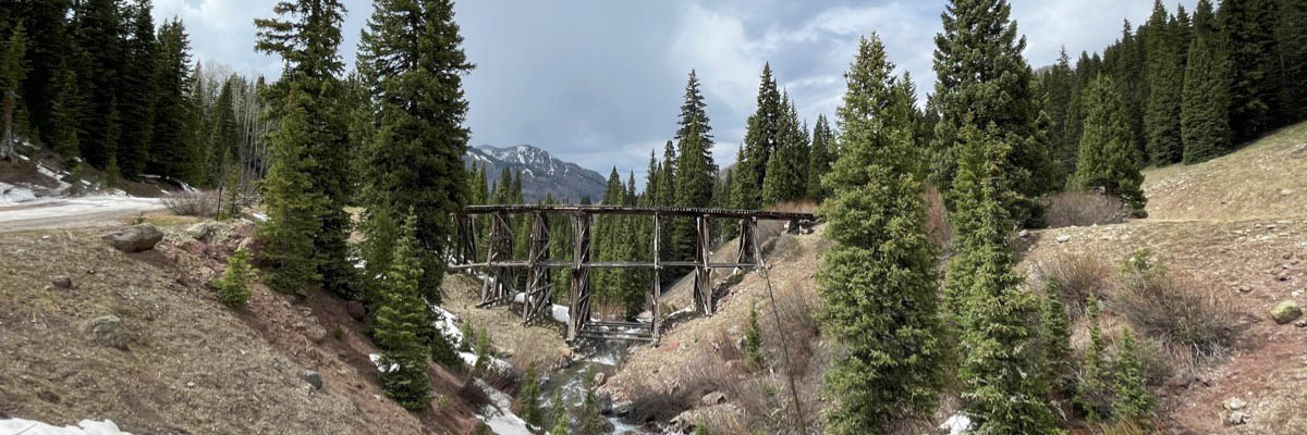
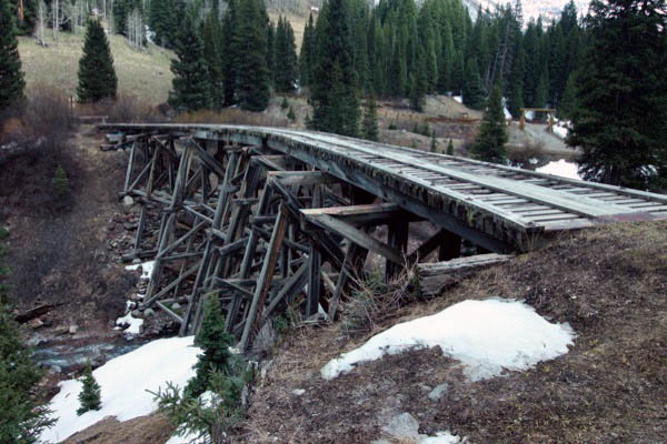
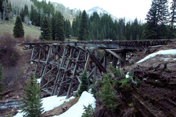
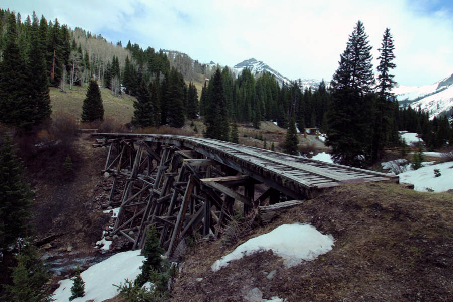
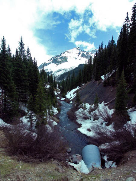
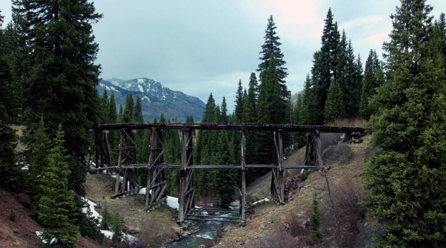
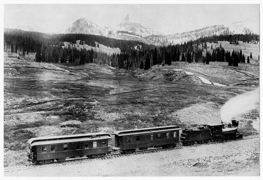
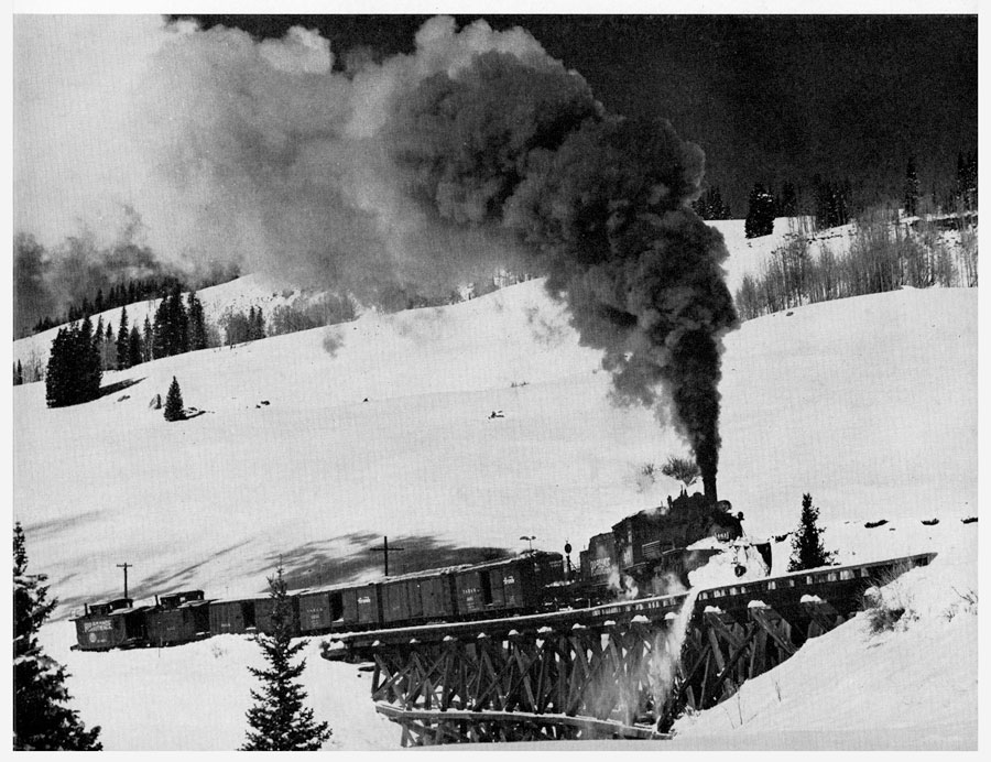
 Trout Lake

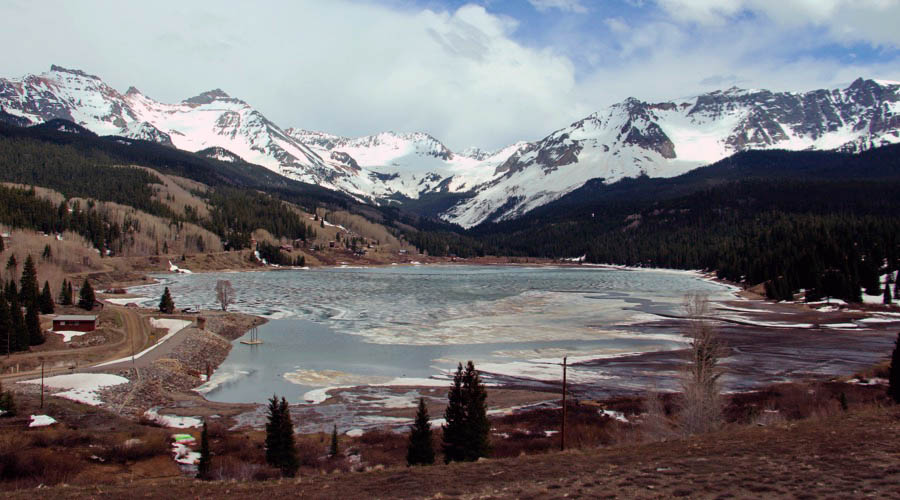
Trout Lake, Co / May 2023 / RWH
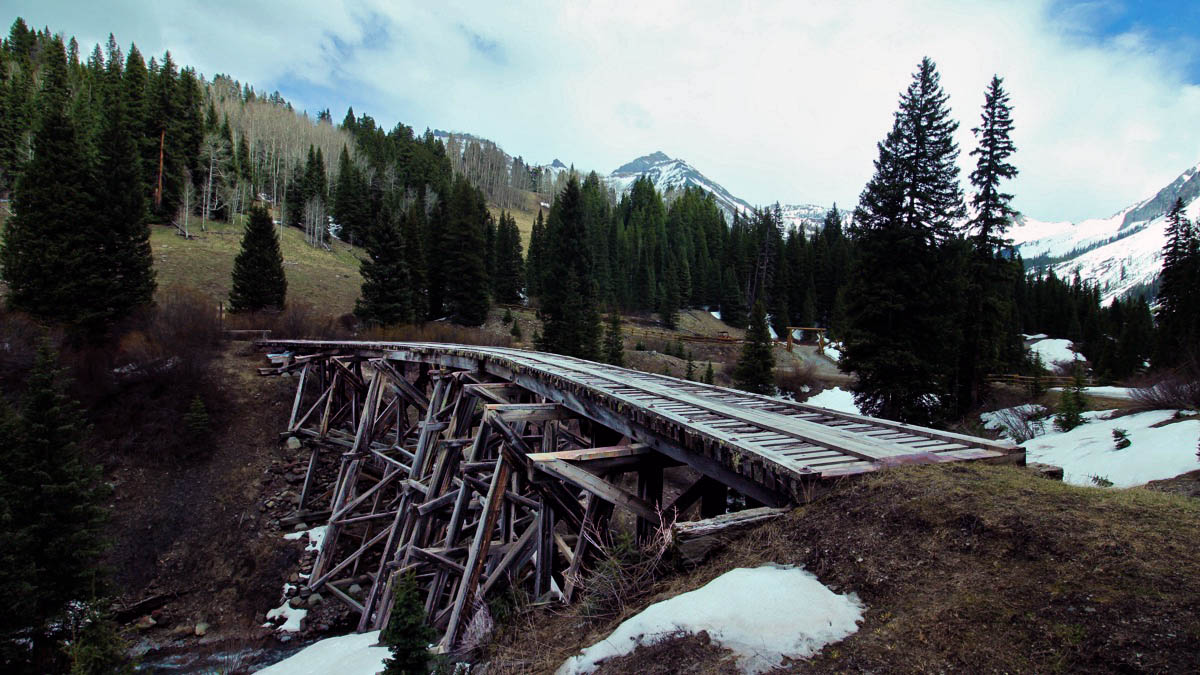
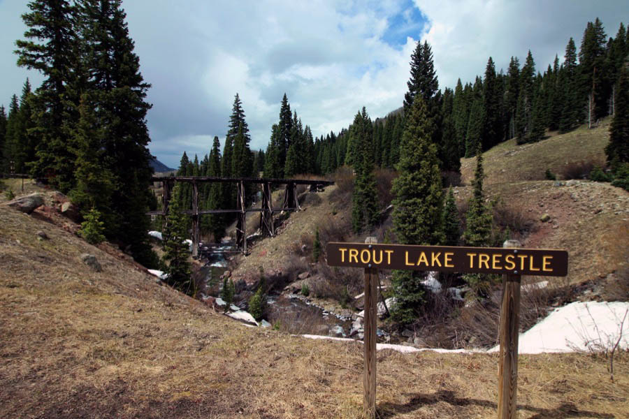
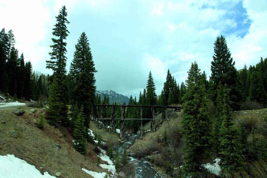
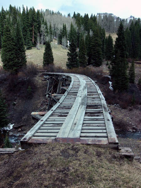
Starting in 1891, Trout Lake was used as a watering station for the Rio Grande Southern Railroad (RGS), which used the water from the lake to fill its steam engines. There were 15 similar stations used by the RGS, all of which were serviced by a large force of men called "water service" who maintained the water tanks. While the railroad is no longer in operation, the 50,000 gallon wood watering tank (one of only two left) and a nearby railroad trestle remain.
After the railroad was abandoned in 1952 the trestle continued to be used as an automobile bridge for several years until a detour was built around it. The trestle was added to the Colorado State Register of Historic Properties on May 14, 1997. The trestle was stabilized in 2004 with grant funds from the Colorado Historical Fund, Intermodel Surface Transportation Efficiency Act, San Miguel County, and US Forest Service.
Trout Lake, Co / May 2023 / RWH
May 2023 / RWH
Trout Lake, Co / Jun 1959 and May 2023 / JCH and RWH
Click to see the Trout Lake water tank plotted on a Google Maps page
May 2023 / RWH
Trout Lake, Co / May 2023 / RWH
Trout Lake, Co / May 2023 / RWH
May 2023 / RWH
Trout Lake, Co / May 2023 / RWH
Trout Lake, Co / May 2023 / RWH
Trout Lake, Co / May 2023 / RWH
Click to see the Trout Lake trestle area plotted on a Google Maps page
Trout Lake, Co / May 2023 / RWH
May 2023 / RWH
Trout Lake, Co / May 2023 / RWH
Trout Lake, Co / May 2023 / RWH
Trout Lake, Co / May 2023 / RWH
Trout Lake, Co / May 2023 / RWH
May 2023 / RWH
Trout Lake, Co / May 2023 / RWH
from Narrow Gauge in the Rockies by Lucius Beebe & Charles Clegg / collection
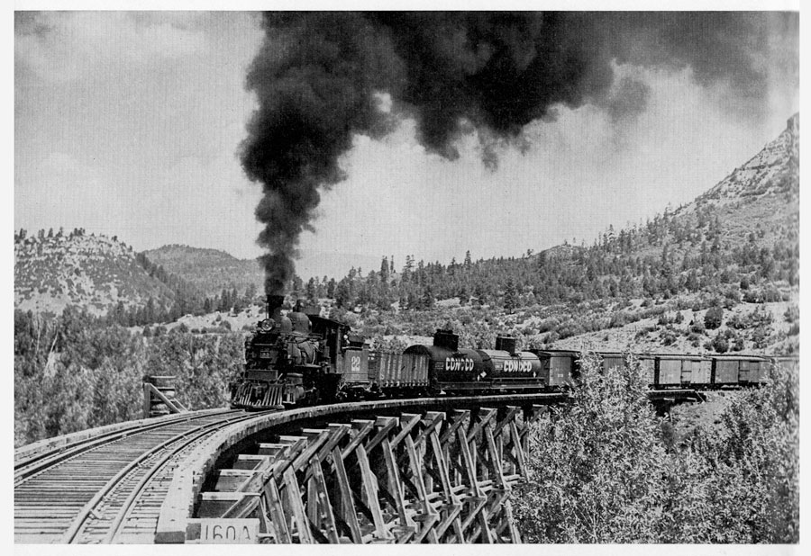
 Rico
Rico
from Narrow Gauge in the Rockies by Lucius Beebe & Charles Clegg / collection
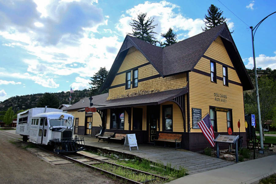
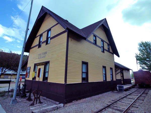
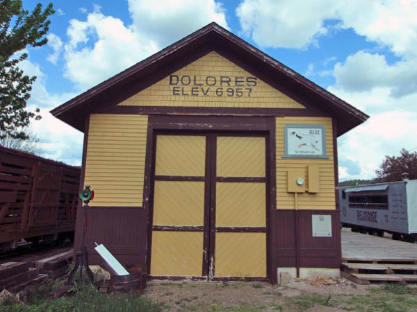
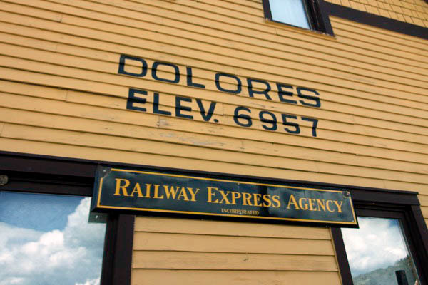
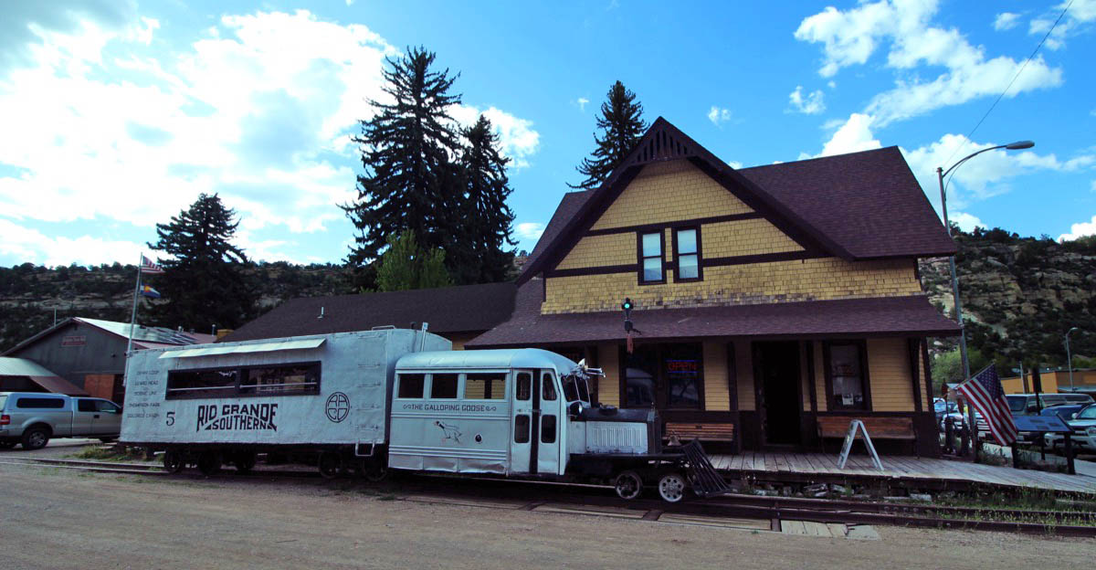
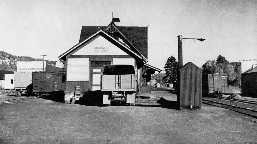
 Dolores

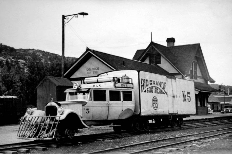
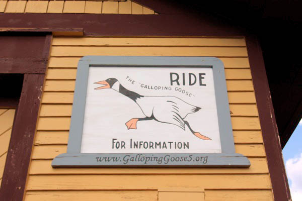
Galloping Goose Historical Society
![]()
 In 1891 the railhead was established at the present site of the town of Dolores. The inhabitants of Big Bend moved everything lock, stock and barrel, to the new site at 6,982 feet elevation and named the town after the river that passed through it.
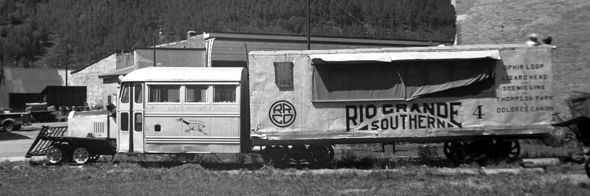
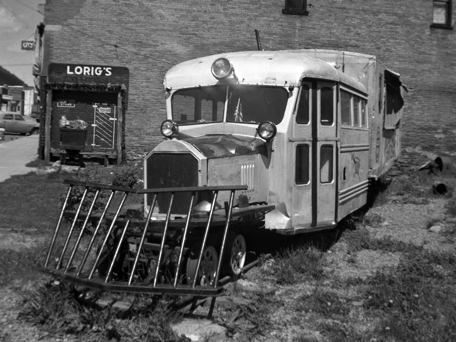
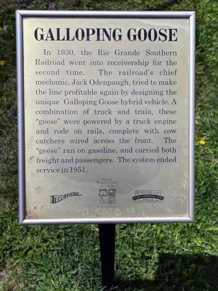
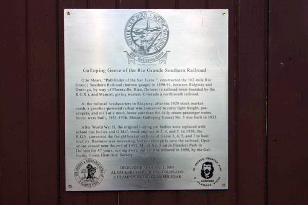
If the Rio Grande Southern Railway had ever been a money making endeavor with the changing economy of it's fledgling days, the Galloping Goose might never have been "hatched" to accommodate mountain travel. The RSG's early revenues came mainly from the silver and gold mines near Telluride, Ophir and Rico. But the repeal of the Sherman Silver Purchase Act caused the Silver Panic of 1893, and silver prices plummeted. As a result, many silver mines were closed, and the railroad slipped into it's first receivership that same year. Nevertheless, the railroad survived — just barely at times — for another 40 years hauling various commodities and passengers until the stock market crash in 1929 spelled the almost certain financial failure of the railroad. It was time to economize! But there remained an obligation and responsibility for the railroad to provide reliable transportation of small amounts of freight, passengers and the always important U.S. mail. There had to be a way! There was. That way was born as an idea that built what later became widely known as the Galloping Goose.
Dolores, Co / May 2023 / RWH
Click to see the Galloping Goose Historical Society plotted on a Google Maps page
Dolores, Co / May 2023 / RWH
Dolores, Co / May 2023 / RWH
May 2023 / RWH
Dolores, Co / May 2023 / RWH
See also our complete Galloping Goose Historical Society scrapbook in Preservation
from Narrow Gauge in the Rockies by Lucius Beebe & Charles Clegg / collection
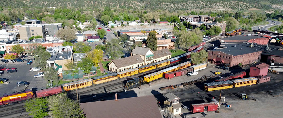
 Durango

from Narrow Gauge in the Rockies by Lucius Beebe & Charles Clegg / collection
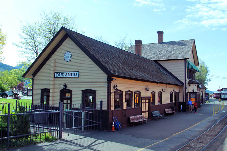
Durango, Co / May 2023 / RWH
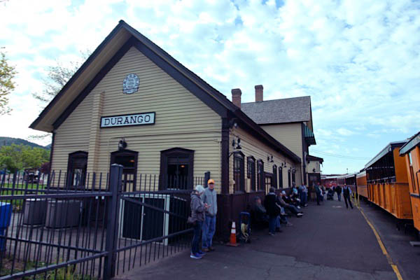
Durango, Co / May 2023 / RWH
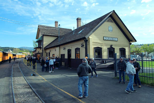
Durango, Co / May 2023 / RWH
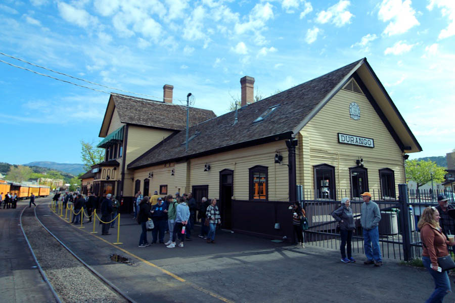
Durango, Co / May 2023 / RWH
Durango, Co / May 2023 / RWH
See also our complete Durango & Silverton Narrow Gauge Railroad scrapbook in Preservation