
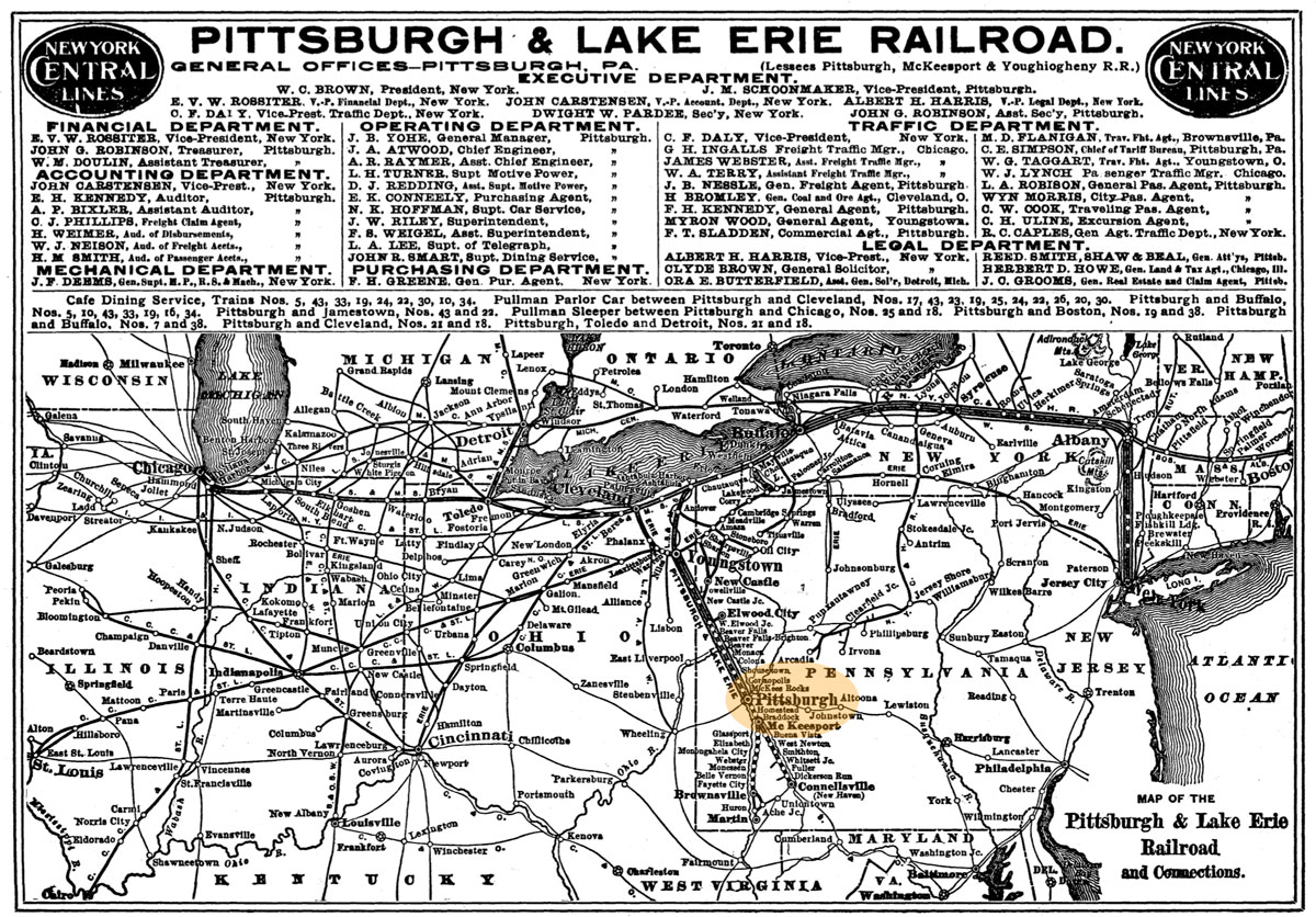
Monongahela Incline"The Mon Incline: A Pittsburgh Icon" |
Pittsburgh, Pa / Jul 2020 / RWH

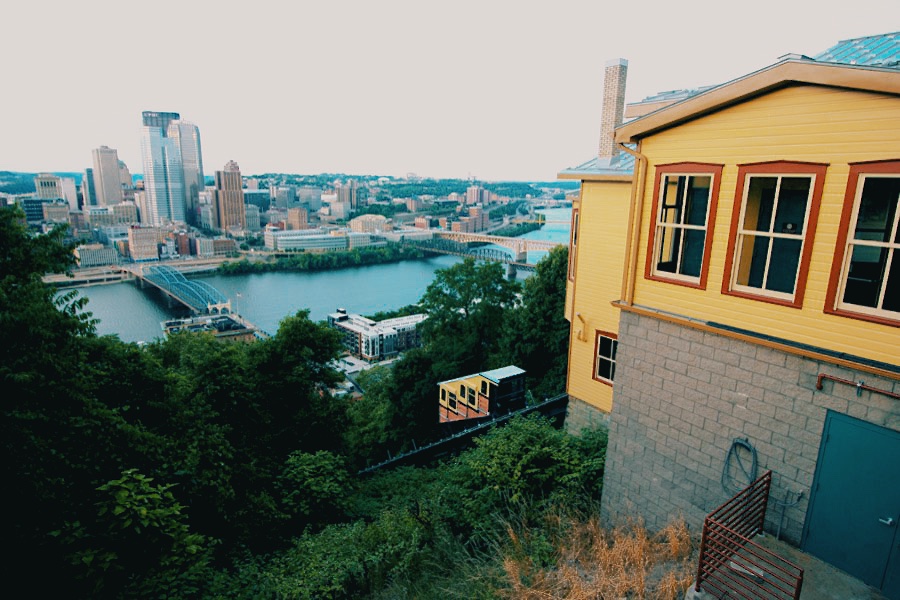
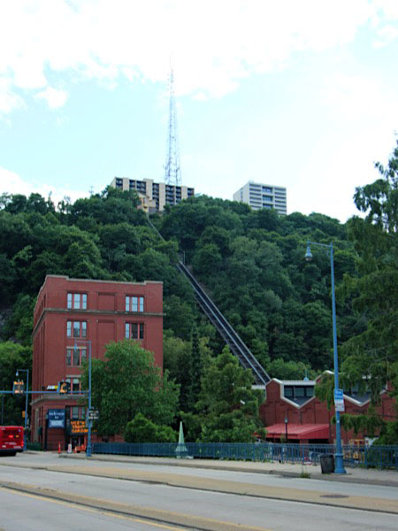
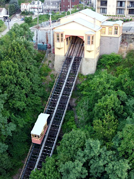
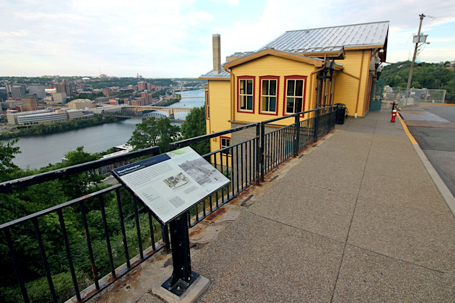
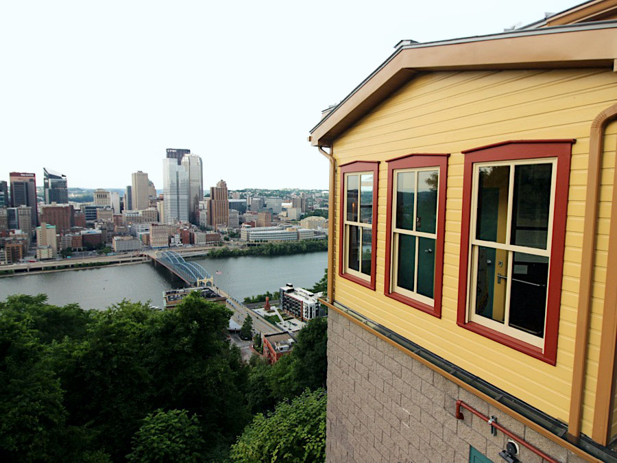
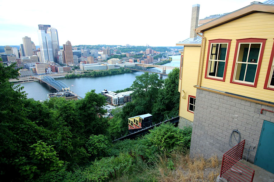
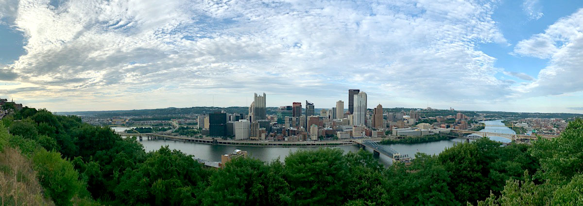
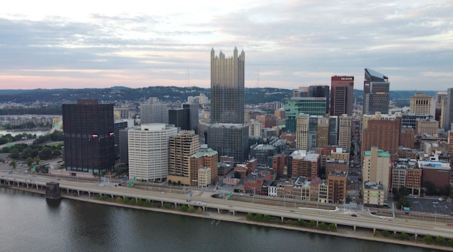
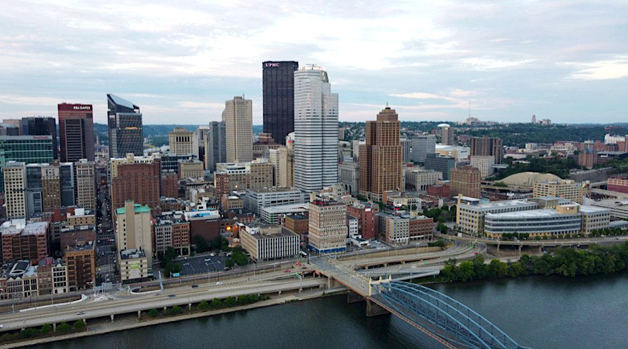
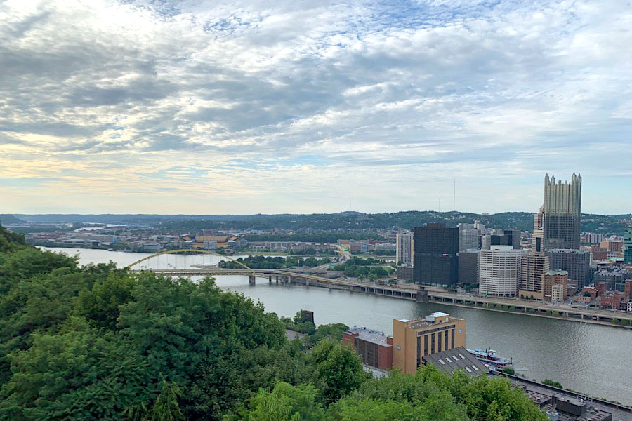
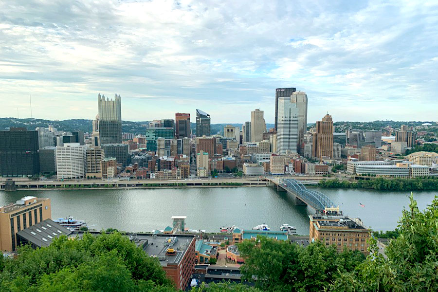
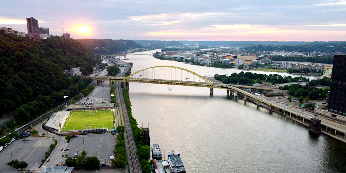
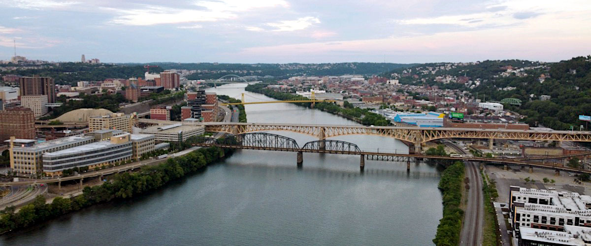
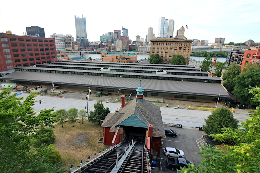
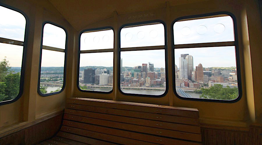
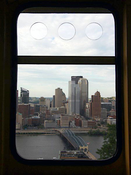
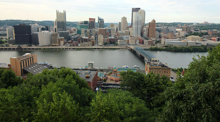
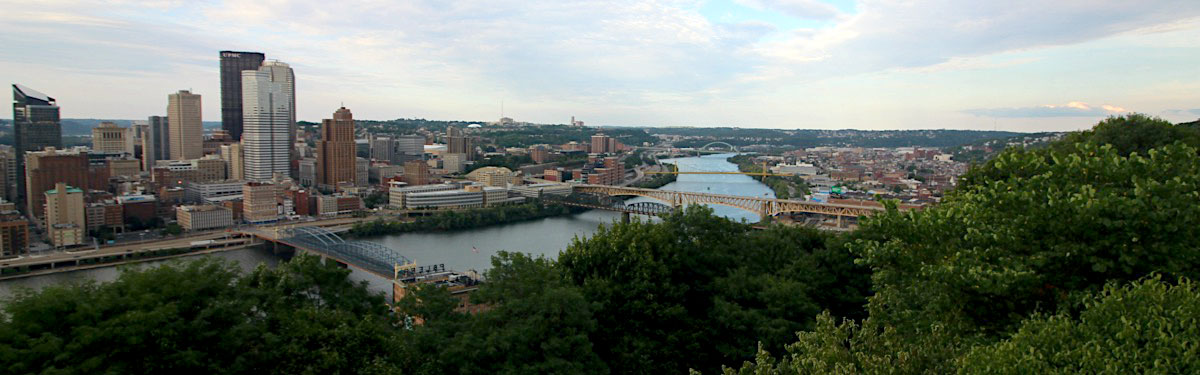
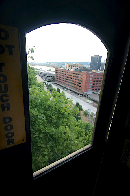
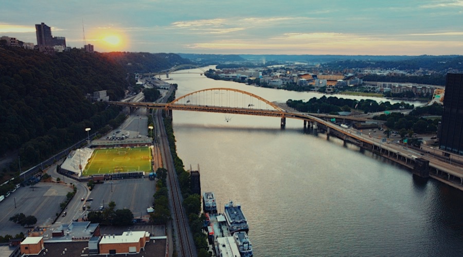
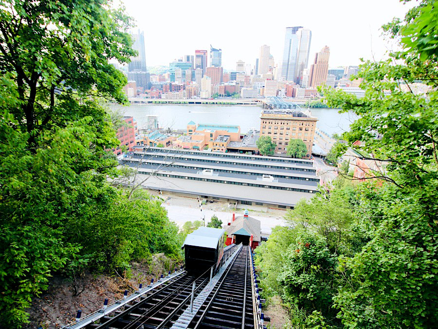
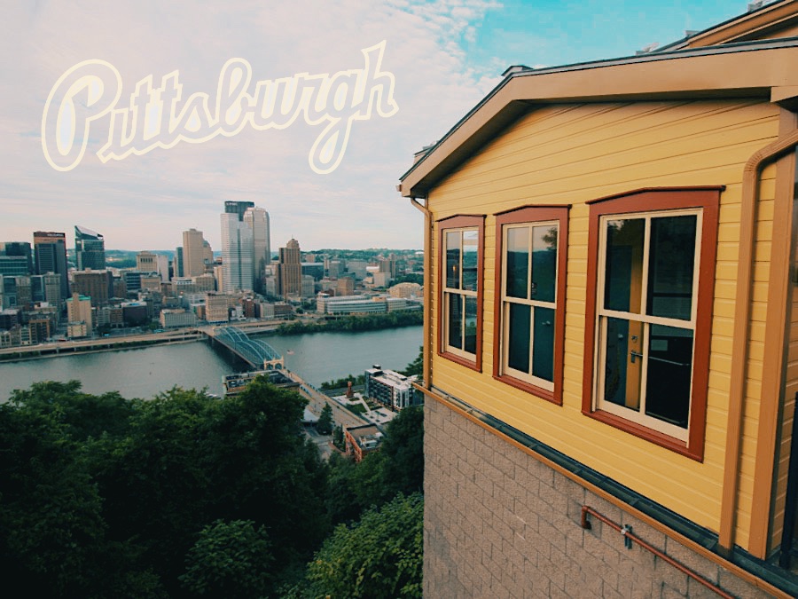
 ittsburgh is renowned for its spectacular cityscape views, and there are no better places to experience them from than the upper stations of The Mon Incline and its sibling The Duquesne Incline, which is located a bit less than a mile west, up the aptly named Grandview Avenue.
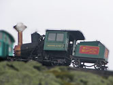
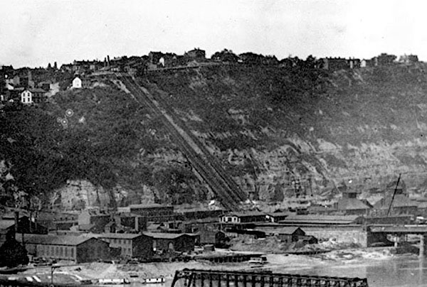
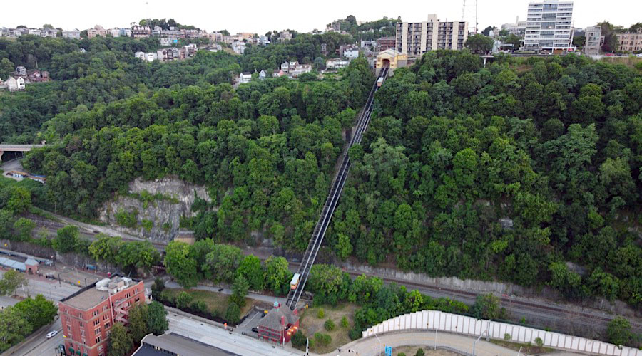
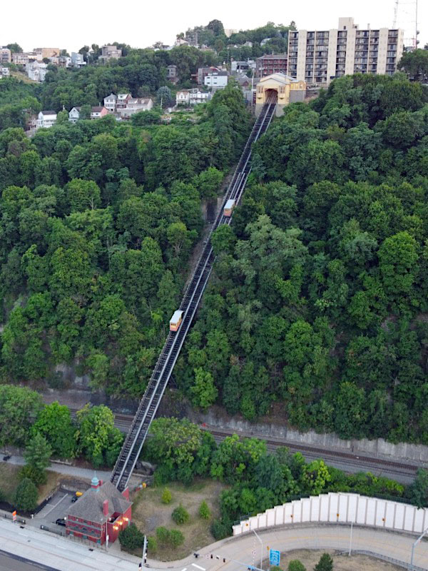
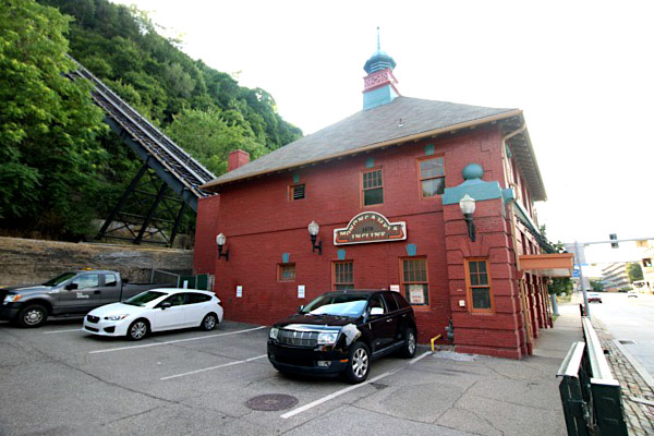
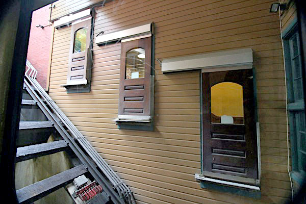
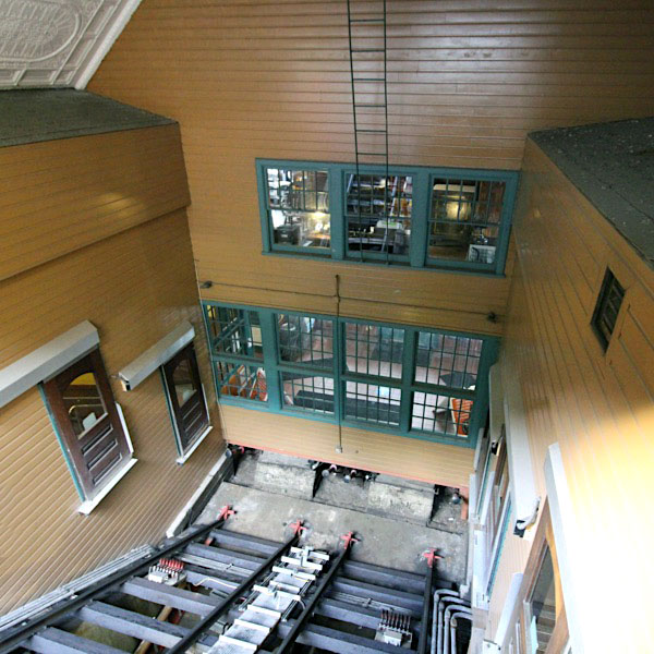
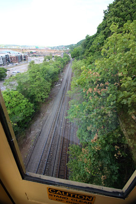
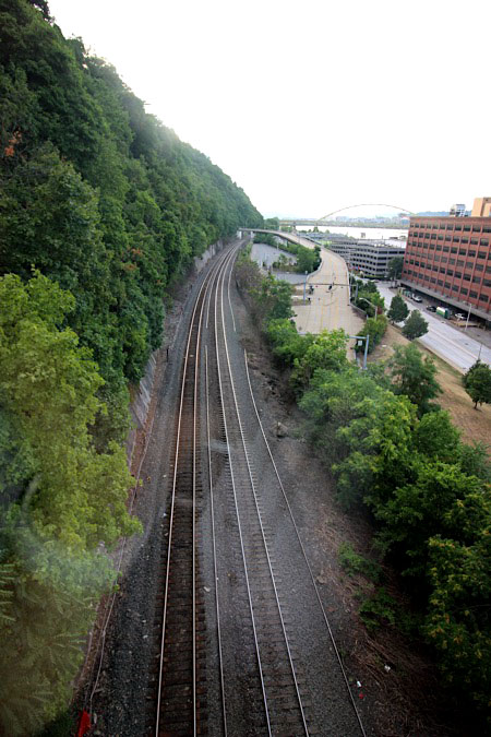
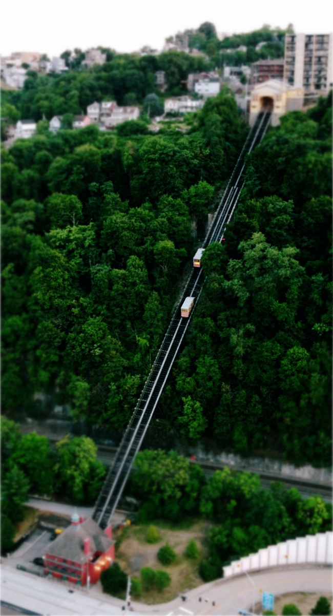
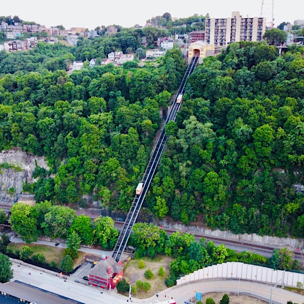
As you travel up or down the incline, you can still see the remnants of a much larger freight incline that ran parallel to the passenger incline until about 1935. The larger incline was capable of transporting horse-drawn freight, and later, motor vehicles. Though only two inclines survive, Pittsburgh was once home to almost two dozen inclines, which provided Pittsburgh residents and their vehicles access to neighborhoods above the steep hills that surround the city.
ittsburgh is renowned for its spectacular cityscape views, and there are no better places to experience them from than the upper stations of The Mon Incline and its sibling The Duquesne Incline, which is located a bit less than a mile west, up the aptly named Grandview Avenue.
As you travel up or down the incline, you can still see the remnants of a much larger freight incline that ran parallel to the passenger incline until about 1935. The larger incline was capable of transporting horse-drawn freight, and later, motor vehicles. Though only two inclines survive, Pittsburgh was once home to almost two dozen inclines, which provided Pittsburgh residents and their vehicles access to neighborhoods above the steep hills that surround the city.
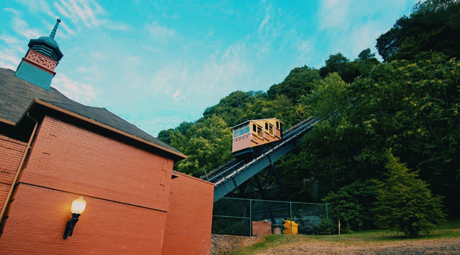
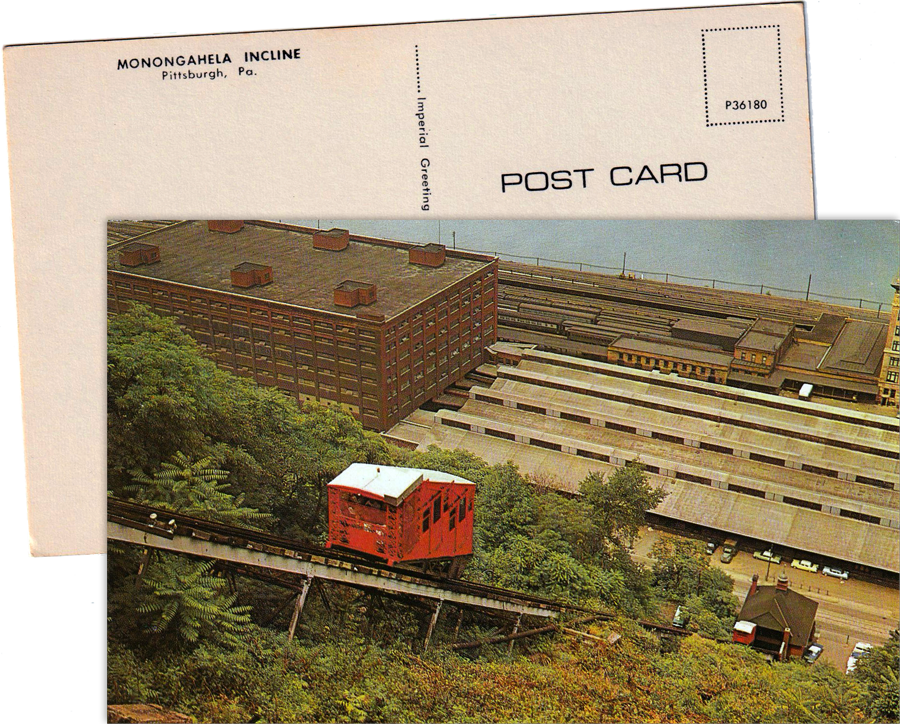
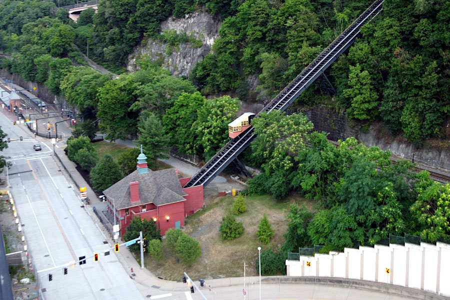
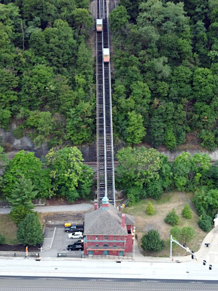
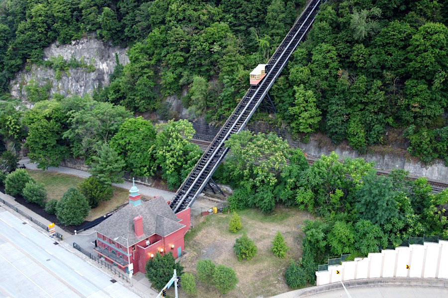
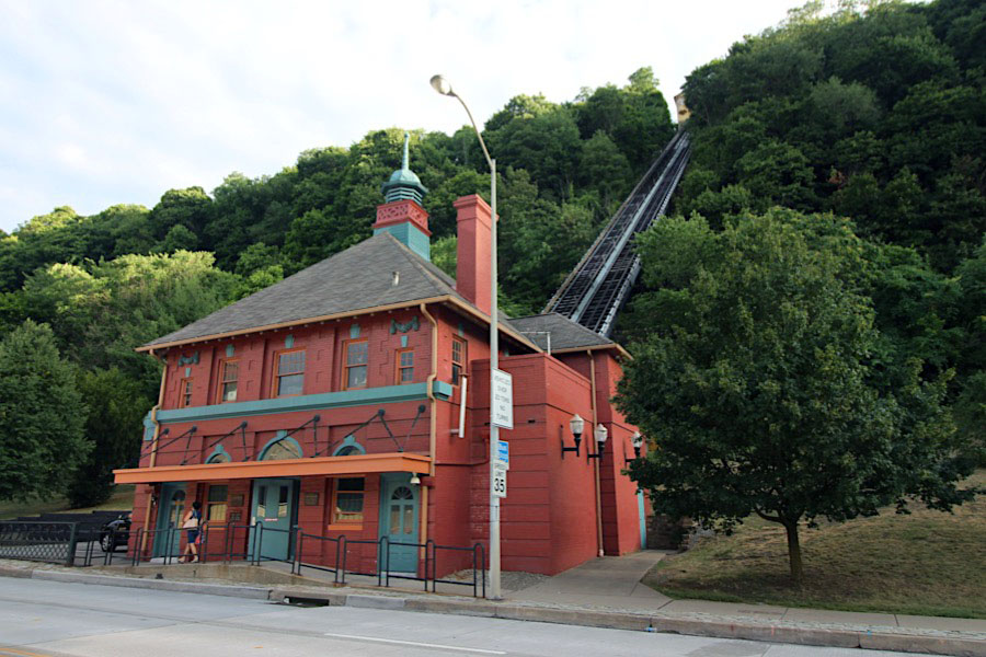
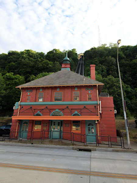
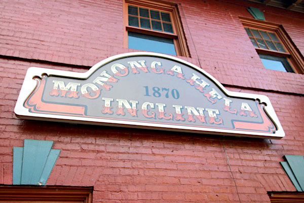
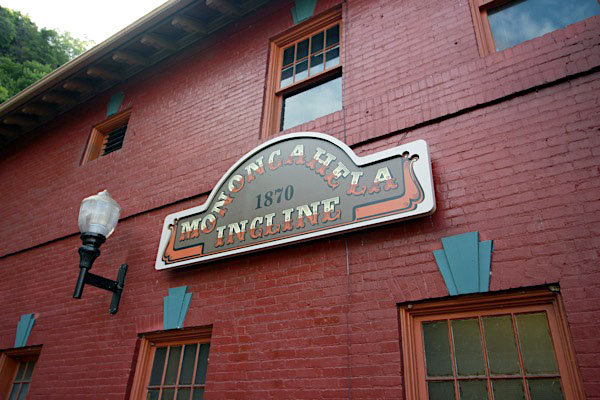
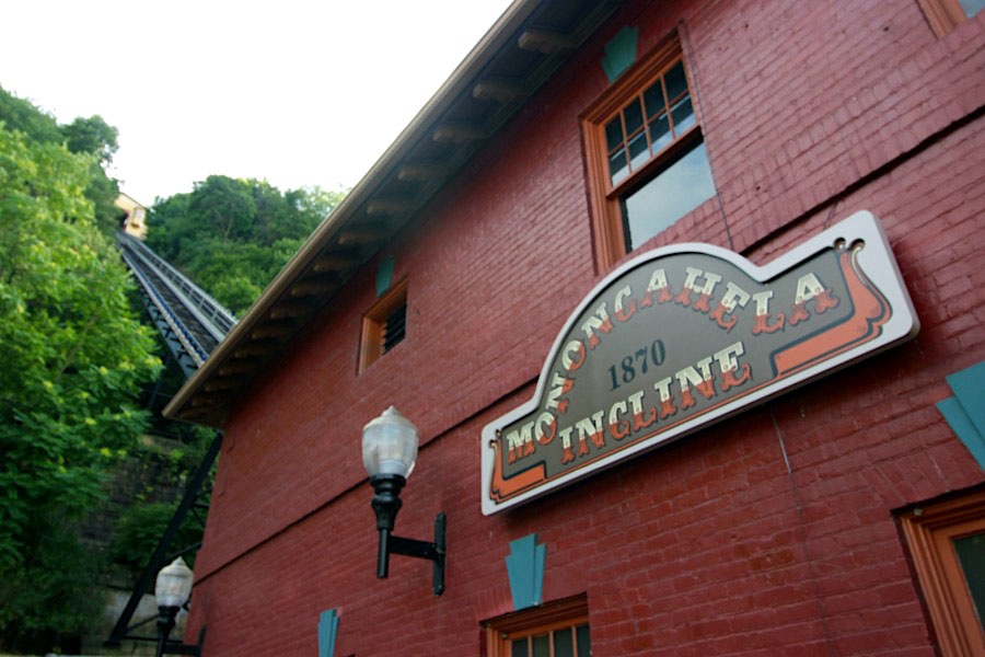
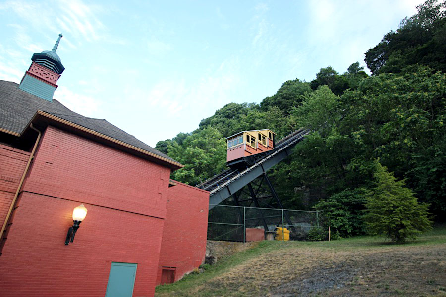
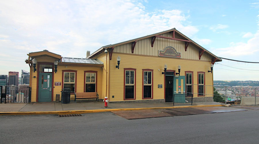
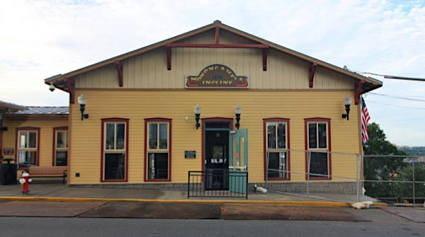
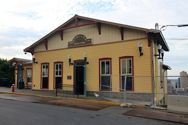
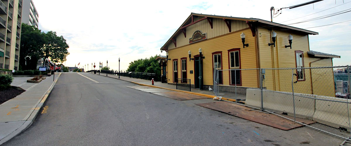
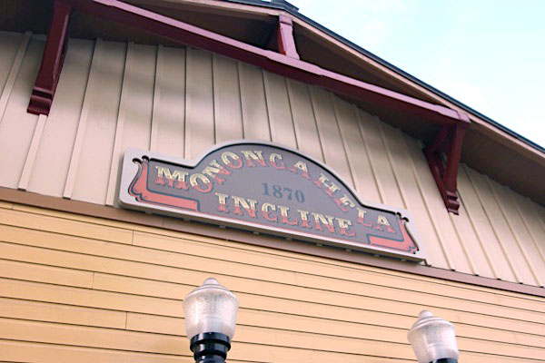
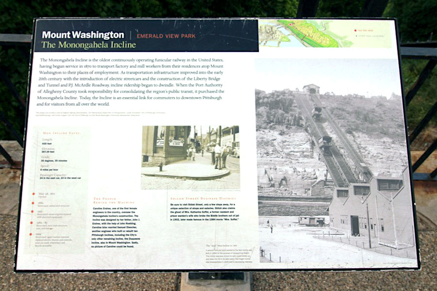
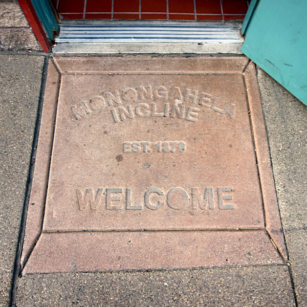
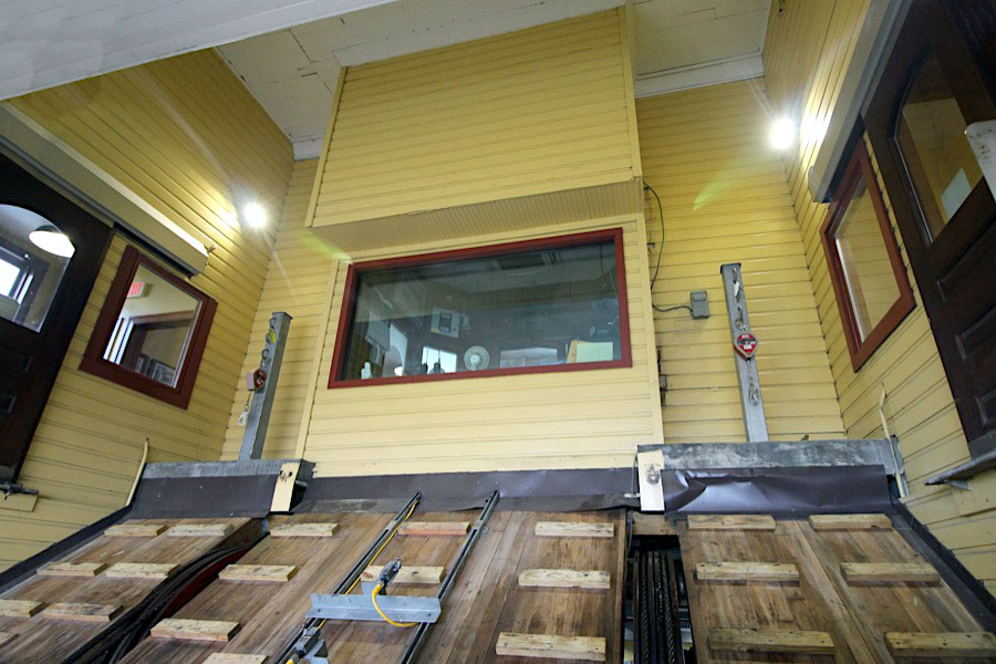
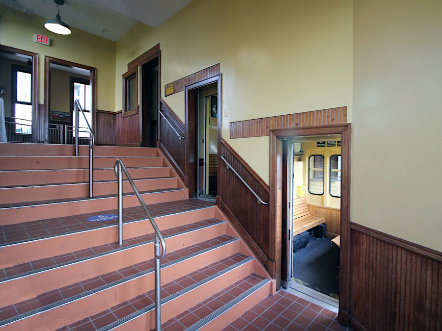
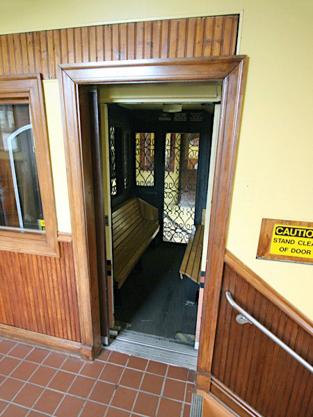
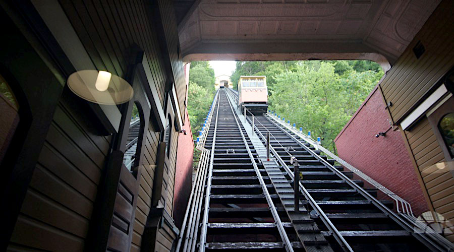
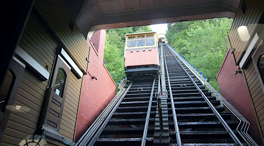
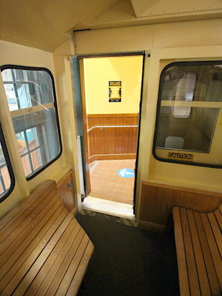
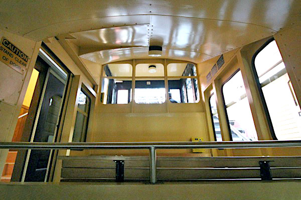
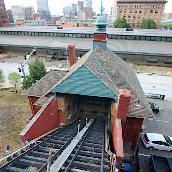
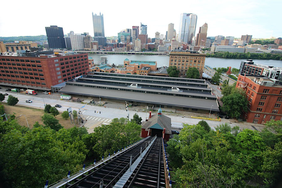
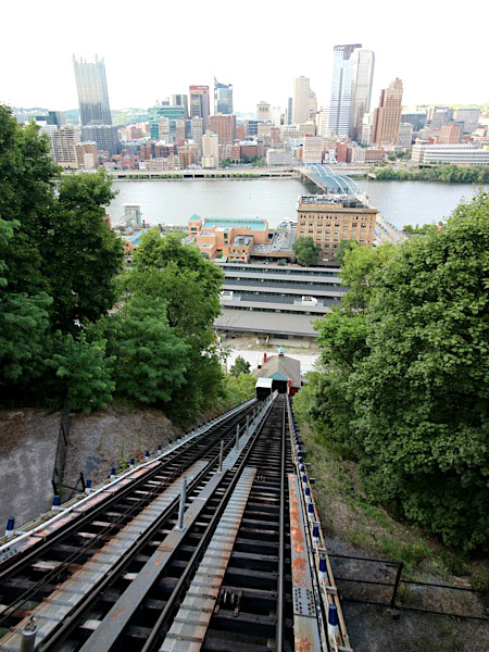
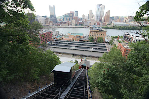
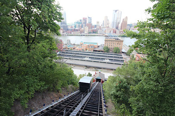
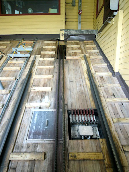
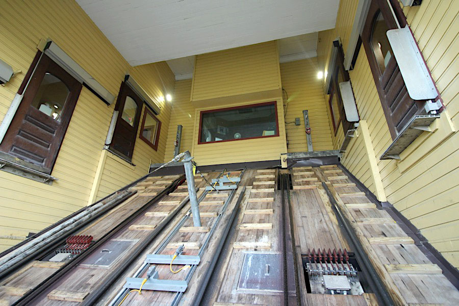
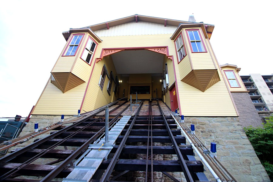
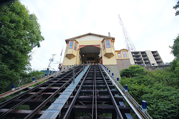
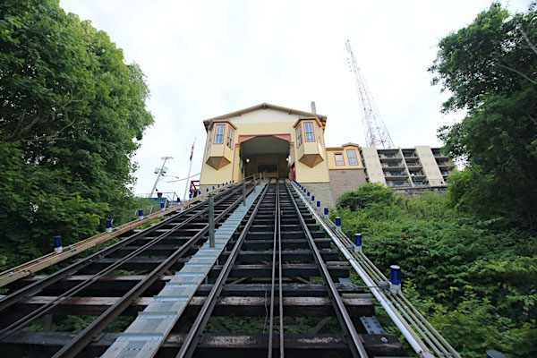
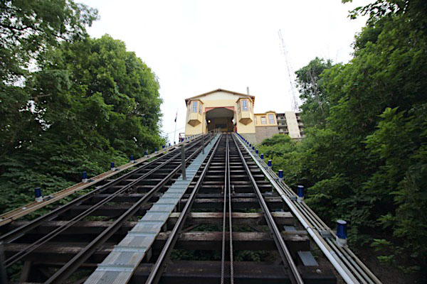
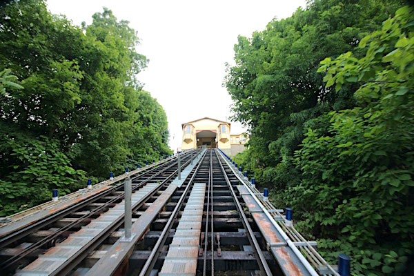
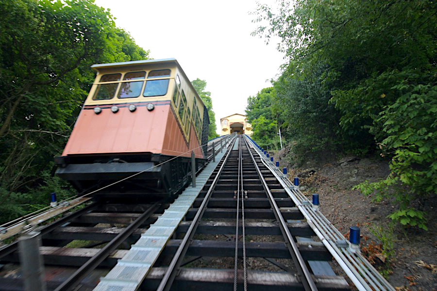
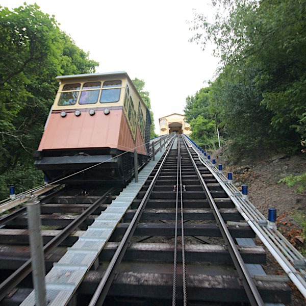
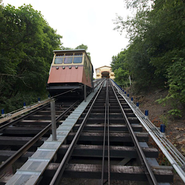
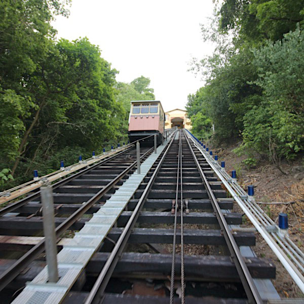
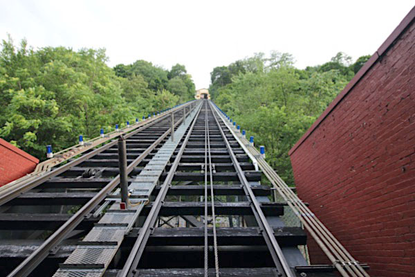
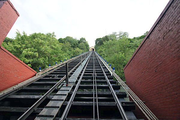
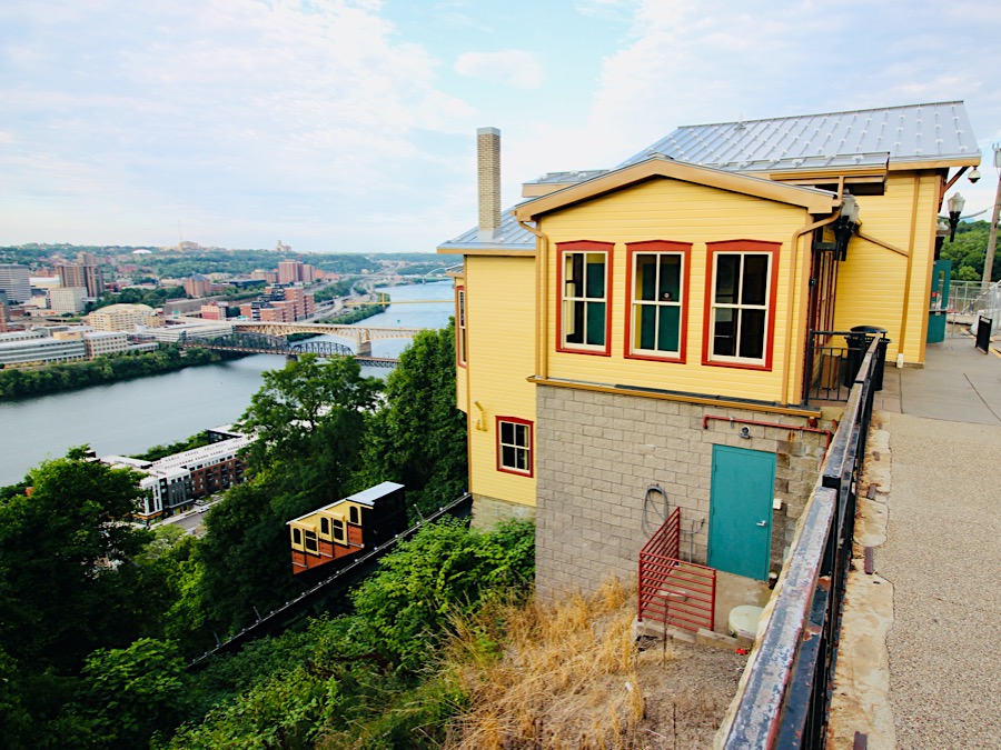
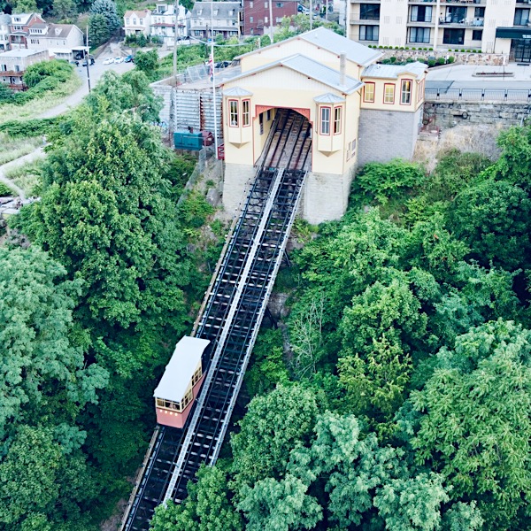
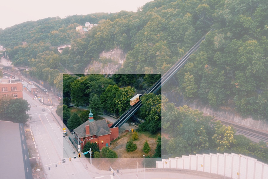
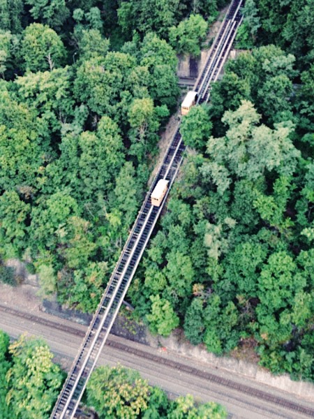
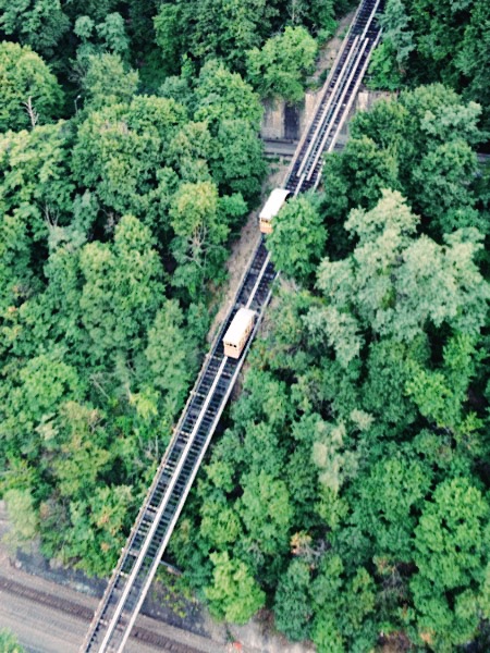
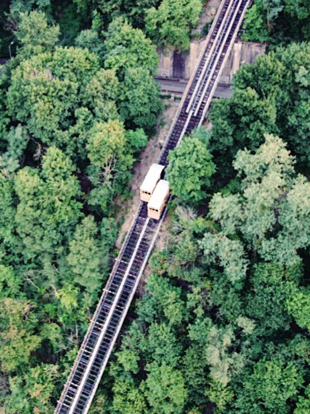
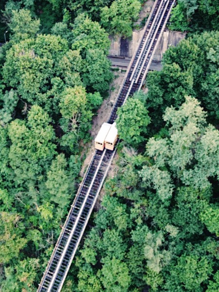
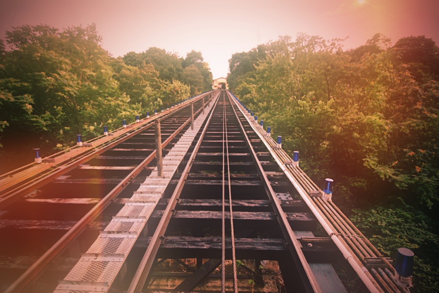
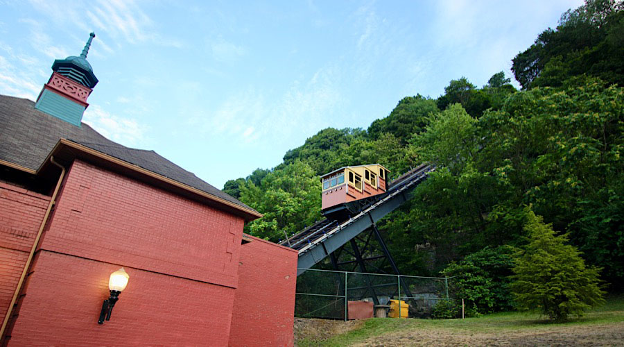
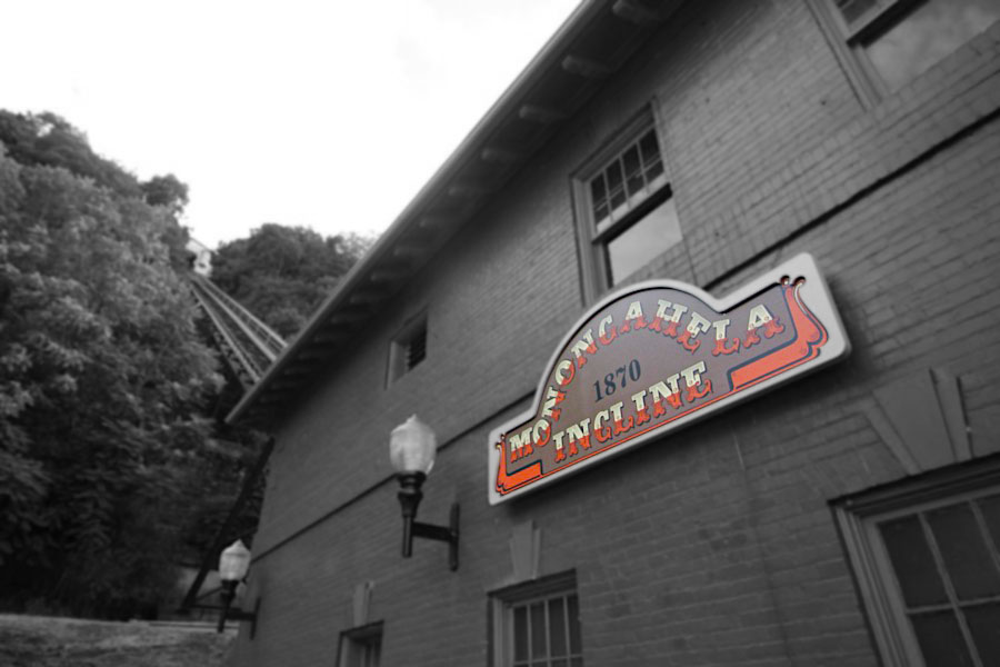
 he Monongahela Incline is a funicular located near the Smithfield Street Bridge in Pittsburgh, Pennsylvania. Designed and built by Prussian-born engineer John Endres in 1870, it is the oldest continuously operating funicular in the United States. It was first electrified in 1935, replacing the original steam power.
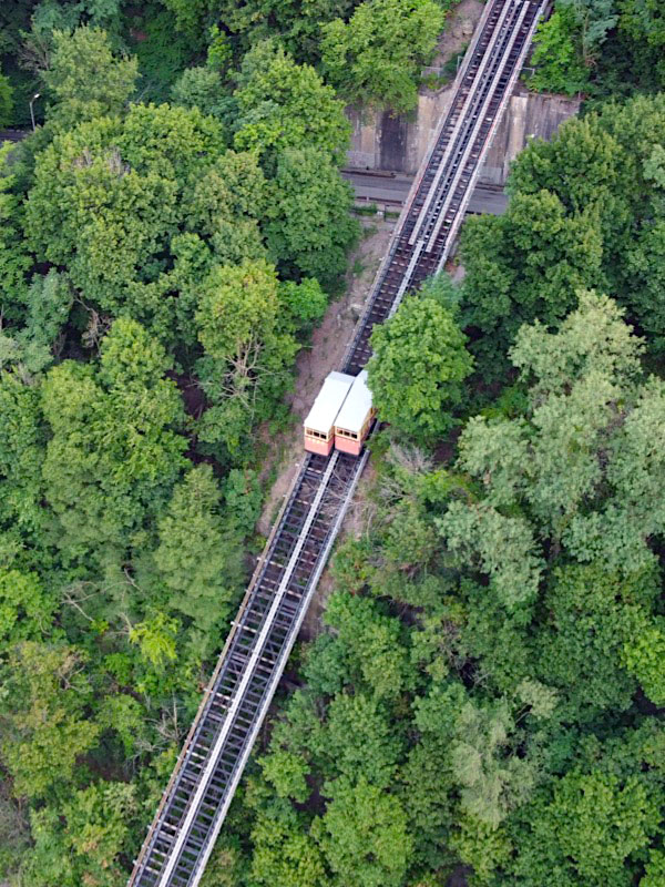
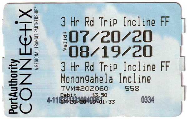
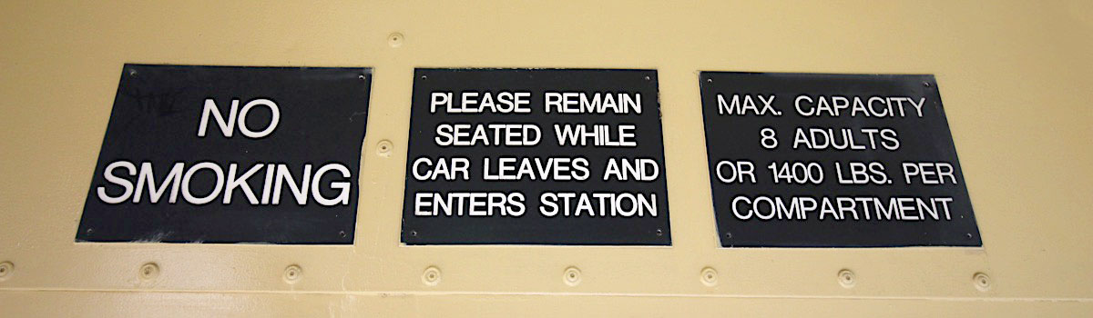
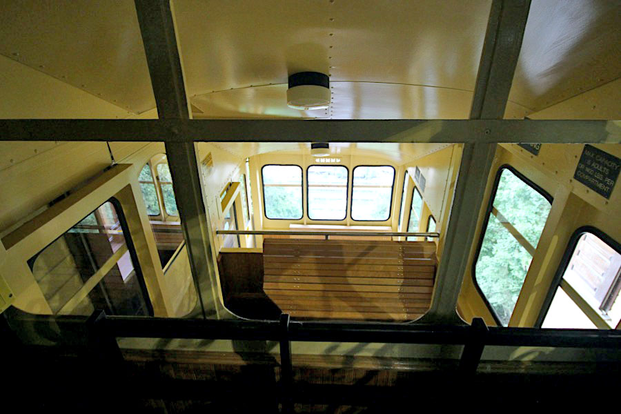
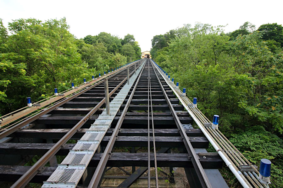
It is one of two surviving inclines in Pittsburgh (the other is nearby Duquesne Incline) from the original 17 passenger-carrying inclines built along Mount Washington starting in the late 19th century. The Monongahela lower station is across the street from what is now the Station Square shopping complex, accessible from Pittsburgh's light rail system at the Station Square station. The 5 foot gauge trackage is 635 feet long at a 35 degree angle, with two cars each travelling at 6 mph.
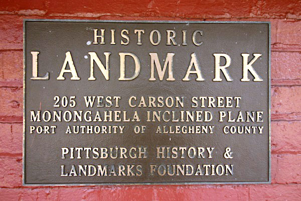
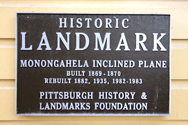
The Monongahela Incline was listed on the National Register of Historic Places in 1974, and in 1977 both inclines were designated as Historic Mechanical Engineering Landmarks by the American Society of Mechanical Engineers. Both inclines are today owned and operated by the Port Authority of Allegheny County.
he Monongahela Incline is a funicular located near the Smithfield Street Bridge in Pittsburgh, Pennsylvania. Designed and built by Prussian-born engineer John Endres in 1870, it is the oldest continuously operating funicular in the United States. It was first electrified in 1935, replacing the original steam power.
It is one of two surviving inclines in Pittsburgh (the other is nearby Duquesne Incline) from the original 17 passenger-carrying inclines built along Mount Washington starting in the late 19th century. The Monongahela lower station is across the street from what is now the Station Square shopping complex, accessible from Pittsburgh's light rail system at the Station Square station. The 5 foot gauge trackage is 635 feet long at a 35 degree angle, with two cars each travelling at 6 mph.
The Monongahela Incline was listed on the National Register of Historic Places in 1974, and in 1977 both inclines were designated as Historic Mechanical Engineering Landmarks by the American Society of Mechanical Engineers. Both inclines are today owned and operated by the Port Authority of Allegheny County.
Pittsburgh, Pa / Jul 2020 / RWH
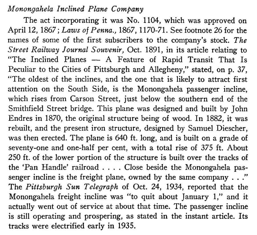
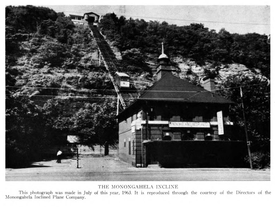
from The Western Pennsylvania Historical Magazine - Oct 1963 / collection

postcard / collection

See also these related Pittsburgh scrapbooks:
Locations
Pittsburgh, Pa / Jul 2020 / RWH
Pittsburgh, Pa / Jul 2020 / RWH
Pittsburgh, Pa / Jul 2020 / RWH
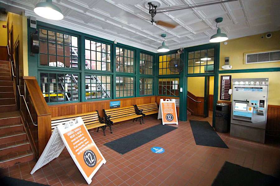
 Lower Station
Pittsburgh, Pa / Jul 2020 / RWH
Jul 2020 / RWH
Pittsburgh, Pa / Jul 2020 / RWH
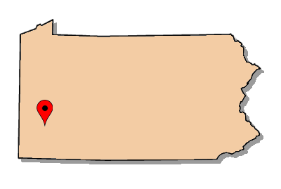
Click to see the Monongahela Incline lower station plotted on a Google Maps page
Pittsburgh, Pa / Jul 2020 / RWH
Jul 2020 / RWH
Pittsburgh, Pa / Jul 2020 / RWH
Jul 2020 / RWH
Jul 2020 / RWH
Jul 2020 / RWH
from The Western Pennsylvania Historical Magazine - Oct 1963 / collection
Pittsburgh, Pa / Jul 2020 / RWH
Jul 2020 / RWH
Pittsburgh, Pa / Jul 2020 / RWH
Jul 2020 / RWH
Upper Station

Pittsburgh, Pa / Jul 2020 / RWH
Jul 2020 / RWH
Click to see the Monongahela Incline upper station plotted on a Google Maps page
Pittsburgh, Pa / Jul 2020 / RWH
Pittsburgh, Pa / Jul 2020 / RWH
Pittsburgh, Pa / Jul 2020 / RWH
Pittsburgh, Pa / Jul 2020 / RWH
Jul 2020 / RWH
Jul 2020 / RWH
Pittsburgh, Pa / Jul 2020 / RWH
Jul 2020 / RWH
Jul 2020 / RWH
Jul 2020 / RWH
Jul 2020 / RWH
Jul 2020 / RWH
Jul 2020 / RWH
Pittsburgh, Pa / Jul 2020 / RWH
Pittsburgh, Pa / Jul 2020 / RWH
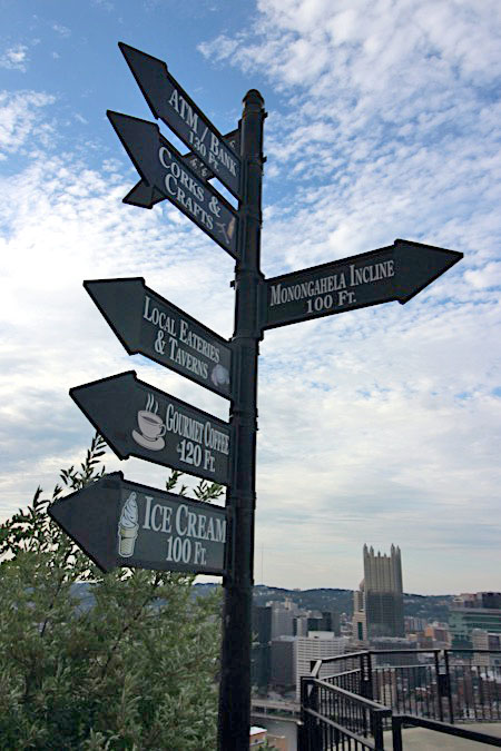
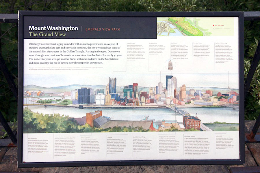
 The Grand View
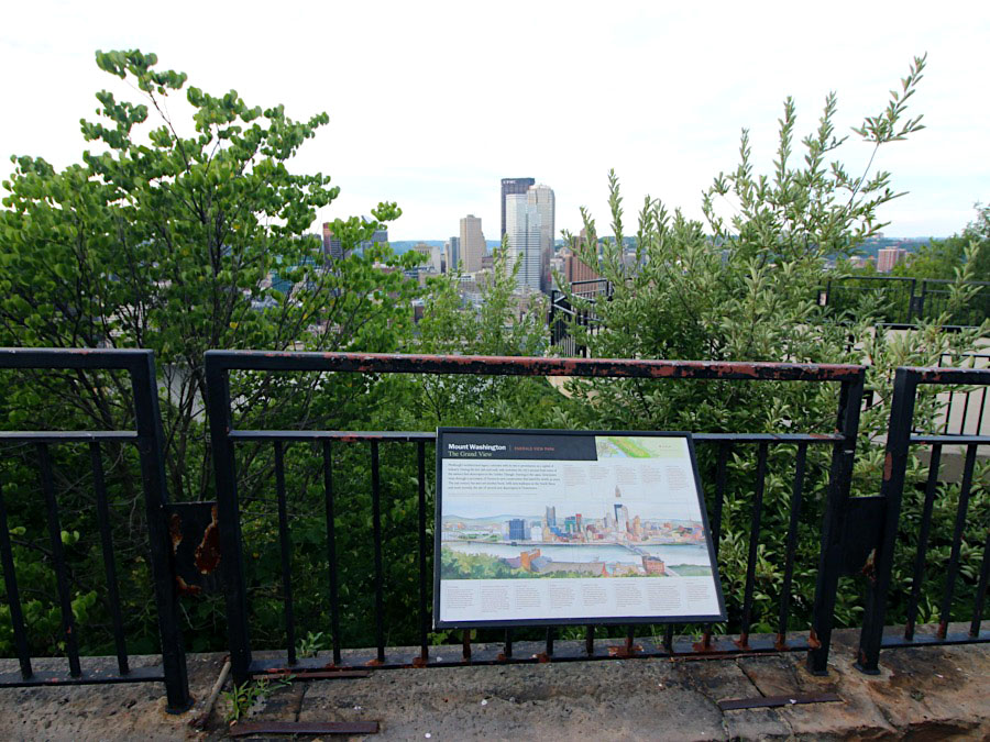
Mount Washington, Pa / Jun 2020 / RWH
Jul 2020 / RWH
ittsburgh is renowned for its spectacular cityscape views, and there are no better places to experience them from than the upper stations of The Mon Incline and its sibling The Duquesne Incline, which is located a bit less than a mile west, up the aptly named Grandview Avenue.
Mount Washington, Pa / Jun 2020 / RWH
Click to see the Grandview Overlook park plotted on a Google Maps page
Mount Washington, Pa / Jun 2020 / RWH
Mount Washington, Pa / Jun 2020 / RWH
Mount Washington, Pa / Jun 2020 / RWH
Mount Washington, Pa / Jun 2020 / RWH
Mount Washington, Pa / Jun 2020 / RWH
Mount Washington, Pa / Jun 2020 / RWH
Incline Ride
Pittsburgh, Pa / Jul 2020 / RWH
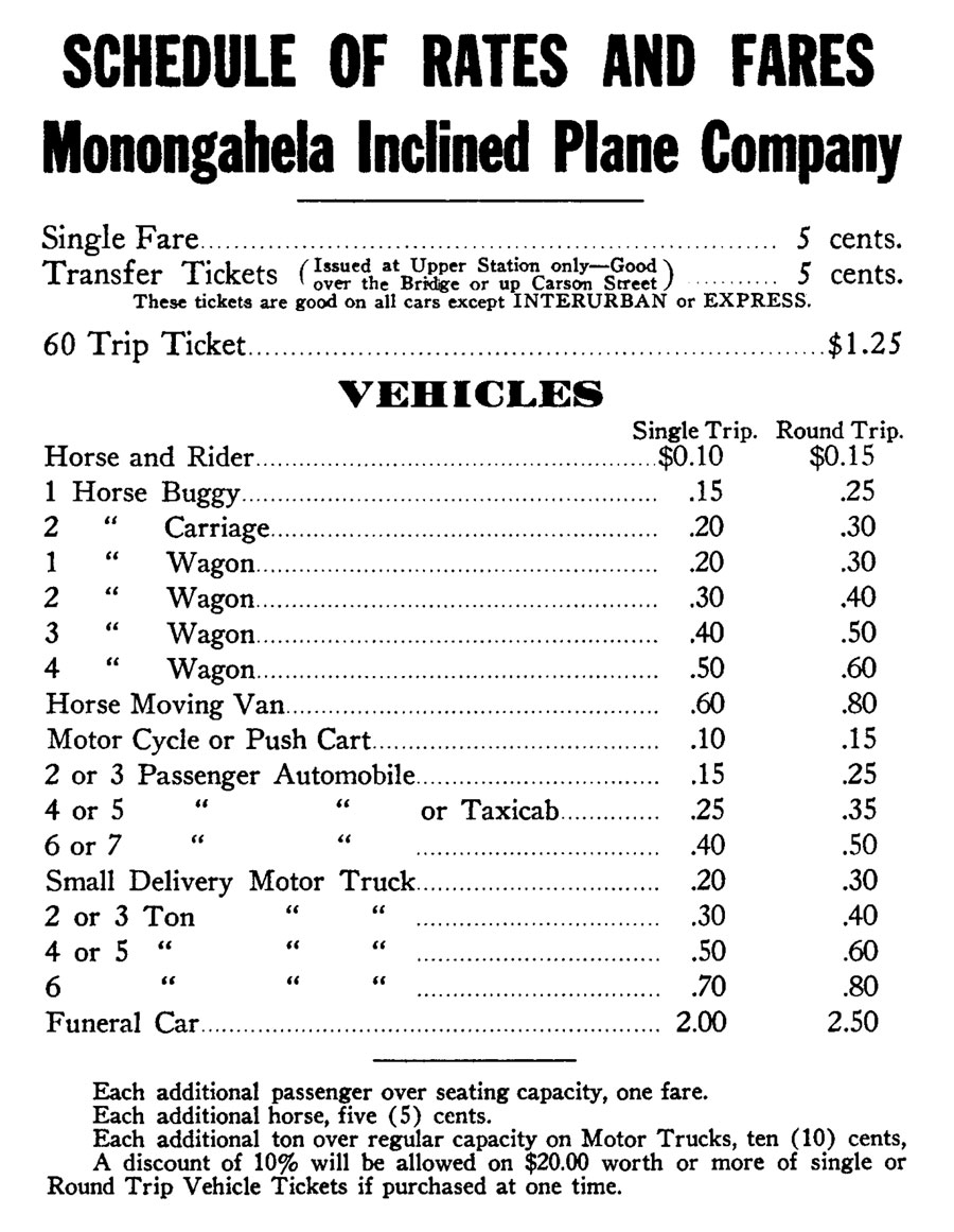
1914 rate sheet / from The Western Pennsylvania Historical Magazine - Oct 1963 / collection
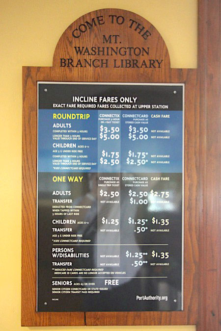
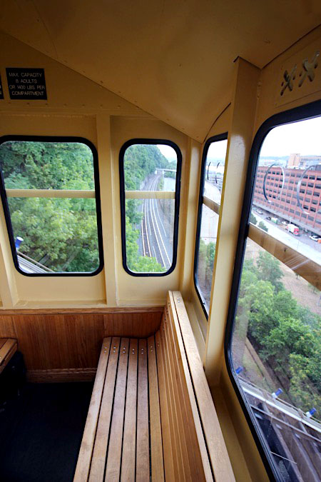
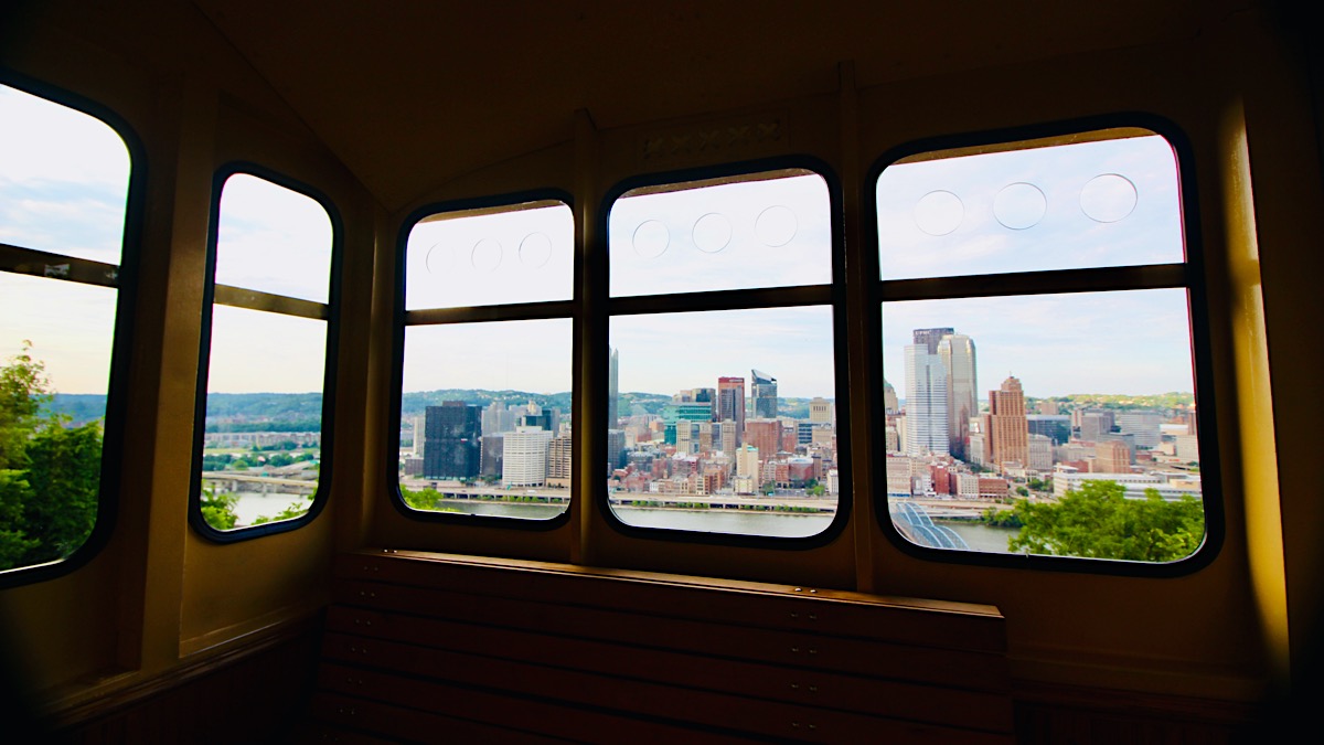
 he incline transports over half a million passengers a year between the upper terminal at Grandview Ave. and the lower, at Carson Street. Many residents of Mount Washington use the incline in their daily commutes, as it provides easy access to the Pittsburgh Light Rail system known as The T, as well as bus routes and The Smithfield Bridge over the Monongahela River to the heart of downtown.
Jul 2020 / RWH
Pittsburgh, Pa / Jul 2020 / RWH
Jul 2020 / RWH
Jul 2020 / RWH
Jul 2020 / RWH
Jul 2020 / RWH
Pittsburgh, Pa / Jul 2020 / RWH
Pittsburgh, Pa / Jul 2020 / RWH
Jul 2020 / RWH
Jul 2020 / RWH
Pittsburgh, Pa / Jul 2020 / RWH
Jul 2020 / RWH
Pittsburgh, Pa / Jul 2020 / RWH
Pittsburgh, Pa / Jul 2020 / RWH
Jul 2020 / RWH
Pittsburgh, Pa / Jul 2020 / RWH
Jul 2020 / RWH
Pittsburgh, Pa / Jul 2020 / RWH
Pittsburgh, Pa / Jul 2020 / RWH
Jul 2020 / RWH
Jul 2020 / RWH
Jul 2020 / RWH
Jul 2020 / RWH
Pittsburgh, Pa / Jul 2020 / RWH
Pittsburgh, Pa / Jul 2020 / RWH
Pittsburgh, Pa / Jul 2020 / RWH
Jul 2020 / RWH
Jul 2020 / RWH
Pittsburgh, Pa / Jul 2020 / RWH
Pittsburgh, Pa / Jul 2020 / RWH
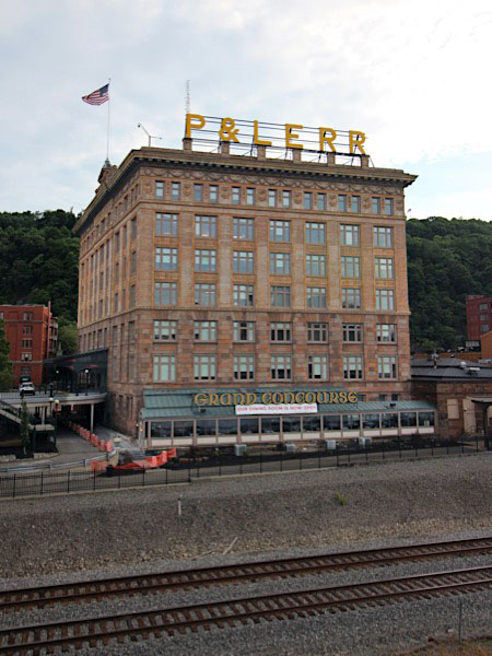
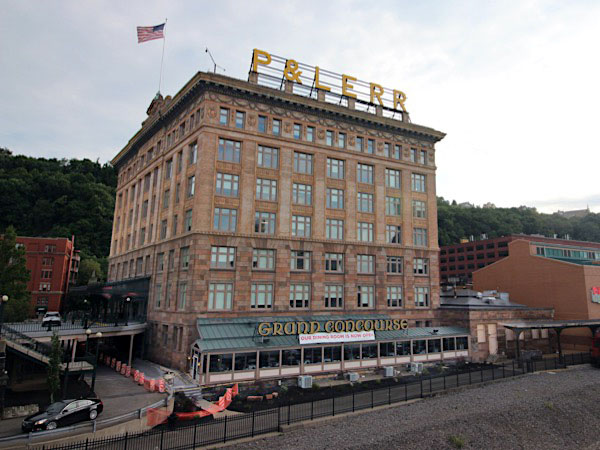
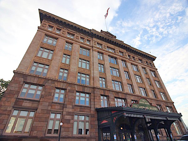
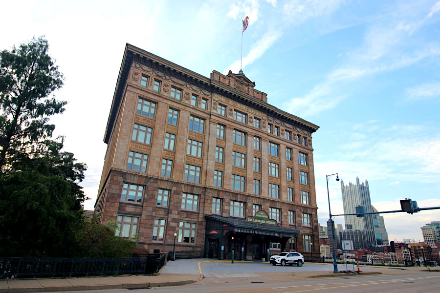
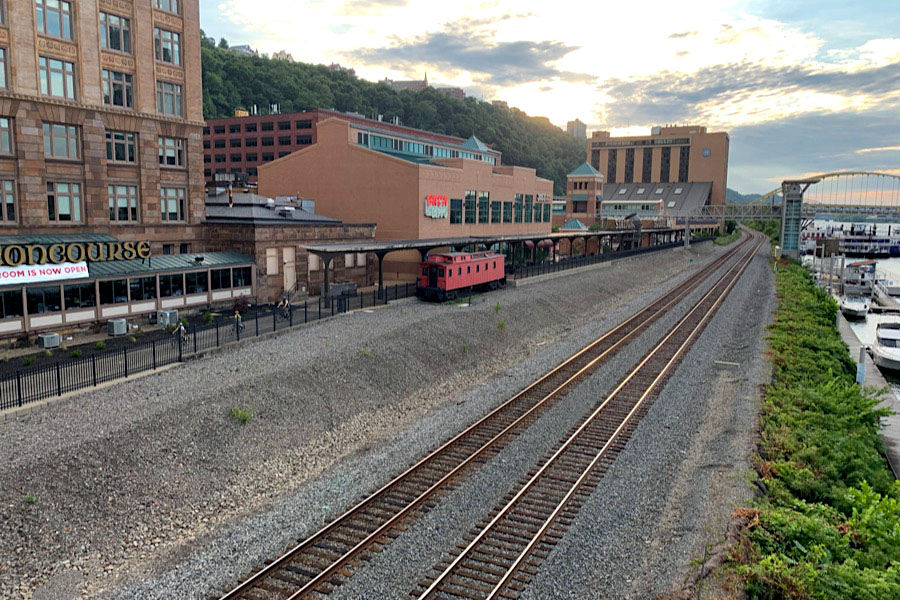
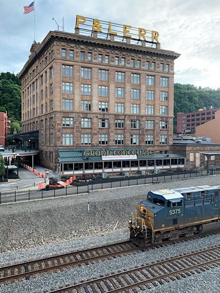
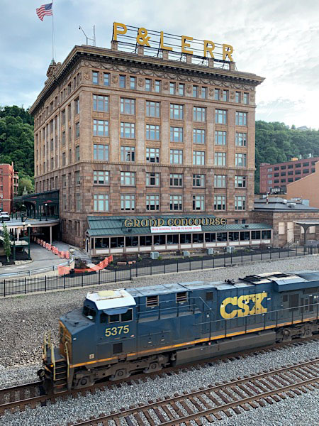
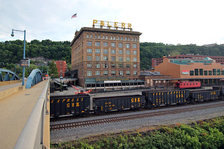
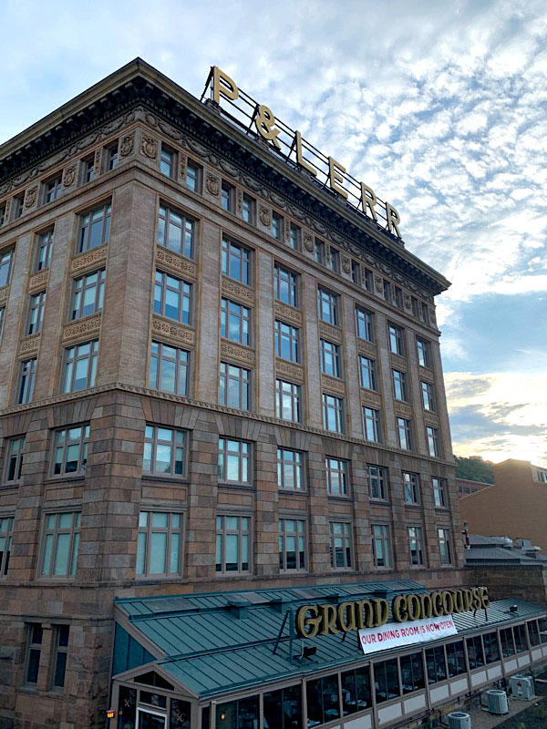
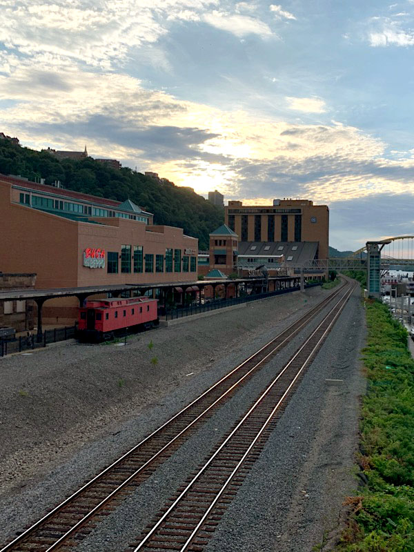
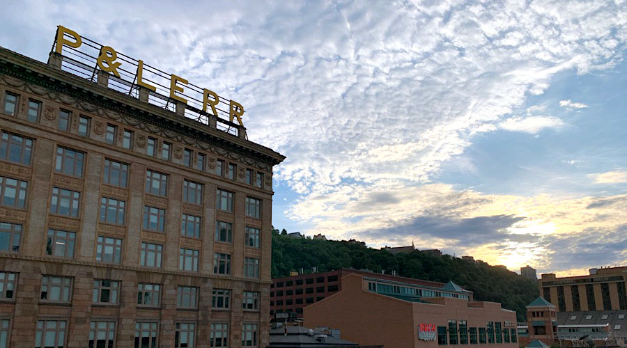
P&LE Building
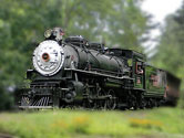
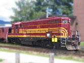
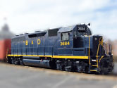
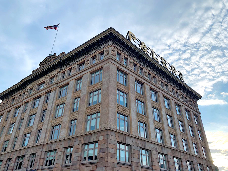
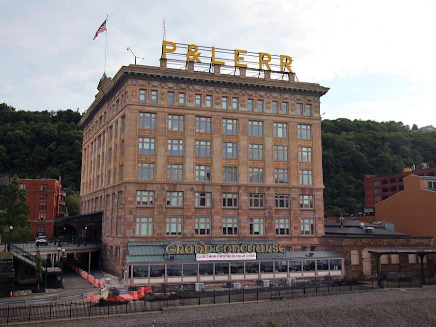
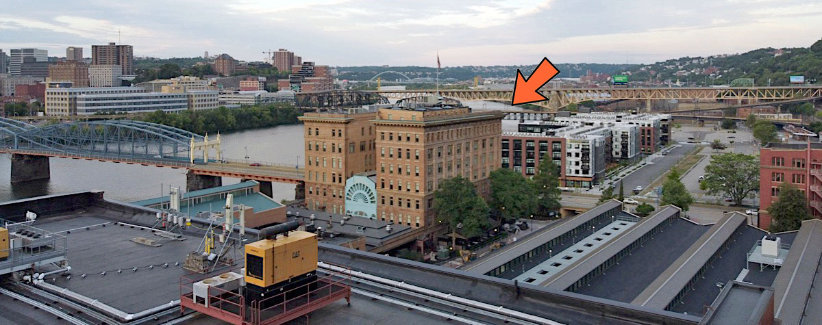
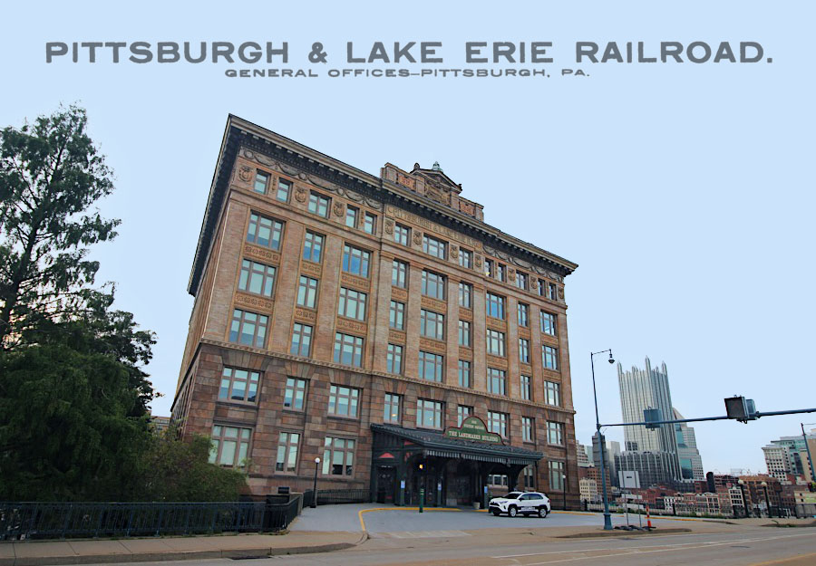
Just around the corner from the Monongahela Incline lower station sits the 1898 passenger station of the former Pittsburgh & Lake Erie Railroad Company. CSX Transportation now operates the busy mainline between the P&LE building and the Monongahela River.
Jul 2020 / RWH
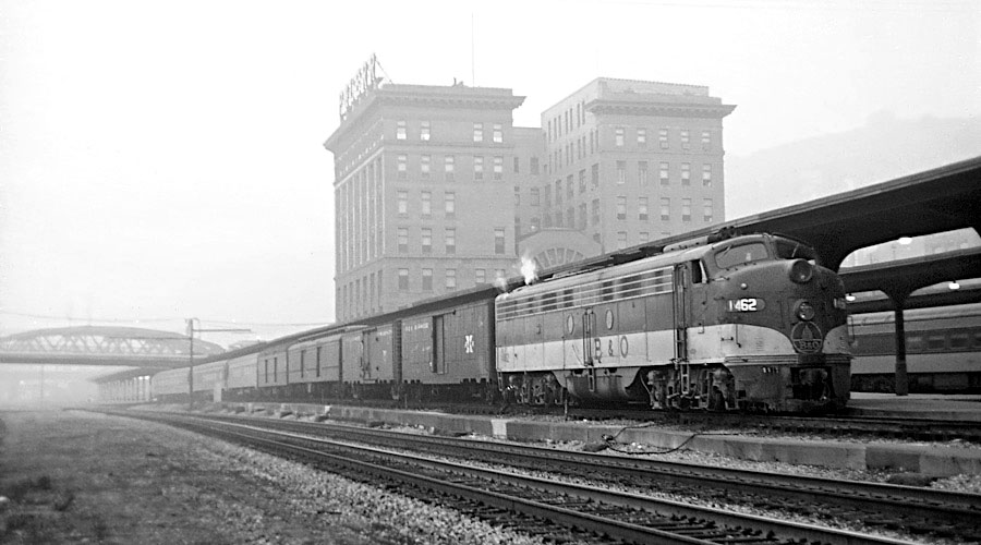 The Pittsburgh & Lake Erie railroad station in Pittsburgh, Pennsylvania, is a building constructed in 1898. Into the 1960s, the station was the depot for the passenger rail operations of the Pittsburgh & Lake Erie Railroad and the Pittsburgh depot from 1934 for the many trains of the Baltimore & Ohio Railroad from Baltimore, Washington, Chicago, Detroit, and St. Louis. In 1934, the B&O obtained trackage rights on the P&LE from New Castle Junction to McKeesport and, until the discontinuance of its passenger service, used the P&LE station to reduce the amount of heavy-curvature trackage required to reach the original B&O station on the opposite side of the Monongahela River. The Pittsburgh Station was listed on the National Register of Historic Places in 1974.
Click to see the Pittsburgh & Lake Erie RR building plotted on a Google Maps page
Pittsburgh, Pa / Jul 2020 / RWH
Pittsburgh, Pa / Jul 2020 / RWH
Jul 2020 / RWH
Pittsburgh, Pa / Jul 2020 / RWH
Pittsburgh, Pa / Jul 2020 / RWH
Pittsburgh, Pa / Jul 2020 / RWH
1910 Official Guide ad / collection
Pittsburgh, Pa / Jul 2020 / RWH
Jul 2020 / RWH
Jul 2020 / RWH
Pittsburgh, Pa / Jul 2020 / RWH
Jul 2020 / RWH
Jul 2020 / RWH
Pittsburgh, Pa / Jul 2020 / RWH
 Lagniappe
Grandview Greetings
Pittsburgh, Pa / Jul 2020 / RWH
We Meet at Last
Pittsburgh, Pa / Jul 2020 / RWH
Docking Station
Pittsburgh, Pa / Jul 2020 / RWH
Up and Down
Pittsburgh, Pa / Jul 2020 / RWH
Sunset on the Monongahela
Pittsburgh, Pa / Jul 2020 / RWH
Lower Expectations
Pittsburgh, Pa / Jul 2020 / RWH
The Little Giant
Pittsburgh, Pa / Jul 2020 / RWH
Farsightedness
Pittsburgh, Pa / Jul 2020 / RWH
"I'm a Rocket Man"
Pittsburgh, Pa / Jul 2020 / RWH
In the Merry Old Land of Oz
Pittsburgh, Pa / Jul 2020 / RWH
Thirty Five Degrees, Thirty Five Minutes
Pittsburgh, Pa / Jul 2020 / RWH
Eighteen Seventy
Pittsburgh, Pa / Jul 2020 / RWH
"I'm on Top of the World, Hey"
Pittsburgh, Pa / Jul 2020 / RWH
 Snapshots

Pittsburgh, Pa / Jul 2020 / RWH
Links / Sources
- Monongahela Incline website
- Port Authority of Allegheny County website
- Wikipedia article for Monongahela Incline
- "Everything You Need to Know About Riding the Pittsburgh Inclines"