


 |
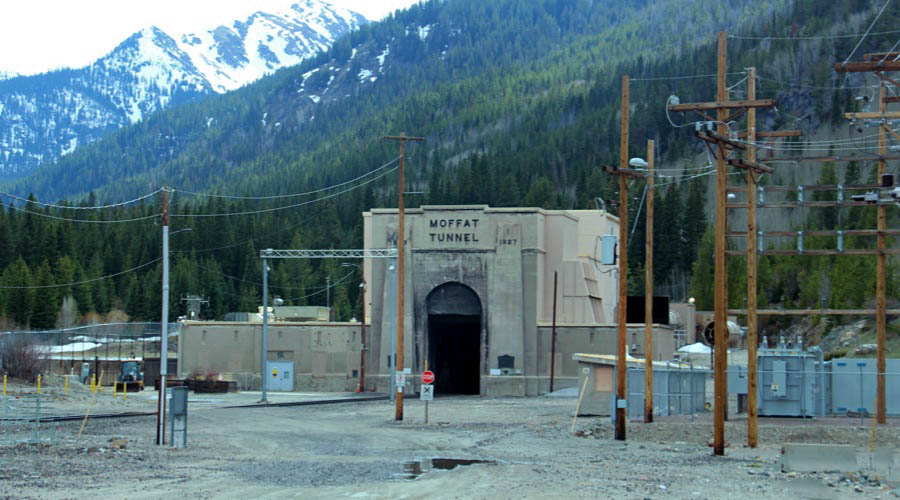
Moffat Tunnel East PortalMr. Moffat's Solution to the Great Continental Divide |
Tolland, Co / May 2023 / RWH

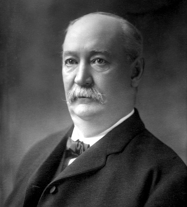
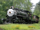
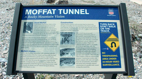
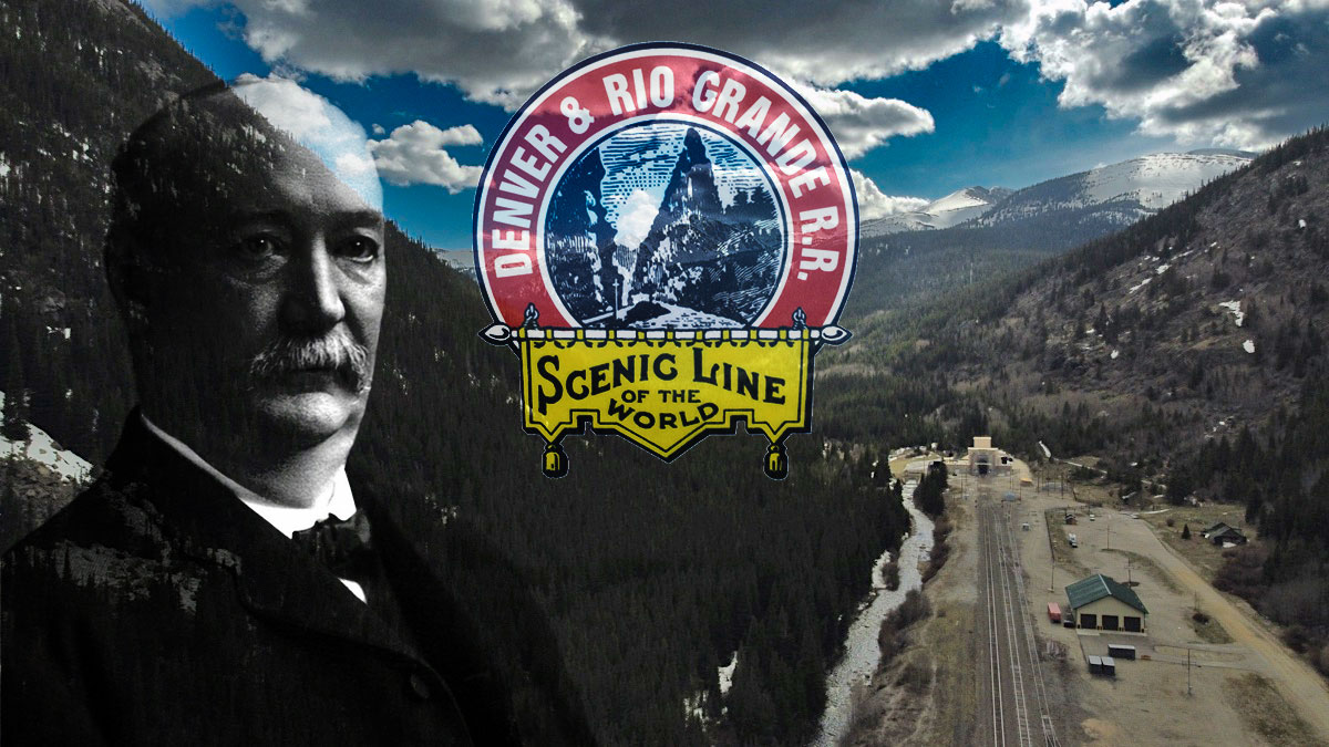
 or seven decades, Denver and Colorado were relegated to the backwaters of transcontinental commerce. There was, however, one man whose destiny became a lifelong project to remedy this situation: David Halliday Moffat, Jr. Although he was to build his fortune in banking and mining, Moffat was destined to be remembered in history because of his involvement with most of the important railroads built in Colorado.
Charles Albi and Kenton Forrest / The Moffat Tunnel: A Brief History
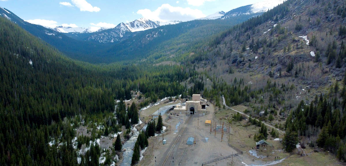
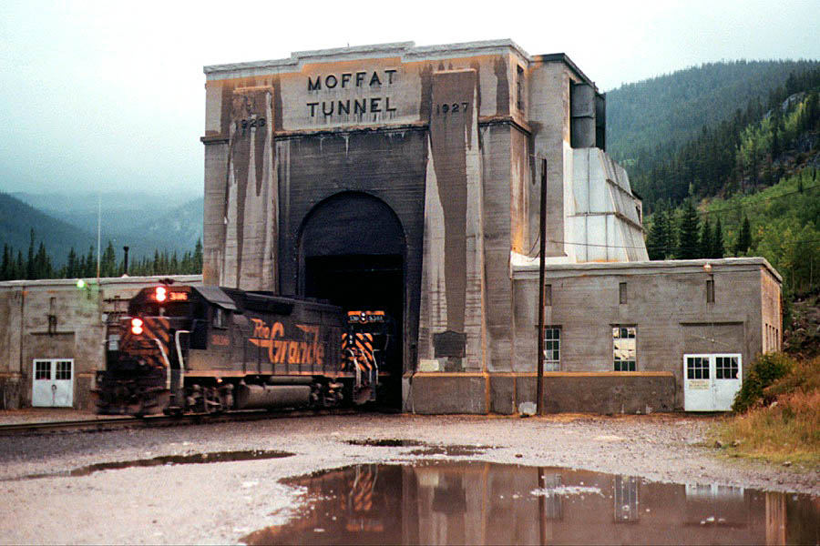
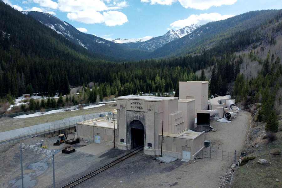
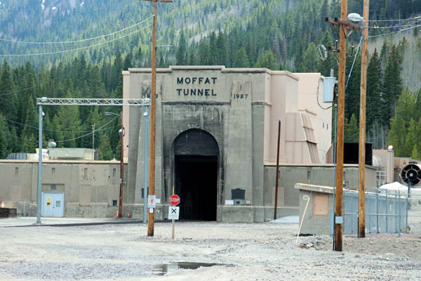
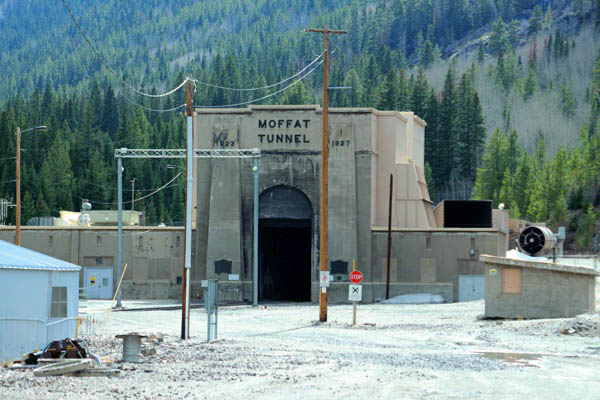
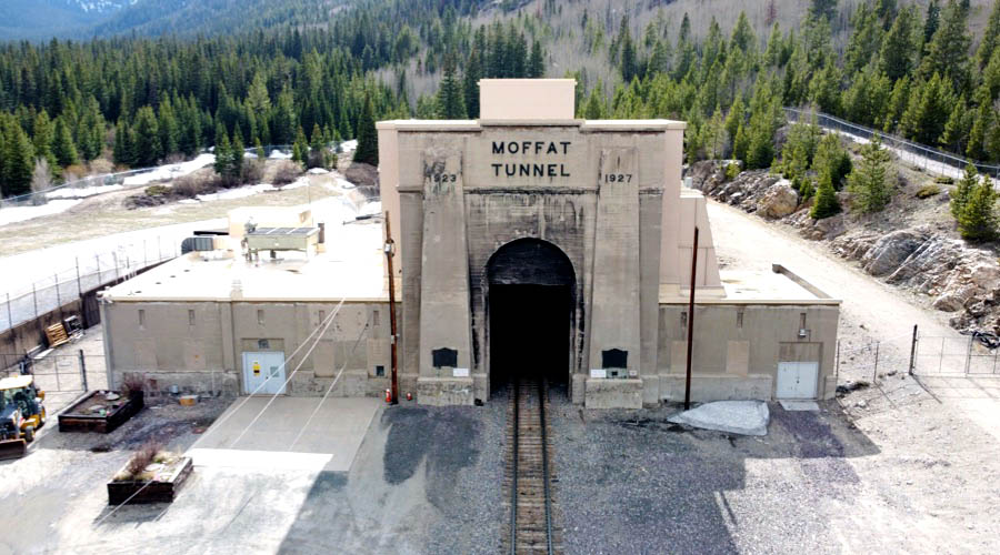
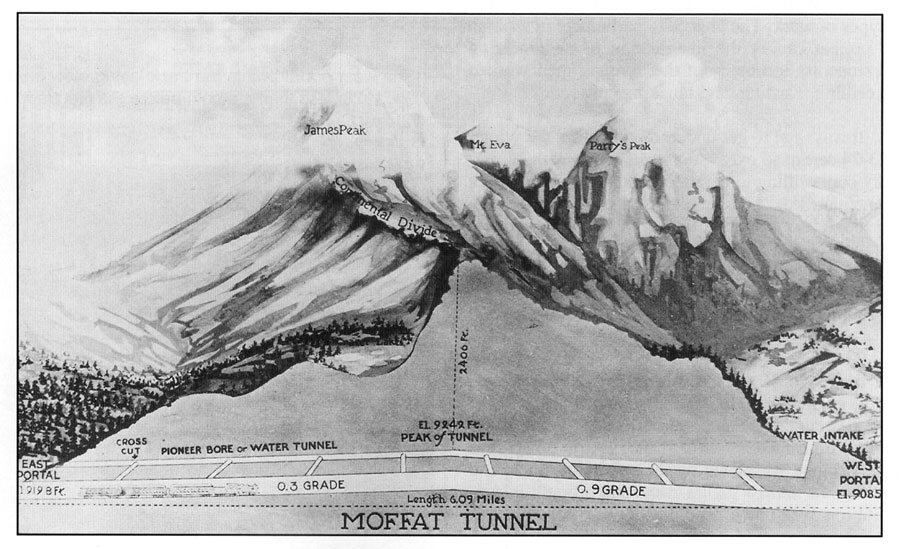
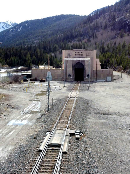
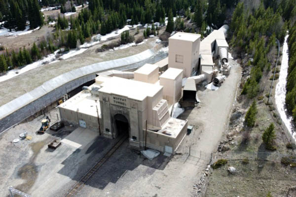
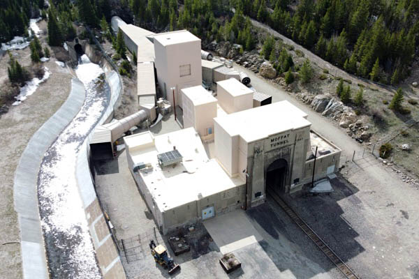
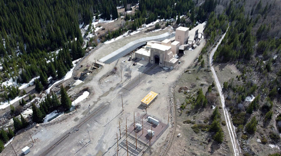
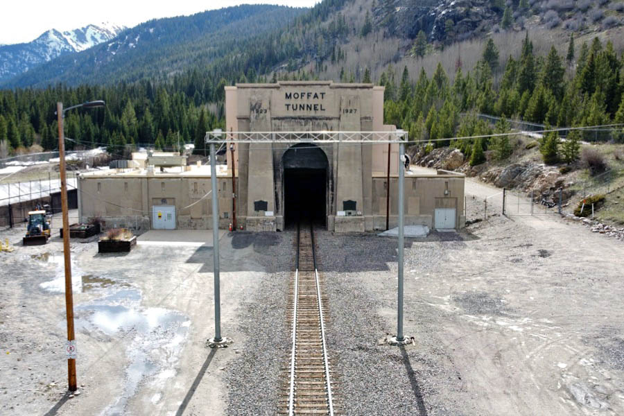
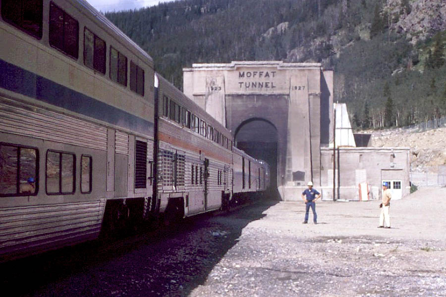
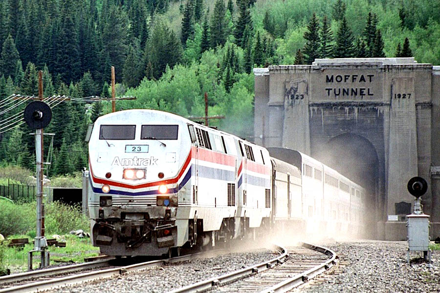
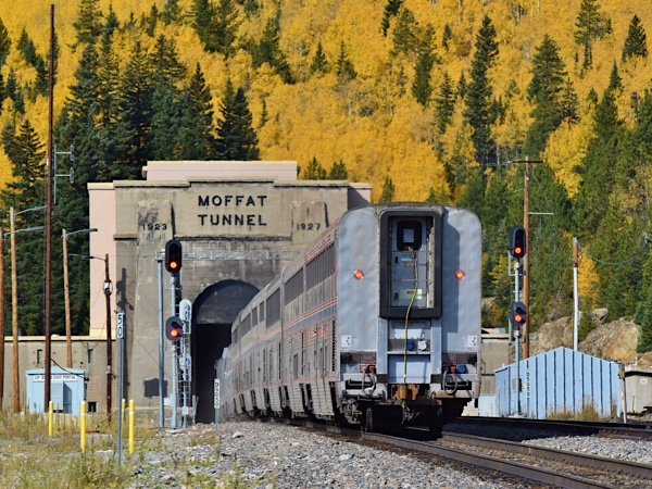
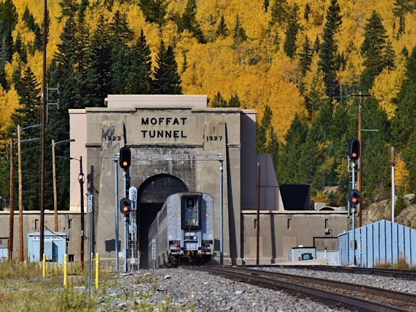
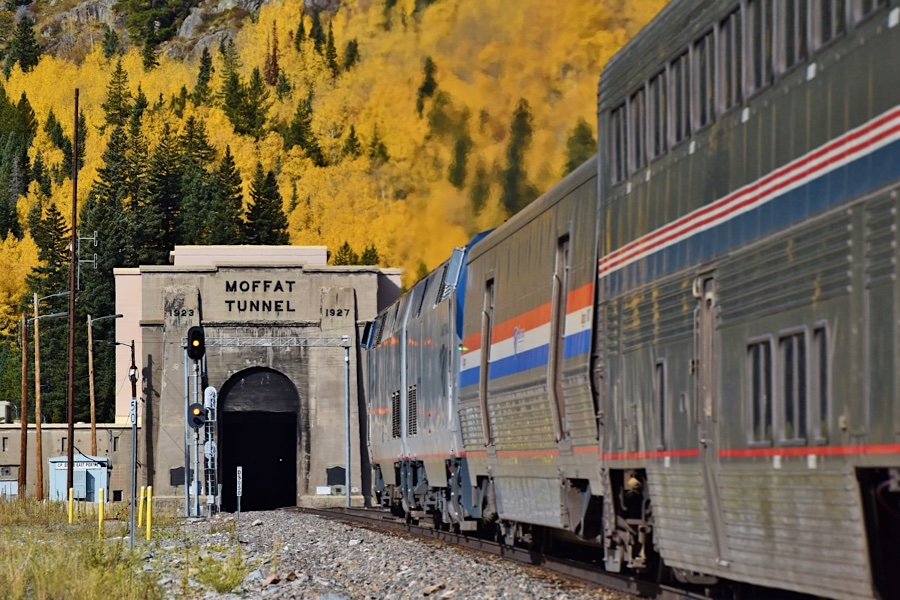
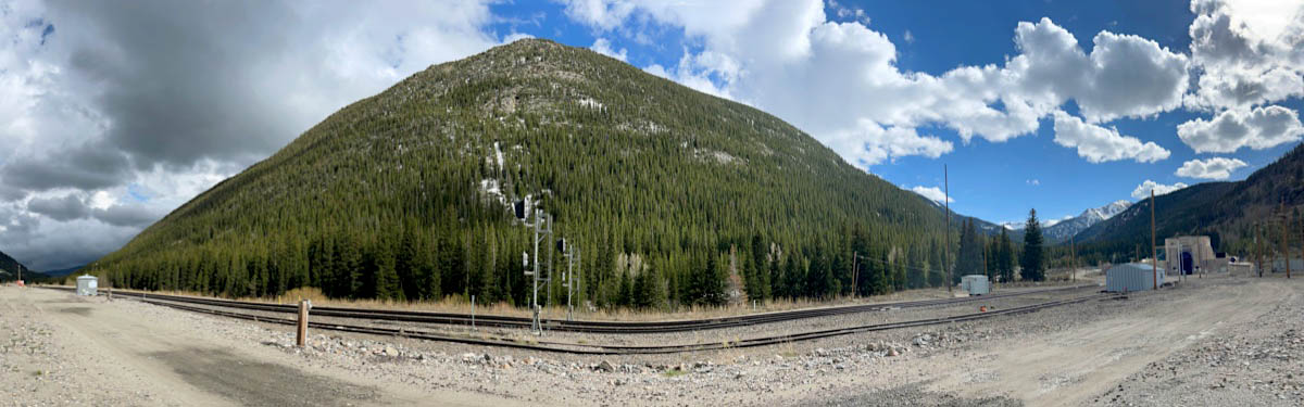
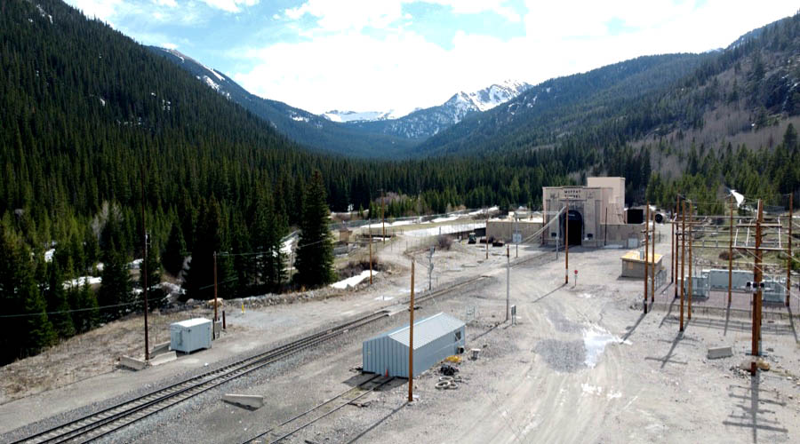
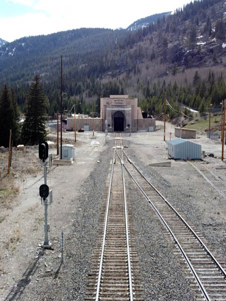
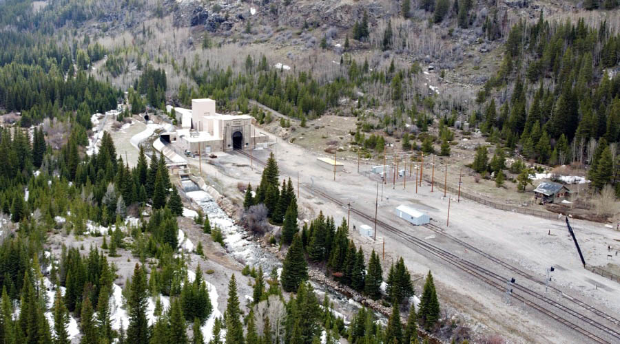
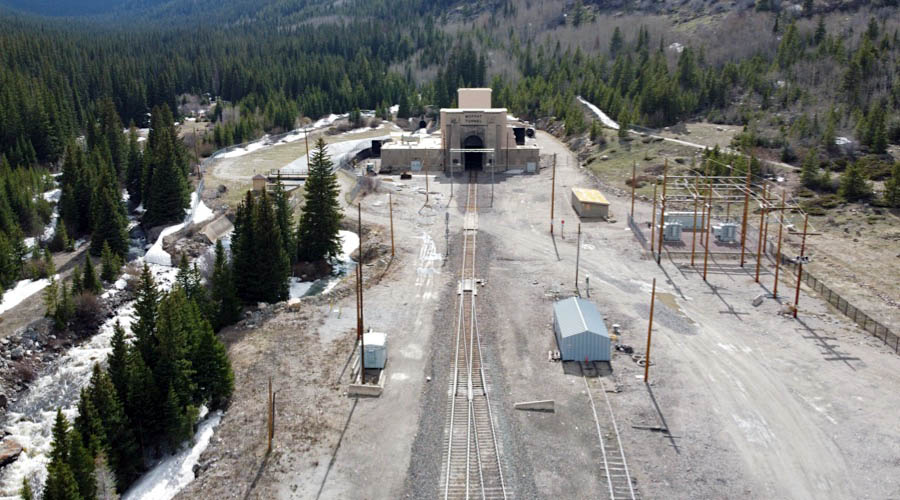
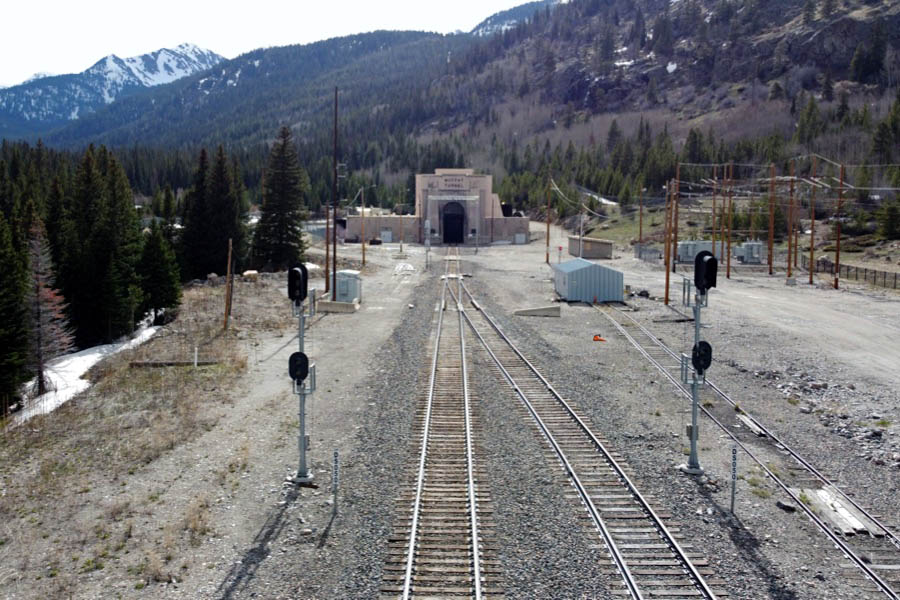
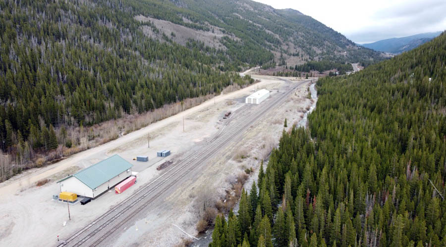
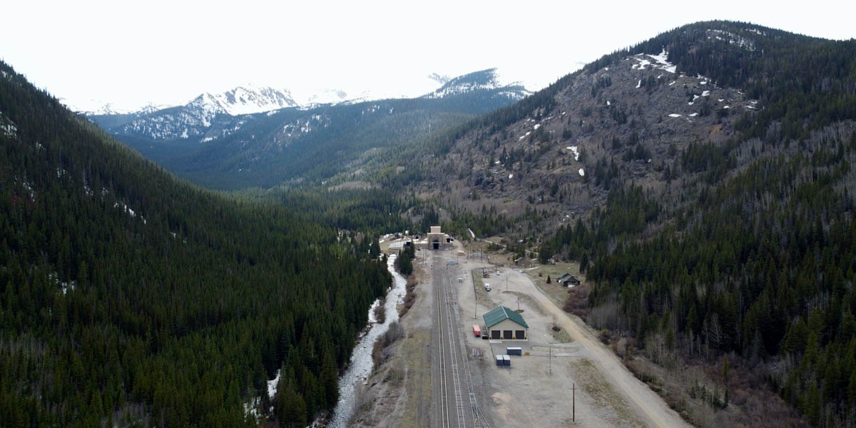
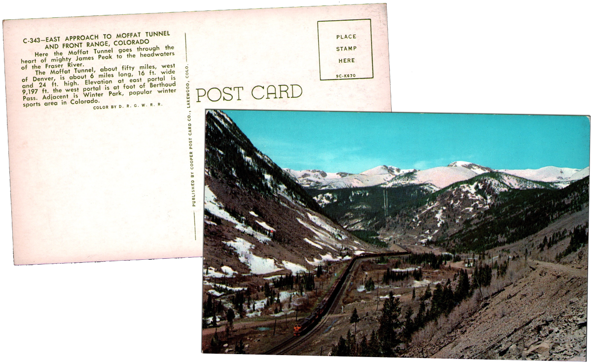
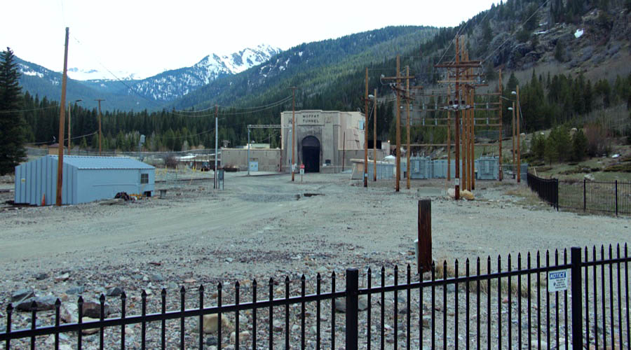
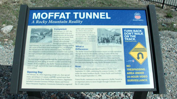
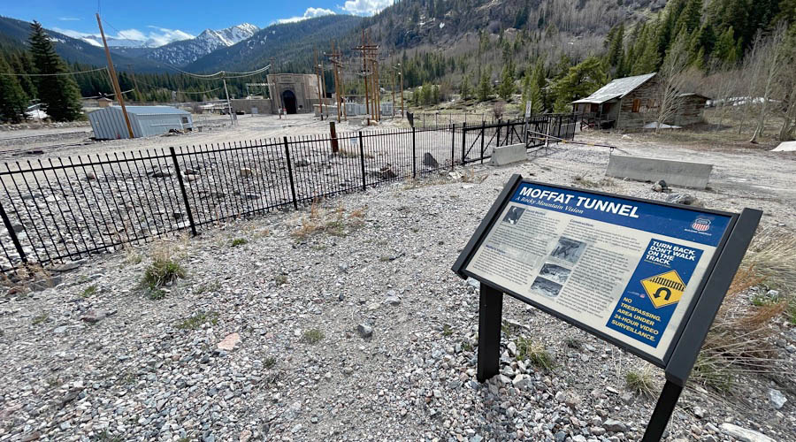
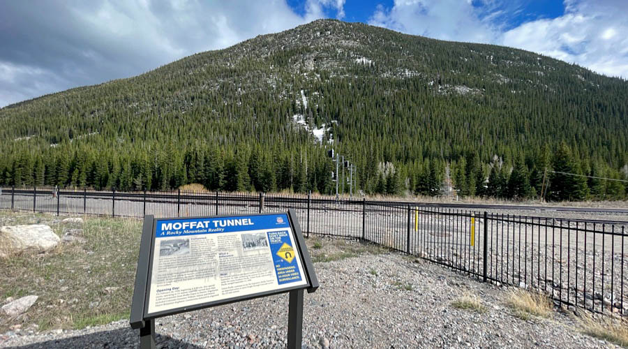
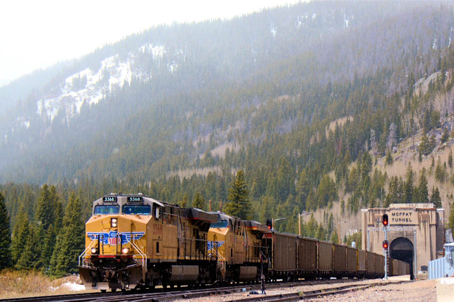
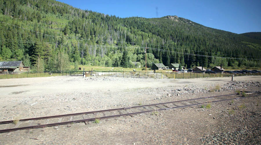
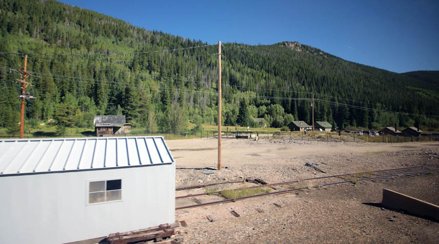
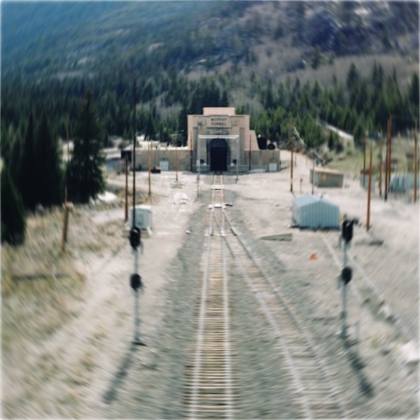
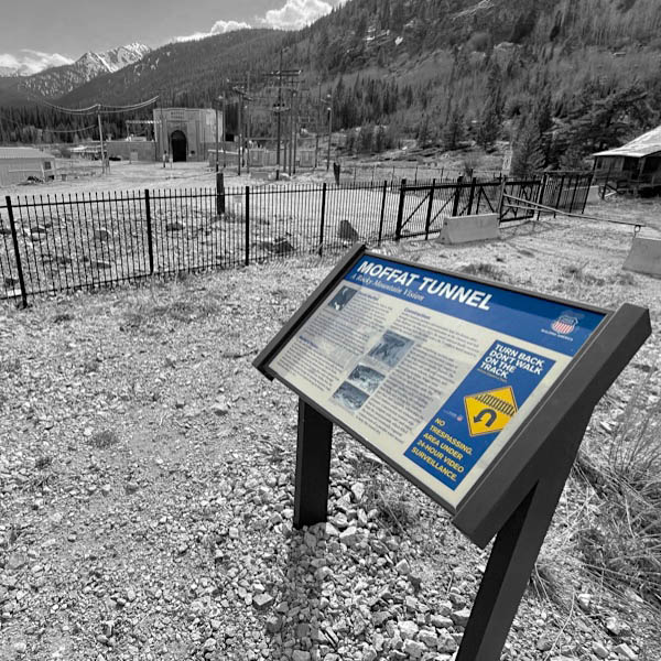
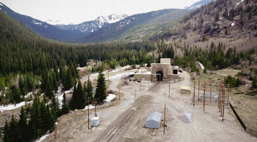
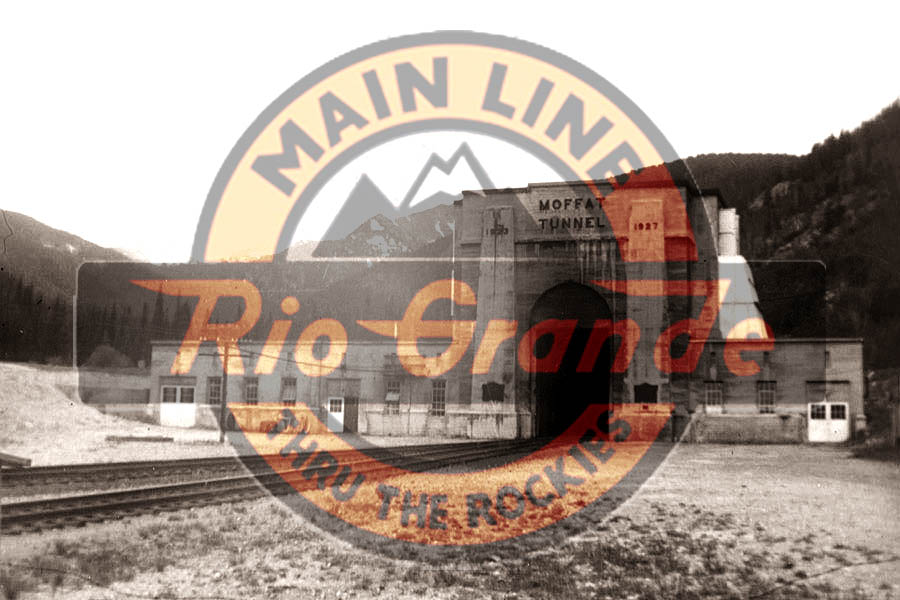
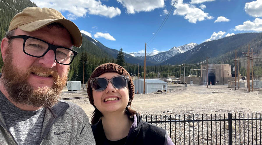
 he Moffat Tunnel is a famous railroad and water tunnel that cuts through the Continental Divide in north-central Colorado, west of Denver. Named for Colorado railroad pioneer David Moffat, the tunnel's first railroad traffic passed through in February 1928. The Moffat bore provided Denver with a western railroad link through the Continental Divide, as both Cheyenne, Wyoming, to the north and Pueblo, Colorado, to the south already enjoyed rail access to western connections. The impressive tunnel follows the right-of-way laid out by Moffat as early as 1902, seeking a more direct route from Denver west to Salt Lake City and dramatically reducing steep grades and curvatures through the Rockies. The Denver, Rio Grande & Western Railroad later made much use of the tunnel as an advertising fixture, in large part because its famed California Zephyr passed through the portals each day, each way. Today the Moffat Tunnel averages 15 trains per day for current operator Union Pacific. Amtrak's daily California Zephyrs also make use of the passage. The railroad and water tunnels parallel one another through the mountain, the latter delivering a portion of Denver's water supply from western sources. The railroad bore is 6.2 miles long, peaks in elevation at 9239 feet above sea level, and enjoys a modest 0.8% grade. In 1979, the tunnel was designated as a National Historic Civil Engineering Landmark by the American Society of Civil Engineers. Union Pacific has developed a small viewing area for visitors at the East Portal, just west of the village of Tolland.

See also these related scrapbooks:
- Denver Rio Grande & Western Railway in Mainlines
- Amtrak's California Zephyr route in Mainlines
- Amtrak's Denver Union Station in Mainlines
- Colorado Railroad Museum in Preservation
- Moffat Road Railroad Museum in Preservation
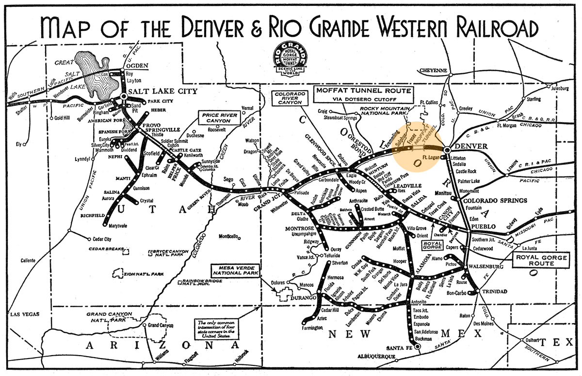
1940 DRGW system map / collection
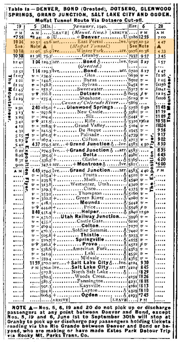
1940 Official Guide timetable / collection
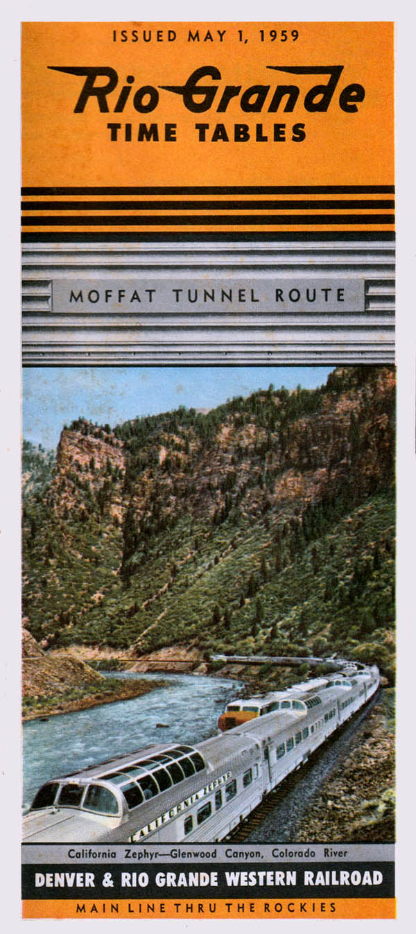
1959 timetable / collection

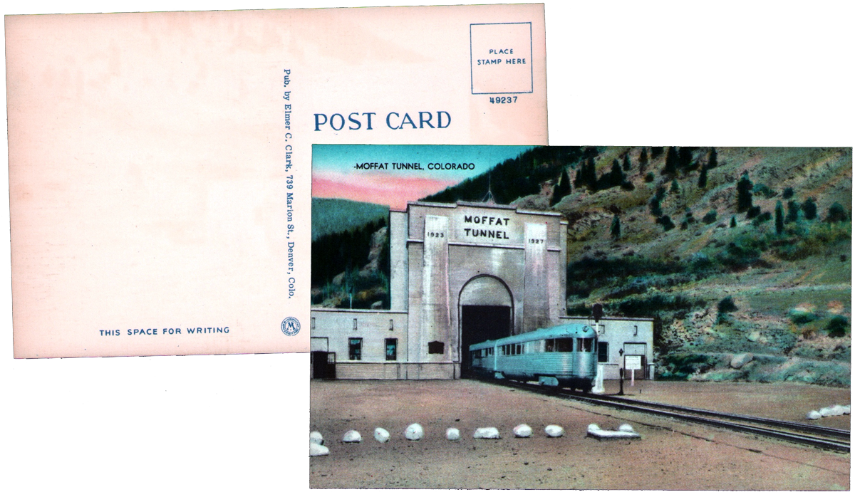
postcard / collection
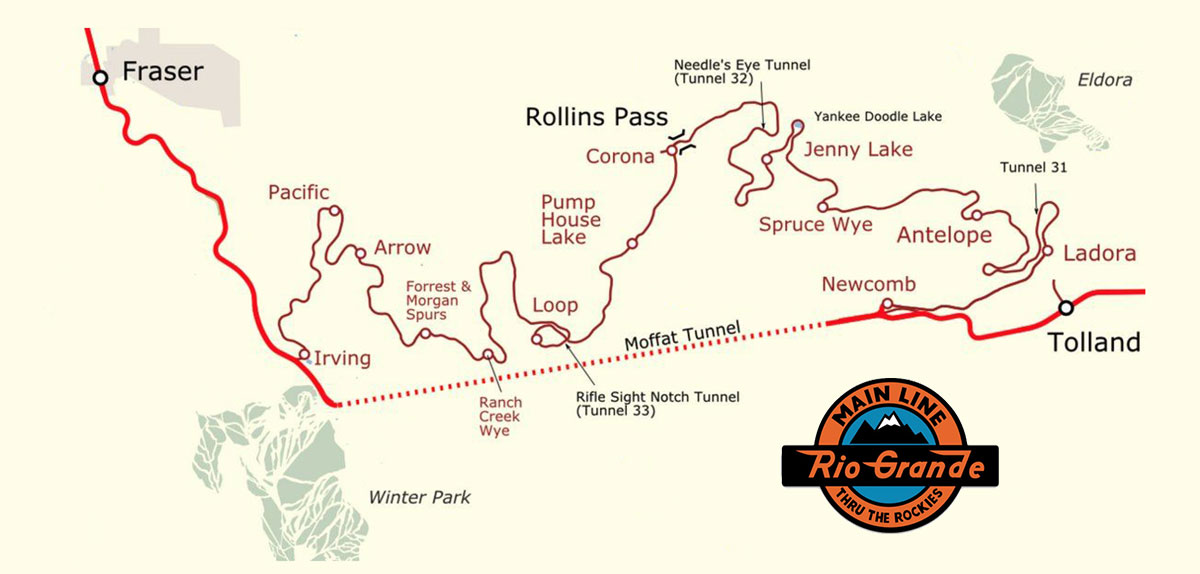
tunnel route map / adapted RWH
from The Story of the California Zephyr by Karl Zimmermann / collection
 Article
TUNNELING THROUGH THE ROCKIES
February 1924
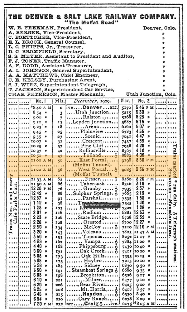
Long tunnels were not originally a feature of American railways in mountainous districts, as the tracks were at first run over the surface in order to save expense. The heavy gradients and difficulties connected with deep winter snows have, however, compelled some of the tracks to be relocated tunnels to be included. The Denver and Salt Lake Railway crosses the Rockies at an elevation of 11,660 feet, and includes gradients of 1 in 25. It has now been decided to pierce the mountains near Moffat with a six-mile tunnel, which will reduce the summit level by 2,220 feet, and the maximum gradient to 1 in 55, besides shortening the distance considerably. The tunnel will have a gradient of 1 in 125 rising from the western portal, and one of 1 in 330 from the eastern portal; and a section of 16 feet by 24 feet. Construction will follow the double-barrelled system found so successful in the Simplon Tunnel. A small pilot will be driven parallel to the main tunnel, 75 feet away, centre to centre, to assist ventilation and the movement of supplies and excavated material. The work is expected to be completed in three years at a cost of 33,600,000 dollars.
The Bunbury Herald and Blackwood Express
Tolland, Co / Jun 1959 / JCH
Tolland, Co / Sep 1980 / Gerard Putz 
Click to see the Moffat Tunnel East Portal area plotted on a Google Maps page
Tolland, Co / May 2023 / RWH
Tolland, Co / May 2023 / RWH
1930 Official Guide ad / collection
Tolland, Co / May 2023 / RWH
Tolland, Co / May 2023 / RWH
Tolland, Co / May 2023 / RWH
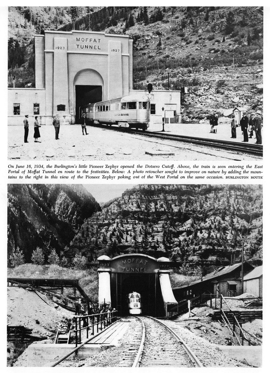
from The Moffat Tunnel: A Brief History - Albi and Forrest / collection
May 2023 / RWH
Tolland, Co / May 2023 / RWH
Tolland, Co / May 2023 / RWH
Tolland, Co / May 2023 / RWH
Tolland, Co / May 2023 / RWH
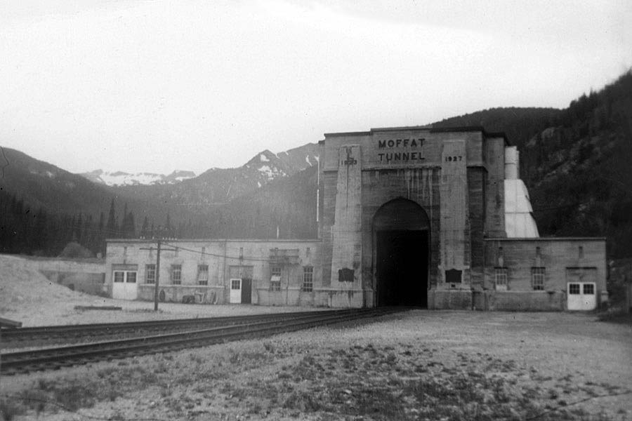
from The Moffat Tunnel: A Brief History - Albi and Forrest / collection
Sep 1984 / Mitch Cline
Tolland, Co / Sep 1984 / Mitch Cline
Tolland, Co / Jun 2000 / Sam Botts
HawkinsRails thanks railfan photographer Derek Brown for sharing his beautiful photos

Tolland, Co / Sep 2023 / Derek Brown
Tolland, Co / Sep 2023 / Derek Brown
See also our complete Amtrak California Zephyr route scrapbook in Mainlines
Tolland, Co / May 2023 / RWH
Tolland, Co / May 2023 / RWH
May 2023 / RWH
Tolland, Co / May 2023 / RWH
Tolland, Co / May 2023 / RWH
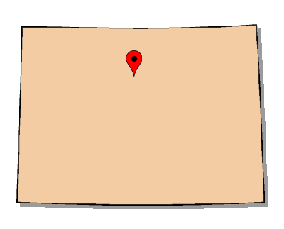
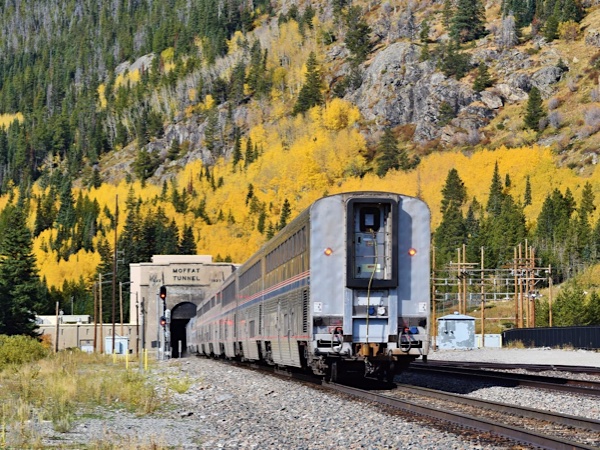
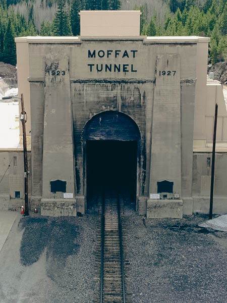 The eastern portal is about 50 miles west of Denver in the Front Range, about 10 miles west of the town of Rollinsville. The West Portal is located at the base area of Winter Park Resort, above and east of the Dotsero Cutoff that leads west towards Salt Lake City. The railroad tunnel is 24 feet high, 18 feet wide, and 6.2 miles long. The apex of the tunnel is at 9,239 feet above sea level. The tunnel has a gradient of 1 in 125 (0.8%).
As of 1989, the Moffat was the fourth longest railroad tunnel in North America. It was the longest non-electrified tunnel until 1956, when electrification was removed from the Cascade Tunnel.
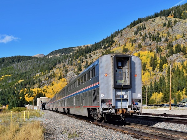
The tunnel is single-tracked, so only one train is run through at a time, usually with eastbound and westbound trains alternating. For safety reasons, passengers are asked not to move from one car to another while the train is in the tunnel.
Wikipedia / image RWH
collection
Tolland, Co / May 2023 / RWH
Tolland, Co / May 2023 / RWH
May 2023 / RWH
Tolland, Co / May 2023 / RWH
Tolland, Co / May 2023 / RWH
postcard / collection
Tolland, Co / May 2023 / RWH
Bridging the eastern and western slopes of the Rocky Mountains at an elevation of 9,200 feet and 2,800 feet below the surface, the Moffat Tunnel is an important water and rail connection. Though less well-known than the Eisenhower Tunnel, a trip to the Moffat Tunnel and the beautiful recreational land nearby is well worth it.
May 2023 / RWH
May 2023 / RWH
Tolland, Co / May 2023 / RWH
Tolland, Co / May 2023 / RWH
Tolland, Co / May 2015 / Kim Piersol
Tolland, Co / Sep 2023 / RWH
Tolland, Co / Sep 2023 / RWH
See also our complete Amtrak California Zephyr Central route scrapbook in Mainlines
 Lagniappe
Mister Moffat's Marvel
image and artwork RWH
Eastern Egress
image and artwork RWH
Portal Playground
May 2023 / RWH
Straight through the Heart
Tolland, Co / May 2023 / RWH
Six Mile Sanctuary
image JCH / artwork RWH
 Snapshots
Tolland, Co / May 2023 / RWH
Links / Sources
- Wikipedia article for Moffat Tunnel
- Union Pacific’s Moffat Tunnel Subdivision by John Crisanti
- Uncover Colorado Moffat Tunnel page
- Kenton Forrest and Charles Albi - The Moffat Tunnel: A Brief History (Colorado Railroad Museum)